Mill Hill

Hill, Mountain in Yorkshire Scarborough

England

Mill Hill

Crop at TA131733 Looking east across the grid square to Southfield Farm in the adjacent square.
Crop at TA131733 Credit: Stephen Horncastle

Mill Hill is a small hill located in the county of Yorkshire, England. Situated in the northern part of the county, it is part of the wider region known as the Yorkshire Dales. Mill Hill is known for its picturesque landscapes and stunning views, making it a popular destination for outdoor enthusiasts and nature lovers.

The hill itself stands at an elevation of approximately 400 meters (1,312 feet) above sea level, making it a relatively modest peak compared to some of the larger mountains in the region. Nevertheless, its position provides visitors with commanding views of the surrounding countryside, including rolling hills, lush valleys, and quaint villages.

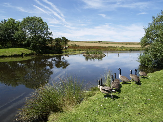
The area around Mill Hill is characterized by its diverse flora and fauna, offering a haven for wildlife. Visitors can expect to encounter a variety of bird species, such as peregrine falcons and red kites, as well as mammals like deer and rabbits.

In addition to its natural beauty, Mill Hill also boasts historical significance. The hill has been inhabited for centuries, with evidence of human activity dating back to prehistoric times. Ruins of old settlements and ancient burial sites can still be found in the vicinity, providing a glimpse into the area's rich past.

For those seeking outdoor activities, Mill Hill offers numerous walking and hiking trails that cater to different skill levels. These trails allow visitors to explore the hill and its surroundings, providing an opportunity to immerse themselves in the natural beauty and tranquility of the Yorkshire countryside.

Overall, Mill Hill in Yorkshire is a captivating destination that combines natural splendor with historical charm, making it a must-visit location for anyone looking to experience the beauty of the region.

If you have any feedback on the listing, please let us know in the comments section below.
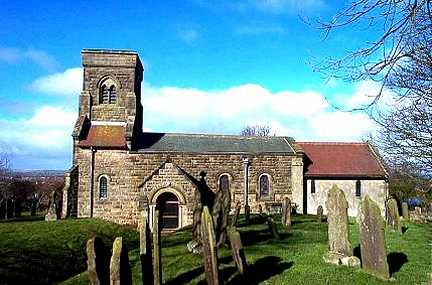
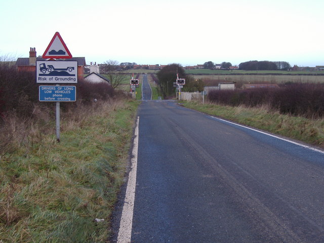
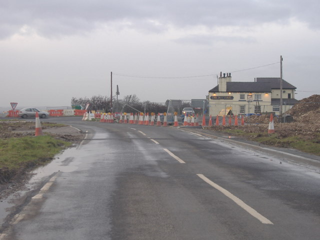
Mill Hill Images

Images are sourced within 2km of 54.156846/-0.24533803 or Grid Reference TA1474. Thanks to Geograph Open Source API. All images are credited.

Crop at TA131733 Looking east across the grid square to Southfield Farm in the adjacent square.
Crop at TA131733
Looking east across the grid square to Southfield Farm in the adjacent square.
Path to Speeton Sands The path heads down over Speeton Hills to the cliffs and Speeton Sands
Path to Speeton Sands
The path heads down over Speeton Hills to the cliffs and Speeton Sands
St. Leonard's Church, Speeton Speeton sits high above the cliffs on Speeton Hills with the church on the west edge of the grid square. The church only has windows on the south facing side, this view looking NW.
St. Leonard's Church, Speeton
Speeton sits high above the cliffs on Speeton Hills with the church on the west edge of the grid square. The church only has windows on the south facing side, this view looking NW.
Track West of Speeton The track heads north on Speeton Hills. This view looking north to the sea.
Track West of Speeton
The track heads north on Speeton Hills. This view looking north to the sea.
Reighton Sands Looking SE along the beach from the west edge of the grid square.
Reighton Sands
Looking SE along the beach from the west edge of the grid square.
Reighton Sands Looking NE from on the cliffs above Reighton Sands.
Reighton Sands
Looking NE from on the cliffs above Reighton Sands.
Reighton, St Peter's Church This Church is in the south west corner of the OS grid which it occupies. It is situated on the eastern side of the A165 road which runs through the village.
Reighton, St Peter's Church
This Church is in the south west corner of the OS grid which it occupies. It is situated on the eastern side of the A165 road which runs through the village.
Speeton Moor This lonely concrete fence post stands at the side of the B1229.  The view is north east towards Buckton Cliffs and the North Sea approximately 1km away.
Speeton Moor
This lonely concrete fence post stands at the side of the B1229. The view is north east towards Buckton Cliffs and the North Sea approximately 1km away.
Speeton Field A very muddy, freshly ploughed field.  I'm glad I took my wellies!
Speeton Field
A very muddy, freshly ploughed field. I'm glad I took my wellies!
Risk of Grounding The level crossing on New Road near Speeton.
Risk of Grounding
The level crossing on New Road near Speeton.
Roadworks at Reighton This photo is taken on the B1229 towards the A165 and The Dotterel Pub.  The roadworks are due to the construction of the Reighton Bypass.
Roadworks at Reighton
This photo is taken on the B1229 towards the A165 and The Dotterel Pub. The roadworks are due to the construction of the Reighton Bypass.
Caravan Site - Reighton Sands
Low Fields and Speeton Hills from the back of Reighton Sands Caravan site
Foreshore at Speeton looking Southwards along the foreshore at Speeton
Foreshore at Speeton
looking Southwards along the foreshore at Speeton
Carpark at St Leonards Church St Leonards church from the carpark at Speeton.
Carpark at St Leonards Church
St Leonards church from the carpark at Speeton.
Cretaceous clay at Speeton Eroding 'Oxford Clay' beds on the foreshore at Speeton, fossiliferous mud of Cretaceous age.
Cretaceous clay at Speeton
Eroding 'Oxford Clay' beds on the foreshore at Speeton, fossiliferous mud of Cretaceous age.
Speeton Sands towards Buckton Cliffs
Reighton Sands Looking across Reighton Sands with the remains of old world war 2 beach defences, towards Speeton.
Reighton Sands
Looking across Reighton Sands with the remains of old world war 2 beach defences, towards Speeton.
Show me another place!

Mill Hill is located at Grid Ref: TA1474 (Lat: 54.156846, Lng: -0.24533803)

Division: East Riding

Administrative County: North Yorkshire

District: Scarborough

Police Authority: North Yorkshire

What 3 Words

///angel.narrate.tightest. Near Grindale, East Yorkshire

Related Wikis

Speeton

Speeton is a village in the civil parish of Reighton, in North Yorkshire, England. It lies near the edge of the coastal cliffs midway between Filey and...

Speeton railway station

Speeton railway station served the villages of Speeton and Reighton in North Yorkshire, England. It was situated on the Yorkshire Coast Line from Scarborough...

Reighton

Reighton is a village and civil parish, in North Yorkshire, England. From the mediaeval era until the 19th century Reighton was part of Dickering Wapentake...

RAF Hunmanby Moor

RAF Hunmanby Moor, (also known as RAF Filey), was a Royal Air Force training camp during the Second World War in Hunmanby, East Riding of Yorkshire, England...

Grindale

Grindale is a village and civil parish in the East Riding of Yorkshire, England. It is situated approximately 4 miles (6 km) north-west of Bridlington...

Butlin's Filey

Filey Holiday Camp was a Butlin's holiday camp near Filey, North Yorkshire, England, built for Billy Butlin's holiday organisation. Construction of the...

Filey Holiday Camp railway station

Filey Holiday Camp railway station was a railway station built by the London and North Eastern Railway to serve Butlin's Filey Holiday Camp just south...

Buckton, East Riding of Yorkshire

Buckton is a small village and former civil parish, now in the parish of Bempton, in the East Riding of Yorkshire, England. It is near the North Sea coast...

Nearby Amenities

Located within 500m of 54.156846,-0.24533803
Parking
St Leonards Church
Fee: donation
Parking: surface
Lat/Long: 54.1551894/-0.2386152
Barrier: kissing_gate
Lat/Long: 54.1553224/-0.2389266
Barrier: kissing_gate
Lat/Long: 54.1556669/-0.238739
Post Box
Post Box Type: lamp
Ref: YO14 151
Royal Cypher: EIIR
Royal Cypher Wikidata: Q33102113
Lat/Long: 54.1544515/-0.2428561
Defibrillator
Access: yes
Defibrillator Location: Chapel Lane, Speeton
Emergency: defibrillator
Indoor: no
Lat/Long: 54.1551614/-0.2420876
Advertising: board
Lat/Long: 54.1550238/-0.2428079
The data included in this document is from www.openstreetmap.org. The data is made available under ODbL.

Have you been to Mill Hill?

Leave your review of Mill Hill below (or comments, questions and feedback).