Kirkby Woodhouse

Settlement in Nottinghamshire Ashfield

England

Kirkby Woodhouse

Field on Castle Hill A view from Orchard Walk. It helps to illustrate that Kirkby-in-Ashfield is on the top of a hill, though it doesn't feel like it when you are in the town.
Field on Castle Hill Credit: Bill Boaden

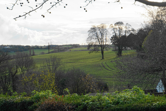
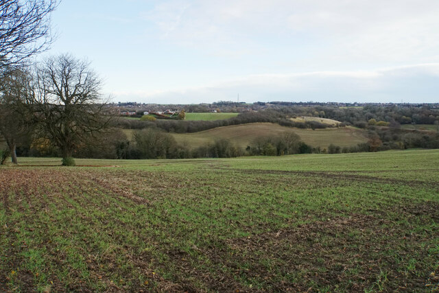
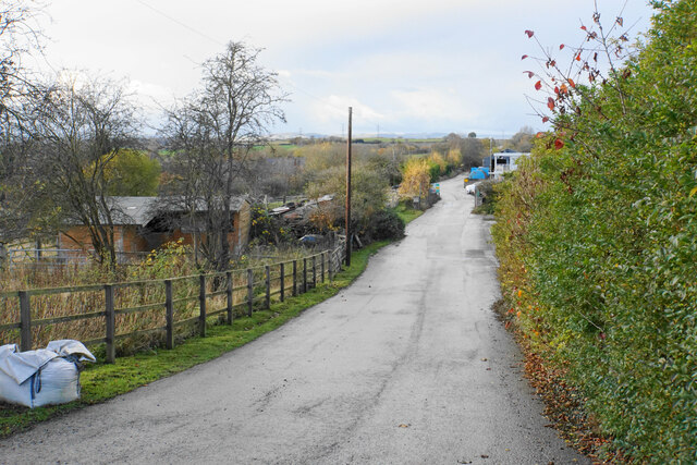
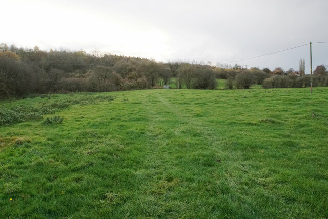
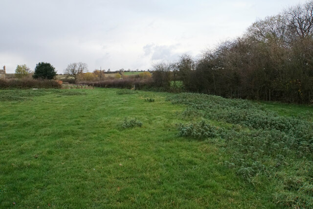
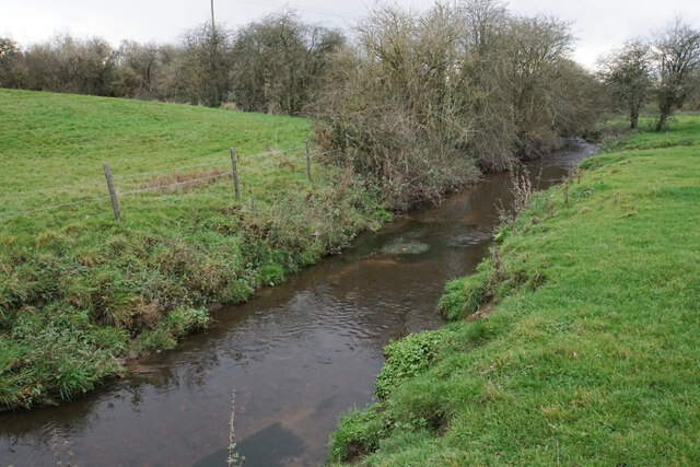
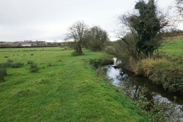
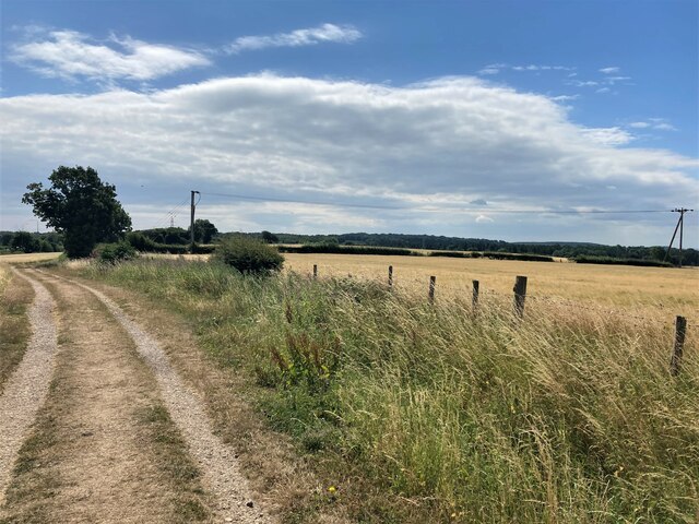
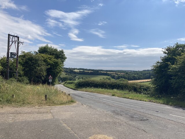
Kirkby Woodhouse is a small village located in the Ashfield district of Nottinghamshire, England. Situated approximately 15 miles north of Nottingham city centre, the village is nestled within a rural setting, surrounded by picturesque countryside and farmland.

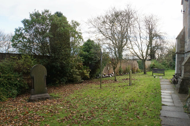
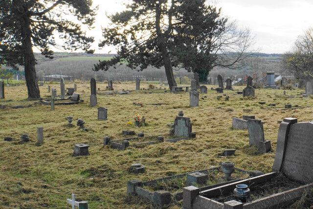
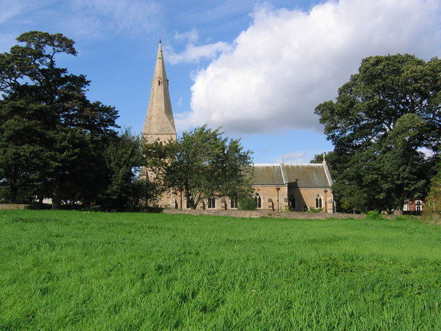
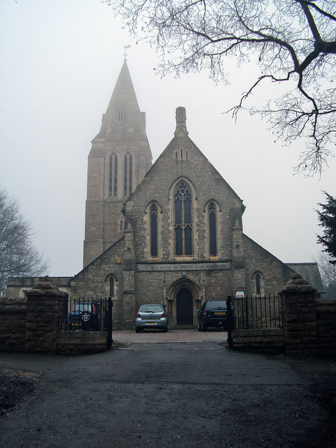
The origins of Kirkby Woodhouse can be traced back to the medieval period, as evidenced by the presence of a 12th-century church, St. John the Evangelist, which still stands today. The village has a close-knit community, with a population of around 700 residents.

The village offers a range of amenities, including a primary school, a community hall, and a local pub, providing essential services and social gathering spaces for the residents. The village also benefits from good public transport links, with regular bus services connecting Kirkby Woodhouse to nearby towns and cities.

The surrounding area offers abundant opportunities for outdoor activities, with several walking and cycling routes passing through the village. Nearby attractions include the Sherwood Forest Country Park, famous for its association with the legendary Robin Hood, and the Rufford Abbey Country Park, a historic estate with beautiful gardens and woodlands.

Kirkby Woodhouse provides a peaceful and idyllic setting, making it an attractive place to live for those seeking a rural lifestyle while still being within easy reach of urban amenities. With its rich history, natural beauty, and strong sense of community, Kirkby Woodhouse offers a charming slice of village life in the heart of Nottinghamshire.

If you have any feedback on the listing, please let us know in the comments section below.

Kirkby Woodhouse Images

Images are sourced within 2km of 53.082739/-1.266189 or Grid Reference SK4954. Thanks to Geograph Open Source API. All images are credited.

Field on Castle Hill A view from Orchard Walk. It helps to illustrate that Kirkby-in-Ashfield is on the top of a hill, though it doesn't feel like it when you are in the town.
Field on Castle Hill
A view from Orchard Walk. It helps to illustrate that Kirkby-in-Ashfield is on the top of a hill, though it doesn't feel like it when you are in the town.
The church garden, St Wilfrid's The church garden is how this is described on a sign at the front of the church. It includes a garden of remembrance.
The church garden, St Wilfrid's
The church garden is how this is described on a sign at the front of the church. It includes a garden of remembrance.
St Wilfrid's Churchyard Extension A little bit further along Castle Hill from the church. The former Bentinck Pit used to be in the valley ahead.
St Wilfrid's Churchyard Extension
A little bit further along Castle Hill from the church. The former Bentinck Pit used to be in the valley ahead.
Valley below Castle Hill The valley produces some of the headwaters of the River Erewash. Some of the southern suburbs of Kirkby-in-Ashfield are seen on the other side.
Valley below Castle Hill
The valley produces some of the headwaters of the River Erewash. Some of the southern suburbs of Kirkby-in-Ashfield are seen on the other side.
St Wilfrid's Park I think the route only has this name because of houses which have been built to the right which require this road as access. It follows the line of a former railway.
St Wilfrid's Park
I think the route only has this name because of houses which have been built to the right which require this road as access. It follows the line of a former railway.
Land being developed by Spring Meadow I don't know what this development is. Until fairly recently, the land was a field.
Land being developed by Spring Meadow
I don't know what this development is. Until fairly recently, the land was a field.
Track to Meadow Farm The track is a turning off Park Lane in the Erewash valley. It is also a public bridleway.
Track to Meadow Farm
The track is a turning off Park Lane in the Erewash valley. It is also a public bridleway.
Harvested field in the Erewash valley Looking up the hill towards Kirkby-in-Ashfield where the spire of St Wilfrid's Church is prominent.
Harvested field in the Erewash valley
Looking up the hill towards Kirkby-in-Ashfield where the spire of St Wilfrid's Church is prominent.
Track to Meadow Farm The track is going under the former railway servicing Bentinck Pit, and there are three separate spans to go under.
Track to Meadow Farm
The track is going under the former railway servicing Bentinck Pit, and there are three separate spans to go under.
Footpath to Kirkby Park The path is in the Erewash valley and the river flows where the gate can be seen ahead. A bit of Lower Portland Farm can be seen in the trees.
Footpath to Kirkby Park
The path is in the Erewash valley and the river flows where the gate can be seen ahead. A bit of Lower Portland Farm can be seen in the trees.
Path to Kirkby-in-Ashfield The path will go past Meadow Farm which is seen on the left.
Path to Kirkby-in-Ashfield
The path will go past Meadow Farm which is seen on the left.
River Erewash The river is noted for marking the boundary between Derbyshire and Nottinghamshire but this early part of its course is all in Nottinghamshire.
River Erewash
The river is noted for marking the boundary between Derbyshire and Nottinghamshire but this early part of its course is all in Nottinghamshire.
Path to Kirkby-in-Ashfield Kirkby-in-Ashfield is seen on the hill ahead. The path runs beside the River Erewash.
Path to Kirkby-in-Ashfield
Kirkby-in-Ashfield is seen on the hill ahead. The path runs beside the River Erewash.
Farm Track and Footpath close to the M1 Motorway Fields of barley are all that separate this rural view from the busy trunk road ahead.
Farm Track and Footpath close to the M1 Motorway
Fields of barley are all that separate this rural view from the busy trunk road ahead.
Salmon Lane Pictured from an embankment above the M1 at Leaside. Looking towards Annesley Woodhouse.
Salmon Lane
Pictured from an embankment above the M1 at Leaside. Looking towards Annesley Woodhouse.
Annesley Woodhouse Post Office Post Office and dwellings located on Forest Road.
Annesley Woodhouse Post Office
Post Office and dwellings located on Forest Road.
Shops on Forest Road in Annesley Woodhouse
All Saints' Church in Annesley A pleasant wooded avenue forms the approach to this church.
All Saints' Church in Annesley
A pleasant wooded avenue forms the approach to this church.
Show me another place!

Kirkby Woodhouse is located at Grid Ref: SK4954 (Lat: 53.082739, Lng: -1.266189)

Administrative County: Nottinghamshire

District: Ashfield

Police Authority: Nottinghamshire

What 3 Words

///food.blame.jukebox. Near Kirkby in Ashfield, Nottinghamshire

Related Wikis

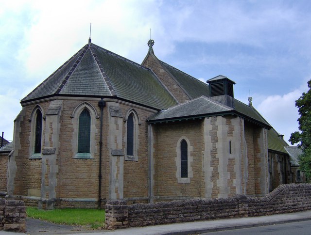
St John the Evangelist's Church, Kirkby Woodhouse

St John the Evangelist's Church, Kirkby-in-Ashfield is a parish church in the Church of England in Kirkby Woodhouse, Nottinghamshire. == History == St...

Annesley Woodhouse

Annesley Woodhouse is a village in Nottinghamshire, England, located approximately 10 miles north of the City of Nottingham and 6 miles south of Mansfield...

Kirkby Bentinck railway station

Kirkby Bentinck railway station served the town of Kirkby-in-Ashfield, Nottinghamshire, England. It was on the Annesley branch of the Manchester, Sheffield...

Annesley

Annesley is a village and civil parish in the Ashfield district of Nottinghamshire, England, between Hucknall and Kirkby-in-Ashfield. At the 2011 census...

St Wilfrid's Church, Kirkby-in-Ashfield

St Wilfrid's Church, Kirkby-in-Ashfield is a parish church in the Church of England in Kirkby-in-Ashfield, Nottinghamshire. The church is Grade II listed...

Kirkby-in-Ashfield Central railway station

Kirkby-in-Ashfield Central is a former railway station that served the town of Kirkby-in-Ashfield, Nottinghamshire. == History == The station was opened...

All Saints' Church, Annesley

All Saints' Church, Annesley is a parish church in the Church of England in Annesley, Nottinghamshire. The church is Grade II* listed by the Department...

Kirkby-in-Ashfield railway station

Kirkby-in-Ashfield railway station serves the town of Kirkby-in-Ashfield in Nottinghamshire, England. The station is on the Robin Hood Line and is operated...

Nearby Amenities

Located within 500m of 53.082739,-1.266189
Bus Stop
Mill Lane
Bus: yes
Naptan AtcoCode: 3300AS0272
Naptan Bearing: NW
Naptan CommonName: Mill Lane
Naptan Crossing: Mill Lane
Naptan Indicator: opp
Naptan NaptanCode: ntsdtmaw
Naptan Notes: none
Naptan Street: Main Road
Naptan Verified: no
Public Transport: platform
Source: naptan_import
Lat/Long: 53.0825016/-1.2597856
Bus Stop
Mill Lane
Bus: yes
Naptan AtcoCode: 3300AS0273
Naptan Bearing: SE
Naptan CommonName: Mill Lane
Naptan Crossing: Mill Lane
Naptan Indicator: adj
Naptan NaptanCode: ntsdtmda
Naptan Notes: none
Naptan Street: Main Road
Naptan Verified: no
Public Transport: platform
Source: naptan_import
Lat/Long: 53.0831295/-1.261014
Bus Stop
Birds Lane
Bus: yes
Naptan AtcoCode: 3300AS0274
Naptan Bearing: SE
Naptan CommonName: Birds Lane
Naptan Crossing: Birds Lane
Naptan Indicator: opp
Naptan NaptanCode: ntsdtmdg
Naptan Notes: none
Naptan Street: Main Road
Naptan Verified: no
Public Transport: platform
Source: naptan_import
Lat/Long: 53.0838458/-1.2634503
Bus Stop
Birds Lane
Bus: yes
Naptan AtcoCode: 3300AS0275
Naptan Bearing: NW
Naptan CommonName: Birds Lane
Naptan Crossing: Birds Lane
Naptan Indicator: adj
Naptan NaptanCode: ntsdtmdj
Naptan Notes: none
Naptan Street: Main Road
Naptan Verified: no
Public Transport: platform
Source: naptan_import
Lat/Long: 53.0839485/-1.2640606
Bus Stop
Hardstaff Close
Bus: yes
Naptan AtcoCode: 3300AS0276
Naptan Bearing: S
Naptan CommonName: Hardstaff Close
Naptan Crossing: Hardstaff Close
Naptan Indicator: adj
Naptan NaptanCode: ntsdtmdm
Naptan Notes: none
Naptan Street: Main Road
Naptan Verified: no
Public Transport: platform
Source: naptan_import
Lat/Long: 53.083884/-1.2681825
Bus Stop
Felley Avenue
Bus: yes
Naptan AtcoCode: 3300AS0277
Naptan Bearing: NW
Naptan CommonName: Felley Avenue
Naptan Crossing: Felley Avenue
Naptan Indicator: adj
Naptan NaptanCode: ntsdtmdp
Naptan Notes: none
Naptan Street: Skegby Road
Naptan Verified: no
Public Transport: platform
Source: naptan_import
Lat/Long: 53.0823667/-1.2670288
Bus Stop
Felley Avenue
Bus: yes
Naptan AtcoCode: 3300AS0278
Naptan Bearing: SE
Naptan CommonName: Felley Avenue
Naptan Crossing: Felley Avenue
Naptan Indicator: opp
Naptan NaptanCode: ntsdtmdt
Naptan Notes: none
Naptan Street: Skegby Road
Naptan Verified: no
Public Transport: platform
Source: naptan_import
Lat/Long: 53.0822548/-1.2663738
Bus Stop
Skegby Road
Bus: yes
Naptan AtcoCode: 3300AS0279
Naptan Bearing: SE
Naptan CommonName: Skegby Road
Naptan Crossing: Birds Lane
Naptan Indicator: SE-bound
Naptan NaptanCode: ntsdtmdw
Naptan Notes: none
Naptan Street: Skegby Road
Naptan Verified: no
Public Transport: platform
Source: naptan_import
Lat/Long: 53.081512/-1.2640126
Bus Stop
Skegby Road
Bus: yes
Naptan AtcoCode: 3300AS0280
Naptan Bearing: N
Naptan CommonName: Skegby Road
Naptan Crossing: Birds Lane
Naptan Indicator: NW-bound
Naptan NaptanCode: ntsdtmga
Naptan Notes: none
Naptan Street: Skegby Road
Naptan Verified: no
Public Transport: platform
Source: naptan_import
Lat/Long: 53.0807507/-1.2630104
Bus Stop
Hardstaff Close
Bus: yes
Naptan AtcoCode: 3300AS0550
Naptan Bearing: N
Naptan CommonName: Hardstaff Close
Naptan Crossing: Hardstaff Close
Naptan Indicator: opp
Naptan NaptanCode: ntsdtawg
Naptan Notes: none
Naptan Street: Main Road
Naptan Verified: no
Public Transport: platform
Source: naptan_import
Lat/Long: 53.0836243/-1.2683511
Power: tower
Source: Bing
Lat/Long: 53.086492/-1.2621505
Power: tower
Source: Bing
Lat/Long: 53.0811498/-1.2721391
Power: tower
Source: Bing
Lat/Long: 53.0833731/-1.2724824
Power: tower
Source: Bing
Lat/Long: 53.087105/-1.2648721
Power: tower
Source: Bing
Lat/Long: 53.0850718/-1.2709632
Ele: 148.0000000
Lat/Long: 53.0795107/-1.2707138
Ele: 158.0000000
Lat/Long: 53.079797/-1.2676479
Barrier: stile
Ele: 158.0000000
Steps: 1
Stile: stepover
Lat/Long: 53.0797841/-1.2675084
Ele: 162.0000000
Lat/Long: 53.0796847/-1.266691
Ele: 165.0000000
Lat/Long: 53.079622/-1.2659329
Ele: 167.0000000
Lat/Long: 53.0795196/-1.2651895
Ele: 170.0000000
Lat/Long: 53.0793845/-1.2641288
Ele: 170.0000000
Lat/Long: 53.0792947/-1.263443
Ele: 170.0000000
Lat/Long: 53.0792073/-1.2629057
Ele: 171.0000000
Lat/Long: 53.0793297/-1.2634851
Ele: 170.0000000
Lat/Long: 53.0793233/-1.2640055
Nuncargate
Place: village
Source: OS_OpenData_StreetView;local_knowledge
Lat/Long: 53.0818501/-1.2627307
Post Box
Lat/Long: 53.0839945/-1.2643699
Barrier: stile
Steps: 1
Stile: stepover
Lat/Long: 53.0859358/-1.2664245
Barrier: stile
Steps: 2
Stile: stepover
Lat/Long: 53.0858617/-1.2642492
Barrier: stile
Steps: 3
Stile: stepover
Lat/Long: 53.0858943/-1.2636209
Power: pole
Lat/Long: 53.0789432/-1.269563
Power: pole
Lat/Long: 53.0797329/-1.2692966
Power: pole
Lat/Long: 53.0803862/-1.2695586
Power: pole
Lat/Long: 53.080945/-1.2697945
Power: pole
Lat/Long: 53.0815996/-1.2702989
Power: pole
Lat/Long: 53.0820653/-1.2706811
Power: pole
Lat/Long: 53.0827657/-1.270834
Power: pole
Lat/Long: 53.0834845/-1.2710218
Power: pole
Lat/Long: 53.084168/-1.2711931
Power: pole
Lat/Long: 53.0845284/-1.2702445
Power: pole
Lat/Long: 53.084907/-1.2692831
Power: pole
Lat/Long: 53.0852739/-1.2683474
Power: pole
Lat/Long: 53.0856201/-1.2674741
Power: pole
Lat/Long: 53.0864883/-1.2652951
Power: pole
Lat/Long: 53.0867182/-1.2646972
Generator Method: photovoltaic
Generator Output Electricity: yes
Generator Source: solar
Generator Type: solar_photovoltaic_panel
Location: roof
Power: generator
Lat/Long: 53.0805154/-1.2669991
Generator Method: photovoltaic
Generator Output Electricity: yes
Generator Source: solar
Generator Type: solar_photovoltaic_panel
Location: roof
Power: generator
Lat/Long: 53.0805218/-1.2669052
Generator Method: photovoltaic
Generator Output Electricity: yes
Generator Source: solar
Generator Type: solar_photovoltaic_panel
Location: roof
Power: generator
Lat/Long: 53.082663/-1.2673076
Generator Method: photovoltaic
Generator Output Electricity: yes
Generator Source: solar
Generator Type: solar_photovoltaic_panel
Location: roof
Power: generator
Lat/Long: 53.0825084/-1.2667738
Generator Method: photovoltaic
Generator Output Electricity: yes
Generator Source: solar
Generator Type: solar_photovoltaic_panel
Location: roof
Power: generator
Lat/Long: 53.082199/-1.2658216
Generator Method: photovoltaic
Generator Output Electricity: yes
Generator Source: solar
Generator Type: solar_photovoltaic_panel
Location: roof
Power: generator
Lat/Long: 53.082025/-1.2653039
Generator Method: photovoltaic
Generator Output Electricity: yes
Generator Source: solar
Generator Type: solar_photovoltaic_panel
Location: roof
Power: generator
Lat/Long: 53.0828064/-1.2676884
Generator Method: photovoltaic
Generator Output Electricity: yes
Generator Source: solar
Generator Type: solar_photovoltaic_panel
Location: roof
Power: generator
Lat/Long: 53.0828822/-1.2678735
Generator Method: photovoltaic
Generator Output Electricity: yes
Generator Source: solar
Generator Type: solar_photovoltaic_panel
Location: roof
Power: generator
Lat/Long: 53.0805444/-1.2663527
Generator Method: photovoltaic
Generator Output Electricity: yes
Generator Source: solar
Generator Type: solar_photovoltaic_panel
Location: roof
Power: generator
Lat/Long: 53.0806137/-1.2657841
Generator Method: photovoltaic
Generator Output Electricity: yes
Generator Source: solar
Generator Type: solar_photovoltaic_panel
Location: roof
Power: generator
Lat/Long: 53.0806491/-1.2658458
Generator Method: photovoltaic
Generator Output Electricity: yes
Generator Source: solar
Generator Type: solar_photovoltaic_panel
Location: roof
Power: generator
Lat/Long: 53.0810422/-1.2657653
Generator Method: photovoltaic
Generator Output Electricity: yes
Generator Source: solar
Generator Type: solar_photovoltaic_panel
Location: roof
Power: generator
Lat/Long: 53.0810471/-1.2658189
Generator Method: photovoltaic
Generator Output Electricity: yes
Generator Source: solar
Generator Type: solar_photovoltaic_panel
Location: roof
Power: generator
Lat/Long: 53.0834186/-1.266401
Generator Method: photovoltaic
Generator Output Electricity: yes
Generator Source: solar
Generator Type: solar_photovoltaic_panel
Location: roof
Power: generator
Lat/Long: 53.0828403/-1.264443
Generator Method: photovoltaic
Generator Output Electricity: yes
Generator Source: solar
Generator Type: solar_photovoltaic_panel
Location: roof
Power: generator
Lat/Long: 53.0815449/-1.2647916
Generator Method: photovoltaic
Generator Output Electricity: yes
Generator Source: solar
Generator Type: solar_photovoltaic_panel
Location: roof
Power: generator
Lat/Long: 53.0815256/-1.2647273
Generator Method: photovoltaic
Generator Output Electricity: yes
Generator Source: solar
Generator Type: solar_photovoltaic_panel
Location: roof
Power: generator
Lat/Long: 53.0824359/-1.2627129
Generator Method: photovoltaic
Generator Output Electricity: yes
Generator Source: solar
Generator Type: solar_photovoltaic_panel
Location: roof
Power: generator
Lat/Long: 53.0801625/-1.263303
Generator Method: photovoltaic
Generator Output Electricity: yes
Generator Source: solar
Generator Type: solar_photovoltaic_panel
Location: roof
Power: generator
Lat/Long: 53.0805835/-1.2607697
Generator Method: photovoltaic
Generator Output Electricity: yes
Generator Source: solar
Generator Type: solar_photovoltaic_panel
Location: roof
Power: generator
Lat/Long: 53.0829475/-1.2659878
Generator Method: photovoltaic
Generator Output Electricity: yes
Generator Source: solar
Generator Type: solar_photovoltaic_panel
Location: roof
Power: generator
Lat/Long: 53.0823892/-1.2623306
Generator Method: photovoltaic
Generator Output Electricity: yes
Generator Source: solar
Generator Type: solar_photovoltaic_panel
Location: roof
Power: generator
Lat/Long: 53.0802228/-1.2652118
Shop: convenience
Lat/Long: 53.0816865/-1.2652863
School
Pollyteach Limited
Addr City: Kirkby-in-Ashfield
Addr County: Nottinghamshire
Addr Housename: Pollyteach Limited
Addr Place: The Gables Farm (Bleak Hall)
Addr Postcode: NG17 7GR
Addr Street: Beauvale Road
Capacity: 75
Email: office@pollyteach.com
Isced Level: 1;2
Max Age: 18
Min Age: 8
Operator: Pollyteach Limited
Phone: +44 7383 204964
Ref GB Uprn: 200003308103
Ref Edubase: 145546
School Trust: no
School Type: special
Website: https://www.pollyteach.com/
Wikidata: Q66141316
Lat/Long: 53.0791356/-1.2678802
Camera Type: fixed
Direction: 120
Man Made: surveillance
Surveillance: public
Surveillance Type: ALPR
Surveillance Zone: traffic
Lat/Long: 53.0833296/-1.2610126
The data included in this document is from www.openstreetmap.org. The data is made available under ODbL.

Have you been to Kirkby Woodhouse?

Leave your review of Kirkby Woodhouse below (or comments, questions and feedback).