Kirkby Underwood

Settlement in Lincolnshire South Kesteven

England

Kirkby Underwood

St.Mary & All Saints' church, Kirkby Underwood, Lincs. Slightly away from the village, up a narrow lane and surrounded by open farmland. Early English and Perpendicular.
St.Mary & All Saints' church, Kirkby Underwood, Lincs. Credit: Richard Croft

Kirkby Underwood is a small village located in the county of Lincolnshire, England. Situated approximately 7 miles north of Bourne and 12 miles southeast of Grantham, the village is nestled in the scenic countryside of the East Midlands.

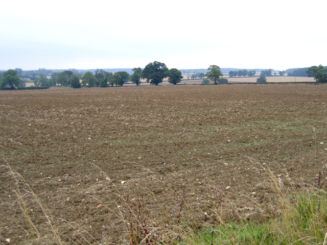
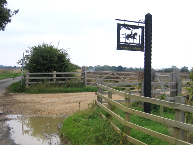
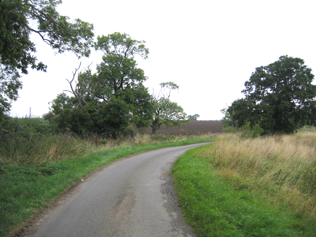
With a population of around 200 residents, Kirkby Underwood exudes a tranquil and close-knit community atmosphere. The village is known for its charming and picturesque surroundings, characterized by lush green fields, rolling hills, and a patchwork of farmlands. The rural landscape provides an idyllic backdrop for those seeking a peaceful and serene setting.

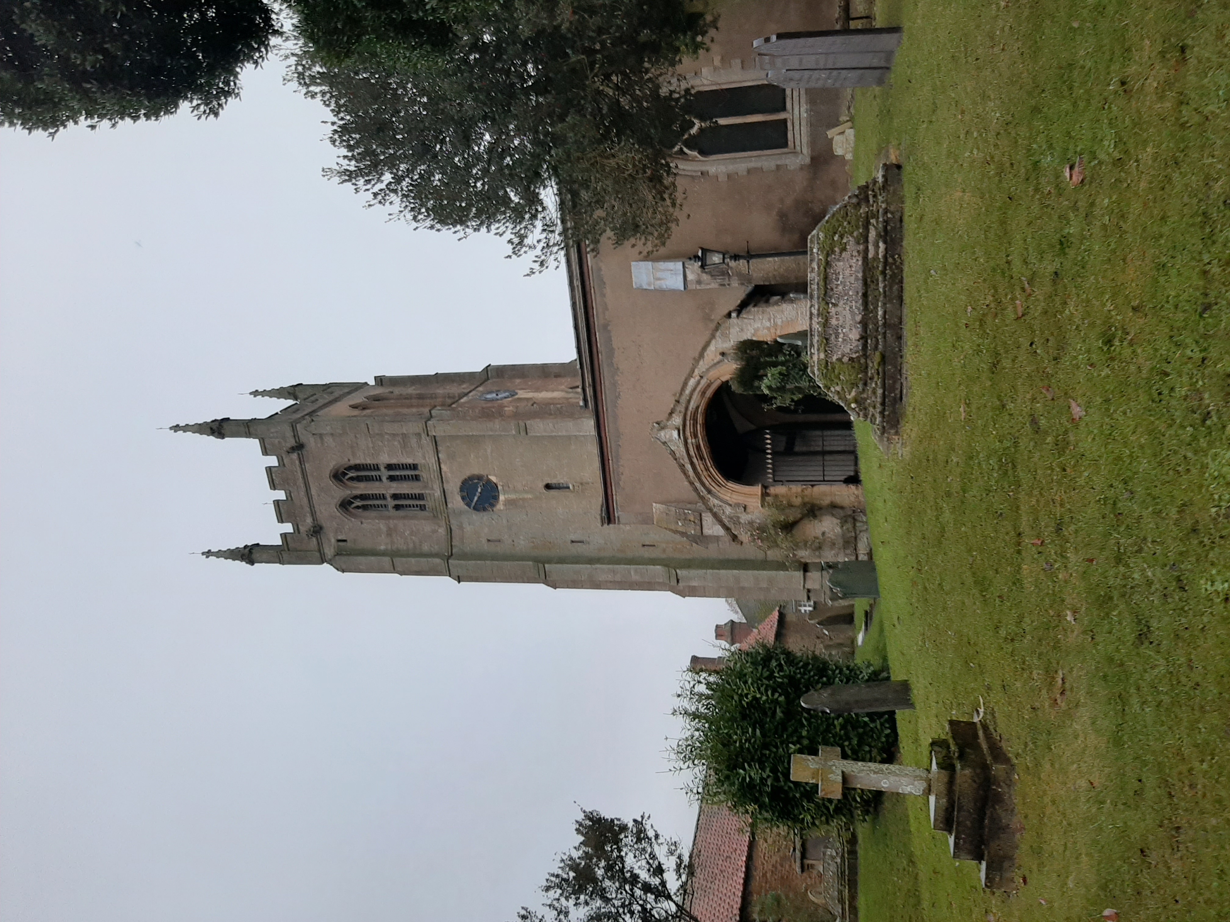
The village itself boasts a rich history, with evidence of human settlement dating back to the Roman era. The name "Kirkby" indicates Norse influence, suggesting a Viking presence in the region during the medieval period. Today, remnants of this past can be seen in the form of historic buildings such as St. Mary's Church, a Grade II-listed structure that dates back to the 12th century.

While Kirkby Underwood may be small in size, it offers basic amenities to cater to the needs of its residents. These include a village hall, a well-maintained playground, and recreational spaces for outdoor activities. Additionally, the village benefits from its proximity to nearby towns, providing access to a wider range of services and facilities.

Overall, Kirkby Underwood is a charming and quintessentially English village, offering a peaceful and picturesque setting for its residents to enjoy the beauty of rural Lincolnshire.

If you have any feedback on the listing, please let us know in the comments section below.

Kirkby Underwood Images

Images are sourced within 2km of 52.832719/-0.405346 or Grid Reference TF0727. Thanks to Geograph Open Source API. All images are credited.

St.Mary & All Saints' church, Kirkby Underwood, Lincs. Slightly away from the village, up a narrow lane and surrounded by open farmland. Early English and Perpendicular.
St.Mary & All Saints' church, Kirkby Underwood, Lincs.
Slightly away from the village, up a narrow lane and surrounded by open farmland. Early English and Perpendicular.
Farmland east of Kirkby Underwood, Lincs looking S from the Rippingale Road across the Old Beck valley.
Farmland east of Kirkby Underwood, Lincs
looking S from the Rippingale Road across the Old Beck valley.
Village Hall, Kirkby Underwood, Lincs beside The Green.
Village Hall, Kirkby Underwood, Lincs
beside The Green.
Ye Olde Three Tuns cottage, Kirkby Underwood, Lincs a former pub, on the corner of Rippingale Road and Aslackby Road.
Ye Olde Three Tuns cottage, Kirkby Underwood, Lincs
a former pub, on the corner of Rippingale Road and Aslackby Road.
Entrance to the village, Kirkby Underwood, Lincs
Rippingale Road, Kirkby Underwood, Lincs
Farmland view, Aslackby, Lincs looking S towards Kirkby Underwood.
Farmland view, Aslackby, Lincs
looking S towards Kirkby Underwood.
Farm entrance, Aslackby, Lincs with sign for Victoria Farm.
Farm entrance, Aslackby, Lincs
with sign for Victoria Farm.
Country lane, Aslackby, Lincs
Communications mast near Kirkby Underwood Communications mast, bristling with dishes for collecting and relaying data, sited north of Callan's Lane Wood near Kirkby Underwood
Communications mast near Kirkby Underwood
Communications mast, bristling with dishes for collecting and relaying data, sited north of Callan's Lane Wood near Kirkby Underwood
King Street Roman Road course of, no surface evidence left This image shows no surface evidence of the Roman Road King Street which crossed this field, at this position, in a northwest--southeast direction. Perhaps the farmer finds too many stones when cultivating here, or is it a 6 metre strip round the field that he receives payment to leave uncultivated?
King Street Roman Road course of, no surface evidence left
This image shows no surface evidence of the Roman Road King Street which crossed this field, at this position, in a northwest--southeast direction. Perhaps the farmer finds too many stones when cultivating here, or is it a 6 metre strip round the field that he receives payment to leave uncultivated?
Stainfield Spa In 1720 a Dr Edward Greathead of Lincoln discovered the existence of mineral springs in the vicinity and a well house was built for the convenience of the many visitors, but nothing of this exists now apart from the name Spa Farm: a livery stable. The gap in the hedge is where the footpath exits onto the Kirky Underwood road.
Stainfield Spa
In 1720 a Dr Edward Greathead of Lincoln discovered the existence of mineral springs in the vicinity and a well house was built for the convenience of the many visitors, but nothing of this exists now apart from the name Spa Farm: a livery stable. The gap in the hedge is where the footpath exits onto the Kirky Underwood road.
Kirkby Underwood Road Looking towards Stainfield with Ringstone Wood to the left and Dunsby Wood straight ahead.
Kirkby Underwood Road
Looking towards Stainfield with Ringstone Wood to the left and Dunsby Wood straight ahead.
Stainfield Spa from the footpath access Standing on the stile on Kirkby Underwood Road.
Stainfield Spa from the footpath access
Standing on the stile on Kirkby Underwood Road.
Farmland near Stainfield Dunsby Wood is on the horizon.
Farmland near Stainfield
Dunsby Wood is on the horizon.
Row Wood from Stainfield Road This deciduous woodland is mainly oak.
Row Wood from Stainfield Road
This deciduous woodland is mainly oak.
Dunsby Wood This large mixed woodland is part of a string of woodland across this part of Lincolnshire. It is commercially managed for timber and this section is mainly oak. Taken from the public bridleway.
Dunsby Wood
This large mixed woodland is part of a string of woodland across this part of Lincolnshire. It is commercially managed for timber and this section is mainly oak. Taken from the public bridleway.
Callan's Lane Wood at dusk This is owned by the Forestry Commission and there is a network of surfaced and unsurfaced forest walks. The wood is a popular place with walkers and dog owners. There is a small carpark on Callan's Lane.
Callan's Lane Wood at dusk
This is owned by the Forestry Commission and there is a network of surfaced and unsurfaced forest walks. The wood is a popular place with walkers and dog owners. There is a small carpark on Callan's Lane.
Show me another place!

Kirkby Underwood is located at Grid Ref: TF0727 (Lat: 52.832719, Lng: -0.405346)

Division: Parts of Kesteven

Administrative County: Lincolnshire

District: South Kesteven

Police Authority: Lincolnshire

What 3 Words

///occupy.populate.begun. Near Bourne, Lincolnshire

Nearby Locations

Kirkby Underwood

Related Wikis

Kirkby Underwood

Kirkby Underwood is a village and civil parish in the South Kesteven district of Lincolnshire, England. The population of the civil parish was 200 at the...

Aveland

Aveland was a Wapentake of Kesteven from the time of the Danelaw until the Local Government Act 1888. Its meeting place was The Aveland at grid reference...

St Andrew's Church, Rippingale

The Church of St Andrew in Rippingale, Lincolnshire, England, is a Grade Iā€“listed Anglican church. The earliest phase of the church dates back to the mid...

Rippingale

Rippingale is a village and civil parish in the South Kesteven district of Lincolnshire, England. The population of the civil parish was 929 at the 2011...

Stainfield near Bourne

Stainfield is a hamlet in the South Kesteven district of Lincolnshire, England. It is 3 miles (5 km) north from Bourne and 1 mile (1.6 km) west from the...

Bulby

Bulby is a hamlet in the South Kesteven district of Lincolnshire, England, and in the civil parish of Irnham, Bulby and Hawthorpe. The village is situated...

Hawthorpe, Lincolnshire

Hawthorpe is a hamlet in the South Kesteven district of Lincolnshire, England, and the civil parish of Irnham, Bulby and Hawthorpe. It is west from the...

Aslackby and Laughton

Aslackby and Laughton is a civil parish in the South Kesteven district of Lincolnshire, England. According to the 2001 census the parish had a population...

Nearby Amenities

Located within 500m of 52.832719,-0.405346
Kirkby Underwood
Is In: Lincolnshire, England, UK
Place: village
Lat/Long: 52.8320699/-0.4066494
Bus Stop
The Green
Naptan AtcoCode: 270000008719
Naptan Bearing: SE
Naptan CommonName: The Green
Naptan Indicator: adj
Naptan Landmark: The Green
Naptan NaptanCode: lingtpmt
Naptan Street: Stainfield Road
Naptan Verified: no
Source: naptan_import
Lat/Long: 52.8316588/-0.4069196
Bus Stop
The Old Three Tuns PH
Naptan AtcoCode: 270000008720
Naptan Bearing: SW
Naptan CommonName: The Old Three Tuns PH
Naptan Indicator: opp
Naptan Landmark: The Old Three Tuns PH
Naptan NaptanCode: lingtpmw
Naptan Street: Rippingale Road
Naptan Verified: no
Shelter: yes
Source: naptan_import
Lat/Long: 52.8328718/-0.4048563
Bus Stop
The Green
Naptan AtcoCode: 2700LKU00389
Naptan Bearing: NW
Naptan CommonName: The Green
Naptan Indicator: opp
Naptan Landmark: The Green
Naptan NaptanCode: linadmwd
Naptan Street: Stainfield Road
Naptan Verified: no
Source: naptan_import
Lat/Long: 52.8316975/-0.407126
Bus Stop
The Old Three Tuns PH
Naptan AtcoCode: 2700LKUB3103
Naptan Bearing: NE
Naptan CommonName: The Old Three Tuns PH
Naptan Indicator: adj
Naptan Landmark: The Old Three Tuns PH
Naptan NaptanCode: linawjmd
Naptan Street: Rippingale Road
Naptan Verified: no
Source: naptan_import
Lat/Long: 52.8329293/-0.4051214
Power: tower
Lat/Long: 52.8318356/-0.4026101
Power: tower
Lat/Long: 52.8344024/-0.4015801
Burbank's Farm
Place: farm
Source: Bing
Lat/Long: 52.8305589/-0.4051798
Grange Farm
Place: farm
Source: Bing
Lat/Long: 52.8324112/-0.4098677
Give Way
Source: Bing
Lat/Long: 52.8318989/-0.4074634
Give Way
Source: Bing
Lat/Long: 52.8318357/-0.4072183
Give Way
Source: Bing
Lat/Long: 52.8319934/-0.407204
Telephone
Booth: K6
Covered: booth
Man Made: telephone_box
Tourism: information
Lat/Long: 52.8328965/-0.4045769
Power: tower
Lat/Long: 52.8295878/-0.4034191
The data included in this document is from www.openstreetmap.org. The data is made available under ODbL.

Have you been to Kirkby Underwood?

Leave your review of Kirkby Underwood below (or comments, questions and feedback).