Oldpark Hill

Hill, Mountain in Surrey Mole Valley

England

Oldpark Hill

Tankards Pond Partly overgrown pond alongside Wolvens Lane, a byway between Coldharbour and Wotton.
Tankards Pond Credit: Ian Capper

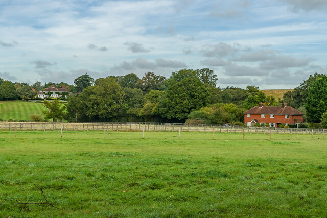
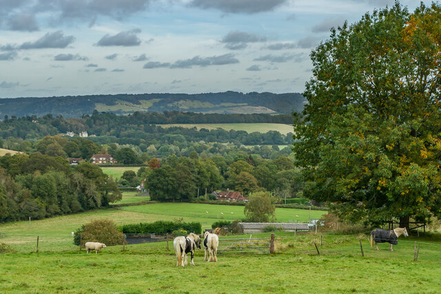
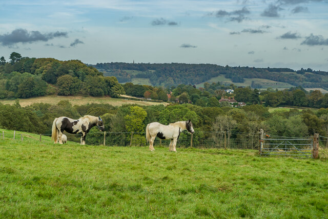
Oldpark Hill is a prominent natural feature located in the county of Surrey, England. Situated in the southern part of the county, it is a hill of moderate elevation and is part of the North Downs, a range of chalk hills that stretches across several counties in southeastern England. Standing at approximately 192 meters (630 feet) above sea level, Oldpark Hill offers stunning panoramic views of the surrounding countryside, making it a popular destination for hikers and nature enthusiasts.

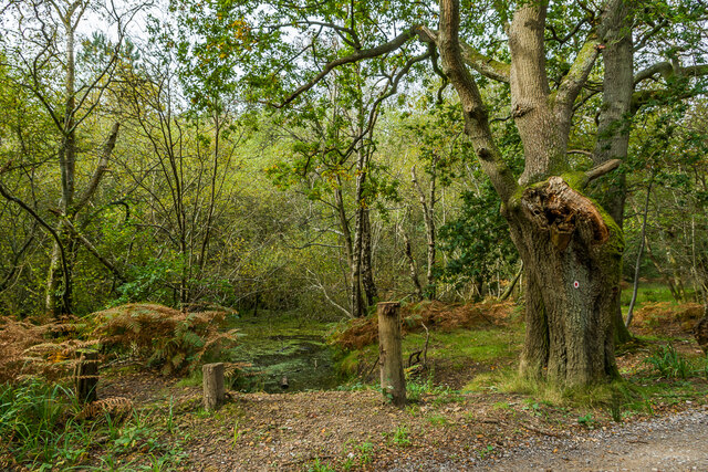
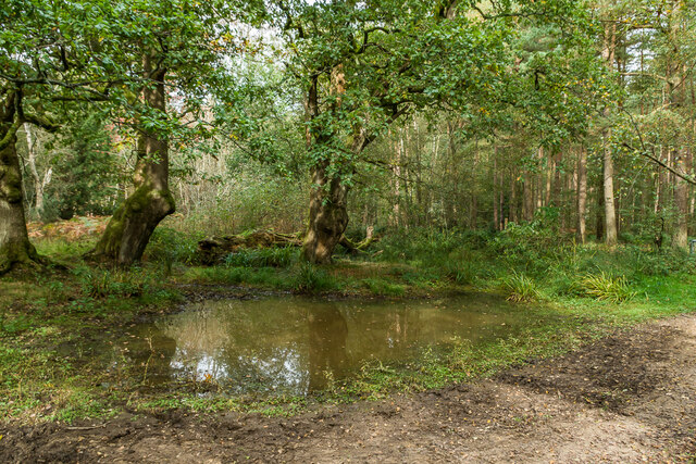
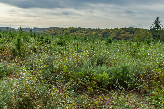
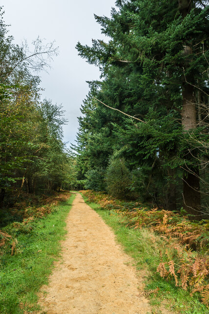
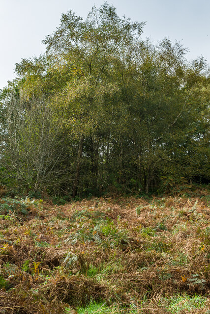
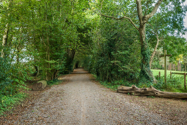
The hill itself is covered in rich grassland, dotted with patches of woodland, and supports a diverse range of flora and fauna. It is home to a variety of plant species, including wildflowers such as bluebells and orchids, as well as several species of butterflies and birds. The chalky soil found on Oldpark Hill also contributes to the growth of rare chalk-loving plants.

In addition to its natural beauty, Oldpark Hill holds historical significance. The site has evidence of Iron Age and Roman settlements, with remnants of ancient earthworks still visible today. The hill's strategic location made it a suitable spot for defensive purposes during these times.

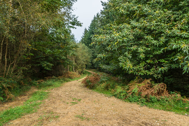
Oldpark Hill is easily accessible, with footpaths and trails leading to its summit. It is a popular spot for walking, picnicking, and birdwatching, attracting visitors from both nearby towns and further afield. The hill's close proximity to urban areas, such as the town of Redhill, adds to its appeal as a tranquil escape from city life.

In conclusion, Oldpark Hill in Surrey offers a blend of natural beauty, historical significance, and recreational opportunities, making it a cherished landmark in the region.

If you have any feedback on the listing, please let us know in the comments section below.
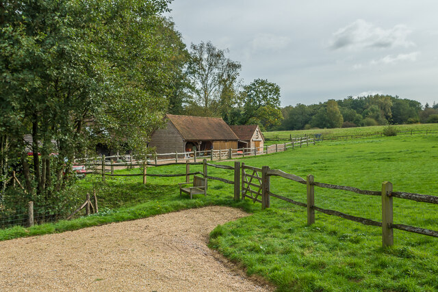
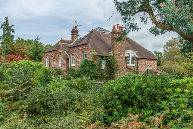
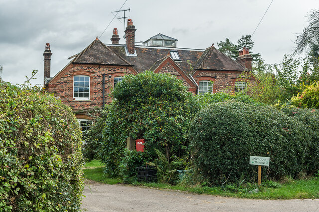
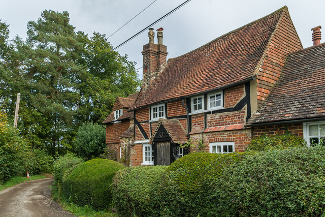
Oldpark Hill Images

Images are sourced within 2km of 51.209676/-0.38611662 or Grid Reference TQ1246. Thanks to Geograph Open Source API. All images are credited.

Tankards Pond Partly overgrown pond alongside Wolvens Lane, a byway between Coldharbour and Wotton.
Tankards Pond
Partly overgrown pond alongside Wolvens Lane, a byway between Coldharbour and Wotton.
Pond A small pond just north of the larger Tankards Pond, alongside Wolvens Lane, a byway between Coldharbour and Wotton.
Pond
A small pond just north of the larger Tankards Pond, alongside Wolvens Lane, a byway between Coldharbour and Wotton.
Replanted woodland Replanted woodland off Wolvens Lane, a byway between Coldharbour and Wotton.  In the left distance can be seen the tower on the summit of Leith Hill.
Replanted woodland
Replanted woodland off Wolvens Lane, a byway between Coldharbour and Wotton. In the left distance can be seen the tower on the summit of Leith Hill.
Squire's Great Wood Path through Squire's Great Wood.
Squire's Great Wood
Path through Squire's Great Wood.
Squire's Great Wood Path through Squire's Great Wood.
Squire's Great Wood
Path through Squire's Great Wood.
Bracken slope A bracken covered slope near Logmore Farm.
Bracken slope
A bracken covered slope near Logmore Farm.
Logmore Farm Track outside Logmore Farm.
Logmore Farm
Track outside Logmore Farm.
Logmore Farm Farm near Logmore Green.
Logmore Farm
Farm near Logmore Green.
Logmore Farm Paddocks at Logmore Farm near Logmore Green.
Logmore Farm
Paddocks at Logmore Farm near Logmore Green.
Meadow House and April Cottage Pair of semi-detached cottages on Logmore Lane.
Meadow House and April Cottage
Pair of semi-detached cottages on Logmore Lane.
Meadow House and April Cottage Pair of semi-detached cottages on Logmore Lane.
Meadow House and April Cottage
Pair of semi-detached cottages on Logmore Lane.
Old Cottage Cottage on Logmore Lane dating from the 17th Century with 19th and 20th Century extensions.  Grade II listed  - see <span class="nowrap"><a title="www.historicengland.org.uk/listing/the-list/list-entry/1391462" rel="nofollow ugc noopener" href="http://www.historicengland.org.uk/listing/the-list/list-entry/1391462">Link</a><img style="margin-left:2px;" alt="External link" title="External link - shift click to open in new window" src="https://s1.geograph.org.uk/img/external.png" width="10" height="10"/></span>.
Old Cottage
Cottage on Logmore Lane dating from the 17th Century with 19th and 20th Century extensions. Grade II listed - see LinkExternal link.
Logmore Place and 3 & 4 Brook Cottages Looking across paddocks from Logmore Green towards 3 & 4 Brook Cottages on the right and Logmore Place in the left distance.
Logmore Place and 3 & 4 Brook Cottages
Looking across paddocks from Logmore Green towards 3 & 4 Brook Cottages on the right and Logmore Place in the left distance.
Above Logmore Farm Looking across paddocks near Logmore Farm with Old Cottage in Logmore Green right of centre, Logmore Green Cottages beyond on the left and Box Hill in the background.
Above Logmore Farm
Looking across paddocks near Logmore Farm with Old Cottage in Logmore Green right of centre, Logmore Green Cottages beyond on the left and Box Hill in the background.
Above Logmore Farm Looking across paddocks near Logmore Farm with Ranmore on the North Downs in the background.
Above Logmore Farm
Looking across paddocks near Logmore Farm with Ranmore on the North Downs in the background.
Above Logmore Farm Looking across paddocks near Logmore Farm with Box Hill in the distance.
Above Logmore Farm
Looking across paddocks near Logmore Farm with Box Hill in the distance.
Logmore Farm Looking across paddocks to Logmore Farm.  In the distance are the North Downs from Box Hill on the left to Colley Hill on the right in the distance.  Logmore Farm dates originally from the 16th Century with subsequent refronting and extensions.  Grade II listed - see <span class="nowrap"><a title="www.historicengland.org.uk/listing/the-list/list-entry/1391056" rel="nofollow ugc noopener" href="http://www.historicengland.org.uk/listing/the-list/list-entry/1391056">Link</a><img style="margin-left:2px;" alt="External link" title="External link - shift click to open in new window" src="https://s1.geograph.org.uk/img/external.png" width="10" height="10"/></span>.
Logmore Farm
Looking across paddocks to Logmore Farm. In the distance are the North Downs from Box Hill on the left to Colley Hill on the right in the distance. Logmore Farm dates originally from the 16th Century with subsequent refronting and extensions. Grade II listed - see LinkExternal link.
Wolvens Lane Byway between Coldharbour and Wotton.  The bridleway on the right leads down to Logmore Green.
Wolvens Lane
Byway between Coldharbour and Wotton. The bridleway on the right leads down to Logmore Green.
Show me another place!

Oldpark Hill is located at Grid Ref: TQ1246 (Lat: 51.209676, Lng: -0.38611662)

Administrative County: Surrey

District: Mole Valley

Police Authority: Surrey

What 3 Words

///dining.candy.ends. Near Westcott, Surrey

Related Wikis

Wotton House, Surrey

Wotton House is a hotel, wedding venue, conference centre and former country house in Wotton near Dorking, Surrey, England. Originally the centre of the...

Wotton, Surrey

Wotton is a well-wooded parish with one main settlement, a small village mostly south of the A25 between Guildford in the west and Dorking in the east...

Abinger

Abinger is a large, well-wooded and mostly rural civil parish that lies between the settlements of Dorking, Shere and Ewhurst in the district of Mole Valley...

Friday Street

Friday Street is a hamlet on the gentle lower north slope of Leith Hill in Surrey, England. It is in a wooded headwater ravine, just to the south of Wotton...

Wotton and Abinger Commons

Wotton and Abinger Commons is a 324-hectare (800-acre) nature reserve south-west of Dorking in Surrey. It is managed by the Surrey Wildlife Trust. Part...

St James's Church, Abinger Common

St James's Church stands on Abinger Lane in Abinger Common, a small village within the civil parish of Abinger in Surrey, south-eastern England. The church...

Goddards

Goddards is a Grade II*-listed house in Abinger Common, Surrey, England. It was designed by Edwin Lutyens in 1898–1900 in the ideals of the Arts and Crafts...

Abinger Common War Memorial

Abinger Common War Memorial is a First World War memorial in the village of Abinger Common in Surrey, south-eastern England. The memorial was destroyed...

Nearby Amenities

Located within 500m of 51.209676,-0.38611662
Tillingbourne
Building: yes
Source: npe
Lat/Long: 51.2105004/-0.3801762
Old park Hill
Natural: wood
Source: 1:25K
Lat/Long: 51.2096991/-0.3870751
Barrier: stile
Lat/Long: 51.2114778/-0.3924926
Damphurst Wood
Natural: wood
Lat/Long: 51.2113469/-0.3868396
Barrier: stile
Lat/Long: 51.2121415/-0.3883332
Noexit: yes
Lat/Long: 51.2106985/-0.3893493
Barrier: stile
Lat/Long: 51.2128914/-0.3886155
Noexit: yes
Lat/Long: 51.2107022/-0.3894611
Crossing
Lat/Long: 51.2126893/-0.3827285
The data included in this document is from www.openstreetmap.org. The data is made available under ODbL.

Have you been to Oldpark Hill?

Leave your review of Oldpark Hill below (or comments, questions and feedback).