Cooper's Hill

Hill, Mountain in Surrey Runnymede

England

Cooper's Hill

The Beehive Pub sign: Fuller's pub on Middle Hill
The Beehive Credit: John Myers

Cooper's Hill is a prominent natural landmark located in Surrey, England. Situated near the village of Englefield Green, this hill is renowned for its picturesque scenery and breathtaking views. Rising to a height of approximately 178 meters (584 feet), it offers visitors a unique vantage point to observe the surrounding countryside.

The hill is formed by layers of chalk and flint, giving it a distinctive appearance and contributing to its geological significance. It is part of the North Downs, a range of hills that stretches across southern England. The slopes of Cooper's Hill are covered in lush greenery, including grasses, wildflowers, and a variety of trees such as beech and oak.

Cooper's Hill holds historical importance as well. It is believed to have been the site of a Roman temple dedicated to the goddess Diana, evidenced by the discovery of Roman coins and pottery fragments in the area. Moreover, it served as a vantage point for the Royalist forces during the English Civil War in the 17th century.

Today, Cooper's Hill continues to attract visitors who come to enjoy its natural beauty and indulge in recreational activities. It has a network of walking trails that allow hikers to explore the hill and enjoy the stunning views of the surrounding Surrey countryside. The annual Cooper's Hill Cheese-Rolling and Wake, a famous event in which participants chase a wheel of cheese down the steep slope, also takes place here, attracting locals and tourists alike.

Overall, Cooper's Hill in Surrey is a captivating natural landmark that offers both historical significance and stunning vistas, making it a popular destination for nature enthusiasts and history buffs alike.

If you have any feedback on the listing, please let us know in the comments section below.

Cooper's Hill Images

Images are sourced within 2km of 51.440627/-0.57081113 or Grid Reference SU9972. Thanks to Geograph Open Source API. All images are credited.

The Beehive Pub sign: Fuller's pub on Middle Hill
The Beehive
Pub sign: Fuller's pub on Middle Hill
High Street, Egham This is the north side looking east.
High Street, Egham
This is the north side looking east.
Ongoing construction work, Egham This was taken where Church Road (running left-right) is met by Station Road (foreground).
Ongoing construction work, Egham
This was taken where Church Road (running left-right) is met by Station Road (foreground).
The George Inn, Wraysbury On Windsor Road.
See <a href="https://www.geograph.org.uk/photo/7297906">TQ0074 : Sign for the George Inn, Wraysbury</a> for sign.
The George Inn, Wraysbury
On Windsor Road. See TQ0074 : Sign for the George Inn, Wraysbury for sign.
Sign for the George Inn, Wraysbury See <a href="https://www.geograph.org.uk/photo/7297905">TQ0074 : The George Inn, Wraysbury</a> for public house.
Sign for the George Inn, Wraysbury
See TQ0074 : The George Inn, Wraysbury for public house.
House on Windsor Road, Wraysbury
House on Staines Road, Wraysbury
Bus stop on Staines Road (B376), Wraysbury
Staines Road (B376)
Staines Road (B376)
Road to sailing club Off Staines Road (B376).
Road to sailing club
Off Staines Road (B376).
Remains of Ankerwycke Priory - looking south-east
Remains of Ankerwycke Priory - looking south-west
Remains of Ankerwycke Priory - looking north-west
Old School Court, Wraysbury A short residential street with the old school on the corner.
Old School Court, Wraysbury
A short residential street with the old school on the corner.
Gate to Ankerwycke Priory A private road to a few houses. Not the entrance to the National Trust's property.
Gate to Ankerwycke Priory
A private road to a few houses. Not the entrance to the National Trust's property.
Lake at Wraysbury With a lot of old gravel pits plus half a dozen or so large reservoirs, a lot of this area south east of Slough is actually water.
Quite a lot of Wraysbury village is along a sort of causeway in between some of these lakes.
Lake at Wraysbury
With a lot of old gravel pits plus half a dozen or so large reservoirs, a lot of this area south east of Slough is actually water. Quite a lot of Wraysbury village is along a sort of causeway in between some of these lakes.
Runnymede
Runnymede
Wedderburn Accommodation Block at Royal Holloway University
Show me another place!

Cooper's Hill is located at Grid Ref: SU9972 (Lat: 51.440627, Lng: -0.57081113)

Administrative County: Surrey

District: Runnymede

Police Authority: Surrey

What 3 Words

///empty.jaws.master. Near Egham, Surrey

Related Wikis

Royal Indian Engineering College

The Royal Indian Engineering College (or RIEC) was a British college of Civil Engineering run by the India Office to train civil engineers for service...

Air Forces Memorial

The Air Forces Memorial, or Runnymede Memorial, in Englefield Green, near Egham, Surrey, England is a memorial dedicated to some 20,456 men and women from...

Englefield Green Rovers F.C.

Englefield Green Rovers F.C. was a football club based in Englefield Green, near Egham, England. They were members of the Surrey FA. == History == Englefield...

Runnymede

Runnymede is a water-meadow alongside the River Thames in the English county of Surrey, and just over 20 miles (32 km) west of central London. It is notable...

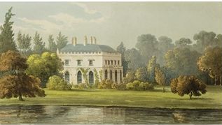
Castle Hill, Englefield Green

Castle Hill (originally known as Elvill's) is a large late-18th-century or early-19th-century Grade II listed mansion in Englefield Green, Surrey. The...

St John's Beaumont School

St John's Beaumont School is a private day and boarding Jesuit preparatory school, and is for boys and girls (from September 2023) aged 3 to 13 years old...
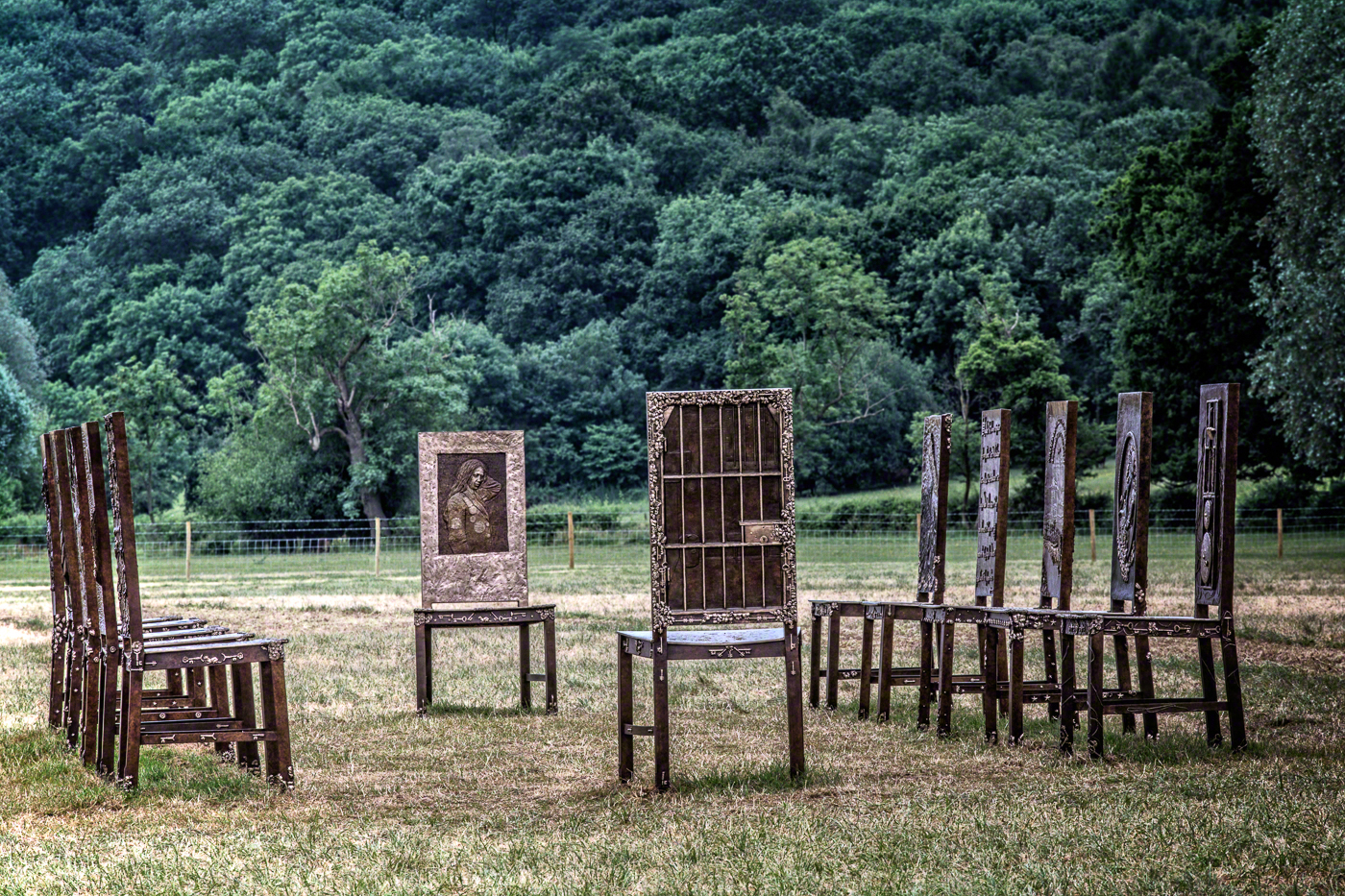
The Jurors

The Jurors is an artwork by Hew Locke, installed at Runnymede in Surrey in 2015 to commemorate the 800th anniversary of the sealing of Magna Carta. Commissioned...

Langham Pond

Langham Pond is a 26.7-hectare (66-acre) biological Site of Special Scientific Interest north of Egham in Surrey.The pond and its surrounding alluvial...

Nearby Amenities

Located within 500m of 51.440627,-0.57081113
Turning Circle
Lat/Long: 51.4364016/-0.5722576
Coopers Hill
Natural: peak
Source: npe
Lat/Long: 51.4411685/-0.5688074
Bus Stop
Beaumont Farm
Addr City: Egham
Addr Street: Priest Hill
Naptan AtcoCode: 40004401003B
Naptan Bearing: SW
Naptan CommonName: Beaumont Farm
Naptan Indicator: Opp
Naptan Landmark: Beaumont Farm
Naptan NaptanCode: suradjad
Naptan Street: Priest Hill
Naptan Verified: no
Public Transport: platform
Source: naptan_import
Toilets Wheelchair: no
Website: http://nextbuses.mobi/WebView/BusStopSearch/BusStopSearchResults/suradjad?currentPage=0
Wheelchair: no
Wheelchair Description: Stop on grass verge. No step free crossing to stop opposite.
Lat/Long: 51.4444875/-0.57434
Bus Stop
Coopers Hill Lane
Addr City: Egham
Addr Street: St Jude's Road
Naptan AtcoCode: 40004401004A
Naptan Bearing: N
Naptan CommonName: Coopers Hill Lane
Naptan Indicator: Opp
Naptan Landmark: Coopers Hill Lane
Naptan NaptanCode: suradmad
Naptan Street: Priest Hill
Naptan Verified: no
Public Transport: platform
Shelter: yes
Source: naptan_import
Toilets Wheelchair: no
Website: http://nextbuses.mobi/WebView/BusStopSearch/BusStopSearchResults/suradpmp?currentPage=0
Wheelchair: no
Wheelchair Description: No step-free crossing to stop opposite.
Lat/Long: 51.4398436/-0.5755062
Bus Stop
Coopers Hill Lane
Naptan AtcoCode: 40004401004B
Naptan Bearing: SE
Naptan CommonName: Coopers Hill Lane
Naptan Indicator: Just after
Naptan Landmark: Coopers Hill Lane
Naptan NaptanCode: suradpmp
Naptan Street: Priest Hill
Naptan Verified: no
Public Transport: platform
Shelter: yes
Source: naptan_import
Lat/Long: 51.4389585/-0.5751884
Post Box
Collection Times: Mo-Fr 16:00; Sa 11:00
Post Box Type: lamp
Ref: TW20 325
Royal Cypher: EIIR
Royal Cypher Wikidata: Q33102113
Lat/Long: 51.4395272/-0.5757322
Barrier: bollard
Lat/Long: 51.4368468/-0.5726778
Barrier: bollard
Lat/Long: 51.4365727/-0.572356
Crossing
Crossing: unmarked
Kerb: lowered
Sloped Curb: yes
Lat/Long: 51.4375513/-0.5723613
Crossing
Crossing: unmarked
Kerb: lowered
Sloped Curb: yes
Lat/Long: 51.4378581/-0.5719514
Bench
Lat/Long: 51.4413602/-0.5667516
Door: no
Entrance: main
Lat/Long: 51.442148/-0.5640317
Bus Stop
Hox Park
Public Transport: platform
Lat/Long: 51.4372629/-0.5687512
Bus Stop
Hox Park
Naptan AtcoCode: 40004406991B
Naptan NaptanCode: surgtmdt
Public Transport: platform
Lat/Long: 51.4371134/-0.5685243
The data included in this document is from www.openstreetmap.org. The data is made available under ODbL.

Have you been to Cooper's Hill?

Leave your review of Cooper's Hill below (or comments, questions and feedback).