Budburrow Hill
Hill, Mountain in Surrey Guildford
England
Budburrow Hill
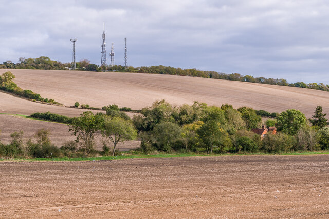
Budburrow Hill, located in Surrey, England, is a prominent natural landmark with an elevation of 185 meters (607 feet) above sea level. It is classified as a hill and not a mountain due to its modest height, yet it offers breathtaking views of the surrounding countryside. The hill is situated near the village of Box Hill and forms part of the North Downs, a ridge of chalk hills stretching across southeastern England.
Budburrow Hill is characterized by its gentle slopes and lush greenery, covered in a variety of plant species typical of the chalk downland habitat. This includes vibrant wildflowers, such as cowslips and orchids, that bloom in the spring and summer months, creating a picturesque landscape. The hill also supports diverse wildlife, including various bird species, butterflies, and small mammals.
Visitors to Budburrow Hill can enjoy numerous walking trails that traverse the area, offering a chance to explore its natural beauty and enjoy the peaceful surroundings. The hill's location provides an excellent vantage point to admire the panoramic views of the surrounding countryside, including the nearby River Mole and the enchanting Surrey Hills Area of Outstanding Natural Beauty.
Budburrow Hill holds historical significance as well, with evidence of human activity dating back to the Iron Age. Archaeological remains, such as earthworks and burial mounds, have been discovered on the hill, providing insights into the area's ancient past.
Overall, Budburrow Hill in Surrey offers visitors a tranquil retreat, showcasing the beauty of the English countryside and providing a glimpse into its rich history.
If you have any feedback on the listing, please let us know in the comments section below.
Budburrow Hill Images
Images are sourced within 2km of 51.217818/-0.63055716 or Grid Reference SU9547. Thanks to Geograph Open Source API. All images are credited.


Budburrow Hill is located at Grid Ref: SU9547 (Lat: 51.217818, Lng: -0.63055716)
Administrative County: Surrey
District: Guildford
Police Authority: Surrey
What 3 Words
///effort.froze.headstone. Near Wood Street Village, Surrey
Nearby Locations
Related Wikis

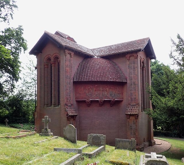
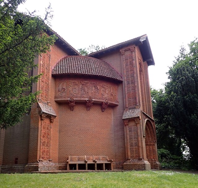
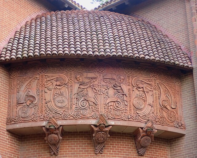
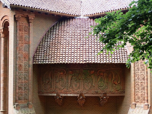
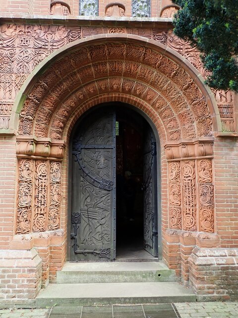
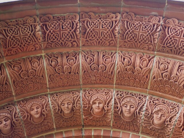
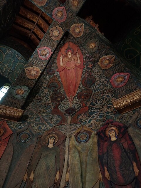
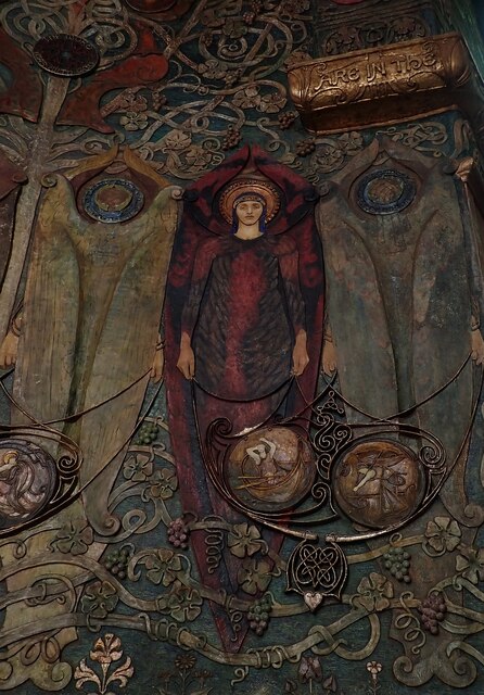
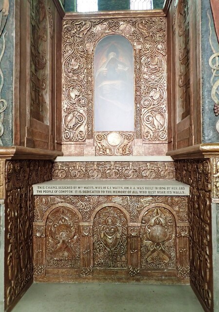
Watts Cemetery Chapel
The Watts Cemetery Chapel or Watts Mortuary Chapel is a chapel in a Modern Style (British Art Nouveau style) version of Celtic Revival in the village cemetery...
Watts Gallery
Watts Gallery – Artists' Village is an art gallery in the village of Compton, near Guildford in Surrey. It is dedicated to the work of the Victorian-era...

De Morgan Centre
The De Morgan Centre for the Study of 19th Century Art and Society was a gallery in the London Borough of Wandsworth, England, which was home for a few...

Compton, Guildford
Compton is a village and civil parish in the Guildford district of Surrey, England. It is between Godalming and Guildford. It has a medieval church and...
Related Videos

The Pilgrims Way - Solo Hiking England's Historic Pilgrimage
Solo hiking 180 miles along the Pilgrims Way; a historic pilgrimage route in Southern England. The hike took 10 days and follows ...

Camberley U3A Walking Group 6
Date: Thursday 18th May 2017 Camberley U3A Walking Group 6 A 2 hour walk in the area of Puttenham and Hurtmore in Surrey.

Walking The Staffordshire and Worcestershire Canal (Part 7)
Continuing my walk along the Staffordshire and Worcestershire Canal, starting at Aldersley Junction and heading off, the walk ...

NORTH DOWNS WAY Doğa Yürüyüşü - KARAVANLA İngiltere'nin güney turu
Bu hafta İngiltere'nin güneyinde, North Downs yolunda yürüyüşteyiz. North Downs Way Güney İngiltere'de 1978'de açılan, ...
Nearby Amenities
Located within 500m of 51.217818,-0.63055716Have you been to Budburrow Hill?
Leave your review of Budburrow Hill below (or comments, questions and feedback).