Bromley Hill

Hill, Mountain in Berkshire

England

Bromley Hill

Queen Anne's Road, Windsor Queen Anne's Road is a private road in Windsor.  The road forms part of the Crown Estate.
Queen Anne's Road, Windsor Credit: Malc McDonald

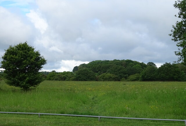
Bromley Hill is a prominent hill located in the county of Berkshire, England. Situated in the southern part of the county, it forms part of the Berkshire Downs, a range of hills known for their scenic beauty and rich history. With an elevation of approximately 261 meters (856 feet), Bromley Hill offers stunning views of the surrounding countryside.

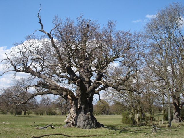
The hill is covered in lush greenery and boasts a diverse range of flora and fauna, making it a popular spot for nature enthusiasts and hikers. The area surrounding Bromley Hill is characterized by rolling hills, picturesque valleys, and charming villages, creating a quintessentially English countryside experience.

In addition to its natural beauty, Bromley Hill also holds historical significance. It is believed that the hill was once the site of an Iron Age hillfort, serving as a defensive settlement during ancient times. Archaeological excavations have uncovered remnants of this ancient fortification, adding to the historical interest of the area.

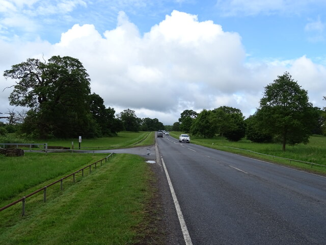
Furthermore, Bromley Hill is located close to several other attractions in Berkshire, including the historic town of Newbury and the famous racecourse of the same name. Visitors to Bromley Hill can easily explore these nearby places of interest, making it an ideal destination for a day trip or a longer stay.

Overall, Bromley Hill in Berkshire offers a combination of natural splendor, historical intrigue, and convenient proximity to other attractions, making it a must-visit location for nature lovers, history buffs, and those seeking a peaceful retreat in the heart of the English countryside.

If you have any feedback on the listing, please let us know in the comments section below.

Bromley Hill Images

Images are sourced within 2km of 51.457767/-0.63511998 or Grid Reference SU9474. Thanks to Geograph Open Source API. All images are credited.

Queen Anne's Road, Windsor Queen Anne's Road is a private road in Windsor.  The road forms part of the Crown Estate.
Queen Anne's Road, Windsor
Queen Anne's Road is a private road in Windsor. The road forms part of the Crown Estate.
Queen's Gate, Windsor Cottages at Queen's Gate on the outskirts of Windsor.
Queen's Gate, Windsor
Cottages at Queen's Gate on the outskirts of Windsor.
King's Road, Windsor King's Road entering the town of Windsor.  This road forms part of the route of the A332.
King's Road, Windsor
King's Road entering the town of Windsor. This road forms part of the route of the A332.
A332 road, Windsor Great Park The A332 road entering Windsor Great Park.  Here the speed limit changes to 50 miles per hour through the park.

This photo was taken in the late afternoon on a bright and sunny February day.  The sun was low in the sky, casting long shadows, while the trees were bare for the winter months.
A332 road, Windsor Great Park
The A332 road entering Windsor Great Park. Here the speed limit changes to 50 miles per hour through the park. This photo was taken in the late afternoon on a bright and sunny February day. The sun was low in the sky, casting long shadows, while the trees were bare for the winter months.
Queen Anne's Gate, Windsor The A332 road passing Queen Anne's Gate as it leaves Windsor Great Park and enters the town of Windsor.  The pink-coloured building is the gate lodge.
Queen Anne's Gate, Windsor
The A332 road passing Queen Anne's Gate as it leaves Windsor Great Park and enters the town of Windsor. The pink-coloured building is the gate lodge.
Path in Windsor Great Park A path on the perimeter of Windsor Great Park.

This image was taken on a bright and sunny afternoon in late February.  Trees were bare for the winter months.
Path in Windsor Great Park
A path on the perimeter of Windsor Great Park. This image was taken on a bright and sunny afternoon in late February. Trees were bare for the winter months.
Path in Windsor Great Park A path on the perimeter of Windsor Great Park.  The small numbers on the wooden post indicate the route of National Cycle Network route 4, which uses this path.

This image was taken late in the afternoon on a bright and sunny February day.  The sun was low in the sky casting long shadows, while the trees were bare for the winter season.
Path in Windsor Great Park
A path on the perimeter of Windsor Great Park. The small numbers on the wooden post indicate the route of National Cycle Network route 4, which uses this path. This image was taken late in the afternoon on a bright and sunny February day. The sun was low in the sky casting long shadows, while the trees were bare for the winter season.
Path and cycle route near Windsor A gate across a path on the outskirts of Windsor.  The path forms part of National Cycle Network route 4, indicated by labels on the gatepost.

This image was taken on a bright and sunny afternoon in February.  Trees were bare for the winter season.
Path and cycle route near Windsor
A gate across a path on the outskirts of Windsor. The path forms part of National Cycle Network route 4, indicated by labels on the gatepost. This image was taken on a bright and sunny afternoon in February. Trees were bare for the winter season.
St. Leonard's Road, Windsor St. Leonard's Road forms part of the route of the B3022.

This image was taken during the late afternoon on a February day.  The sun was low in the sky, casting long shadows.
St. Leonard's Road, Windsor
St. Leonard's Road forms part of the route of the B3022. This image was taken during the late afternoon on a February day. The sun was low in the sky, casting long shadows.
Peel Close, Windsor Peel Close is a residential cul-de-sac in Windsor.

This image was taken in the late afternoon on a bright and sunny February day.  The sun was low in the sky, casting long shadows.
Peel Close, Windsor
Peel Close is a residential cul-de-sac in Windsor. This image was taken in the late afternoon on a bright and sunny February day. The sun was low in the sky, casting long shadows.
Peel Close, Windsor Peel Close is a residential cul-de-sac in Windsor.

This image was taken in the late afternoon on a bright and sunny February day.  The sun was low in the sky, casting long shadows, while the tree in the foreground was bare for the winter season.
Peel Close, Windsor
Peel Close is a residential cul-de-sac in Windsor. This image was taken in the late afternoon on a bright and sunny February day. The sun was low in the sky, casting long shadows, while the tree in the foreground was bare for the winter season.
Former manor house, Windsor The building in the centre of this image was built as Clewer Manor.  It has now been converted into apartments and is named Meryton House.  It is Grade II listed.

This image was taken in the late afternoon on a bright and sunny February day.  The sun was low in the sky, casting long shadows.
Former manor house, Windsor
The building in the centre of this image was built as Clewer Manor. It has now been converted into apartments and is named Meryton House. It is Grade II listed. This image was taken in the late afternoon on a bright and sunny February day. The sun was low in the sky, casting long shadows.
Hatch Lane, Windsor Hatch Lane is a residential road in Windsor.

This image was taken in the late afternoon on a bright and sunny February day.  The sun was low in the sky, casting long shadows.
Hatch Lane, Windsor
Hatch Lane is a residential road in Windsor. This image was taken in the late afternoon on a bright and sunny February day. The sun was low in the sky, casting long shadows.
Old Boundary Markers on the B3022 St Leonard's Road in Windsor Two War Department Boundary Markers set in the corner of the front garden wall of No.182, on the B3022 St Leonard's Road in Windsor, the former gate of the military hospital.

Milestone Society National ID: BE_WDWIND21em
Old Boundary Markers on the B3022 St Leonard's Road in Windsor
Two War Department Boundary Markers set in the corner of the front garden wall of No.182, on the B3022 St Leonard's Road in Windsor, the former gate of the military hospital. Milestone Society National ID: BE_WDWIND21em
Windsor Great Park
Windsor Great Park
Sheet Street Road (A332) Through Windsor Great Park.
Sheet Street Road (A332)
Through Windsor Great Park.
Windsor Great Park
Windsor Great Park
Sheet Street Road (A332) Through Windsor Great Park.
Sheet Street Road (A332)
Through Windsor Great Park.
Show me another place!

Bromley Hill is located at Grid Ref: SU9474 (Lat: 51.457767, Lng: -0.63511998)

Unitary Authority: Windsor and Maidenhead

Police Authority: Thames Valley

What 3 Words

///duty.plot.adults. Near Windsor, Berkshire

Related Wikis

Cranbourne Lodge

Cranbourne Lodge was a keeper's lodge for the royal hunting grounds of Cranbourne Chase, once adjoining but now part of Windsor Great Park in the English...

Legoland Windsor Resort

Legoland Windsor Resort (), styled and also known as Legoland Windsor, is a theme park and resort in Windsor, Berkshire in England, themed around the Lego...
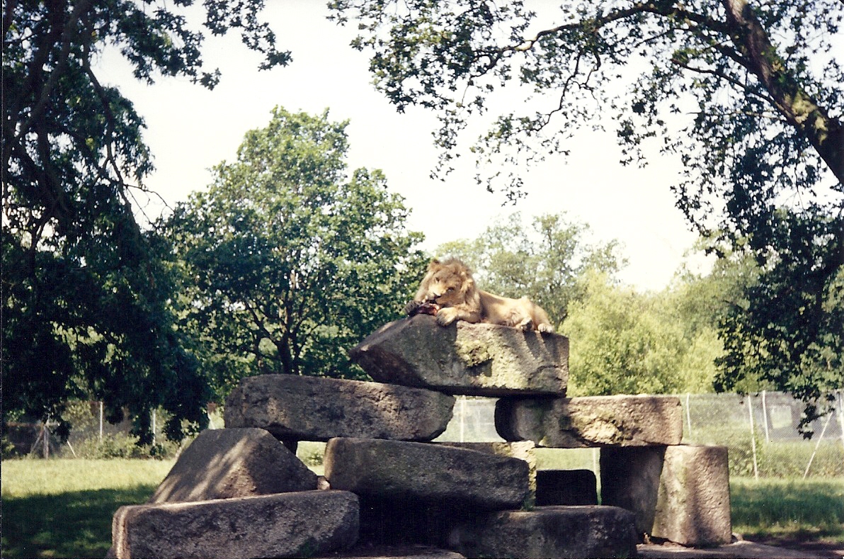
Windsor Safari Park

Windsor Safari Park was a safari park built on St Leonard's Hill on the outskirts of the town of Windsor in Berkshire, England; it has since been converted...

Windsor Forest and Great Park

Windsor Forest and Great Park is a 1,778.9-hectare (4,396-acre) biological Site of Special Scientific Interest in Berkshire and Surrey, located south of...

Nearby Amenities

Located within 500m of 51.457767,-0.63511998
Bromley Hill
Natural: peak
Lat/Long: 51.4575915/-0.6356149
Bromley Hill
Place: locality
Lat/Long: 51.4579584/-0.6339132
The data included in this document is from www.openstreetmap.org. The data is made available under ODbL.

Have you been to Bromley Hill?

Leave your review of Bromley Hill below (or comments, questions and feedback).