Barns Cliff End

Hill, Mountain in Yorkshire Scarborough

England

Barns Cliff End

Track in Broxa Forest Looking west.
Track in Broxa Forest Credit: T Eyre

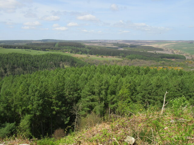
Barns Cliff End is an impressive hill located in the picturesque county of Yorkshire, England. Rising to a height of approximately 1,200 feet, it is considered one of the highest points in the region, offering breathtaking views of the surrounding countryside.

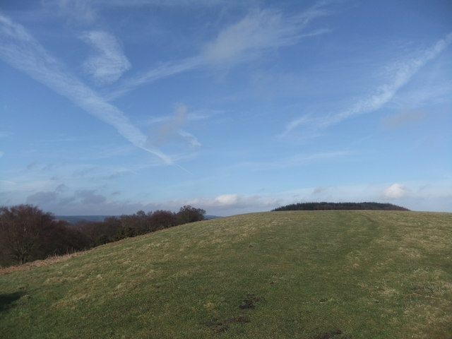
Situated in the North York Moors National Park, Barns Cliff End is a popular destination for outdoor enthusiasts and nature lovers alike. The hill is characterized by its rugged terrain, with steep slopes covered in heather and grasses. It is a haven for wildlife, providing a habitat for various bird species, including peregrine falcons and kestrels.

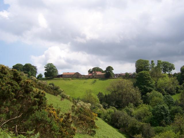
The summit of Barns Cliff End offers a panoramic vista of the surrounding landscape. On a clear day, visitors can marvel at the rolling hills, lush valleys, and charming villages that dot the countryside. The hill's strategic location also provides a stunning viewpoint of the North Sea coastline, with the iconic Whitby Abbey visible in the distance.

For hikers and walkers, Barns Cliff End offers a range of trails and paths to explore. The ascent to the summit can be challenging, but the reward of the breathtaking views makes it worth the effort. Additionally, the hill is part of a network of footpaths that connect to other attractions in the area, such as the Cleveland Way National Trail.

Overall, Barns Cliff End is a natural gem in Yorkshire, offering visitors the opportunity to immerse themselves in the region's beauty and tranquility. Whether it's for a leisurely stroll or a more adventurous hike, this hill provides an unforgettable experience for all who venture to its peak.

If you have any feedback on the listing, please let us know in the comments section below.

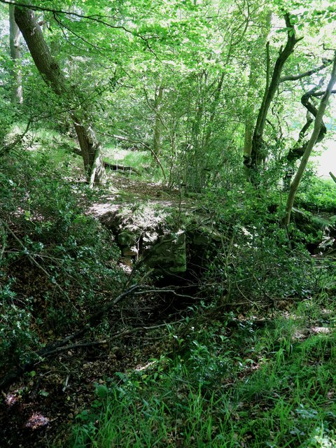
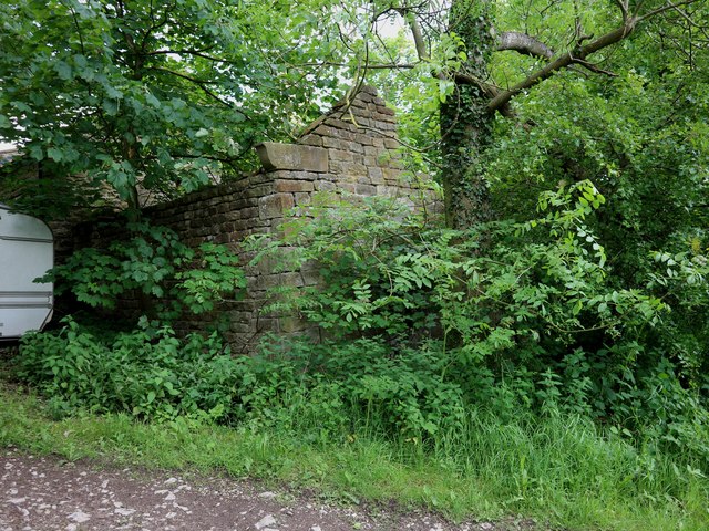
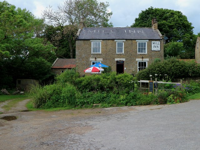
Barns Cliff End Images

Images are sourced within 2km of 54.338367/-0.55341101 or Grid Reference SE9494. Thanks to Geograph Open Source API. All images are credited.

Track in Broxa Forest Looking west.
Track in Broxa Forest
Looking west.
Barns Cliff End Looking NW, a Cuckoo was heard in the trees below.
Barns Cliff End
Looking NW, a Cuckoo was heard in the trees below.
Barns Cliff view Looking NE from the forest track.
Barns Cliff view
Looking NE from the forest track.
May in Broxa Forest Fresh leaves on the Birch trees.
May in Broxa Forest
Fresh leaves on the Birch trees.
Low West Side The area of Langdale Forest called Low West Side.
Low West Side
The area of Langdale Forest called Low West Side.
The upper Derwent valley Looking north.
The upper Derwent valley
Looking north.
Near Barley Carr Dike Looking SE.
Near Barley Carr Dike
Looking SE.
Footpath off High Seat A public footpath running south from High Seat towards Lownorth Park. On the horizon the deep valley of the Derwent is seen dividing the plateau of broxa Forest from that of Langdale Rigg
Footpath off High Seat
A public footpath running south from High Seat towards Lownorth Park. On the horizon the deep valley of the Derwent is seen dividing the plateau of broxa Forest from that of Langdale Rigg
High Seat This low mound forming the end of a spur appears to be natural and is known as High Seat
High Seat
This low mound forming the end of a spur appears to be natural and is known as High Seat
Leat for Harwood Dale mill The stone culvert carries a public footpath over the leat for Harwood Dale mill. The leat comes off Jugger Howe Beck (a tributary of the Derwent) at a weir a few yards behind the camera and continues for nearly three quarters of a mile to the mill
Leat for Harwood Dale mill
The stone culvert carries a public footpath over the leat for Harwood Dale mill. The leat comes off Jugger Howe Beck (a tributary of the Derwent) at a weir a few yards behind the camera and continues for nearly three quarters of a mile to the mill
Part of Harwood Dale mill This roofless building housed the water wheel for Harwood Dale mill. The mill dated from the 18th century. It was served by the leat shown in <a href="https://www.geograph.org.uk/photo/5422276">SE9496 : Leat for Harwood Dale mill</a>.
Part of Harwood Dale mill
This roofless building housed the water wheel for Harwood Dale mill. The mill dated from the 18th century. It was served by the leat shown in SE9496 : Leat for Harwood Dale mill.
The Mill Inn, Harwood Dale The mill was in the pantiled roofed building on the left and adjacent to that, though not visible, is the derelict building which housed the wheel shown in <a href="https://www.geograph.org.uk/photo/5422283">SE9596 : Part of Harwood Dale mill</a>
The Mill Inn, Harwood Dale
The mill was in the pantiled roofed building on the left and adjacent to that, though not visible, is the derelict building which housed the wheel shown in SE9596 : Part of Harwood Dale mill
On High West Side
On High West Side
High West Side Ridge path
Langdale Rigg End
Langdale Rigg End
Footpath near High Langdale End
Stepping stones, River Derwent
Barns Cliff End
Barns Cliff End
Show me another place!

Barns Cliff End is located at Grid Ref: SE9494 (Lat: 54.338367, Lng: -0.55341101)

Division: North Riding

Administrative County: North Yorkshire

District: Scarborough

Police Authority: North Yorkshire

What 3 Words

///lamppost.supported.speedily. Near Burniston, North Yorkshire

Nearby Locations

Merry Wood Barns Cliff End

Related Wikis

Harwood Dale

Harwood Dale is a village and civil parish in the Scarborough district of North Yorkshire, England. It lies within the North York Moors National Park...

Broxa, North Yorkshire

Broxa is a village in the Scarborough district of North Yorkshire, England, within the North York Moors National Park. The village is 6.2 miles (10 km...

Broxa-cum-Troutsdale

Broxa-cum-Troutsdale is a civil parish in the Scarborough district of North Yorkshire, England. The population as of the 2011 census remained less than...

Silpho

Silpho is a village and civil parish in the Scarborough district of the county of North Yorkshire, England. According to the 2001 UK census, Silpho parish...

Nearby Amenities

Located within 500m of 54.338367,-0.55341101
The data included in this document is from www.openstreetmap.org. The data is made available under ODbL.

Have you been to Barns Cliff End?

Leave your review of Barns Cliff End below (or comments, questions and feedback).