Birch Hill

Hill, Mountain in Berkshire

England

Birch Hill

SU8566 Great Hollands The Great Hollands Recreation Ground, in the east of the square. Great Hollands is part of the huge sprawl called Bracknell.
SU8566 Great Hollands Credit: Brendan and Ruth McCartney

Birch Hill is a small hill located in the county of Berkshire, England. Situated in the town of Bracknell, it is part of the larger Bracknell Forest district. Standing at an elevation of approximately 80 meters, Birch Hill is not considered a substantial mountain but rather a modest hill.

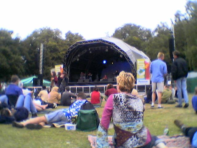
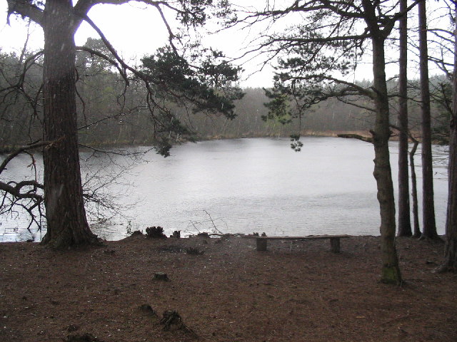
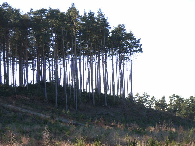
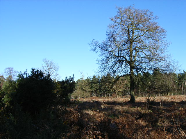
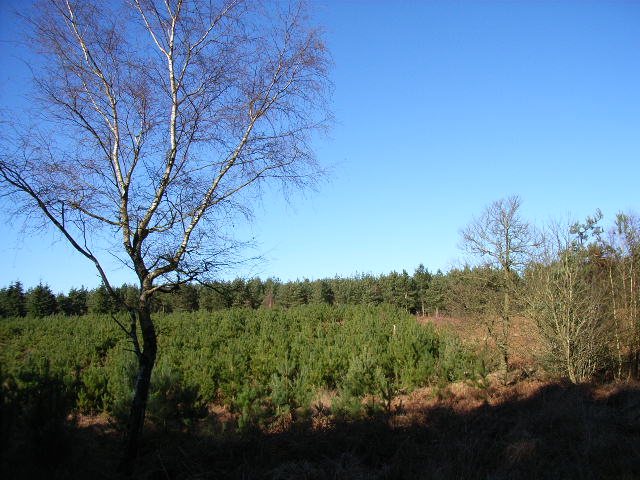
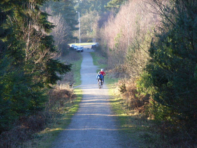
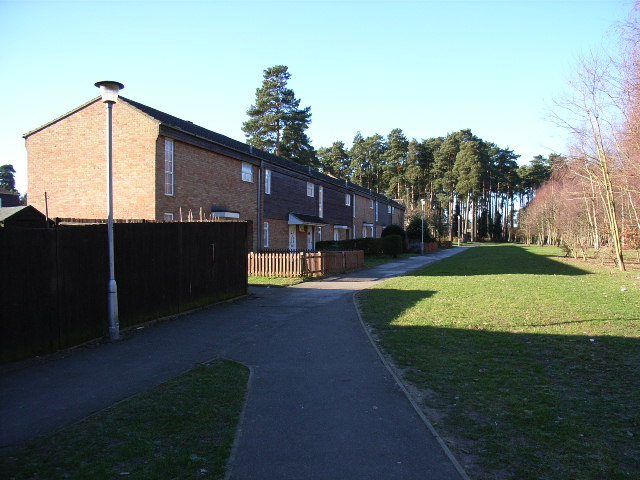
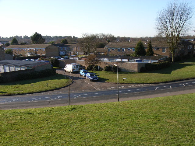
The hill is known for its picturesque surroundings, featuring a mix of woodland and open fields. It is a popular spot for locals and visitors alike to enjoy outdoor activities such as hiking, walking, and picnicking. Birch Hill also offers stunning panoramic views of the surrounding countryside, providing an ideal vantage point for photographers and nature enthusiasts.

The hill is easily accessible, with several footpaths and trails leading to its summit. It is particularly renowned for its bluebell woods, which come alive with a vibrant display of flowers in the spring. These woods attract numerous visitors who come to admire and photograph the natural beauty.

Birch Hill is also home to a variety of wildlife, including birds, rabbits, and foxes. The hill's diverse ecosystem supports a range of plant species, making it an important habitat for local flora and fauna.

Overall, Birch Hill offers a tranquil and scenic escape from the bustling town of Bracknell. Its natural beauty, combined with its accessibility and recreational opportunities, make it a popular destination for outdoor enthusiasts and nature lovers in Berkshire.

If you have any feedback on the listing, please let us know in the comments section below.

Birch Hill Images

Images are sourced within 2km of 51.387824/-0.7560703 or Grid Reference SU8666. Thanks to Geograph Open Source API. All images are credited.

SU8566 Great Hollands The Great Hollands Recreation Ground, in the east of the square. Great Hollands is part of the huge sprawl called Bracknell.
SU8566 Great Hollands
The Great Hollands Recreation Ground, in the east of the square. Great Hollands is part of the huge sprawl called Bracknell.
Bracknell Forest towards Caesar's Camp
South Hill Park Bracknell "Out There" festival 2004
South Hill Park
Bracknell "Out There" festival 2004
Mill Pond, Look Out Discovery Centre Mill Pond, in the rain, in the heart of the woodland which is part of the Look Out Discovery Centre
Mill Pond, Look Out Discovery Centre
Mill Pond, in the rain, in the heart of the woodland which is part of the Look Out Discovery Centre
Look Out Discovery Centre Vast woodland of the Look Out Discovery Centre
Look Out Discovery Centre
Vast woodland of the Look Out Discovery Centre
Easthampstead Park Crematorium, Bracknell
St Michael and St Mary Magdalene's, Easthampstead Formerly the centre of Easthampstead village, which was engulfed by the new town of Bracknell.
St Michael and St Mary Magdalene's, Easthampstead
Formerly the centre of Easthampstead village, which was engulfed by the new town of Bracknell.
Great Hollands, Bracknell
Hanworth, Bracknell
Hanworth, Bracknell
Wagbullock Hill, Swinley Forest Swinley Forest is crown estate land open to the public.
Wagbullock Hill, Swinley Forest
Swinley Forest is crown estate land open to the public.
Wickham Bushes, Swinley Forest A cleared area with a broad-leaved tree left to stand.
Wickham Bushes, Swinley Forest
A cleared area with a broad-leaved tree left to stand.
Great Hollands, Bracknell Another view of the estate. The shops are on the left.
Great Hollands, Bracknell
Another view of the estate. The shops are on the left.
Hanworth, Bracknell When they built this estate the developers left plenty of pine trees. These make it one of the more pleasant (not saying much) estates in the town.
Hanworth, Bracknell
When they built this estate the developers left plenty of pine trees. These make it one of the more pleasant (not saying much) estates in the town.
Hanworth, Bracknell Another view of the estate, looking from Bucklebury to Ollerton.
Hanworth, Bracknell
Another view of the estate, looking from Bucklebury to Ollerton.
Area of young pine trees, Swinley Forest
Frozen pond, Swinley Forest The grassy mound behind is South East Water's Crowthorne reservoir.
Frozen pond, Swinley Forest
The grassy mound behind is South East Water's Crowthorne reservoir.
Hut Hill, Swinley Forest Looking down the hill to the small car park next to the A3095. Only permit-holders are allowed to cycle in the forest.
Hut Hill, Swinley Forest
Looking down the hill to the small car park next to the A3095. Only permit-holders are allowed to cycle in the forest.
Cadence offices, Bracknell Situated on the sports centre roundabout, near the Harmans Water district.
Cadence offices, Bracknell
Situated on the sports centre roundabout, near the Harmans Water district.
Show me another place!

Birch Hill is located at Grid Ref: SU8666 (Lat: 51.387824, Lng: -0.7560703)

Unitary Authority: Bracknell Forest

Police Authority: Thames Valley

What 3 Words

///aware.deeper.trunk. Near Bracknell, Berkshire

Nearby Locations

Hanworth Birch Hill

Related Wikis

Birch Hill

Birch Hill is a southern suburb of Bracknell, originally part of the now-defunct civil parish of Easthampstead, in the English county of Berkshire. Although...

Caesar's Camp, Bracknell Forest

Caesar's Camp is an Iron Age hill fort around 2,400 years old. It is located just in Crowthorne civil parish to the south of Bracknell in the English county...

Hanworth, Bracknell

Hanworth is a southern suburb of Bracknell, originally part of the now-defunct civil parish of Easthampstead, in the English county of Berkshire. The Hanworth...

Wooden Hill

Wooden Hill is a private estate within the council ward of Great Hollands, Bracknell, in Berkshire, England. The settlement lies west of the A3095 road...

St Michael and St Mary Magdalene's Church, Easthampstead

The Church of St Michael and St Mary Magdalene, is the Parish Church of Easthampstead, Berkshire. The ethos of the parish is one of traditional worship...

Great Hollands

Great Hollands is a suburb of Bracknell in Berkshire, England. It takes its name from a medieval field-name of Easthampstead parish, which it was previously...

Crown Wood

Crown Wood is a south-eastern estate of Bracknell in the English county of Berkshire, and formerly part of the parish of Winkfield. Crown Wood was built...

Easthampstead

Easthampstead is a former village and now a southern suburb of the town of Bracknell in the English county of Berkshire, although the old village can still...

Nearby Amenities

Located within 500m of 51.387824,-0.7560703
Crossing
Bicycle: yes
Crossing: unmarked
Kerb: lowered
Sloped Curb: yes
Traffic Calming: choker
Lat/Long: 51.3894575/-0.7504663
Traffic Calming: cushion
Lat/Long: 51.3900769/-0.7530822
Bench
Lat/Long: 51.3856062/-0.7606797
Traffic Calming: island
Lat/Long: 51.3894675/-0.753137
Turning Circle
Lat/Long: 51.3877356/-0.7525171
Crossing
Crossing: unmarked
Kerb: lowered
Sloped Curb: yes
Lat/Long: 51.3888759/-0.7514077
Bus Stop
Bus: yes
Naptan AtcoCode: 0380F816J251
Naptan NaptanCode: bknataj
Public Transport: platform
Shelter: yes
Lat/Long: 51.388645/-0.7537848
Barrier: bollard
Lat/Long: 51.3915634/-0.7574961
Barrier: bollard
Lat/Long: 51.3917064/-0.75747
Crossing
Bicycle: yes
Crossing: uncontrolled
Kerb: lowered
Traffic Calming: choker
Lat/Long: 51.389173/-0.7605721
Barrier: stile
Lat/Long: 51.387179/-0.7522349
Barrier: cycle_barrier
Bicycle: yes
Foot: yes
Lat/Long: 51.3895382/-0.7504626
Crossing
Crossing: uncontrolled
Crossing Ref: zebra
Kerb: lowered
Sloped Curb: yes
Source: Bing
Lat/Long: 51.3910048/-0.753
Crossing
Crossing: unmarked
Kerb: lowered
Sloped Curb: yes
Lat/Long: 51.3886832/-0.7579315
Crossing
Crossing: unmarked
Kerb: lowered
Sloped Curb: yes
Lat/Long: 51.3908331/-0.7529207
Crossing
Crossing Island: yes
Kerb: lowered
Sloped Curb: yes
Lat/Long: 51.3885221/-0.7550154
Crossing
Crossing: unmarked
Kerb: lowered
Sloped Curb: yes
Lat/Long: 51.3886694/-0.7534182
Crossing
Crossing: unmarked
Kerb: lowered
Sloped Curb: yes
Lat/Long: 51.3890434/-0.7515522
Crossing
Crossing: unmarked
Kerb: lowered
Sloped Curb: yes
Lat/Long: 51.3890299/-0.7519338
Crossing
Crossing: unmarked
Kerb: lowered
Sloped Curb: yes
Lat/Long: 51.3909609/-0.7521946
Crossing
Crossing: unmarked
Kerb: lowered
Sloped Curb: yes
Lat/Long: 51.3909307/-0.7524524
Crossing
Crossing: unmarked
Kerb: lowered
Sloped Curb: yes
Lat/Long: 51.3910329/-0.7518146
Crossing
Crossing: unmarked
Kerb: lowered
Sloped Curb: yes
Lat/Long: 51.3886674/-0.7583005
Barrier: bollard
Bicycle: yes
Foot: yes
Lat/Long: 51.3892169/-0.7504902
Traffic Calming: island
Lat/Long: 51.389215/-0.7607811
Traffic Calming: island
Lat/Long: 51.3920679/-0.7552563
Crossing
Crossing: unmarked
Kerb: lowered
Lat/Long: 51.3892731/-0.7621586
Bus Stop
Bus: yes
Naptan AtcoCode: 0380F869J536
Naptan NaptanCode: bknatdp
Public Transport: platform
Shelter: yes
Lat/Long: 51.3912285/-0.7529039
Bus Stop
Bus: yes
Naptan AtcoCode: 0380F855J541
Naptan NaptanCode: bknatdm
Public Transport: platform
Shelter: yes
Lat/Long: 51.3912445/-0.7530485
Direction: 100
Generator Method: photovoltaic
Generator Output Electricity: yes
Generator Solar Modules: 10
Generator Source: solar
Generator Type: solar_photovoltaic_panel
Location: roof
Power: generator
Lat/Long: 51.3877892/-0.7495085
Direction: 150
Generator Method: photovoltaic
Generator Output Electricity: yes
Generator Solar Modules: 16
Generator Source: solar
Generator Type: solar_photovoltaic_panel
Location: roof
Power: generator
Lat/Long: 51.3887773/-0.7518818
Direction: 175
Generator Method: photovoltaic
Generator Output Electricity: yes
Generator Solar Modules: 8
Generator Source: solar
Generator Type: solar_photovoltaic_panel
Location: roof
Power: generator
Lat/Long: 51.3875867/-0.7518299
Turning Circle
Lat/Long: 51.3890043/-0.7626944
Turning Circle
Lat/Long: 51.3889138/-0.7617637
Direction: 180
Generator Method: photovoltaic
Generator Output Electricity: yes
Generator Solar Modules: 10
Generator Source: solar
Generator Type: solar_photovoltaic_panel
Location: roof
Power: generator
Lat/Long: 51.3890454/-0.7615377
Direction: 120
Generator Method: photovoltaic
Generator Output Electricity: yes
Generator Solar Modules: 22
Generator Source: solar
Generator Type: solar_photovoltaic_panel
Location: roof
Power: generator
Lat/Long: 51.3886304/-0.7604301
Direction: 210
Generator Method: photovoltaic
Generator Output Electricity: yes
Generator Solar Modules: 16
Generator Source: solar
Generator Type: solar_photovoltaic_panel
Location: roof
Power: generator
Lat/Long: 51.3887902/-0.759866
Bus Stop
Bus: yes
Naptan AtcoCode: 0380F497J257
Naptan NaptanCode: bknapmd
Public Transport: platform
Shelter: yes
Lat/Long: 51.3887661/-0.7582644
Direction: 90
Generator Method: photovoltaic
Generator Output Electricity: yes
Generator Solar Modules: 16
Generator Source: solar
Generator Type: solar_photovoltaic_panel
Location: roof
Power: generator
Lat/Long: 51.3905454/-0.7615939
Direction: 190
Generator Method: photovoltaic
Generator Output Electricity: yes
Generator Solar Modules: 12
Generator Source: solar
Generator Type: solar_photovoltaic_panel
Location: roof
Power: generator
Lat/Long: 51.391365/-0.7601278
Direction: 160
Generator Method: photovoltaic
Generator Output Electricity: yes
Generator Solar Modules: 16
Generator Source: solar
Generator Type: solar_photovoltaic_panel
Location: roof
Power: generator
Lat/Long: 51.3911781/-0.7556679
Direction: 180
Generator Method: photovoltaic
Generator Output Electricity: yes
Generator Solar Modules: 16
Generator Source: solar
Generator Type: solar_photovoltaic_panel
Location: roof
Power: generator
Lat/Long: 51.3908624/-0.7547181
Direction: 180
Generator Method: photovoltaic
Generator Output Electricity: yes
Generator Solar Modules: 16
Generator Source: solar
Generator Type: solar_photovoltaic_panel
Location: roof
Power: generator
Lat/Long: 51.3910776/-0.7547129
Direction: 180
Generator Method: photovoltaic
Generator Output Electricity: yes
Generator Solar Modules: 16
Generator Source: solar
Generator Type: solar_photovoltaic_panel
Location: roof
Power: generator
Lat/Long: 51.3910791/-0.7545412
Direction: 90
Generator Method: photovoltaic
Generator Output Electricity: yes
Generator Solar Modules: 10
Generator Source: solar
Generator Type: solar_photovoltaic_panel
Location: roof
Power: generator
Lat/Long: 51.3910121/-0.7539803
Traffic Calming: cushion
Lat/Long: 51.3914734/-0.7530056
Direction: 270
Generator Method: photovoltaic
Generator Output Electricity: yes
Generator Solar Modules: 14
Generator Source: solar
Generator Type: solar_photovoltaic_panel
Location: roof
Power: generator
Lat/Long: 51.3894852/-0.7542559
Direction: 105
Generator Method: photovoltaic
Generator Output Electricity: yes
Generator Solar Modules: 20
Generator Source: solar
Generator Type: solar_photovoltaic_panel
Location: roof
Power: generator
Lat/Long: 51.3892595/-0.7587227
Artwork Type: sculpture
Material: wood
Tourism: artwork
Lat/Long: 51.3913981/-0.7559614
The data included in this document is from www.openstreetmap.org. The data is made available under ODbL.

Have you been to Birch Hill?

Leave your review of Birch Hill below (or comments, questions and feedback).