Asylum Hill
Hill, Mountain in Yorkshire Scarborough
England
Asylum Hill
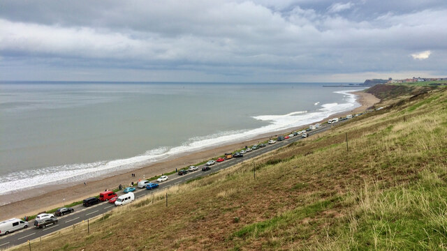
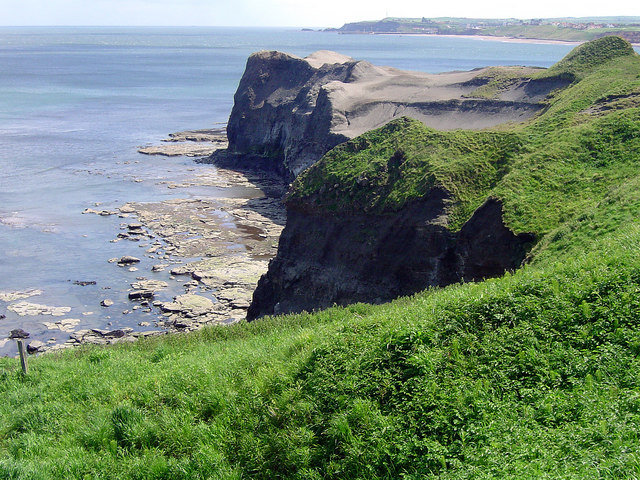
![Sandsend Alum Quarries Extract from the Historic England Research Records:
Summary : The remains of three post medieval alum quarries at Sandsend. Alum was principally used in the textile industry as a fixing agent for clothing dyes. It was also used by tanners to produce supple leather. After the shale had been quarried it was then heaped into large mounds, fired and left to smoulder for up to nine months. The shale was then tipped into leaching tanks where it was left to soak in water. The solution, containing aluminium sulphate was then drained off and ran along stone or wooden conduits known as liquor troughs to the alum house. Here the water was boiled away from the solution in evaporating pans. An alkali, derived from human urine or burnt kelp, was added to cause precipitation of the alum crystals. The crystals were then bagged and transported for sale. The burnt shale left in the leaching pits was either disposed of nearby to form enormous shale tips or thrown in to the sea. Quarrying at Sandsend moved from south to north along the coastal cliffs. The earliest quarry was Gaytrees, opened in 1733, followed by Ness End and finally Deep Grove. The quarry probably contains significant archaeological remains of buildings, pits, cisterns and parts of the wooden liquor trough also survive within a rock cut channel. From 1811 to 1933 cementstone was also mined within the quarries. The Middlesborough to Whitby railway was being constructed through the disused alum quarries by 1874.
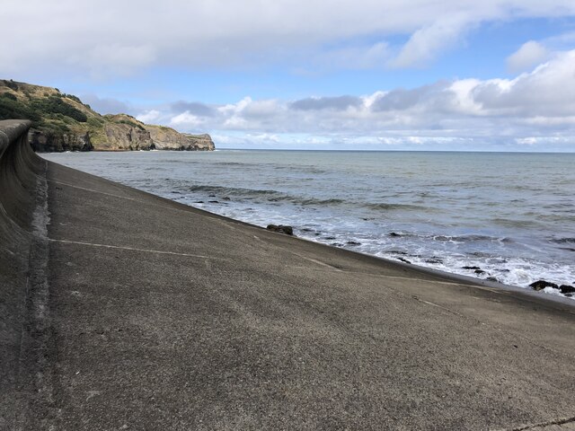
More information : NZ 859138. Alum quarries at Sandsend Ness in operation from c1613 - 1880. Remains clearly visible. The alum house was on the site of Sandsend station at NZ 860 129 (NZ 81 SE 496).
The monument includes remains of the alum quarries and associated features on the coastal cliffs north of Sandsend. As well as the quarries, the monument also includes structures used for initial processing and transport of the alum. There are three discrete quarries within the monument, extending northwards along the coast for 1km. The earliest quarry, which was working from 1733, was the closest to Sandsend at Gaytrees. The other two, at Ness End and Deep Grove, were excavated later as the extraction progressed along the coast. The quarries were cut into the east and north east-facing coastal cliffs where alum bearing shales were exposed. Once the cliffs were cut back, processing of the alum was carried out on the enlarging quarry floors. The first stage of processing was calcination, remains of which survive as areas of burnt shale, particularly on the sea edge of the central quarry. The next stage was steeping which occurred in stone lined pits, some of which survive throughout the quarry floor. A mid-19th century map shows steeping pits located in the Deep Grove quarry. In the later use of the site the raw liquor thus produced was stored and then sent to the nearby alum house by timber channels known as liquor troughs, part of which survive within a stone tunnel. Remains of other structures such as workshops, offices, stores and a laboratory survive on the quarry floor. Remains of other structures are thought to survive below ground level.
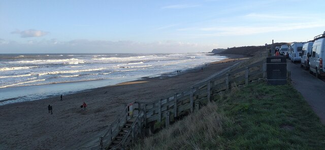
At the northern quarry, Deep Grove, cement stone was also extracted from mines and processed at a mill south of Sandsend. Cement stone was mined from 1811 to 1933 and overlapped the last 50 or so years of alum production. A now disused railway line was built through the length of the monument after the quarries went out of use. This was the Middlesborough to Whitby line which was completed in 1883 and closed in 1958. Embankments, cuttings and supporting walls associated with the railway still survive within the monument.
A number of features are excluded from the scheduling; these are the surface of the old railway line and the trail markers; although the ground beneath these features is included.
The remains of post medieval alum quarry is visible as earthworks on air photographs, centred at NZ 8582 1376.
The remains of three post medieval alum quarries at Sandsend. Alum was principally used in the textile industry as a fixing agent for clothing dyes. It was also used by tanners to produce supple leather. Quarrying at Sandsend moved from south to north along the coastal cliffs. The earliest quarry was Gaytrees, opened in 1733, the next Ness End and the last Deep Grove; Deep Grove closed before 1874. The quarry probably contains significant archaeological remains of buildings, pits, cisterns and parts of the wooden liquor trough also survive within a rock cut channel. From 1811 to 1933 cementstone was also mined within the quarries. The Middlesborough to Whitby railway was being constructed through the disused alum quarries by 1874.
Heritagegateway.org.uk. (2012). Heritage Gateway - Results. [online] Available at: <span class="nowrap"><a title="https://www.heritagegateway.org.uk/Gateway/Results_Single.aspx?uid=1118514&amp;resourceID=19191" rel="nofollow ugc noopener" href="https://www.heritagegateway.org.uk/Gateway/Results_Single.aspx?uid=1118514&amp;resourceID=19191">Link</a><img style="margin-left:2px;" alt="External link" title="External link - shift click to open in new window" src="https://s1.geograph.org.uk/img/external.png" width="10" height="10"/></span> [Accessed 11 Dec. 2021].](https://s1.geograph.org.uk/geophotos/07/04/10/7041097_8cbabcf2.jpg)
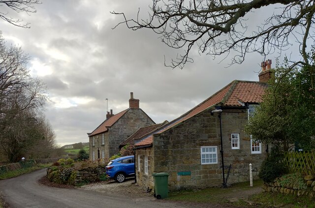
Asylum Hill, located in Yorkshire, is a picturesque hill that offers breathtaking views and a tranquil atmosphere. Situated amidst the stunning landscape of the Yorkshire Dales, this hill stands tall at an elevation of approximately 500 meters (1,640 feet).
The hill is covered in lush greenery, with rolling meadows and fields stretching out in all directions. It is also home to a variety of plant and animal species, making it a haven for nature enthusiasts and wildlife lovers. The area is dotted with charming country houses and cottages, adding to its idyllic charm.
Asylum Hill is a popular destination for hikers and outdoor enthusiasts, offering numerous trails and paths that cater to all levels of fitness and experience. These trails lead to the summit of the hill, rewarding hikers with panoramic views of the surrounding countryside, including other peaks in the Yorkshire Dales.
The hill also has historical significance, with traces of ancient settlements and burial mounds found in the vicinity. It is believed that these sites date back to prehistoric times, adding a layer of intrigue to the area's allure.
In addition to its natural beauty, Asylum Hill is known for its peaceful and serene environment. Away from the hustle and bustle of urban life, visitors can find solace and relaxation in this tranquil setting.
Overall, Asylum Hill offers a perfect blend of natural beauty, historical significance, and a peaceful atmosphere, making it a must-visit destination for those seeking a serene escape in the heart of Yorkshire.
If you have any feedback on the listing, please let us know in the comments section below.
Asylum Hill Images
Images are sourced within 2km of 54.510927/-0.67503178 or Grid Reference NZ8513. Thanks to Geograph Open Source API. All images are credited.
![Sandsend Alum Quarries Extract from the Historic England Research Records:
Summary : The remains of three post medieval alum quarries at Sandsend. Alum was principally used in the textile industry as a fixing agent for clothing dyes. It was also used by tanners to produce supple leather. After the shale had been quarried it was then heaped into large mounds, fired and left to smoulder for up to nine months. The shale was then tipped into leaching tanks where it was left to soak in water. The solution, containing aluminium sulphate was then drained off and ran along stone or wooden conduits known as liquor troughs to the alum house. Here the water was boiled away from the solution in evaporating pans. An alkali, derived from human urine or burnt kelp, was added to cause precipitation of the alum crystals. The crystals were then bagged and transported for sale. The burnt shale left in the leaching pits was either disposed of nearby to form enormous shale tips or thrown in to the sea. Quarrying at Sandsend moved from south to north along the coastal cliffs. The earliest quarry was Gaytrees, opened in 1733, followed by Ness End and finally Deep Grove. The quarry probably contains significant archaeological remains of buildings, pits, cisterns and parts of the wooden liquor trough also survive within a rock cut channel. From 1811 to 1933 cementstone was also mined within the quarries. The Middlesborough to Whitby railway was being constructed through the disused alum quarries by 1874.
More information : NZ 859138. Alum quarries at Sandsend Ness in operation from c1613 - 1880. Remains clearly visible. The alum house was on the site of Sandsend station at NZ 860 129 (NZ 81 SE 496).
The monument includes remains of the alum quarries and associated features on the coastal cliffs north of Sandsend. As well as the quarries, the monument also includes structures used for initial processing and transport of the alum. There are three discrete quarries within the monument, extending northwards along the coast for 1km. The earliest quarry, which was working from 1733, was the closest to Sandsend at Gaytrees. The other two, at Ness End and Deep Grove, were excavated later as the extraction progressed along the coast. The quarries were cut into the east and north east-facing coastal cliffs where alum bearing shales were exposed. Once the cliffs were cut back, processing of the alum was carried out on the enlarging quarry floors. The first stage of processing was calcination, remains of which survive as areas of burnt shale, particularly on the sea edge of the central quarry. The next stage was steeping which occurred in stone lined pits, some of which survive throughout the quarry floor. A mid-19th century map shows steeping pits located in the Deep Grove quarry. In the later use of the site the raw liquor thus produced was stored and then sent to the nearby alum house by timber channels known as liquor troughs, part of which survive within a stone tunnel. Remains of other structures such as workshops, offices, stores and a laboratory survive on the quarry floor. Remains of other structures are thought to survive below ground level.
At the northern quarry, Deep Grove, cement stone was also extracted from mines and processed at a mill south of Sandsend. Cement stone was mined from 1811 to 1933 and overlapped the last 50 or so years of alum production. A now disused railway line was built through the length of the monument after the quarries went out of use. This was the Middlesborough to Whitby line which was completed in 1883 and closed in 1958. Embankments, cuttings and supporting walls associated with the railway still survive within the monument.
A number of features are excluded from the scheduling; these are the surface of the old railway line and the trail markers; although the ground beneath these features is included.
The remains of post medieval alum quarry is visible as earthworks on air photographs, centred at NZ 8582 1376.
The remains of three post medieval alum quarries at Sandsend. Alum was principally used in the textile industry as a fixing agent for clothing dyes. It was also used by tanners to produce supple leather. Quarrying at Sandsend moved from south to north along the coastal cliffs. The earliest quarry was Gaytrees, opened in 1733, the next Ness End and the last Deep Grove; Deep Grove closed before 1874. The quarry probably contains significant archaeological remains of buildings, pits, cisterns and parts of the wooden liquor trough also survive within a rock cut channel. From 1811 to 1933 cementstone was also mined within the quarries. The Middlesborough to Whitby railway was being constructed through the disused alum quarries by 1874.
Heritagegateway.org.uk. (2012). Heritage Gateway - Results. [online] Available at: <span class="nowrap"><a title="https://www.heritagegateway.org.uk/Gateway/Results_Single.aspx?uid=1118514&amp;resourceID=19191" rel="nofollow ugc noopener" href="https://www.heritagegateway.org.uk/Gateway/Results_Single.aspx?uid=1118514&amp;resourceID=19191">Link</a><img style="margin-left:2px;" alt="External link" title="External link - shift click to open in new window" src="https://s1.geograph.org.uk/img/external.png" width="10" height="10"/></span> [Accessed 11 Dec. 2021].](https://s2.geograph.org.uk/geophotos/07/04/10/7041098_f25792d3.jpg)
![Sandsend and The Maharajah of Mulgrave Castle In the decade following the death of Maharajah Ranjit Singh in 1839, the Punjab was thrown into turmoil with several successions to the throne and a threat of annexation by the British East India Company.
In 1843, Duleep Singh, just five years old, was crowned King of the Punjab and head of the Sikh nation. He was now extremely rich and ruled under the regency of Ranjit Singh’s youngest widow, Jind Kaur. His wealth included one of the largest diamonds in the world, the Koh-i-Noor, weighing in at 21.12 grms. (105.6 carats).
War with the British East India Company broke out, and, in 1848, the young Singh, now aged ten years old, was forced to sign papers that sacrificed his kingdom and forcing him to resign ‘for himself, his heirs, his successors, all right, title and claim to the sovereignty of the Punjab or to any sovereign power whatsoever, the confiscation of all state property, and the surrender of the Koh-i-Noor diamond’. The Punjab was now British territory.
In return, he was to be given a pension of £40,000 and granted the honour of the title Maharajah (I guess the equivalent to His Royal Highness). He was sent for exile in England where Queen Victoria was apparently quite taken with the young man. She wrote in her diary: ‘Osborne 22 August: A most beautiful morning. We breakfasted in the Alcove with the truly amicable young Maharajah, who is so kind to the children, playing so nicely with them’. I am sure she wasn’t at all influenced by the latest addition to her crown jewels: the Koh-i-Noor diamond.
The Maharajah grew up into the life of an English squire, with a love of shooting, hawking, and other country pursuits and, in 1858, took up residency at Mulgrave Castle which he rented from the Marquis of Normanby, who was serving as British Ambassador in Florence. Queen Victoria was one of the many guests who dined with Singh during his tenure at Mulgrave Castle.
But he wasn’t happy, and frequently clashed with the Government over his financial compensation. His money slowly dwindled, he spent lavishly on his estate at Elveden, Norfolk, which he had brought after vacating Mulgrave in 1862. He made many fruitless attempts to regain the Koh-i-Noor diamond, and grew ever more disillusioned with Britain, developing an intent to reclaim his homeland in the Punjab, a direct threat to the Empire. On a trip to India in 1886, he was arrested and subsequently settled in exile in Paris from which he journeyed across Europe and to Russia in the search of allies in starting a rebellion in the Punjab.
The Maharajah Duleep Singh died in 1893 in Paris at the age of 55 and is buried at Elveden.
During his thirteen years at Mulgrave Castle, the Maharajah would often be seen fishing from a boat at Sandsend, using the Chinese method of hunting with specially-trained tethered cormorants. These had a ring fitted around their necks so they couldn’t swallow the fish. He also had a new toll-road constructed between Sandsend and Whitby, which formed the foundation for today’s modern road alongside the beach. Some say he had this road built as his elephants did not like walking through the sand, but sadly there is no evidence that there have ever been elephants at Mulgrave.
For sources and references see my blog: Out and about ... (2021). Sandsend and The Maharajah of Mulgrave Castle. [online] Available at: <span class="nowrap"><a title="http://www.fhithich.uk/?p=26632" rel="nofollow ugc noopener" href="http://www.fhithich.uk/?p=26632">Link</a><img style="margin-left:2px;" alt="External link" title="External link - shift click to open in new window" src="https://s1.geograph.org.uk/img/external.png" width="10" height="10"/></span> [Accessed 11 Dec. 2021].
](https://s1.geograph.org.uk/geophotos/07/04/11/7041101_01b225ea.jpg)


Asylum Hill is located at Grid Ref: NZ8513 (Lat: 54.510927, Lng: -0.67503178)
Division: North Riding
Administrative County: North Yorkshire
District: Scarborough
Police Authority: North Yorkshire
What 3 Words
///freshen.belonged.increases. Near Whitby, North Yorkshire
Nearby Locations
Related Wikis
Sandsend Ness
Sandsend Ness is an old alum quarrying site close to Whitby in North Yorkshire, England. Beneath extensive deposits of grey pyritic shale a thin band of...

Sandsend railway station
Sandsend railway station was a railway station on the Whitby, Redcar and Middlesbrough Union Railway. It was opened on 3 December 1883, and served the...

Church of St Oswald, Lythe
The Church of St Oswald, Lythe, is the parish church for the village of Lythe, 4 miles (6.4 km) west, north west of Whitby in North Yorkshire, England...

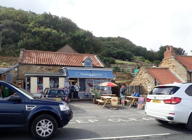
Sandsend
Sandsend is a small fishing village, near to Whitby in the Scarborough district of North Yorkshire, England. It forms part of the civil parish of Lythe...

Lythe
Lythe is a small village and large civil parish, in North Yorkshire, England, situated near Whitby within the North York Moors National Park. The name...

Ewe Cote, Whitby
Ewe Cote is a small hamlet on the edge of the North York Moors National Park, set in the northern edge of the civil parish of Whitby, in the Scarborough...
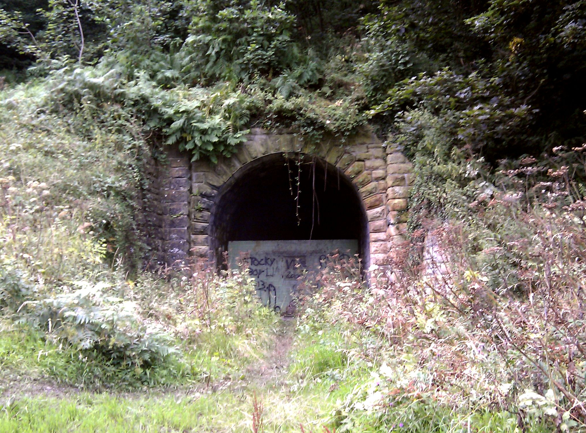
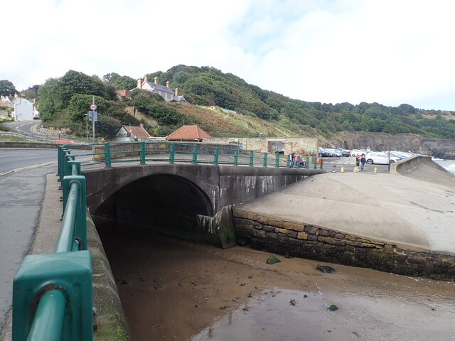
Sandsend Tunnel
Sandsend Tunnel is a tunnel on the former Whitby, Redcar and Middlesbrough Union Railway that was opened in 1883 and closed in 1958. The rail line that...
Goldsborough, Scarborough
Goldsborough is a small hamlet in the civil parish of Lythe, North Yorkshire, England within the North York Moors National Park. It is situated a few miles...
Related Videos

SANDSEND | Full 4k Virtual Walking tour through SANDSEND Whitby North Yorkshire England
SANDSEND | Full 4k Virtual Walk through Sandsend Whitby North Yorkshire UK A full walking tour of SANDSEND near Whitby ...

Sandsend Village Walk, English Countryside 4K
https://www.buymeacoffee.com/Daveswalks All support is hugely appreciated and it helps me keep the channel going! No talking ...

SANDSEND
sandsend, holiday, beach,

Sandsend, North Yorkshire
A 12 mile walk through woodland and farmland with a walk through the Coastal town of Sandsend at the mid section.
Nearby Amenities
Located within 500m of 54.510927,-0.67503178Have you been to Asylum Hill?
Leave your review of Asylum Hill below (or comments, questions and feedback).