Kinsham

Settlement in Worcestershire Wychavon

England

Kinsham

Footpath over railway bridge, Bredon
Footpath over railway bridge, Bredon Credit: Liz Stone

Kinsham is a small village located in the county of Worcestershire, England. Situated approximately 7 miles southeast of the city of Worcester, Kinsham is nestled in a rural area surrounded by picturesque countryside. The village is part of the Wychavon district and falls within the civil parish of Hill Croome and St. Nicholas.

With a population of around 200 residents, Kinsham has a close-knit community atmosphere. The village is characterized by its charming, traditional cottages, many of which date back several centuries. The architecture reflects the village's rich history and offers a glimpse into its past.

A notable feature of Kinsham is its beautiful St. John the Baptist Church, which stands prominently in the heart of the village. This medieval church is a Grade I listed building and showcases intricate stained glass windows and historical artifacts.

Although small in size, Kinsham benefits from its proximity to larger towns and cities. Residents have easy access to amenities and services in nearby Worcester, including schools, healthcare facilities, and shopping centers. The village also boasts a handful of local businesses, such as a village pub and a small convenience store, providing essential goods and services for the community.

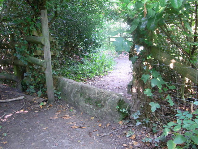
Kinsham is surrounded by rolling hills and lush green fields, making it an idyllic location for those seeking a peaceful and tranquil environment. The village offers numerous opportunities for outdoor activities and exploration, with many footpaths and bridleways winding through the surrounding countryside.

In summary, Kinsham is a quaint and picturesque village in Worcestershire, known for its historic architecture, close-knit community, and its scenic rural setting.

If you have any feedback on the listing, please let us know in the comments section below.

Kinsham Images

Images are sourced within 2km of 52.020543/-2.094693 or Grid Reference SO9335. Thanks to Geograph Open Source API. All images are credited.

Footpath over railway bridge, Bredon
Cross-field to B 4080 Footpath over to the main road, Bredon/Westmancote area.
Cross-field to B 4080
Footpath over to the main road, Bredon/Westmancote area.
Old stone on footpath/boundary No barrier to cyclists or horse-riders, Bredon.
Old stone on footpath/boundary
No barrier to cyclists or horse-riders, Bredon.
Roadworks at the M5 bridge The B4080's remarkably oblique bridge is receiving attention.
Roadworks at the M5 bridge
The B4080's remarkably oblique bridge is receiving attention.
B4080 in Bredon
B4080 in Bredon
Old pub in Bredon village
Curve on Moreton Lane (B4080)
Northway level crossing The barriers are just rising after the passage of a lengthy southbound freight train.
Northway level crossing
The barriers are just rising after the passage of a lengthy southbound freight train.
Large field near Aston Fields Farm
View toward Bredon Hill
B4079 north of Aston Cross
Approaching the old railway bridge on the B4079
View north from the railway bridge
The lane at Aston Fields Farm
Level crossing warning sign 1 The eastern access to Northway level crossing is via two 90-degree bends on a single-track lane.  Sign placement is "creative"!
Level crossing warning sign 1
The eastern access to Northway level crossing is via two 90-degree bends on a single-track lane. Sign placement is "creative"!
Level crossing warning sign 2 The eastern access to Northway level crossing is via two 90-degree bends on a single-track lane.  Sign placement is "creative"!  Large vehicles would have some difficulty negotiating the bends, let alone the level crossing.
Level crossing warning sign 2
The eastern access to Northway level crossing is via two 90-degree bends on a single-track lane. Sign placement is "creative"! Large vehicles would have some difficulty negotiating the bends, let alone the level crossing.
Waiting for the train at Northway A southbound freight train would arrive within a few seconds.
Waiting for the train at Northway
A southbound freight train would arrive within a few seconds.
Kemerton Court, west front Kemerton Court seen from Kemerton Lane (using zoom)
Kemerton Court, west front
Kemerton Court seen from Kemerton Lane (using zoom)
Show me another place!

Kinsham is located at Grid Ref: SO9335 (Lat: 52.020543, Lng: -2.094693)

Administrative County: Worcestershire

District: Wychavon

Police Authority: West Mercia

What 3 Words

///extensive.pitching.indulgent. Near Bredon, Worcestershire

Nearby Locations

Kinsham

Related Wikis

Kemerton Court

Kemerton Court is the principal manor house of the village of Kemerton, near Tewkesbury in Gloucestershire. The house is built of local Cotswold stone...

Bredon railway station

Bredon railway station was on the Birmingham–Gloucester railway line to the north of Ashchurch for Tewkesbury railway station. The station closed in 1965...

Kemerton

Kemerton is a village and civil parish in Worcestershire in England. It lies at the extreme south of the county in the local government district of Wychavon...

Bredon

Bredon is a village and civil parish in Wychavon district at the southern edge of Worcestershire in England. It lies on the banks of the River Avon on...

Nearby Amenities

Located within 500m of 52.020543,-2.094693
Kinsham
Created By: Potlatch 0.10f
Place: hamlet
Lat/Long: 52.0186439/-2.0967546
Barrier: stile
Lat/Long: 52.0172292/-2.0988173
Barrier: stile
Lat/Long: 52.0171785/-2.0985749
Barrier: stile
Lat/Long: 52.0170814/-2.0981976
Barrier: stile
Lat/Long: 52.0169252/-2.0975271
Barrier: stile
Lat/Long: 52.0168972/-2.0974488
Barrier: stile
Lat/Long: 52.0167754/-2.0973266
Barrier: stile
Lat/Long: 52.0162886/-2.0967706
Barrier: stile
Lat/Long: 52.0172804/-2.0981557
Post Box
Collection Times: Mo-Fr 09:00; Sa 07:00
Post Box Mounting: building
Post Box Type: wall
Ref: GL20 3D
Royal Cypher: VR
Royal Cypher Wikidata: Q33102356
Lat/Long: 52.0182146/-2.098008
Barrier: kissing_gate
Lat/Long: 52.0242671/-2.0955057
Public Bookcase
Defibrillator
Booth: K6
Colour: red
Defibrillator Location: Inside old red telephone box in layby on the main road through Kinsham.
Disused Amenity: telephone
Emergency: defibrillator
Man Made: telephone_box
Note: Both AED and book exchange housed in old telephone box
Operator: Bredon Parish Council
Public Bookcase Type: phone_box
Lat/Long: 52.0193763/-2.0957775
Bus Stop
Chapel Lane
Bus: yes
Naptan AtcoCode: 2000G083200
Naptan Bearing: SE
Naptan CommonName: Chapel Lane
Naptan Crossing: Chapel Lane
Naptan Indicator: opp
Naptan Landmark: opposite Telephone Box
Naptan NaptanCode: wocdgjwj
Naptan Street: Cheltenham Road
Naptan Verified: no
Public Transport: platform
Source: naptan_import
Lat/Long: 52.0194731/-2.0959184
Bus Stop
Chapel Lane
Bus: yes
Naptan AtcoCode: 2000G501661
Naptan Bearing: NW
Naptan CommonName: Chapel Lane
Naptan Crossing: Chapel Lane
Naptan Indicator: Adj
Naptan Landmark: Telephone Box
Naptan NaptanCode: wocdamdp
Naptan Street: Cheltenham Road
Naptan Verified: no
Public Transport: platform
Source: naptan_import
Lat/Long: 52.0193203/-2.0959669
Kinsham North
Power: pole
Transformer: distribution
Voltage Primary: 11000
Lat/Long: 52.0204593/-2.0978601
Power: pole
Lat/Long: 52.0207022/-2.0987102
Power: pole
Lat/Long: 52.0214404/-2.0978453
Power: pole
Lat/Long: 52.0202134/-2.0970339
Power: pole
Lat/Long: 52.0215737/-2.0976888
Power: pole
Lat/Long: 52.0197405/-2.0995212
Fixme: Is there a barrier=stile here?
Lat/Long: 52.0188378/-2.0940552
Fixme: barrier?
Lat/Long: 52.0187317/-2.0919618
Mile 7 THM 2015
Lat/Long: 52.0228381/-2.0889309
Generator Location: roof
Generator Method: photovoltaic
Generator Orientation: 105
Generator Output Electricity: yes
Generator Solar Modules: 10
Generator Source: solar
Generator Type: solar_photovoltaic_panel
Power: generator
Lat/Long: 52.0172815/-2.0940278
Kinsham
Power: pole
Transformer: distribution
Voltage Primary: 11000
Lat/Long: 52.0190204/-2.0938557
Kinsham Dairy
Power: pole
Transformer: distribution
Voltage Primary: 11000
Lat/Long: 52.0189275/-2.0968705
Location Transition: yes
Power: pole
Lat/Long: 52.0196967/-2.0965299
Location Transition: yes
Power: pole
Lat/Long: 52.0188611/-2.1001851
Power: pole
Lat/Long: 52.019166/-2.0998552
Power: pole
Lat/Long: 52.022331/-2.0979743
Power: pole
Lat/Long: 52.0231686/-2.0983136
Power: pole
Lat/Long: 52.0239848/-2.098626
The data included in this document is from www.openstreetmap.org. The data is made available under ODbL.

Have you been to Kinsham?

Leave your review of Kinsham below (or comments, questions and feedback).