Cedar Hill

Hill, Mountain in Leicestershire Melton

England

Cedar Hill

Knipton, All Saints
Knipton, All Saints Credit: Dave Kelly

Cedar Hill is a prominent geographical landmark located in the county of Leicestershire, England. Standing at an impressive height of 250 meters above sea level, it is considered one of the highest points in the region. Situated near the town of Coalville, Cedar Hill offers breathtaking panoramic views of the surrounding countryside.

The name Cedar Hill derives from the abundance of cedar trees that once covered its slopes. The hill itself is a natural formation composed primarily of limestone, which lends to its distinct character and geological significance. Over the years, Cedar Hill has become a popular destination for nature enthusiasts, hikers, and photographers due to its stunning vistas and tranquil atmosphere.

The hill boasts a diverse range of flora and fauna, attracting wildlife such as deer, foxes, and various bird species. It is also home to several rare and protected plant species, which add to its ecological value. The surrounding area features numerous walking trails and footpaths, allowing visitors to explore the hill's enchanting woodlands and meadows.

Cedar Hill is not only a natural beauty but also holds historical significance. It is believed to have played a role in the industrial heritage of Leicestershire, with evidence of coal mining and quarrying activities in the vicinity. Today, remnants of these industries can still be seen, adding an extra layer of intrigue to the hill's story.

Overall, Cedar Hill in Leicestershire is a remarkable geographical feature that offers both natural beauty and historical interest. Whether it is for a leisurely walk, birdwatching, or simply enjoying the stunning views, this hill is a must-visit destination for nature lovers and history enthusiasts alike.

If you have any feedback on the listing, please let us know in the comments section below.
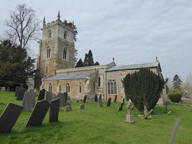
Cedar Hill Images

Images are sourced within 2km of 52.861856/-0.7715581 or Grid Reference SK8230. Thanks to Geograph Open Source API. All images are credited.
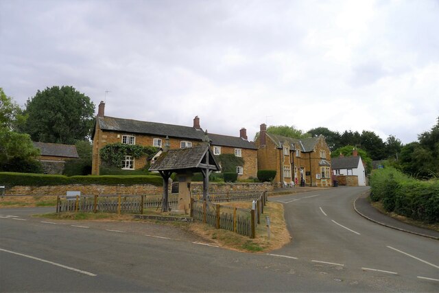
Knipton, All Saints
Knipton, All Saints
Church of St Botolph and St John the Baptist, Croxton Kerrial 15th C. church restored in 1866-68 by Scott. Has a central tower (although more eastern than central) on diagonal stepped buttresses with 8 pinnacles. 
North and south aisles with 3 bay arcades and clerestories. 
The pews date from 1534 when they were donated by Croxton Abbey at the time of dissolution. There are 42 unique pew ends.
The organ is by Nicholson of Worcester 1849.
There is no stained glass.
Church of St Botolph and St John the Baptist, Croxton Kerrial
15th C. church restored in 1866-68 by Scott. Has a central tower (although more eastern than central) on diagonal stepped buttresses with 8 pinnacles. North and south aisles with 3 bay arcades and clerestories. The pews date from 1534 when they were donated by Croxton Abbey at the time of dissolution. There are 42 unique pew ends. The organ is by Nicholson of Worcester 1849. There is no stained glass.
Croxton Lane leaving Croxton Kerrial Heading north to Knipton
Croxton Lane leaving Croxton Kerrial
Heading north to Knipton
Junction of Croxton Lane and Croxton Lane The main Croxton Lane goes to Knipton, and the Croxton Lane to the right goes to Harston
Junction of Croxton Lane and Croxton Lane
The main Croxton Lane goes to Knipton, and the Croxton Lane to the right goes to Harston
Track up the side of Croxton Banks wood The 'bank' is the face of the escarpment of Jurassic limestones and ironstones on which Croxton Kerrial sits
Track up the side of Croxton Banks wood
The 'bank' is the face of the escarpment of Jurassic limestones and ironstones on which Croxton Kerrial sits
Footpath to Croxton Kerrial The path crosses the wheat field, passes through the edge of Harston Wood, and then onto the top of the escarpment
Footpath to Croxton Kerrial
The path crosses the wheat field, passes through the edge of Harston Wood, and then onto the top of the escarpment
Footpath to Croxton Kerrial leaving the south side of Harston The grass now brown after England's driest July in over a hundred years.
Footpath to Croxton Kerrial leaving the south side of Harston
The grass now brown after England's driest July in over a hundred years.
Church of St Michael and All Angels, Harston Original 14th century tower is retained, but the rest of the church was rebuilt in the late 19th century.
Church of St Michael and All Angels, Harston
Original 14th century tower is retained, but the rest of the church was rebuilt in the late 19th century.
Knipton Lane climbing up to Harston
The Gatehouse, Knipton An entrance to the grounds of Belvoir Castle
The Gatehouse, Knipton
An entrance to the grounds of Belvoir Castle
The Manners Arms, Knipton Pub and restaurant occupying an early 19th century Listed Grade II house. The Manners family hold the Dukedom of Rutland, and are resident at Belvoir Castle. To  the disappointment of this parched walker the pub was closed "Due to unforseen [sic] circumstances"
The Manners Arms, Knipton
Pub and restaurant occupying an early 19th century Listed Grade II house. The Manners family hold the Dukedom of Rutland, and are resident at Belvoir Castle. To the disappointment of this parched walker the pub was closed "Due to unforseen [sic] circumstances"
Main Street, Knipton A restored 19th century village pump in the foreground.
Main Street, Knipton
A restored 19th century village pump in the foreground.
Branston Lane passing the entrance to Keeper's Cottage The lane takes Cycle Route 64 past Knipton Reservoir, but views of the reservoir are limited
Branston Lane passing the entrance to Keeper's Cottage
The lane takes Cycle Route 64 past Knipton Reservoir, but views of the reservoir are limited
View north-east of Branston Looking along the route of a bridleway to Croxton Lodge
View north-east of Branston
Looking along the route of a bridleway to Croxton Lodge
Track up to the A607, west of Croxton Kerrial During the driest July for over a hundred years, the rare sound of running water. The stream by the side of the path comes from Croxton Kerrial's famous spring-fed water spout <a href="https://www.geograph.org.uk/photo/30072">SK8328 : Water spout, Croxton Kerrial</a>. The spring emerges at the base of the Lincolnshire Limestone, and the miniature waterfall on the right is formed from tuffa.
Track up to the A607, west of Croxton Kerrial
During the driest July for over a hundred years, the rare sound of running water. The stream by the side of the path comes from Croxton Kerrial's famous spring-fed water spout SK8328 : Water spout, Croxton Kerrial. The spring emerges at the base of the Lincolnshire Limestone, and the miniature waterfall on the right is formed from tuffa.
View over the valley of the River Devon near Croxton Kerrial Croxton Kerrial sits on the left of the horizon. If the Roman road, the Salt Way, ran as an uninterrupted straight line to the south of Croxton Kerrial (rather than along the line of the current A607 through the village), as is suggested by some sources <span class="nowrap"><a title="https://archaeologydataservice.ac.uk/archives/view/romangl/map.html" rel="nofollow ugc noopener" href="https://archaeologydataservice.ac.uk/archives/view/romangl/map.html">Link</a><img style="margin-left:2px;" alt="External link" title="External link - shift click to open in new window" src="https://s1.geograph.org.uk/img/external.png" width="10" height="10"/></span> , it would have been along the line of this view. It would still have had to cross the valley, but possibly with an easier gradient.
View over the valley of the River Devon near Croxton Kerrial
Croxton Kerrial sits on the left of the horizon. If the Roman road, the Salt Way, ran as an uninterrupted straight line to the south of Croxton Kerrial (rather than along the line of the current A607 through the village), as is suggested by some sources LinkExternal link , it would have been along the line of this view. It would still have had to cross the valley, but possibly with an easier gradient.
Goosey goosey wander Wonder what the future holds for these geese?

Not good!
<span class="nowrap"><a title="http://www.freerangebirds.co.uk/" rel="nofollow ugc noopener" href="http://www.freerangebirds.co.uk/">Link</a><img style="margin-left:2px;" alt="External link" title="External link - shift click to open in new window" src="https://s1.geograph.org.uk/img/external.png" width="10" height="10"/></span>
Goosey goosey wander
Wonder what the future holds for these geese? Not good! LinkExternal link
The Cottage, Knipton Knipton is a Belvoir Castle estate village, and this house, distinguished by its elaborate bargeboards, is its most ambitious. Grade II listed.
On the right is the war memorial <a href="https://www.geograph.org.uk/photo/3096569">SK8231 : Knipton War Memorial</a>.
The Cottage, Knipton
Knipton is a Belvoir Castle estate village, and this house, distinguished by its elaborate bargeboards, is its most ambitious. Grade II listed. On the right is the war memorial SK8231 : Knipton War Memorial.
Show me another place!

Cedar Hill is located at Grid Ref: SK8230 (Lat: 52.861856, Lng: -0.7715581)

Administrative County: Leicestershire

District: Melton

Police Authority: Leicestershire

What 3 Words

///cleanser.pest.sweeten. Near Barrowby, Lincolnshire

Related Wikis

Croxton Kerrial

Croxton Kerrial (pronounced [ˈkroʊsən ˈkɛrɨl]) is a village and civil parish in the Melton borough of Leicestershire, England, 6.6 miles (10.6 km) south...

Knipton

Knipton is a village and former civil parish, now in the parish of Belvoir, in the Melton district, in the county of Leicestershire, England. It lies about...

Croxton Abbey

Croxton Abbey, near Croxton Kerrial, Leicestershire, was a Premonstratensian monastery founded by William I, Count of Boulogne. == History == Croxton Abbey...

Branston, Leicestershire

Branston is a village and former civil parish, now in the parish of Croxton Kerrial in the Melton district, in the county of Leicestershire, England. It...

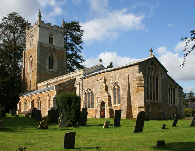
St Guthlac's Church, Branston

St Guthlac's Church is a church in Branston, Leicestershire. It is a Grade II* listed building. == History == The church dates from the 13th century but...

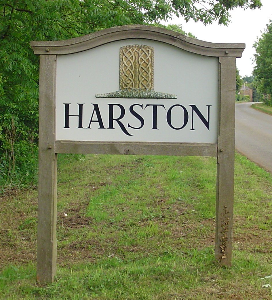
Harston, Leicestershire

Harston is a crossroads village and former civil parish, now in the parish of Belvoir, in the Melton district, in Leicestershire, England, near the border...
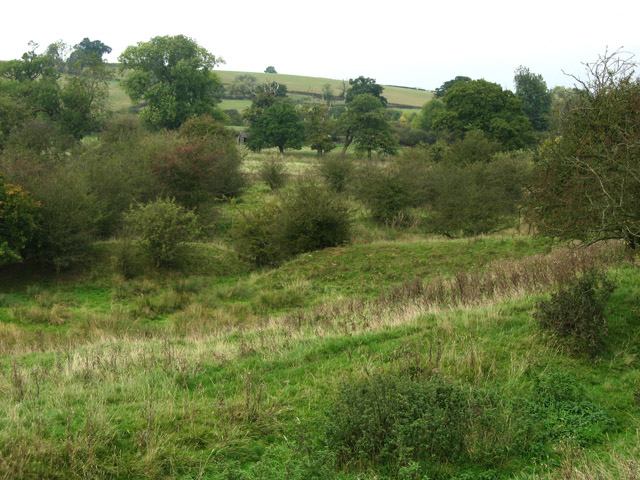
Croxton Park

Croxton Park is a 97.3-hectare (240-acre) biological Site of Special Scientific Interest south-west of Croxton Kerrial in Leicestershire.This medieval...

Waltham Iron Ore Tramway

The Waltham Iron Ore Tramway was a 1,000 mm (3 ft 3+3⁄8 in) gauge industrial tramway serving the ironstone pits of the Waltham Iron Ore Company, a subsidiary...

Nearby Amenities

Located within 500m of 52.861856,-0.7715581
Power: pole
Lat/Long: 52.8579837/-0.7714215
Power: pole
Lat/Long: 52.8600598/-0.7746697
Power: pole
Lat/Long: 52.8613942/-0.7771051
Power: pole
Lat/Long: 52.8620905/-0.776912
Power: pole
Lat/Long: 52.8593586/-0.7735968
Power: pole
Lat/Long: 52.8645648/-0.7764346
Power: pole
Lat/Long: 52.8637017/-0.7765821
Power: pole
Lat/Long: 52.8607691/-0.7758203
Power: pole
Lat/Long: 52.8586655/-0.7725185
Power: pole
Lat/Long: 52.8627949/-0.7767108
Power: pole
Lat/Long: 52.8574832/-0.7709494
The data included in this document is from www.openstreetmap.org. The data is made available under ODbL.

Have you been to Cedar Hill?

Leave your review of Cedar Hill below (or comments, questions and feedback).