Covermill Hill

Hill, Mountain in Leicestershire Melton

England

Covermill Hill

Woodland with cow parsley beside Woodfold Lane
Woodland with cow parsley beside Woodfold Lane Credit: Luke Shaw

Covermill Hill is a prominent hill located in Leicestershire, England. Situated near the village of Nailstone, it is part of the beautiful and picturesque countryside of the area. With an elevation of approximately 196 meters (643 feet), it is not categorized as a mountain but rather a hill.

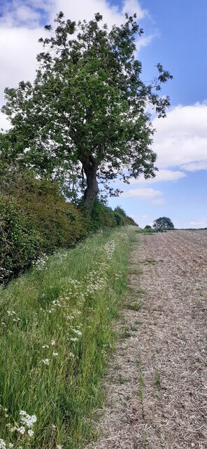
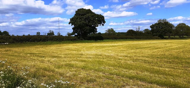
Covermill Hill offers breathtaking views of the surrounding landscape, including the rolling hills, fields, and woodlands typical of the region. It is a popular spot for both locals and visitors who enjoy hiking, walking, and taking in the natural beauty of the area. The hill is easily accessible, with footpaths and trails leading up to its summit.

At the top of Covermill Hill, there is a small ancient monument known as the Nailstone Bottle Knap, which dates back to the Bronze Age. This archaeological feature adds historical significance to the hill and attracts those with an interest in the prehistoric era.

Covermill Hill is also home to a diverse range of wildlife, including various species of birds, mammals, and plants. Nature enthusiasts often visit to observe and appreciate the natural habitats that thrive in this area.

Overall, Covermill Hill offers a peaceful and tranquil escape from the hustle and bustle of everyday life. Its natural beauty, historical significance, and diverse ecosystem make it a must-visit destination for those exploring Leicestershire.

If you have any feedback on the listing, please let us know in the comments section below.

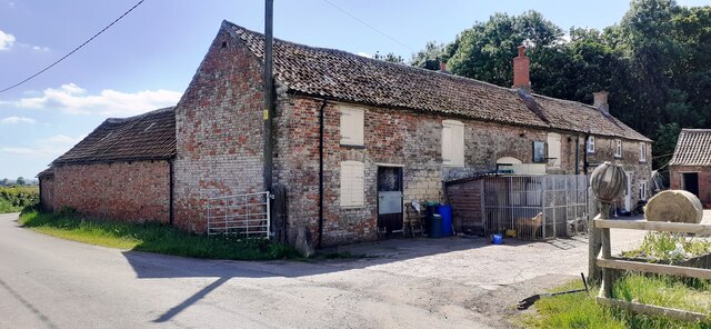
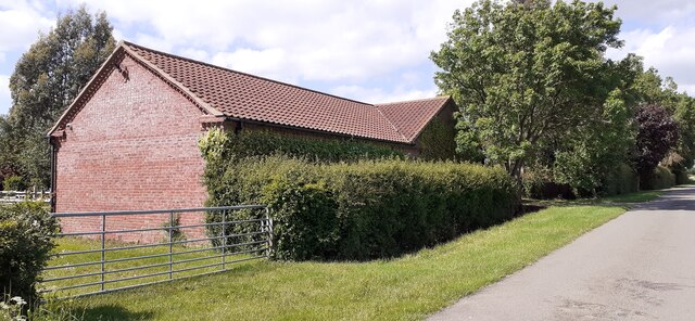
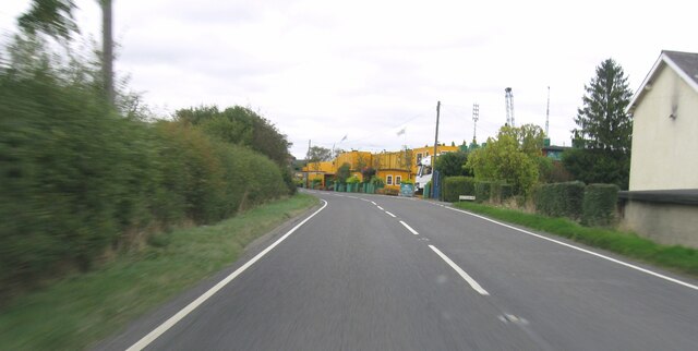
Covermill Hill Images

Images are sourced within 2km of 52.773334/-0.81687713 or Grid Reference SK7920. Thanks to Geograph Open Source API. All images are credited.

Woodland with cow parsley beside Woodfold Lane
Culvert for stream under Woodfold Lane Ordnance Survey documents indicate that a benchmark levelled at 96.238m above Newlyn Datum was verified in 1962 on the culvert
Culvert for stream under Woodfold Lane
Ordnance Survey documents indicate that a benchmark levelled at 96.238m above Newlyn Datum was verified in 1962 on the culvert
Track (also footpath) into Brentingby Lodge Farm Ordnance Survey documents indicate that a benchmark levelled at 114.477m above Newlyn Datum was verified in 1962 on a culvert on the right hand side of the track near the hedge junction
Track (also footpath) into Brentingby Lodge Farm
Ordnance Survey documents indicate that a benchmark levelled at 114.477m above Newlyn Datum was verified in 1962 on a culvert on the right hand side of the track near the hedge junction
Entrance to Brentingby Lodge Farm from Woodfold Lane
Hedge with tree dividing fields east of Hills Barn Farm
Farm buildings at Hills Barn Farm on west side of Woodfold Lane Ordnance Survey documents indicate that a benchmark levelled at 123.761m above Newlyn Datum was verified in 1962 on the road face, 4.3m from the near angle, of a building at this location. The present building is probably a replacement.
Farm buildings at Hills Barn Farm on west side of Woodfold Lane
Ordnance Survey documents indicate that a benchmark levelled at 123.761m above Newlyn Datum was verified in 1962 on the road face, 4.3m from the near angle, of a building at this location. The present building is probably a replacement.
Horses in field on east side of Woodfold Lane near Poole's Lodge Farm
Field NE of Bell's Plantation There is a hare in the field!
Field NE of Bell's Plantation
There is a hare in the field!
Benchmark on Pooles Lodge Farm farmhouse Ordnance Survey cut mark benchmark levelled at 127.516m above Newlyn Datum verified 1962
Benchmark on Pooles Lodge Farm farmhouse
Ordnance Survey cut mark benchmark levelled at 127.516m above Newlyn Datum verified 1962
Buildings at Pooles Lodge Farm There is an Ordnance Survey benchmark <a href="https://www.geograph.org.uk/photo/7186594">SK7821 : Benchmark on Pooles Lodge Farm farmhouse</a> on the building at the right hand end of the row
Buildings at Pooles Lodge Farm
There is an Ordnance Survey benchmark SK7821 : Benchmark on Pooles Lodge Farm farmhouse on the building at the right hand end of the row
Roadside building at West Lodge Ordnance Survey documents describe a benchmark levelled at 131.235m above Newlyn Datum and verified in 1962 at this location
Roadside building at West Lodge
Ordnance Survey documents describe a benchmark levelled at 131.235m above Newlyn Datum and verified in 1962 at this location
Field NE of West Lodge
B676 eastbound
B676 eastbound
B676 eastbound
B676 eastbound
B676 eastbound
B676 eastbound
The Willow Pool If I wanted to dispose of Excalibur, at my Lord's command, this is the sort of place I would fling it.  Ancient, surviving, wrecked willows in a deep pool.

The pool is the remnant of recent rains, when the adjacent River Eye rose and met the torrents falling on the field.  This area is all low-lying wetland, and the Willow is the queen of the landscape.  

This is a stitch of 6 separate images of 6252x4164 pixels, stitched with Microsoft ICE to yield a panoramic shot of 13642x8203 pixels - subsequently downsized to suit Geograph.   The full stitch is available on request.
The Willow Pool
If I wanted to dispose of Excalibur, at my Lord's command, this is the sort of place I would fling it. Ancient, surviving, wrecked willows in a deep pool. The pool is the remnant of recent rains, when the adjacent River Eye rose and met the torrents falling on the field. This area is all low-lying wetland, and the Willow is the queen of the landscape. This is a stitch of 6 separate images of 6252x4164 pixels, stitched with Microsoft ICE to yield a panoramic shot of 13642x8203 pixels - subsequently downsized to suit Geograph. The full stitch is available on request.
Willow in the water One of the trees featured in <a href="https://www.geograph.org.uk/photo/7058886">SK8018 : The Willow Pool</a>.  It is very hard to dissuade a willow from growing, and they revel in wet feet.
Willow in the water
One of the trees featured in SK8018 : The Willow Pool. It is very hard to dissuade a willow from growing, and they revel in wet feet.
Wet enough for thee? One of the Willow trees seen in <a href="https://www.geograph.org.uk/photo/7058886">SK8018 : The Willow Pool</a>.  Broken, wrecked, drowned it still grows vigorously.  This won't be the first time it has stood in floodwater.
Wet enough for thee?
One of the Willow trees seen in SK8018 : The Willow Pool. Broken, wrecked, drowned it still grows vigorously. This won't be the first time it has stood in floodwater.
Show me another place!

Covermill Hill is located at Grid Ref: SK7920 (Lat: 52.773334, Lng: -0.81687713)

Administrative County: Leicestershire

District: Melton

Police Authority: Leicestershire

What 3 Words

///custodian.darling.tweaked. Near Melton Mowbray, Leicestershire

Related Wikis

Freeby

Freeby is a village and civil parish in the Melton district of Leicestershire, England, about 3 miles (5 km) east of Melton Mowbray. As well as the village...

Saxby railway station

Saxby railway station was a station serving the villages of Saxby and Freeby, Leicestershire. It was located between the two villages. == Access == The...

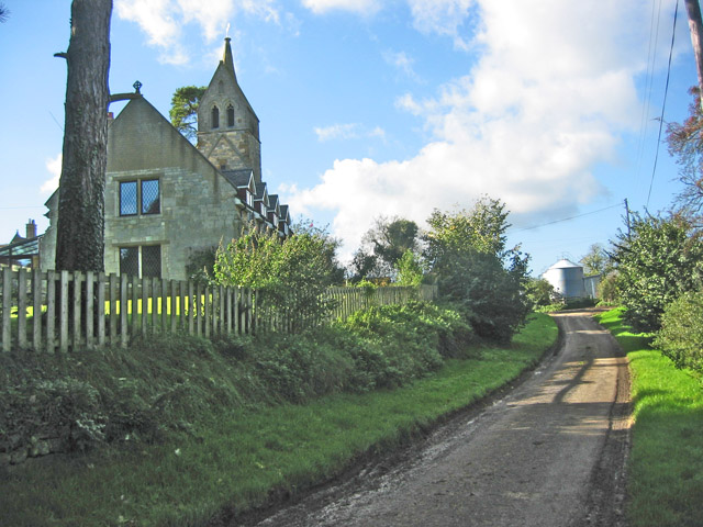
St Mary's Church, Brentingby

St Mary's Church is a redundant Anglican church in the village of Brentingby, Leicestershire, England. The walls of the church required renovation when...

Stapleford, Leicestershire

Stapleford is a village and former civil parish, now in the parish of Freeby, in the Melton district of Leicestershire, England, east of Melton Mowbray...

Langham Brook

The Langham Brook is a watercourse in the East Midlands of England. It is a tributary of the River Eye and part of the River Soar catchment. == Course... ==

Stapleford Miniature Railway

Stapleford Miniature Railway is an historic steam locomotive-hauled 10+1⁄4 in (260 mm) gauge railway at Stapleford Park, Stapleford near Melton Mowbray...

St Mary Magdalene's Church, Stapleford

St Mary Magdalene's Church is a redundant Anglican church near the village of Stapleford, Leicestershire, England. It is recorded in the National Heritage...
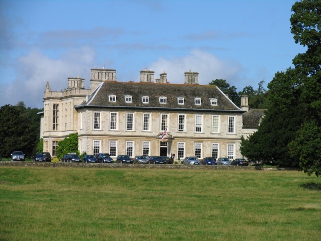
Stapleford Park

Stapleford Park is a Grade I listed country house in Stapleford, near Melton Mowbray in Leicestershire, England, which is now used as a hotel. It was originally...

Nearby Amenities

Located within 500m of 52.773334,-0.81687713
Freeby
Created By: Potlatch 0.10f
Place: hamlet
Lat/Long: 52.7714008/-0.8109919
Bus Stop
Bus Shelter
Bus: yes
Naptan AtcoCode: 260000902
Naptan Bearing: SW
Naptan CommonName: Bus Shelter
Naptan Indicator: outside
Naptan Landmark: Ivy Farm House
Naptan NaptanCode: leidmwtg
Naptan Notes: Non-Hourly - County
Naptan Street: Main Street
Naptan Verified: no
Public Transport: platform
Shelter: yes
Source: naptan_import
Lat/Long: 52.7719692/-0.811794
Place: farm
Lat/Long: 52.7704014/-0.8133047
The data included in this document is from www.openstreetmap.org. The data is made available under ODbL.

Have you been to Covermill Hill?

Leave your review of Covermill Hill below (or comments, questions and feedback).