Colborough Hill

Hill, Mountain in Leicestershire Harborough

England

Colborough Hill

Monument in Skeffington Woods Inscribed "Skeffington Wood Reaforrested 1945 - 1955 Harry Walker"
Monument in Skeffington Woods Credit: Tim Glover

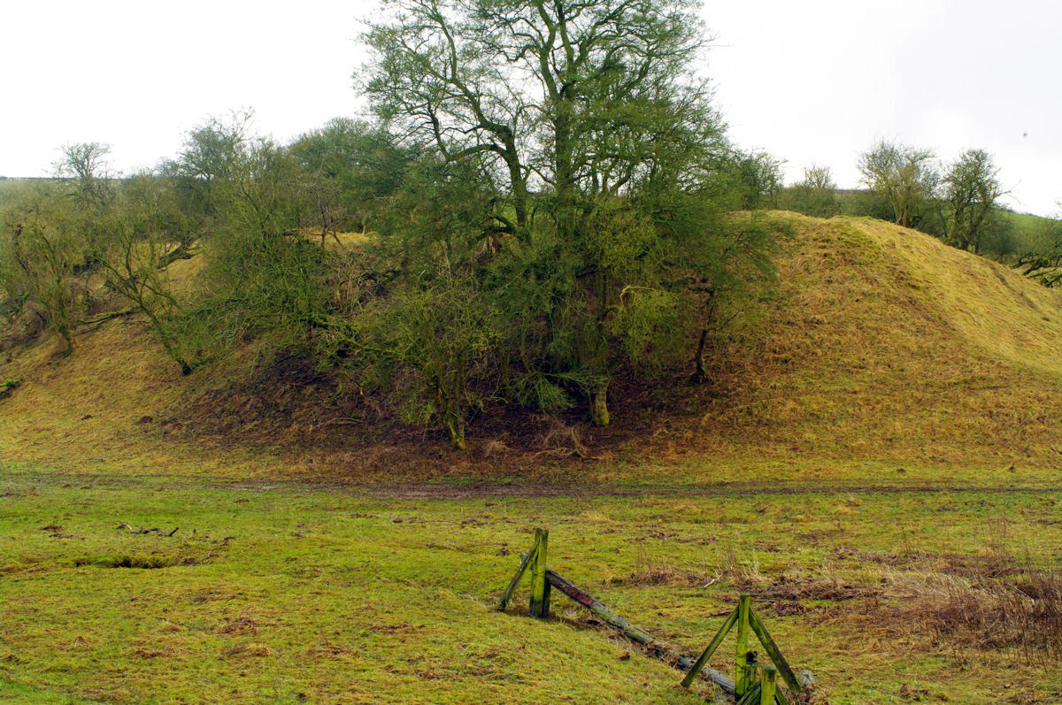
Colborough Hill is a prominent geographical feature located in Leicestershire, England. Standing at an elevation of 174 meters, it is often referred to as a hill rather than a mountain due to its relatively moderate height. Despite this classification, it offers breathtaking panoramic views of the surrounding countryside.

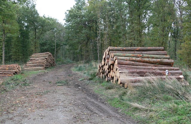
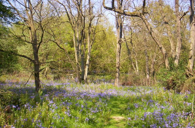
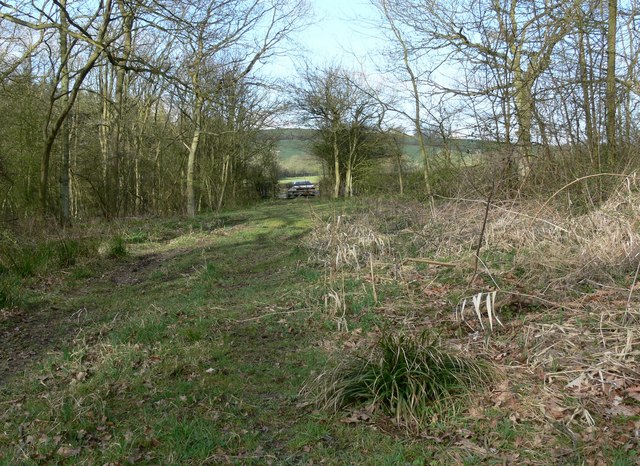
Situated in the Charnwood Forest area, Colborough Hill is covered by dense woodland consisting mainly of oak, birch, and beech trees. The hill is a popular destination for hikers, nature enthusiasts, and photographers, offering a variety of well-marked trails that cater to different fitness levels.

The summit of Colborough Hill provides an excellent vantage point to admire the picturesque landscape, including the nearby Bradgate Park and Cropston Reservoir. On clear days, it is even possible to see Leicester city center in the distance.

In addition to its natural beauty, Colborough Hill is also of historical significance. It is believed to have been used as a lookout point during the Roman period and later as a beacon site during the Anglo-Saxon era. The hill has also witnessed human activity during the Industrial Revolution when mining operations took place in the surrounding area.

Colborough Hill remains a popular destination for locals and visitors alike, offering a tranquil escape from the bustling city life. Its natural beauty, diverse flora, and historical significance make it an attractive spot for those seeking to connect with nature and explore the rich history of Leicestershire.

If you have any feedback on the listing, please let us know in the comments section below.

Colborough Hill Images

Images are sourced within 2km of 52.638291/-0.87672404 or Grid Reference SK7605. Thanks to Geograph Open Source API. All images are credited.

Monument in Skeffington Woods Inscribed "Skeffington Wood Reaforrested 1945 - 1955 Harry Walker"
Monument in Skeffington Woods
Inscribed "Skeffington Wood Reaforrested 1945 - 1955 Harry Walker"
Combine harvester at work In a field of wheat adjacent to Skeffington Wood Road
Combine harvester at work
In a field of wheat adjacent to Skeffington Wood Road
St Peter's Church, Tilton on the Hill
The tomb of Sir Everard Digby In St Peter's Church, Tilton-on-the-Hill. During the Wars of the Roses his family suffered big financial losses in relation to The Battle of Towton (1461). In 1485 he joined the rebel forces at The Battle of Bosworth Field. His great great grandson - also called Everard Digby was involved in The Gunpowder Plot of 1605. That Everard Digby was hanged, drawn and quartered early on Thursday 30 January 1606.
The tomb of Sir Everard Digby
In St Peter's Church, Tilton-on-the-Hill. During the Wars of the Roses his family suffered big financial losses in relation to The Battle of Towton (1461). In 1485 he joined the rebel forces at The Battle of Bosworth Field. His great great grandson - also called Everard Digby was involved in The Gunpowder Plot of 1605. That Everard Digby was hanged, drawn and quartered early on Thursday 30 January 1606.
A wonky window in St Peter's Church, Tilton
Oddly weathered gravestone In the churchyard of St Peter's, Tilton-on-the-Hill
Oddly weathered gravestone
In the churchyard of St Peter's, Tilton-on-the-Hill
Strange medieval stone carving in St Peter's Church At Tilton-on-the-Hill, Leicestershire
Strange medieval stone carving in St Peter's Church
At Tilton-on-the-Hill, Leicestershire
Norman font in St Peter's Church, Tilton-on-the-Hill For more information about this lovely, ancient church and its contents, go here:-
<span class="nowrap"><a title="https://www.greatenglishchurches.co.uk/html/tilton-on-the-hill.html" rel="nofollow ugc noopener" href="https://www.greatenglishchurches.co.uk/html/tilton-on-the-hill.html">Link</a><img style="margin-left:2px;" alt="External link" title="External link - shift click to open in new window" src="https://s1.geograph.org.uk/img/external.png" width="10" height="10"/></span>
Norman font in St Peter's Church, Tilton-on-the-Hill
For more information about this lovely, ancient church and its contents, go here:- LinkExternal link
Church of St. Peter, Tilton on the Hill
Fields near Tilton on the Hill
The Old School, Tilton on the Hill Dated 1844 <span class="nowrap"><a title="https://historicengland.org.uk/listing/the-list/list-entry/1180162" rel="nofollow ugc noopener" href="https://historicengland.org.uk/listing/the-list/list-entry/1180162">Link</a><img style="margin-left:2px;" alt="External link" title="External link - shift click to open in new window" src="https://s1.geograph.org.uk/img/external.png" width="10" height="10"/></span>
The Old School, Tilton on the Hill
Dated 1844 LinkExternal link
Churchyard Cross, Tilton on the Hill Medieval churchyard cross <span class="nowrap"><a title="https://historicengland.org.uk/listing/the-list/list-entry/1360999" rel="nofollow ugc noopener" href="https://historicengland.org.uk/listing/the-list/list-entry/1360999">Link</a><img style="margin-left:2px;" alt="External link" title="External link - shift click to open in new window" src="https://s1.geograph.org.uk/img/external.png" width="10" height="10"/></span>
Churchyard Cross, Tilton on the Hill
Medieval churchyard cross LinkExternal link
House in Tilton on the Hill
Cottages in Tilton on the Hill
Cottage in Tilton on the Hill
Coach House at Rodhill Farm, Tilton on the Hill Dates from the early nineteenth century <span class="nowrap"><a title="https://historicengland.org.uk/listing/the-list/list-entry/1295029" rel="nofollow ugc noopener" href="https://historicengland.org.uk/listing/the-list/list-entry/1295029">Link</a><img style="margin-left:2px;" alt="External link" title="External link - shift click to open in new window" src="https://s1.geograph.org.uk/img/external.png" width="10" height="10"/></span>
Coach House at Rodhill Farm, Tilton on the Hill
Dates from the early nineteenth century LinkExternal link
Location of Stone Lodge Surface Block <span class="nowrap"><a title="http://trigpointing.uk/trig/204" rel="nofollow ugc noopener" href="http://trigpointing.uk/trig/204">Link</a><img style="margin-left:2px;" alt="External link" title="External link - shift click to open in new window" src="https://s1.geograph.org.uk/img/external.png" width="10" height="10"/></span>
Location of Stone Lodge Surface Block
Oakham Road near Owston
Show me another place!

Colborough Hill is located at Grid Ref: SK7605 (Lat: 52.638291, Lng: -0.87672404)

Administrative County: Leicestershire

District: Harborough

Police Authority: Leicestershire

What 3 Words

///dugouts.nicer.disputes. Near Houghton on the Hill, Leicestershire

Related Wikis

Tilton Cutting

Tilton Cutting is a 4.4 hectares (11 acres) geological Site of Special Scientific Interest west of Tilton on the Hill in Leicestershire. It is a Geological...

Tilton railway station

Tilton railway station was a railway station serving the village of Tilton on the Hill, in Leicestershire, England. on the Great Northern and London and...

Tilton on the Hill

Tilton on the Hill is a village and (as just Tilton) a former civil parish, now in the parish of Tilton on the Hill and Halstead in the Harborough district...

Sauvey Castle

Sauvey Castle is a medieval castle, near Withcote, Leicestershire, England. It was probably built by King John in 1211 as a secluded hunting lodge in Leighfield...

Launde Woods

Launde Woods is a 99 hectares (240 acres) nature reserve north of Launde in Leicestershire. It is owned by the Leicester Diocesan Board of Finance and...

Launde Big Wood

Launde Big Wood is a 41.1 hectares (102 acres) biological Site of Special Scientific Interest east of Leicester. It is part of Launde Woods nature reserve...

Owston Woods

Owston Woods is a 139.6 hectares (345 acres) biological Site of Special Scientific Interest south of Owston in Leicestershire.The dominant trees in these...

Skeffington

Skeffington is a village and civil parish in the Harborough district of Leicestershire, England. It lies 11 miles/18 km east of Leicester on the A47 Uppingham...

Nearby Amenities

Located within 500m of 52.638291,-0.87672404
Colborough Hill
Natural: peak
Source: OS OpenData StreetView
Lat/Long: 52.638194/-0.8765361
The data included in this document is from www.openstreetmap.org. The data is made available under ODbL.

Have you been to Colborough Hill?

Leave your review of Colborough Hill below (or comments, questions and feedback).