Crossburrow Hill

Hill, Mountain in Leicestershire Harborough

England

Crossburrow Hill

Cycle Route 64 crossing Langton Lane, Cranoe A most enjoyable cycle route from Market Harborough (left) to Lincoln. Mostly gentle gradients, though a steep climb up the hill to the right.
Cycle Route 64 crossing Langton Lane, Cranoe Credit: Tim Heaton

Crossburrow Hill is a prominent hill located in Leicestershire, England. Situated approximately 5 miles east of Loughborough, it forms part of the Charnwood Forest and is renowned for its picturesque surroundings and natural beauty.

Rising to an elevation of around 220 meters (720 feet), Crossburrow Hill offers breathtaking views of the surrounding countryside and is a popular destination for hikers, nature enthusiasts, and photographers alike. The hill is characterized by its rolling slopes covered in lush green vegetation, dotted with trees, and interspersed with rocky outcrops.

The area surrounding Crossburrow Hill is rich in wildlife, with numerous species of birds, mammals, and plants making their home here. The hill's diverse ecosystem provides habitats for a wide range of species, including rabbits, foxes, deer, and various bird species.

Crossburrow Hill also holds historical significance, with evidence of ancient human activity in the form of Iron Age hillforts. These hillforts, known as Beacon Hill and Bury Camp, are located nearby and add to the cultural and archaeological value of the area.

Access to Crossburrow Hill is facilitated by a network of footpaths and trails, allowing visitors to explore its natural wonders. The hill offers a serene and peaceful environment, providing an escape from the hustle and bustle of urban life.

Overall, Crossburrow Hill in Leicestershire is a captivating natural landmark, offering stunning views, diverse wildlife, and a glimpse into the region's rich history.

If you have any feedback on the listing, please let us know in the comments section below.

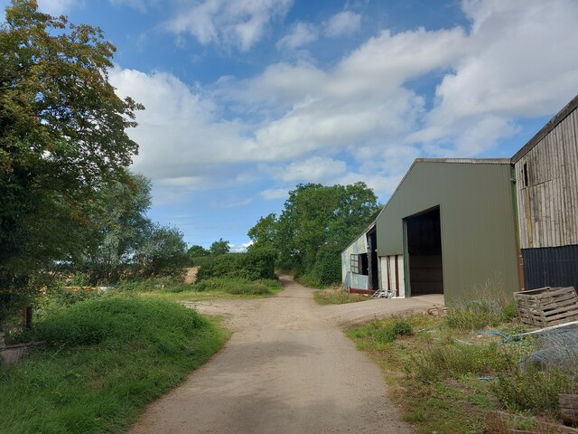
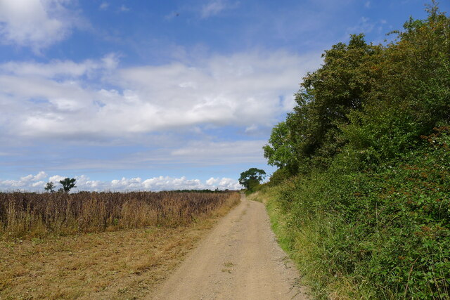
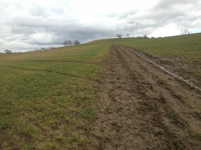
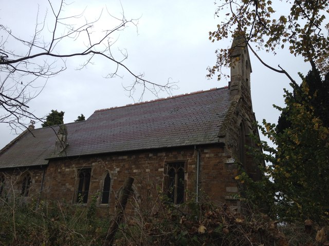
Crossburrow Hill Images

Images are sourced within 2km of 52.549102/-0.89805661 or Grid Reference SP7495. Thanks to Geograph Open Source API. All images are credited.

Cycle Route 64 crossing Langton Lane, Cranoe A most enjoyable cycle route from Market Harborough (left) to Lincoln. Mostly gentle gradients, though a steep climb up the hill to the right.
Cycle Route 64 crossing Langton Lane, Cranoe
A most enjoyable cycle route from Market Harborough (left) to Lincoln. Mostly gentle gradients, though a steep climb up the hill to the right.
Fields south of Cranoe Looking along the supposed route of Via Devana on the north side of the Welland valley
Fields south of Cranoe
Looking along the supposed route of Via Devana on the north side of the Welland valley
Cranoe Road. View north-west towards Glooston On Cycle Route 64 after the climb up Church Hill, Cranoe
Cranoe Road. View north-west towards Glooston
On Cycle Route 64 after the climb up Church Hill, Cranoe
Andrew's Lane leaving the west side of Glooston
Andrew's Lane leading to Glooston
Gartree Road west of Glooston This is the south-eastern end of the 10 miles of straight roads and byways leading north-west to Leicester: the Gartree Road; which follows the route of the Roman road, Via Devana.
At this point the OS map marks the line of the Roman road a few metres to the left of the track, where there is indeed a slightly raised, broad ridge - the agger?
Gartree Road west of Glooston
This is the south-eastern end of the 10 miles of straight roads and byways leading north-west to Leicester: the Gartree Road; which follows the route of the Roman road, Via Devana. At this point the OS map marks the line of the Roman road a few metres to the left of the track, where there is indeed a slightly raised, broad ridge - the agger?
Leicestershire Round footpath looking down Langton Caudle
Leicestershire Round footpath The Leicestershire Round follows this field track and was very slippery on Easter Monday and that was coming down hill.
Leicestershire Round footpath
The Leicestershire Round follows this field track and was very slippery on Easter Monday and that was coming down hill.
Fields to the west of Welham Lane
Welham Lane towards Cranoe The Midshires Way long distance footpath follow this road at this point.
Welham Lane towards Cranoe
The Midshires Way long distance footpath follow this road at this point.
Welham Lane towards Welham The Midshires Way long distance footpath follow this road at this point.
Welham Lane towards Welham
The Midshires Way long distance footpath follow this road at this point.
Welham Lane towards Cranoe The Midshires Way long distance footpath follow this road at this point.
Welham Lane towards Cranoe
The Midshires Way long distance footpath follow this road at this point.
Welham Lane south from Cranoe
Welham Lane towards Welham The Midshires Way long distance footpath follow this road at this point.
Welham Lane towards Welham
The Midshires Way long distance footpath follow this road at this point.
Gate into a field east of Welham Lane
Into the centre of Cranoe
Glooston Parish Church
Stonton Wyville
Stonton Wyville
Show me another place!

Crossburrow Hill is located at Grid Ref: SP7495 (Lat: 52.549102, Lng: -0.89805661)

Administrative County: Leicestershire

District: Harborough

Police Authority: Leicestershire

What 3 Words

///expose.dissolves.notes. Near Kibworth Harcourt, Leicestershire

Nearby Locations

Crossburrow Hill

Related Wikis

Glooston

Glooston is a small village and civil parish in the Harborough district of Leicestershire, England. According to the 2001 census the parish had a population...

Stonton Wyville

Stonton Wyville is a small village and civil parish in the Harborough district of Leicestershire, England. According to the 2001 census the parish had...

Cranoe

Cranoe is a small village and civil parish in the Harborough district of Leicestershire, England. The parish had a population of 35 in 2001. The population...

Knave Hill

Knave Hill is an archaeological site near the village of Stonton Wyville, Leicestershire, in the English East Midlands. It was excavated by Channel 4's...

Nearby Amenities

Located within 500m of 52.549102,-0.89805661
Power: tower
Lat/Long: 52.5496165/-0.9035287
Power: tower
Lat/Long: 52.5473331/-0.9004173
The data included in this document is from www.openstreetmap.org. The data is made available under ODbL.

Have you been to Crossburrow Hill?

Leave your review of Crossburrow Hill below (or comments, questions and feedback).