Brock Hill

Hill, Mountain in Leicestershire Melton

England

Brock Hill

Grass field off Clawson Lane A hazy Vale of Belvour beyond.
Grass field off Clawson Lane Credit: Jonathan Thacker

Brock Hill is a small hill located in Leicestershire, England. Situated in the Charnwood Forest, it forms part of the eastern boundary of the county. Despite its modest elevation, reaching only 210 meters (689 feet) above sea level, Brock Hill offers stunning panoramic views of the surrounding countryside.

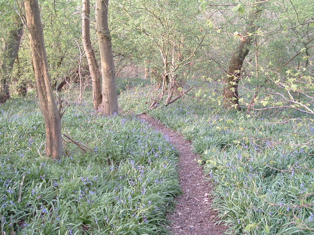
The hill is covered in lush greenery, with a mix of deciduous and coniferous trees creating a picturesque landscape. Walking trails crisscross the area, making it a popular destination for outdoor enthusiasts and nature lovers. These paths lead visitors through woodlands, meadows, and past babbling brooks, providing a serene and tranquil experience.

Brock Hill also holds historical significance, as it is home to the remains of an Iron Age hillfort. The earthworks and ramparts surrounding the hillfort are still visible today, offering glimpses into the past and attracting archaeology enthusiasts.

The hill is easily accessible, with a car park located nearby, and it is a great spot for a leisurely hike or a picnic. Visitors can enjoy the breathtaking views of the Leicestershire countryside, including the rolling hills and charming villages that dot the landscape.

Overall, Brock Hill is a hidden gem in Leicestershire, offering a peaceful escape from the hustle and bustle of everyday life. Whether it's for a scenic walk, a historical exploration, or simply to appreciate the beauty of nature, Brock Hill is a must-visit destination for anyone in the area.

If you have any feedback on the listing, please let us know in the comments section below.

Brock Hill Images

Images are sourced within 2km of 52.828114/-0.89758639 or Grid Reference SK7426. Thanks to Geograph Open Source API. All images are credited.
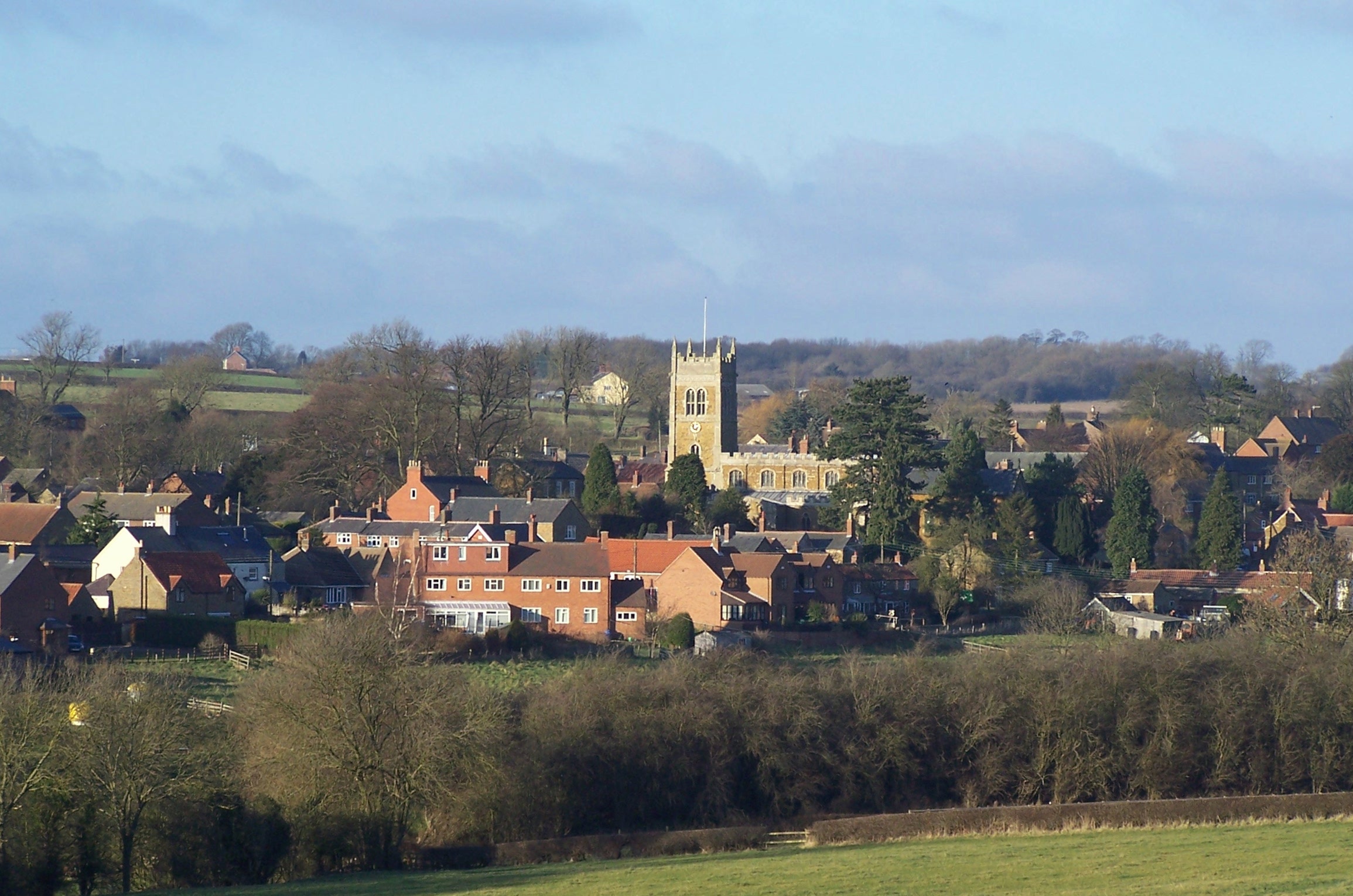
Grass field off Clawson Lane A hazy Vale of Belvour beyond.
Grass field off Clawson Lane
A hazy Vale of Belvour beyond.
Mill Farm seen from Sandpit Lane, Long Clawson Mill Farm is in the centre of the picture.
Mill Farm seen from Sandpit Lane, Long Clawson
Mill Farm is in the centre of the picture.
Grass field and horses, Long Clawson
Clawson Lane
Clawson Lane
Bridleway passing Grange Farm Following the parish boundary and the line of 'le ferdgate' across the Leicestershire Wolds
Bridleway passing Grange Farm
Following the parish boundary and the line of 'le ferdgate' across the Leicestershire Wolds
A green lane north of Ironstone Lane The probable route of 'le ferdgate' continuing as a public access route across the Leicestershire Wolds
A green lane north of Ironstone Lane
The probable route of 'le ferdgate' continuing as a public access route across the Leicestershire Wolds
A green lane north of Ironstone Lane The probable route of 'le ferdgate' continuing as a public access route and the parish boundary across the Leicestershire Wolds
A green lane north of Ironstone Lane
The probable route of 'le ferdgate' continuing as a public access route and the parish boundary across the Leicestershire Wolds
A crossing of salt ways The green lane following the route of 'le ferdgate' (used as a saltway <span class="nowrap"><a title="https://epns.nottingham.ac.uk/browse/id/53285cd4b47fc40adf00110f-Framland+Hundred" rel="nofollow ugc noopener" href="https://epns.nottingham.ac.uk/browse/id/53285cd4b47fc40adf00110f-Framland+Hundred">Link</a><img style="margin-left:2px;" alt="External link" title="External link - shift click to open in new window" src="https://s1.geograph.org.uk/img/external.png" width="10" height="10"/></span> ) crossing Langdyke Lane, the route of the Roman road Margary 58a (aka the Salt Way).
A crossing of salt ways
The green lane following the route of 'le ferdgate' (used as a saltway LinkExternal link ) crossing Langdyke Lane, the route of the Roman road Margary 58a (aka the Salt Way).
'le ferdgate' crossing Langdyke Lane A crossing of two ancient (pre-Roman origins?) roads: 'le ferdgate' and the Salt Way
'le ferdgate' crossing Langdyke Lane
A crossing of two ancient (pre-Roman origins?) roads: 'le ferdgate' and the Salt Way
Public access route crossing a tributary to Scalford Brook Double hedges and the parish boundary continuing the route of 'le ferdgate' across the Leicestershire Wolds
Public access route crossing a tributary to Scalford Brook
Double hedges and the parish boundary continuing the route of 'le ferdgate' across the Leicestershire Wolds
An ancient route much abused The route of 'le ferdgate' rendered almost impassable by modern 4WDs and motorbikes
An ancient route much abused
The route of 'le ferdgate' rendered almost impassable by modern 4WDs and motorbikes
Public access route across the Leicestershire Wolds The route of 'le ferdgate' approaching the top of the Belvoir escarpment
Public access route across the Leicestershire Wolds
The route of 'le ferdgate' approaching the top of the Belvoir escarpment
Crossing Clawson Lane at the top of the Belvoir escarpment The route of 'le ferdgate' about to drop down Brock Hill
Crossing Clawson Lane at the top of the Belvoir escarpment
The route of 'le ferdgate' about to drop down Brock Hill
Brock Hill down to the Vale of Belvoir The route of  'le ferdgate' into the Vale of Belvoir.
The village of Harby, where " ...  Walter son of Roger de Herdebi  [granted] land and meadow in Herdebi ... part abutting 'in le Ferdgate' ... " <span class="nowrap"><a title="https://www.british-history.ac.uk/ancient-deeds/vol3/pp387-399" rel="nofollow ugc noopener" href="https://www.british-history.ac.uk/ancient-deeds/vol3/pp387-399">Link</a><img style="margin-left:2px;" alt="External link" title="External link - shift click to open in new window" src="https://s1.geograph.org.uk/img/external.png" width="10" height="10"/></span> lies in the vale about 3 miles ahead.
Brock Hill down to the Vale of Belvoir
The route of 'le ferdgate' into the Vale of Belvoir. The village of Harby, where " ... Walter son of Roger de Herdebi [granted] land and meadow in Herdebi ... part abutting 'in le Ferdgate' ... " LinkExternal link lies in the vale about 3 miles ahead.
Former railway cutting north of Landyke Lane Now effectively an extension (at a lower level) of a field out of shot to the left, this cutting appears to have partially been filled in. The railway line that used it, the former Great Northern and London & North Western joint line through high Leicestershire, entered a tunnel at the north end of this cutting on its way towards Nottingham, Newark and Grantham.
Former railway cutting north of Landyke Lane
Now effectively an extension (at a lower level) of a field out of shot to the left, this cutting appears to have partially been filled in. The railway line that used it, the former Great Northern and London & North Western joint line through high Leicestershire, entered a tunnel at the north end of this cutting on its way towards Nottingham, Newark and Grantham.
Animal sheds
Animal sheds
New gate into field No public footpath is marked on the map.
New gate into field
No public footpath is marked on the map.
Towards Scalford
Towards Scalford
Show me another place!

Brock Hill is located at Grid Ref: SK7426 (Lat: 52.828114, Lng: -0.89758639)

Administrative County: Leicestershire

District: Melton

Police Authority: Leicestershire

What 3 Words

///paths.coasting.feuds. Near Long Clawson, Leicestershire

Nearby Locations

Brock Hill Round Covert

Related Wikis

Long Clawson and Hose railway station

Long Clawson and Hose railway station was a railway station serving the villages of Long Clawson and Hose, Leicestershire on the Great Northern and London...

Long Clawson

Long Clawson is a village and former civil parish, now included in that of Clawson, Hose and Harby, in the Melton district and the county of Leicestershire...

Scalford railway station

Scalford railway station was a railway station serving the village of Scalford, Leicestershire on the Great Northern and London and North Western Joint...

Holwell Mouth

Holwell Mouth is a 14.5-hectare (36-acre) biological Site of Special Scientific Interest south-east of Nether Broughton in Leicestershire. It is common...

Scalford

Scalford is a village and civil parish in the Melton borough of Leicestershire, England. It lies 4 miles (6.4 km) to the north of Melton Mowbray at the...

Holwell Reserves

Holwell Reserves is a 16.4 hectares (41 acres) nature reserve north of Melton Mowbray in Leicestershire. It is owned and managed by the Leicestershire...

Harby Hill Wood

Harby Hill Wood is a 16.9-hectare (42-acre) biological Site of Special Scientific Interest west of Eastwell in Leicestershire.This site has steeply sloping...

Melton Rural District

Melton was a rural district in Leicestershire, England from 1894 to 1935. It was created in 1894 under the Local Government Act 1894 as a successor to...

Nearby Amenities

Located within 500m of 52.828114,-0.89758639
Give Way
Direction: backward
Lat/Long: 52.8289755/-0.8959345
Barrier: entrance
Source: Bing
Lat/Long: 52.8271634/-0.900153
The data included in this document is from www.openstreetmap.org. The data is made available under ODbL.

Have you been to Brock Hill?

Leave your review of Brock Hill below (or comments, questions and feedback).