Devil's Hill

Hill, Mountain in Oxfordshire South Oxfordshire

England

Devil's Hill

Ploughed field near Cookley Green
Ploughed field near Cookley Green Credit: Simon Mortimer

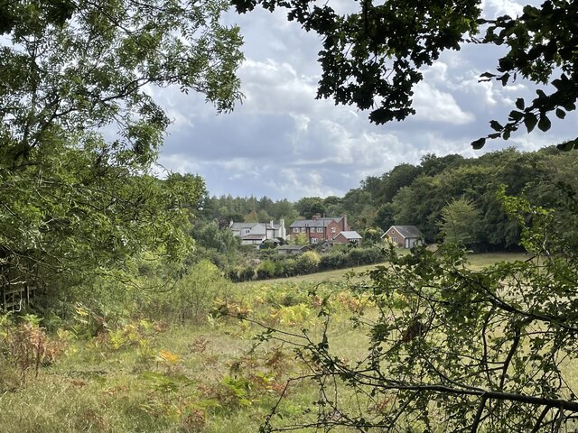
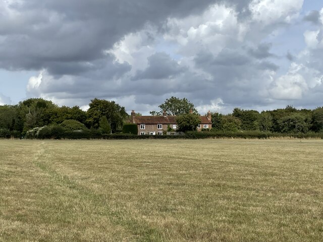
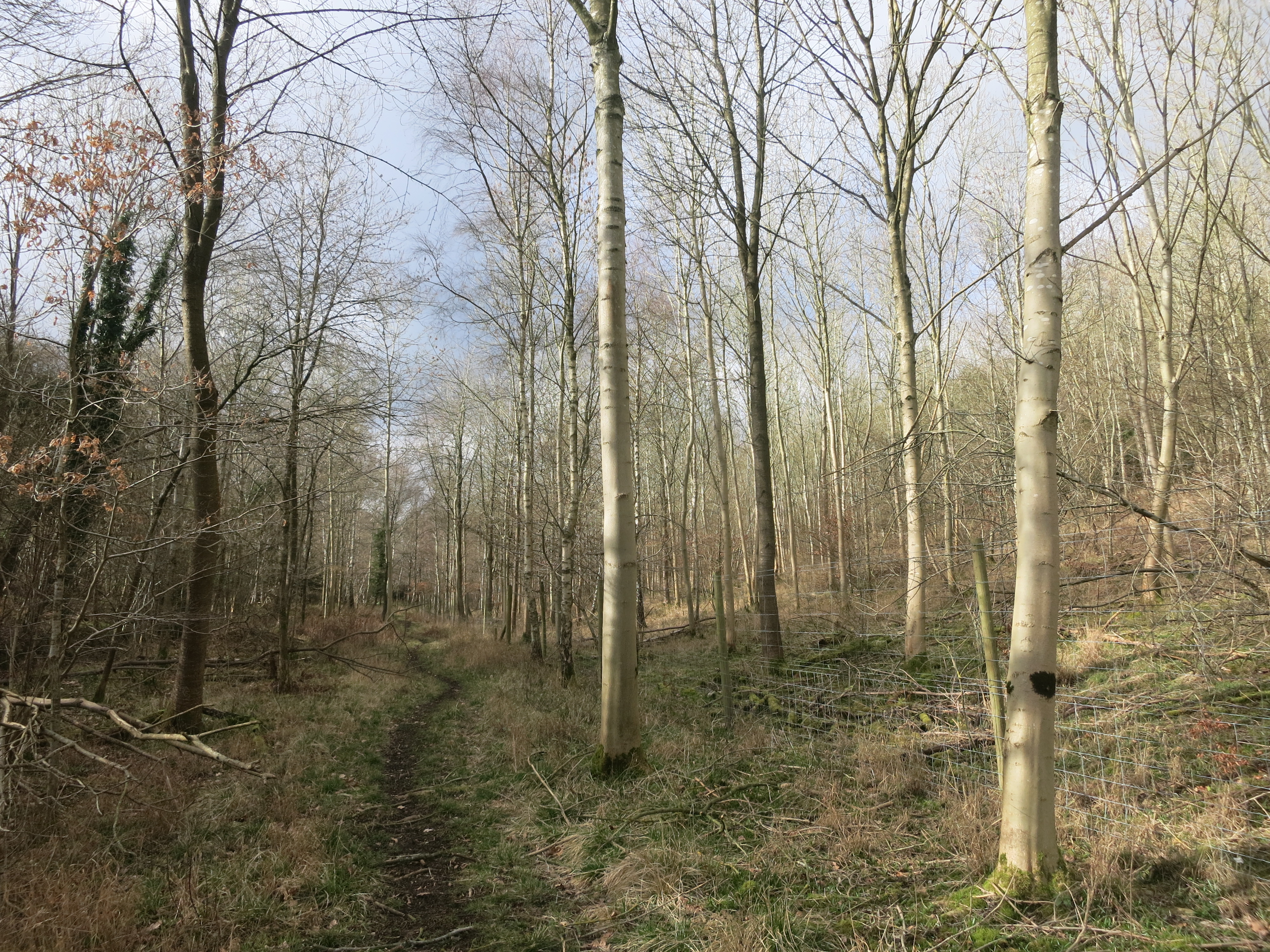
Devil's Hill, located in Oxfordshire, is an imposing hill that dominates the landscape with its rugged beauty. Rising to an elevation of 267 meters (876 feet) above sea level, it is a prominent feature within the county. The hill is situated in the Chiltern Hills, a designated Area of Outstanding Natural Beauty, and offers stunning panoramic views of the surrounding countryside.

The name "Devil's Hill" is believed to have originated from local folklore, which tells tales of supernatural occurrences and devilish activities associated with the site. However, there is no historical evidence to support these claims, and the name is likely a result of ancient superstitions.

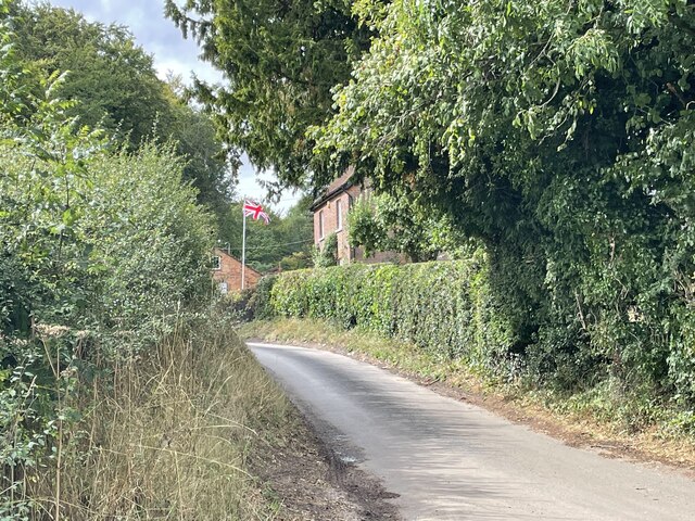
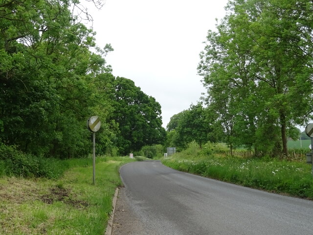
The hill itself is composed mainly of chalk, a sedimentary rock that forms the characteristic rolling hills of the Chilterns. Its slopes are covered in lush grasses and scattered with wildflowers, creating a picturesque landscape. Visitors can enjoy walking trails that wind their way up the hill, providing opportunities for leisurely hikes and breathtaking views.

Devil's Hill is also home to a diverse range of wildlife, including various bird species, small mammals, and insects. The hillside is a haven for nature enthusiasts and birdwatchers, who can spot species such as skylarks, kestrels, and yellowhammers in their natural habitat.

Overall, Devil's Hill in Oxfordshire offers visitors a chance to immerse themselves in the natural beauty and tranquility of the Chiltern Hills, while also providing a glimpse into the region's folklore and history.

If you have any feedback on the listing, please let us know in the comments section below.

Devil's Hill Images

Images are sourced within 2km of 51.601032/-0.98715054 or Grid Reference SU7089. Thanks to Geograph Open Source API. All images are credited.

Ploughed field near Cookley Green
Cottages on the edge of Nettlebed Common This group of cottages sit facing the northern edge of Nettlebed Common but within the parish of Swyncombe.
Cottages on the edge of Nettlebed Common
This group of cottages sit facing the northern edge of Nettlebed Common but within the parish of Swyncombe.
Digberry Farm, Huntercombe Lane The farm sits within a large square earthwork of unknown age measuring 200 metres across.
Digberry Farm, Huntercombe Lane
The farm sits within a large square earthwork of unknown age measuring 200 metres across.
Cottages at Park Corner Looking north along the footpath from Huntercombe End.
Cottages at Park Corner
Looking north along the footpath from Huntercombe End.
Red Lane at the junction of Patemore Lane
Cereal crop off Red Lane
Red Lane (B481) Towards Cookley Green.
Red Lane (B481)
Towards Cookley Green.
Field entrance, Howe Hill Off Britwell Hill Road.
Field entrance, Howe Hill
Off Britwell Hill Road.
Britwell Hill Road Towards Britwell Hill.
Britwell Hill Road
Towards Britwell Hill.
Elizabeth II postbox, Howe Hill Postbox No. OX49 566.
See <a href="https://www.geograph.org.uk/photo/7296773">SU6991 : Howe Hill (B480)</a> for context.
Elizabeth II postbox, Howe Hill
Postbox No. OX49 566. See SU6991 : Howe Hill (B480) for context.
Howe Hill (B480) Showing position of Postbox No. OX49 566.
See <a href="https://www.geograph.org.uk/photo/7296772">SU6991 : Elizabeth II postbox, Howe Hill</a> for postbox.
Howe Hill (B480)
Showing position of Postbox No. OX49 566. See SU6991 : Elizabeth II postbox, Howe Hill for postbox.
Frosty House at Cookley Green A light dusting of snow this morning brought out the usual crop of wintery scenes.
This house is facing onto the village green.
Frosty House at Cookley Green
A light dusting of snow this morning brought out the usual crop of wintery scenes. This house is facing onto the village green.
Burial Copse Woodland north of Church Lane.
Burial Copse
Woodland north of Church Lane.
Country north of Church Lane
View towards Coates Copse In the direction of telecommunications masts in Eatonsfield Shaw.
View towards Coates Copse
In the direction of telecommunications masts in Eatonsfield Shaw.
Church Lane Towards Cookley Green.
Church Lane
Towards Cookley Green.
Church Lane Towards Ewelme.
Church Lane
Towards Ewelme.
Little Stoneyfield Farm, Howe Hill, Watlington The original farmhouse of Little Stoney Farm was demolished and a new one constructed bearing a slightly different name.
Little Stoneyfield Farm, Howe Hill, Watlington
The original farmhouse of Little Stoney Farm was demolished and a new one constructed bearing a slightly different name.
Show me another place!

Devil's Hill is located at Grid Ref: SU7089 (Lat: 51.601032, Lng: -0.98715054)

Administrative County: Oxfordshire

District: South Oxfordshire

Police Authority: Thames Valley

What 3 Words

///yachting.character.rope. Near Watlington, Oxfordshire

Related Wikis

Russell's Water

Russell's Water is a hamlet about 6 miles (9.7 km) north of Henley-on-Thames in South Oxfordshire. It is in the Chiltern Hills about 620 feet (190 m)...

Pishill Woods

Pishill Woods is a 42.8-hectare (106-acre) biological Site of Special Scientific Interest north of Nettlebed in Oxfordshire.These semi-natural woods have...

Berrick Trench

Berrick Trench is a 2.1-hectare (5.2-acre) biological Site of Special Scientific Interest north of Nettlebed in Oxfordshire.This is an ancient semi-natural...

Swyncombe

Swyncombe is a hamlet and large civil parish in the high Chilterns, within the Area of Outstanding Natural Beauty about 4+1⁄2 miles (7 km) east of Wallingford...

Bix Bottom

Bix Bottom is a 102.3-hectare (253-acre) biological Site of Special Scientific Interest north-west of Henley-on-Thames in Oxfordshire. It is owned and...

Pishill

Pishill is a village and former civil parish, now in the parish of Pishill with Stonor, in the South Oxfordshire district, in the county of Oxfordshire...

Nettlebed

Nettlebed is a village and civil parish in Oxfordshire in the Chiltern Hills about 4+1⁄2 miles (7 km) northwest of Henley-on-Thames and 6 miles (10 km...

HM Prison Huntercombe

HM Prison Huntercombe is a Category C men's prison, located near Nuffield in Oxfordshire, England. It is operated by His Majesty's Prison Service. ��2...

Nearby Amenities

Located within 500m of 51.601032,-0.98715054
Power: pole
Source: Bing
Lat/Long: 51.5989389/-0.9815974
Power: pole
Source: Bing
Lat/Long: 51.6031274/-0.9870798
Power: pole
Source: Bing
Lat/Long: 51.6020928/-0.98458
Power: pole
Source: Bing
Lat/Long: 51.6047732/-0.9890003
Power: pole
Source: Bing
Lat/Long: 51.6026425/-0.9857817
Power: pole
Source: Bing
Lat/Long: 51.6028175/-0.9864039
Power: pole
Source: Bing
Lat/Long: 51.599662/-0.9813667
Power: pole
Source: Bing
Lat/Long: 51.6039786/-0.9878899
Power: pole
Source: Bing
Lat/Long: 51.5991639/-0.9820963
Power: pole
Source: Bing
Lat/Long: 51.601533/-0.9833623
Power: pole
Source: Bing
Lat/Long: 51.5995105/-0.9817476
Power: pole
Lat/Long: 51.6047748/-0.9887642
Power: pole
Lat/Long: 51.6006449/-0.9827694
Power: pole
Lat/Long: 51.602181/-0.9849742
Power: pole
Lat/Long: 51.6032122/-0.9869832
Power: pole
Lat/Long: 51.5969878/-0.9851646
Power: pole
Lat/Long: 51.597511/-0.9844646
Power: pole
Lat/Long: 51.5981058/-0.9836251
Power: pole
Lat/Long: 51.5987539/-0.9826836
Power: pole
Lat/Long: 51.6009931/-0.9822062
Power: pole
Lat/Long: 51.6002434/-0.9819648
The data included in this document is from www.openstreetmap.org. The data is made available under ODbL.

Have you been to Devil's Hill?

Leave your review of Devil's Hill below (or comments, questions and feedback).