Wether Down
Hill, Mountain in Hampshire East Hampshire
England
Wether Down

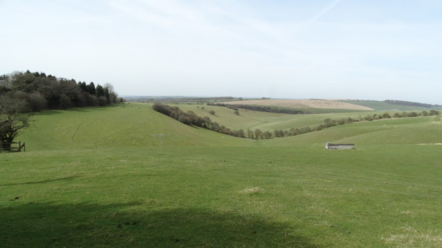
Wether Down is a prominent hill located in the county of Hampshire, England. Standing at an elevation of 201 meters (659 feet) above sea level, it is part of the South Downs National Park and offers breathtaking views of the surrounding picturesque countryside.
Situated in the eastern part of the national park, Wether Down is a popular destination for outdoor enthusiasts, hikers, and nature lovers. The hill is covered in a mix of grasses, heathers, and low-growing shrubs, creating a diverse and vibrant landscape. Its slopes are gentle, making it accessible for people of all ages and fitness levels.
The summit of Wether Down provides panoramic views of the rolling hills of Hampshire, with glimpses of the nearby towns and villages. On a clear day, it is said that one can even see as far as the English Channel to the south. The hill is also home to a variety of wildlife, including birds, rabbits, and deer, making it a haven for nature enthusiasts and photographers.
Visitors to Wether Down can explore the numerous footpaths and trails that crisscross the hill, offering opportunities for leisurely walks and more challenging hikes. The area is well-maintained and easily accessible, with car parking facilities and nearby amenities.
Overall, Wether Down in Hampshire is a beautiful and picturesque hill, providing visitors with a tranquil escape from the hustle and bustle of daily life, while offering stunning views and a chance to connect with nature.
If you have any feedback on the listing, please let us know in the comments section below.
Wether Down Images
Images are sourced within 2km of 50.973287/-1.0396472 or Grid Reference SU6719. Thanks to Geograph Open Source API. All images are credited.


Wether Down is located at Grid Ref: SU6719 (Lat: 50.973287, Lng: -1.0396472)
Administrative County: Hampshire
District: East Hampshire
Police Authority: Hampshire
What 3 Words
///clots.swimsuits.thumb. Near Denmead, Hampshire
Nearby Locations
Related Wikis

Wether Down
Wether Down is one of the highest hills in the county of Hampshire, England, and in the South Downs, rising to 234 metres (768 ft) above sea level. Wether...

HMS Mercury (shore establishment)
HMS Mercury was a shore establishment of the Royal Navy, and the site of the Royal Navy Signals School and Combined Signals School. There was also a subsidiary...

Coombe, Hampshire
Coombe is a village in Hampshire, England. == Location == Coombe is located at grid reference SU662205 == External links == Media related to Coombe, Hampshire...
East Meon
East Meon is a village and civil parish in the East Hampshire district of Hampshire, England. It is 4.4 miles (7.1 km) west of Petersfield. The village...

Henwood Down
Henwood Down is one of the highest points in the county of Hampshire, England, and in the South Downs, reaching a height of 201 metres (659 ft) above sea...
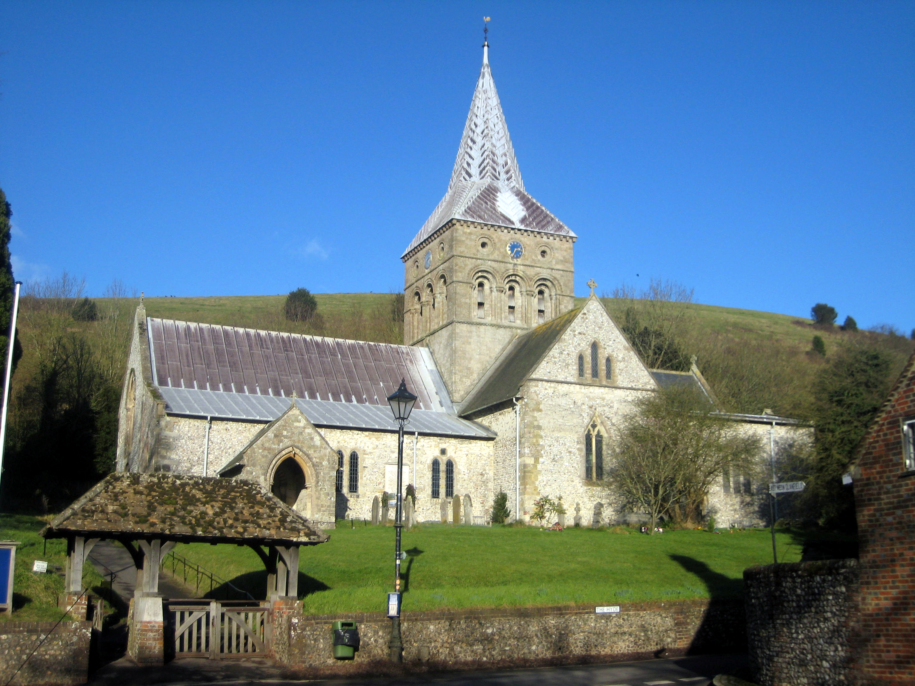
All Saints Church, East Meon
All Saints' Church is an Anglican parish church in the village of East Meon, Hampshire, England. It is a Grade I listed building and the oldest building...

Broadhalfpenny Down
Broadhalfpenny Down (pronounced /ˌbrɔ:dˈheɪpniː/; brawd-HAYP-nee) is a historic cricket ground in Hambledon, Hampshire. It is known as the "Cradle of Cricket...

East Hampshire AONB
East Hampshire Area of Outstanding Natural Beauty (AONB) in England was designated in 1962. The designation was revoked in March 2010, together with the...
Nearby Amenities
Located within 500m of 50.973287,-1.0396472Have you been to Wether Down?
Leave your review of Wether Down below (or comments, questions and feedback).