Harcourt Hill

Hill, Mountain in Oxfordshire South Oxfordshire

England

Harcourt Hill

A4130 eastbound near May's Farm
A4130 eastbound near May's Farm Credit: Colin Pyle

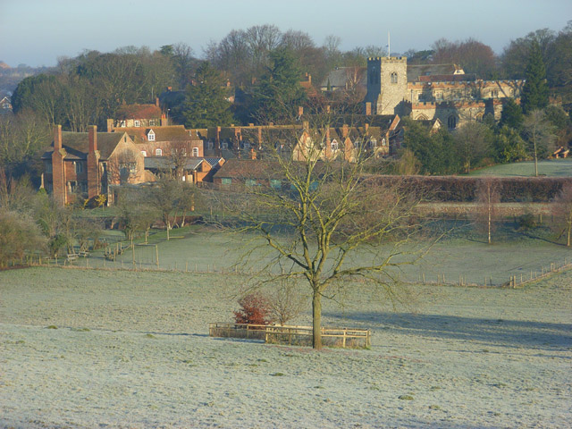
Harcourt Hill is a prominent hill located in the county of Oxfordshire, England. Reaching an elevation of approximately 176 meters (577 feet) above sea level, it forms part of the rolling hills within the wider Oxfordshire Cotswolds region. Situated just 3 miles west of the historic city of Oxford, Harcourt Hill offers a stunning panoramic view of the surrounding countryside and the city itself.

The hill is renowned for its rich historical and cultural significance. It takes its name from the Harcourt family, who were prominent landowners in the area during the medieval period. At the summit of Harcourt Hill, one can find a distinctive tower known as the Harcourt Hill Tower, which was built in the mid-18th century as a folly. This tower not only adds to the aesthetic appeal of the hill but also serves as a navigational landmark.

Harcourt Hill is a popular destination for outdoor enthusiasts and nature lovers. It features numerous walking trails and footpaths that wind through the picturesque countryside, offering breathtaking views and opportunities to spot local wildlife. The hill is also home to a diverse range of plant species, including wildflowers and ancient woodland.

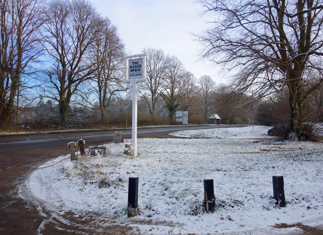
In addition to its natural beauty, Harcourt Hill is also home to Oxford Brookes University's Harcourt Hill Campus. This campus is known for its scenic setting and offers a range of academic programs, particularly in the fields of social sciences and humanities. The presence of the university adds a vibrant and youthful atmosphere to the area.

Overall, Harcourt Hill in Oxfordshire is a captivating destination that combines natural beauty, historical charm, and educational opportunities, making it a must-visit location for locals and tourists alike.

If you have any feedback on the listing, please let us know in the comments section below.

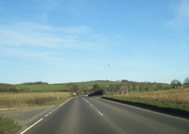
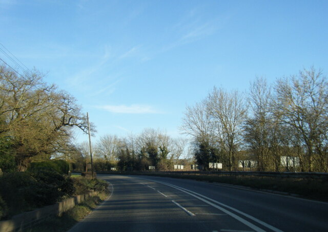
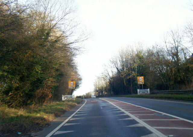
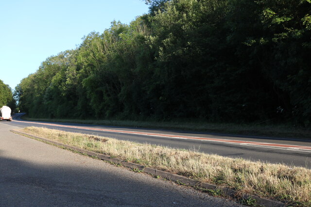
Harcourt Hill Images

Images are sourced within 2km of 51.595983/-1.0423832 or Grid Reference SU6689. Thanks to Geograph Open Source API. All images are credited.

A4130 eastbound near May's Farm
A4130 at Gangsdown Hill
A4130 at Nuffield village boundary
Layby on Gangsdown Hill west on Nettlebed
Farmland, Ewelme Arable land beside a bridleway to the east of Potter's Farm.
Farmland, Ewelme
Arable land beside a bridleway to the east of Potter's Farm.
Light Snow at The Maker Space The Crown at Nuffield was a lovely traditional pub in the Brakspears of Henley estate, but like so many country pubs these days couldn't keep going. It was closed for a long time <a href="https://www.geograph.org.uk/photo/5583827">SU6787 : The Crown closed inn beside the A4130</a> but happily is now open again as The Maker Space (at The Crown) aiming more at the coffee, cake and light meals market, and also as a craft centre.
Light Snow at The Maker Space
The Crown at Nuffield was a lovely traditional pub in the Brakspears of Henley estate, but like so many country pubs these days couldn't keep going. It was closed for a long time SU6787 : The Crown closed inn beside the A4130 but happily is now open again as The Maker Space (at The Crown) aiming more at the coffee, cake and light meals market, and also as a craft centre.
Track and farmland, Ewelme Approaching the bridleway crossroads beside Down Farm.
Track and farmland, Ewelme
Approaching the bridleway crossroads beside Down Farm.
Swan's Way bridleway near Down Farm Looking south from the slopes of Littleworth Hill.  In the valley bottom the bridleway crosses the avenue planted in the early 1900s that leads from Down Farm to Ewelme Down House.
Swan's Way bridleway near Down Farm
Looking south from the slopes of Littleworth Hill. In the valley bottom the bridleway crosses the avenue planted in the early 1900s that leads from Down Farm to Ewelme Down House.
Rolling arable farmland near Down Farm, Ewelme Looking west from the Swan's Way bridleway along the shelter belt called The Nuttery.
Rolling arable farmland near Down Farm, Ewelme
Looking west from the Swan's Way bridleway along the shelter belt called The Nuttery.
Littleworth Hill near Ewelme Looking north along the Swan's Way bridleway.
Littleworth Hill near Ewelme
Looking north along the Swan's Way bridleway.
Ladies Walk bridlepath on the Swyncombe Estate Looking east from Littleworth Hill towards Colliers Bottom.
Ladies Walk bridlepath on the Swyncombe Estate
Looking east from Littleworth Hill towards Colliers Bottom.
Ladies Walk bridlepath and Colliersbottom Shaw Looking east along Ladies Walk.  A shaw is an Anglo-Saxon term for a strip of woodland, often marking a boundary.
Ladies Walk bridlepath and Colliersbottom Shaw
Looking east along Ladies Walk. A shaw is an Anglo-Saxon term for a strip of woodland, often marking a boundary.
Tree Stump in Grindon Lane Grindon Lane is an old green lane with thick hedges on both sides, but here a recently felled tree has opened up this view.
Tree Stump in Grindon Lane
Grindon Lane is an old green lane with thick hedges on both sides, but here a recently felled tree has opened up this view.
Swans Way on Ewelme Downs This hillside section is well graded, wide and dry.
That's by no means typical.
Swans Way on Ewelme Downs
This hillside section is well graded, wide and dry. That's by no means typical.
Ewelme Downs Looking south-east from the side of Littleworth Hill. The farmland is white with chalk, not snow, although it was snowing lightly at the time.
Ewelme Downs
Looking south-east from the side of Littleworth Hill. The farmland is white with chalk, not snow, although it was snowing lightly at the time.
Farm road, Ewelme Downs Looking east from the bridleway crossroads to the east of Ewelme Down Farm.
Farm road, Ewelme Downs
Looking east from the bridleway crossroads to the east of Ewelme Down Farm.
Ewelme Down Farm The western end of quite a large complex of farm buildings.
Ewelme Down Farm
The western end of quite a large complex of farm buildings.
Looking west from Ewelme Down Farm
Show me another place!

Harcourt Hill is located at Grid Ref: SU6689 (Lat: 51.595983, Lng: -1.0423832)

Administrative County: Oxfordshire

District: South Oxfordshire

Police Authority: Thames Valley

What 3 Words

///contrived.pitch.rejoined. Near Benson, Oxfordshire

Nearby Locations

Harcourt Hill Burnham Shaw

Related Wikis

Nuffield, Oxfordshire

Nuffield is a village and civil parish in the Chiltern Hills in South Oxfordshire, England, just over 4 miles (6 km) east of Wallingford. The 2011 Census...

A4130 road

The A4130 is a British A road which runs from a junction with the A404 at Burchetts Green (Maidenhead), Berkshire to the A417 at Rowstock in Oxfordshire...

Nuffield Place

Nuffield Place is a country house near the village of Nuffield in the Chiltern Hills in South Oxfordshire, England, just over 4 miles (6 km) east of Wallingford...

HM Prison Huntercombe

HM Prison Huntercombe is a Category C men's prison, located near Nuffield in Oxfordshire, England. It is operated by His Majesty's Prison Service. ��2...

Swyncombe

Swyncombe is a hamlet and large civil parish in the high Chilterns, within the Area of Outstanding Natural Beauty about 4+1⁄2 miles (7 km) east of Wallingford...

Swyncombe Downs

Swyncombe Downs is a 47.1-hectare (116-acre) biological Site of Special Scientific Interest east of Wallingford in Oxfordshire.This is an area of chalk...

Henley Rural District

Henley was a rural district in Oxfordshire, England from 1894 to 1974.It was named after the borough of Henley-on-Thames, which it surrounded on the west...

Ewelme

Ewelme () is a village and civil parish in the Chiltern Hills in South Oxfordshire, 2.5 miles (4 km) north-east of the market town of Wallingford. The...

Nearby Amenities

Located within 500m of 51.595983,-1.0423832
Harcourt Hill
Place: locality
Lat/Long: 51.5967593/-1.0474276
The data included in this document is from www.openstreetmap.org. The data is made available under ODbL.

Have you been to Harcourt Hill?

Leave your review of Harcourt Hill below (or comments, questions and feedback).