Airy Hill
Hill, Mountain in Yorkshire
England
Airy Hill
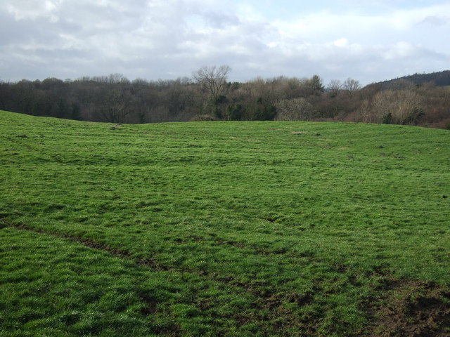
Airy Hill is a prominent hill located in the county of Yorkshire, England. Situated near the coastal town of Whitby, it forms part of the picturesque North York Moors National Park. Rising to an elevation of 101 meters (331 feet), Airy Hill offers stunning panoramic views of the surrounding countryside and coastline.
The hill is characterized by its gently rolling slopes, covered in lush green grass and scattered with heather and wildflowers, creating a beautiful landscape throughout the year. It is a popular destination for hikers, walkers, and nature enthusiasts who enjoy exploring its peaceful and serene environment.
One of the main attractions of Airy Hill is the Whitby Abbey, an ancient ruin that dates back to the 7th century. The hill provides an ideal vantage point to admire the magnificent abbey and its Gothic architecture from afar. Additionally, the surrounding area is home to various trails and footpaths, allowing visitors to embark on scenic walks and discover the natural beauty of the Yorkshire countryside.
Airy Hill is easily accessible by foot or car, with several parking areas available nearby. The hill offers a tranquil escape from the hustle and bustle of city life, inviting visitors to unwind and immerse themselves in the captivating scenery. Whether it is a leisurely stroll or a challenging hike, Airy Hill provides a memorable experience for nature lovers and history enthusiasts alike.
If you have any feedback on the listing, please let us know in the comments section below.
Airy Hill Images
Images are sourced within 2km of 54.541628/-1.0070396 or Grid Reference NZ6416. Thanks to Geograph Open Source API. All images are credited.


Airy Hill is located at Grid Ref: NZ6416 (Lat: 54.541628, Lng: -1.0070396)
Division: North Riding
Unitary Authority: Redcar and Cleveland
Police Authority: Cleveland
What 3 Words
///dispensed.crossing.habit. Near Boosbeck, North Yorkshire
Nearby Locations
Related Wikis

Charltons
Charltons is a village in the borough of Redcar and Cleveland and the ceremonial county of North Yorkshire, England.It is located 5 mi (8 km) south of...

Margrove Park
Margrove Park is a village in the borough of Redcar and Cleveland and the ceremonial county of North Yorkshire, England. == References == == External... ==
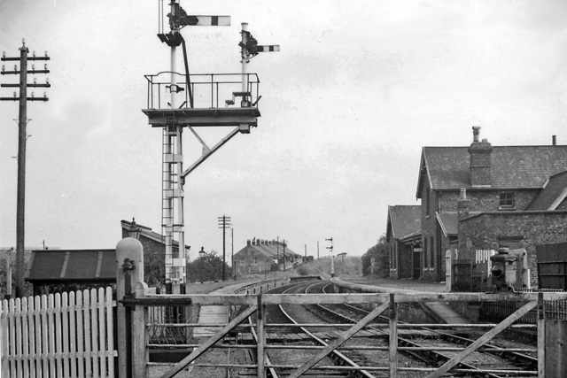
Boosbeck railway station
Boosbeck railway station was a railway station serving the village of Boosbeck in the ceremonial county of the North Riding of Yorkshire (now Redcar and...
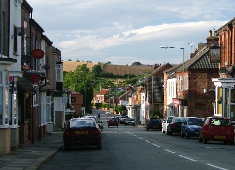
Boosbeck
Boosbeck is a village in the borough of Redcar and Cleveland and the ceremonial county of North Yorkshire, England. The name is Viking in origin and means...

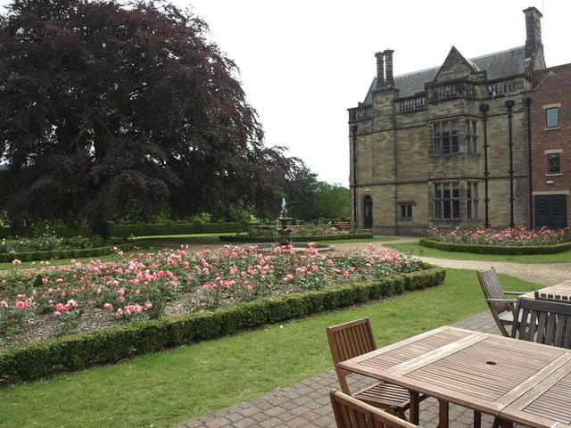
Gisborough Hall
Gisborough Hall is a 19th-century mansion house, now a hotel, at Guisborough, Redcar and Cleveland, England. It is a Grade II listed building. The manor...
North Skelton
North Skelton is a village in Redcar and Cleveland, North Yorkshire, England. The village is 1 mile (2 km) south of Skelton-in-Cleveland, and just south...
Laurence Jackson School
Laurence Jackson School is a coeducational secondary school located in Guisborough, North Yorkshire, England. It has a capacity of 1,250 pupils. The school...

Old All Saints Church, Skelton-in-Cleveland
Old All Saints Church is a redundant Anglican church in the town of Skelton-in-Cleveland, North Yorkshire, England. It is recorded in the National Heritage...
Nearby Amenities
Located within 500m of 54.541628,-1.0070396Have you been to Airy Hill?
Leave your review of Airy Hill below (or comments, questions and feedback).