Castle Hill
Hill, Mountain in Oxfordshire South Oxfordshire
England
Castle Hill

Castle Hill is a prominent landmark located in the county of Oxfordshire, England. Situated near the village of Burford, it is a notable hill and historical site that offers stunning views of the surrounding countryside. Although referred to as a hill, it stands at an elevation of 230 meters (750 feet), which could be considered more of a mountainous terrain by local standards.
The hill derives its name from the medieval earthworks that once crowned its summit. These ancient fortifications, known as a motte-and-bailey castle, were constructed in the late 11th century by the Normans. Today, only remnants of the castle's earthworks remain, providing a glimpse into its rich history.
Visitors to Castle Hill can enjoy various activities, such as hiking, picnicking, and photography. The hill's panoramic views stretch across the picturesque Cotswold countryside, with rolling green hills and charming villages dotting the landscape. On a clear day, one can even catch a glimpse of the distant city of Oxford.
Nature enthusiasts will appreciate the hill's diverse flora and fauna, as it is home to a range of plant and animal species. The surrounding woodlands offer opportunities for birdwatching, with species such as woodpeckers and owls commonly spotted.
Castle Hill is easily accessible, with a car park located nearby for visitors' convenience. Its historical significance, coupled with its natural beauty, makes it a popular destination for locals and tourists alike, offering a peaceful and scenic respite from the bustling city life.
If you have any feedback on the listing, please let us know in the comments section below.
Castle Hill Images
Images are sourced within 2km of 51.735912/-1.1269986 or Grid Reference SP6004. Thanks to Geograph Open Source API. All images are credited.


Castle Hill is located at Grid Ref: SP6004 (Lat: 51.735912, Lng: -1.1269986)
Administrative County: Oxfordshire
District: South Oxfordshire
Police Authority: Thames Valley
What 3 Words
///plants.pairings.community. Near Wheatley, Oxfordshire
Nearby Locations
Related Wikis

Bullingdon Rural District
Bullingdon Rural District was a rural district in Oxfordshire, England from 1932 to 1974, covering an area to the south-east of the city of Oxford. The...
Waterstock House Training Centre
Waterstock House Training Centre (WHTC) is situated in the village of Waterstock in Oxfordshire, England. It is a well used venue for local and national...
Oxford Centre for Ecclesiology and Practical Theology
The Oxford Centre for Ecclesiology and Practical Theology (OxCEPT) is a research centre based at Ripon College Cuddesdon. == Overview == OxCEPT was founded...

Ripon College Cuddesdon
Ripon College Cuddesdon is a Church of England theological college in Cuddesdon, a village 5.5 miles (8.9 km) outside Oxford, England. The College trains...
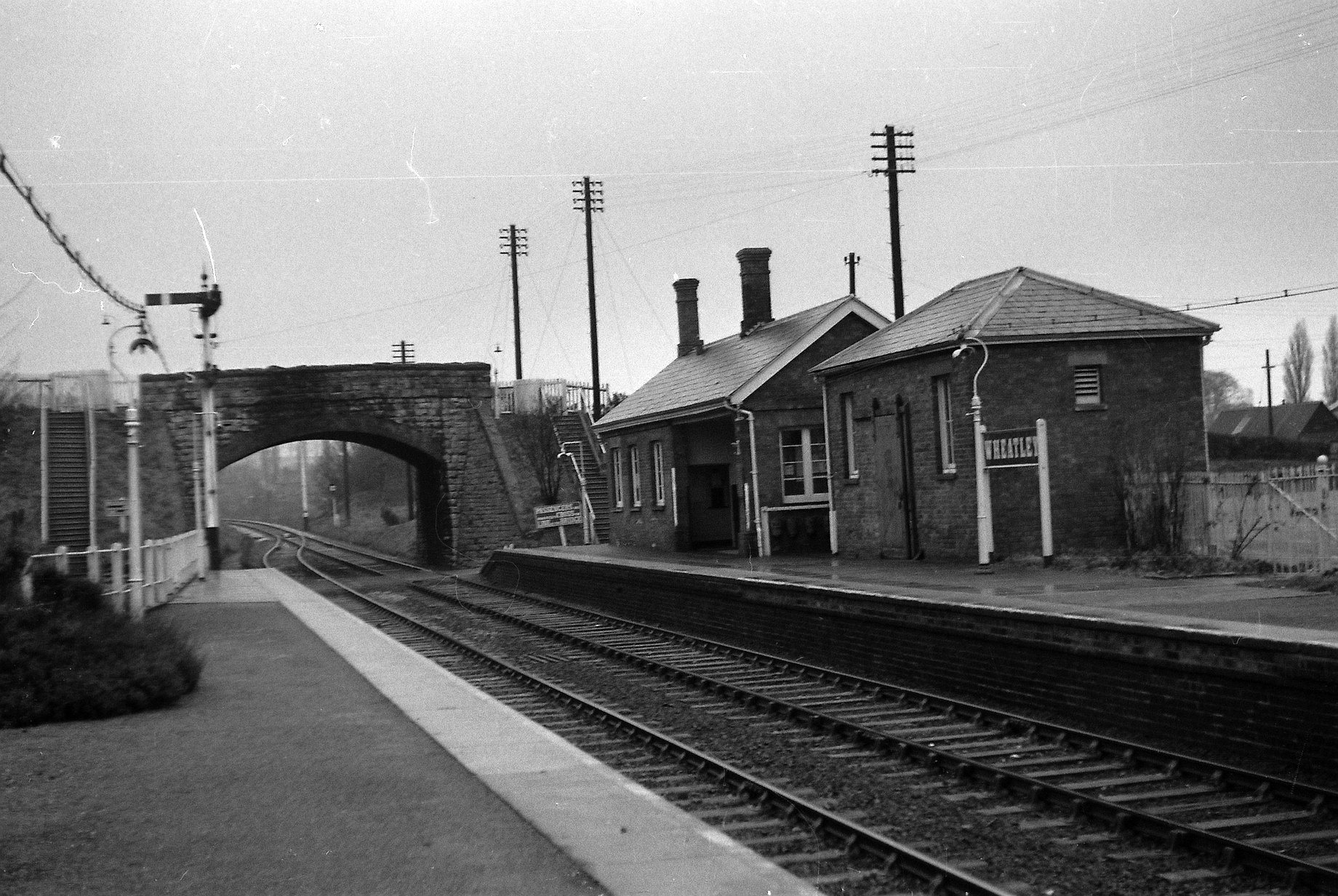
Wheatley railway station
Wheatley railway station was on the Wycombe Railway and served the village of Wheatley in Oxfordshire. It was opened in 1864 as part of an extension from...
Cuddesdon Palace
Cuddesdon Palace was the episcopal palace for the Bishop of Oxford, located near the village of Cuddesdon, Oxfordshire, England. == History == Cuddesdon...

Bishop Edward King Chapel
Bishop Edward King Chapel is the chapel of Ripon College Cuddesdon, a Church of England theological college near Oxford, and of the Sisters of the Communities...
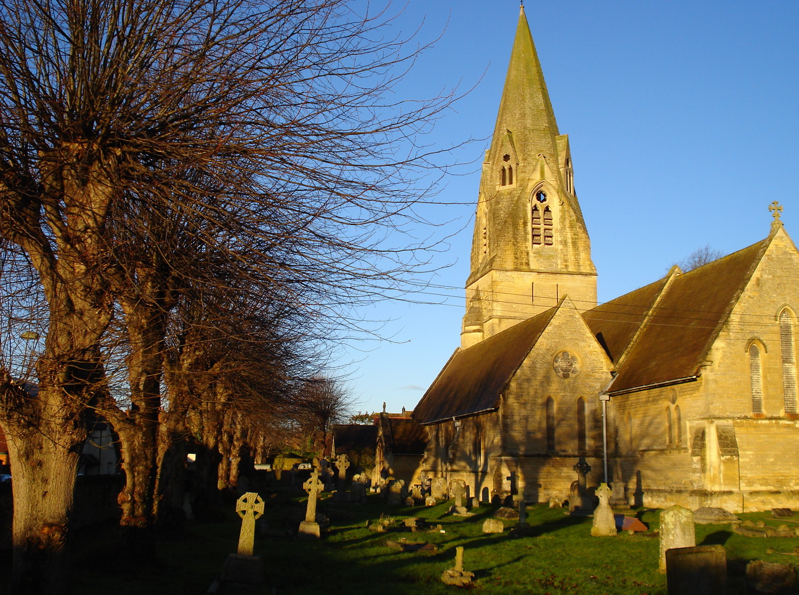
St Mary the Virgin, Wheatley
The Church of St Mary the Virgin is a parish church in Wheatley, Oxfordshire, in the Church of England Diocese of Oxford. The church was designed by George...
Nearby Amenities
Located within 500m of 51.735912,-1.1269986Have you been to Castle Hill?
Leave your review of Castle Hill below (or comments, questions and feedback).