Beacon Hill

Hill, Mountain in Hampshire Winchester

England

Beacon Hill

Misty view from Beacon Hill Looking across the Meon Valley to Exton in the valley, and Old Winchester Hill Fort on the far side.
Misty view from Beacon Hill Credit: Peter Facey

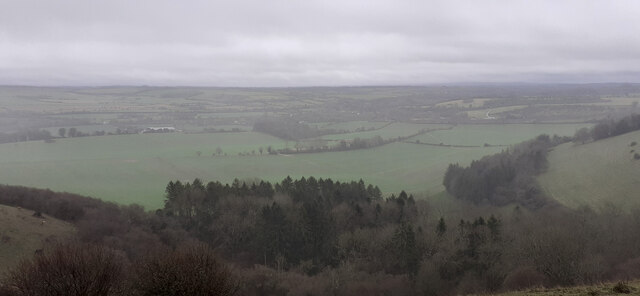
Beacon Hill is a prominent hill located in the county of Hampshire, England. It forms part of the South Downs National Park and is situated near the village of Buriton. Rising to an elevation of 242 meters (794 feet), Beacon Hill offers breathtaking panoramic views of the surrounding countryside and beyond.

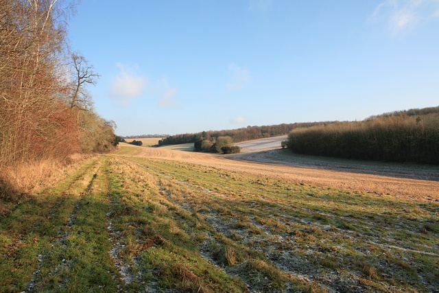
The hill is known for its distinctive shape, featuring a gently sloping south-facing side and a steeper, more rugged northern face. Covered in lush grasslands and adorned with patches of woodland, Beacon Hill is a haven for nature enthusiasts and hikers alike. The diverse range of flora and fauna found on the hill provides a rich habitat for many species of plants, birds, and mammals.

At the summit of Beacon Hill stands a prominent beacon, which gives the hill its name. This beacon was historically used as a signal point to warn of potential invasions or to communicate important messages across the region. Today, the beacon serves as a reminder of the hill's historical significance and adds to its unique charm.

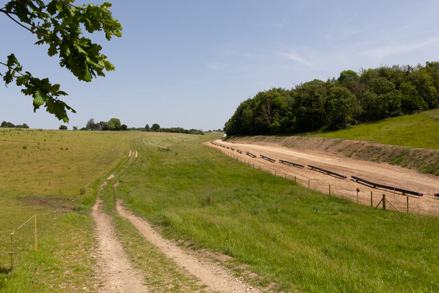
Visitors to Beacon Hill can enjoy a variety of recreational activities, such as walking, cycling, and picnicking. There are several well-maintained footpaths and trails that wind their way through the hill, offering visitors the chance to explore its beauty at their own pace.

Overall, Beacon Hill is a cherished natural landmark in Hampshire, offering stunning views, a rich ecosystem, and a glimpse into the region's history. It serves as a popular destination for both locals and tourists seeking tranquility and a connection with nature.

If you have any feedback on the listing, please let us know in the comments section below.

Beacon Hill Images

Images are sourced within 2km of 50.998405/-1.1427454 or Grid Reference SU6022. Thanks to Geograph Open Source API. All images are credited.

Misty view from Beacon Hill Looking across the Meon Valley to Exton in the valley, and Old Winchester Hill Fort on the far side.
Misty view from Beacon Hill
Looking across the Meon Valley to Exton in the valley, and Old Winchester Hill Fort on the far side.
Lomer Farm Seen from drive to Lomer Cottage, on the South Downs Way. Unclearly seen in front of the farm are works for Esso pipeline laying <a title="https://www.geograph.org.uk/snippet/22652" href="https://www.geograph.org.uk/snippet/22652">Link</a> .
Lomer Farm
Seen from drive to Lomer Cottage, on the South Downs Way. Unclearly seen in front of the farm are works for Esso pipeline laying Link .
Studio of Robert Hunt, Sculptor at Lomer Farm With Mr Hunt in the doorway beside two of his works. I was passing upon the footpath and Mr Hunt was working inside on a hot day so I stopped for a chat. His web site is <span class="nowrap"><a title="https://roberthuntsculpture.com/" rel="nofollow ugc noopener" href="https://roberthuntsculpture.com/">Link</a><img style="margin-left:2px;" alt="External link" title="External link - shift click to open in new window" src="https://s1.geograph.org.uk/img/external.png" width="10" height="10"/></span> . The upper floor of this building is occupied by an office of the Preshaw Estate.
Studio of Robert Hunt, Sculptor at Lomer Farm
With Mr Hunt in the doorway beside two of his works. I was passing upon the footpath and Mr Hunt was working inside on a hot day so I stopped for a chat. His web site is LinkExternal link . The upper floor of this building is occupied by an office of the Preshaw Estate.
Esso pipeline laying works on Lomer Farm The individual pipes are lying upon wooden cradles, known as 'skids', which are actually just four pieces of <a href="https://www.geograph.org.uk/photo/7173617">SU6126 : Timber used to support the pipes temporarily</a>. Later they will be welded together and supported upon piles of earth before burying.
Esso pipeline laying works on Lomer Farm
The individual pipes are lying upon wooden cradles, known as 'skids', which are actually just four pieces of SU6126 : Timber used to support the pipes temporarily. Later they will be welded together and supported upon piles of earth before burying.
Esso pipeline laying works on Lomer Farm The individual pipes are lying upon wooden cradles, known as 'skids', which are actually just four pieces of SU6126 <a href="https://www.geograph.org.uk/photo/7173617">SU6126 : Timber used to support the pipes temporarily</a>. Later they will be welded together and supported upon piles of earth before burying.
Esso pipeline laying works on Lomer Farm
The individual pipes are lying upon wooden cradles, known as 'skids', which are actually just four pieces of SU6126 SU6126 : Timber used to support the pipes temporarily. Later they will be welded together and supported upon piles of earth before burying.
Farm land seen from Beacon Hill Looking towards Preshaw Down and Downleaze Copse from the top end of Sailor's Lane.
Farm land seen from Beacon Hill
Looking towards Preshaw Down and Downleaze Copse from the top end of Sailor's Lane.
Farmland, Corhampton A footpath through oil-seed rape above the Meon valley.
Farmland, Corhampton
A footpath through oil-seed rape above the Meon valley.
Tree felling on Beacon Hill due to ash dieback Many ash trees in the Beauworth area have been felled if they were near public footpaths or highways. The branches and trunks when cut up do not look rotten. I sometimes wonder if it is the Ash dieback disease or human reaction to it that is more dangerous to Ash trees.
Tree felling on Beacon Hill due to ash dieback
Many ash trees in the Beauworth area have been felled if they were near public footpaths or highways. The branches and trunks when cut up do not look rotten. I sometimes wonder if it is the Ash dieback disease or human reaction to it that is more dangerous to Ash trees.
The South Downs Way crossing a field of cattle near Exton, Hampshire There seemed to be around 500 head of cattle in this one field. The two walkers approaching the field look set for an interesting encounter...

Taken from Beacon Hill (the one near Exton).
The South Downs Way crossing a field of cattle near Exton, Hampshire
There seemed to be around 500 head of cattle in this one field. The two walkers approaching the field look set for an interesting encounter... Taken from Beacon Hill (the one near Exton).
The Meon Valley, Exton, Hampshire
2016: a year on Geograph (Day 45) Walking the dog at Warnford
2016: a year on Geograph (Day 45)
Walking the dog at Warnford
Snowdrops at Warnford (III) Every year thousands come to Warnford Park for Snowdrop Sundays.
Snowdrops at Warnford (III)
Every year thousands come to Warnford Park for Snowdrop Sundays.
Snowdrops at Warnford (IV) Every year thousands come to Warnford Park for Snowdrop Sundays.
Snowdrops at Warnford (IV)
Every year thousands come to Warnford Park for Snowdrop Sundays.
Our Lady, Warnford: war memorial Also see <span class="nowrap"><a title="http://www.cwgc.org/find-war-dead/casualty/2649546/TOMKINSON,%20JOHN%20La%20BASSEE" rel="nofollow ugc noopener" href="http://www.cwgc.org/find-war-dead/casualty/2649546/TOMKINSON,%20JOHN%20La%20BASSEE">Link</a><img style="margin-left:2px;" alt="External link" title="External link - shift click to open in new window" src="https://s1.geograph.org.uk/img/external.png" width="10" height="10"/></span>
Our Lady, Warnford: war memorial
Also see LinkExternal link
Our Lady, Warnford: a saint honoured
Tree on Wheely Down Lane, Warnford
Field by Wheely Down Lane, Warnford
Farmers hut by Wheely Down Lane This is either for his tools or toilet or both.
Farmers hut by Wheely Down Lane
This is either for his tools or toilet or both.
Show me another place!

Beacon Hill is located at Grid Ref: SU6022 (Lat: 50.998405, Lng: -1.1427454)

Administrative County: Hampshire

District: Winchester

Police Authority: Hampshire

What 3 Words

///dentures.report.various. Near Swanmore, Hampshire

Nearby Locations

Beacon Hill

Related Wikis

Beacon Hill, Warnford

There are two hills in Hampshire called Beacon Hill; the other one is near BurghclereBeacon Hill, Warnford is a 46.4-hectare (115-acre) biological Site...
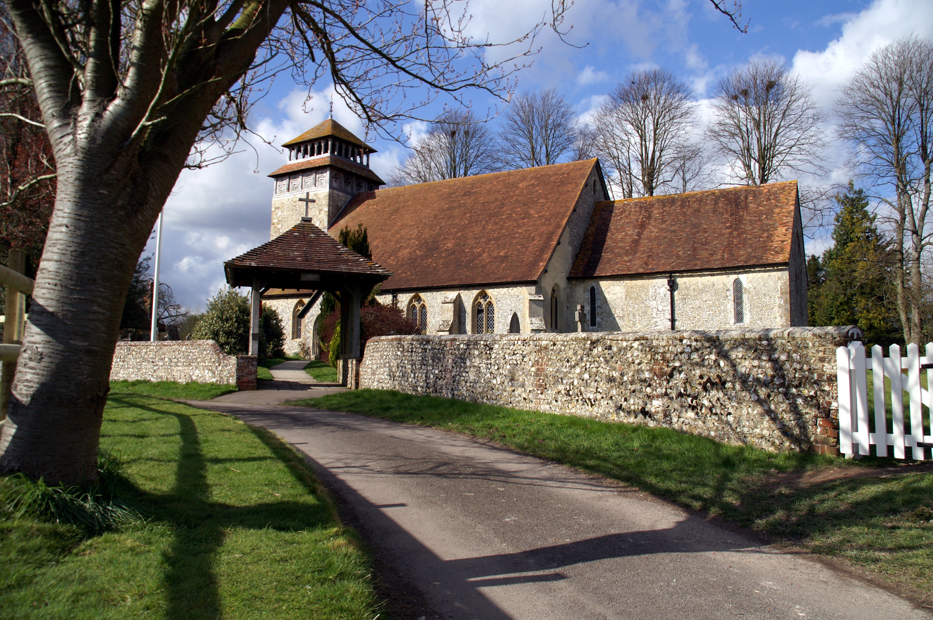
Exton, Hampshire

Exton is a small village and civil parish in the City of Winchester district of Hampshire, England. The village lies in the South Downs National Park,...

Betty Mundy's Bottom

Betty Mundy's Bottom is a wooded valley in the South Downs of Hampshire. There are a variety of folk tales about the name, which goes back centuries....
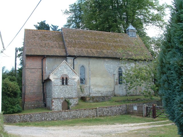
Corhampton Church

Corhampton Church is an Anglican church in the village of Corhampton, in Hampshire, England. Unusually, it does not have a dedication to a saint or other...

Corhampton

Corhampton is a village and former civil parish, now in the parish of Corhampton and Meonstoke, in the Winchester district, in the county of Hampshire...

Warnford

Warnford is a village and civil parish in the City of Winchester district of Hampshire, England. The parish covers 1283 hectares (3170 acres). The village...

Corhampton and Meonstoke

Corhampton and Meonstoke is a civil parish in the English county of Hampshire forming part of the area administered as the City of Winchester. It comprises...

Meonstoke

Meonstoke is a village and former civil parish, now in the parish of Corhampton and Meonstoke, in the Winchester district, in the county of Hampshire,...

Nearby Amenities

Located within 500m of 50.998405,-1.1427454
Barrier: kissing_gate
Material: wood
Lat/Long: 50.9957744/-1.1432345
Beacon Hill
Ele: 201
Man Made: survey_point
Natural: peak
Ref: S1532
Source Ele: NPE
Survey Point Structure: pillar
Wikidata: Q4875948
Wikipedia: en:Beacon Hill, Warnford
Lat/Long: 50.99841/-1.1427223
Barrier: stile
Lat/Long: 50.9984573/-1.1467605
Description: Beacon to commemorate the diamond jubilee of Elizabeth II
Man Made: beacon
Source: survey
Start Date: 2012-05-27
Lat/Long: 50.9958389/-1.1430476
Bicycle Parking
Bicycle Parking: stands
Capacity: 4
Check Date Capacity: 2023-08-20
Covered: no
Fee: no
Lat/Long: 50.9984441/-1.1428371
The data included in this document is from www.openstreetmap.org. The data is made available under ODbL.

Have you been to Beacon Hill?

Leave your review of Beacon Hill below (or comments, questions and feedback).