Castle Hill
Hill, Mountain in Northamptonshire
England
Castle Hill
Castle Hill is a prominent hill located in the county of Northamptonshire, England. Rising to an elevation of 312 meters (1,024 feet) above sea level, it stands as one of the highest points in the county. Situated near the village of Castle Ashby, Castle Hill offers stunning panoramic views of the surrounding countryside.
The hill derives its name from the remnants of a medieval castle that once stood on its summit. Although the castle itself has long since disappeared, some archaeological evidence suggests that it was built in the 11th century and served as a defensive structure. Today, all that remains are a series of earthworks and ditches, which provide clues to the castle's former layout.
Castle Hill is a popular destination for outdoor enthusiasts and history buffs alike. Its extensive network of footpaths and trails allows visitors to explore the area's natural beauty and experience the tranquil countryside. The hill is particularly renowned for its diverse wildlife and is home to various species of birds, mammals, and plants.
Additionally, Castle Hill is a designated site of special scientific interest due to its geological significance. The hill features exposed layers of Jurassic limestone, which provide valuable insights into the region's geological history.
With its rich historical heritage, breathtaking views, and diverse natural surroundings, Castle Hill is a must-visit destination for those seeking a combination of outdoor adventure and cultural exploration in Northamptonshire.
If you have any feedback on the listing, please let us know in the comments section below.
Castle Hill Images
Images are sourced within 2km of 52.023391/-1.1550512 or Grid Reference SP5836. Thanks to Geograph Open Source API. All images are credited.


Castle Hill is located at Grid Ref: SP5836 (Lat: 52.023391, Lng: -1.1550512)
Unitary Authority: West Northamptonshire
Police Authority: Northamptonshire
What 3 Words
///dizziness.odds.paves. Near Brackley, Northamptonshire
Nearby Locations
Related Wikis
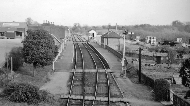
Brackley railway station
Brackley Town was a railway station which served the Northamptonshire town of Brackley in England. It opened in 1850 as part of the Buckinghamshire Railway...

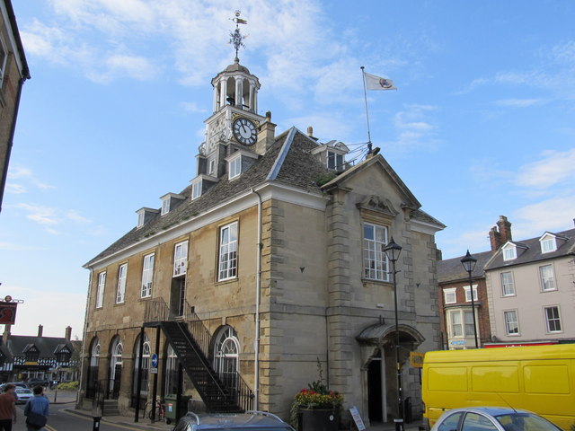
Brackley Town Hall
Brackley Town Hall is a municipal structure in the Market Place, Brackley, Northamptonshire, England. The structure, which serves as the meeting place...

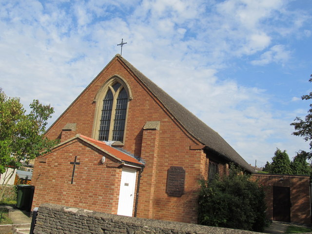
St Martin's Catholic Church, Brackley
St Martin's is the Roman Catholic Church in Brackley. It is in the joint Parish of Buckingham and Brackley, together with St Bernardine's Catholic Church...
Brawn GP
Brawn GP was a Formula One constructor which competed in the 2009 Formula One World Championship, with drivers Jenson Button and Rubens Barrichello. The...
Nearby Amenities
Located within 500m of 52.023391,-1.1550512Have you been to Castle Hill?
Leave your review of Castle Hill below (or comments, questions and feedback).