Lawns Hill

Hill, Mountain in Yorkshire Hambleton

England

Lawns Hill

Hasty Bank Hasty Bank from a footpath near Urra.
Hasty Bank Credit: John Peacock

Lawns Hill is a prominent geographical feature located in the county of Yorkshire, England. Situated in the northern region of the county, it falls within the boundaries of the North York Moors National Park, renowned for its breathtaking landscapes and diverse wildlife.

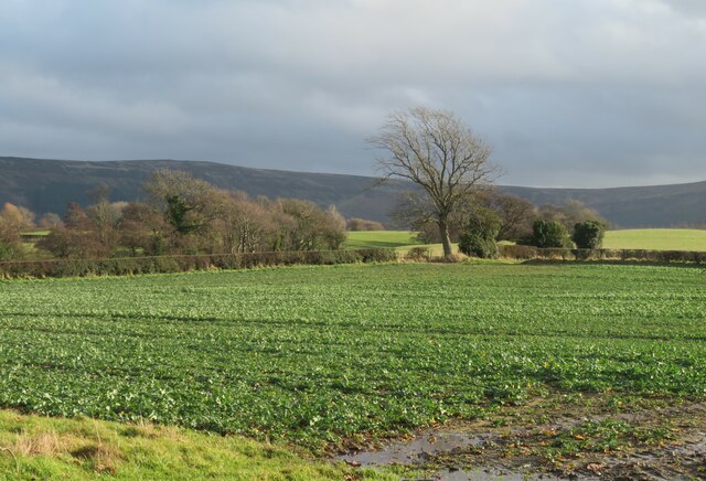
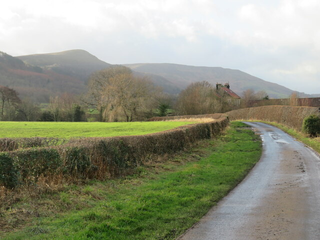
Rising to an elevation of approximately 400 meters (1,312 feet), Lawns Hill is classified as a hill rather than a mountain due to its height. However, it offers panoramic views of the surrounding countryside, making it a popular destination for nature enthusiasts and hikers alike.

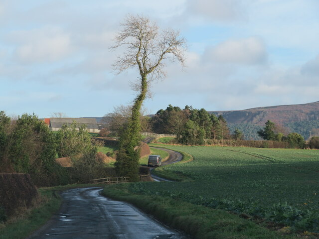
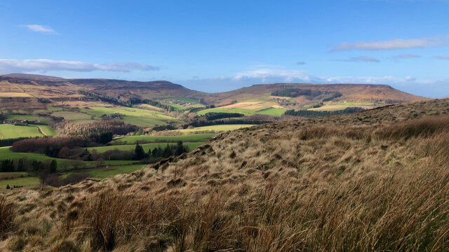
The hill is characterized by its rolling green slopes, covered in a carpet of lush grasses and dotted with patches of heather and wildflowers. These vibrant colors change throughout the seasons, creating a picturesque sight for visitors. Lawns Hill forms part of the wider North York Moors landscape, which is known for its dramatic scenery, deep valleys, and rugged cliffs.

The area around Lawns Hill is also home to a variety of wildlife, including birds, mammals, and plant species. It provides a habitat for species such as red grouse, curlews, and hares, attracting nature lovers and birdwatchers throughout the year.

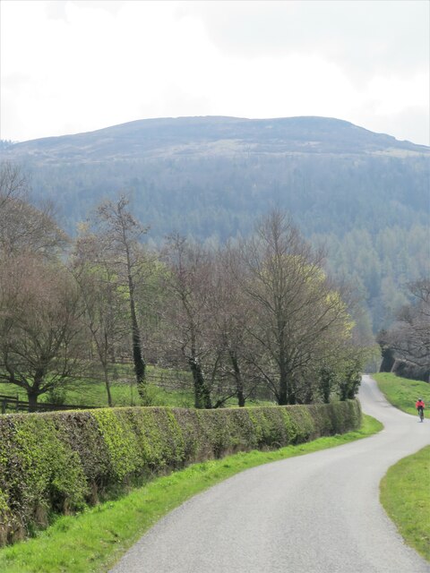
Lawns Hill is easily accessible via well-maintained footpaths and trails, allowing visitors to explore its natural beauty and take advantage of the stunning views it offers. It is a perfect destination for those seeking tranquility and a connection with nature in the heart of Yorkshire.

If you have any feedback on the listing, please let us know in the comments section below.
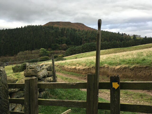
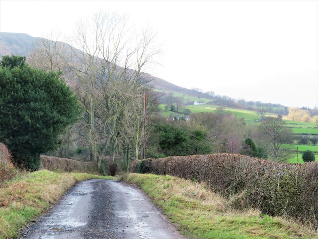
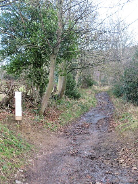
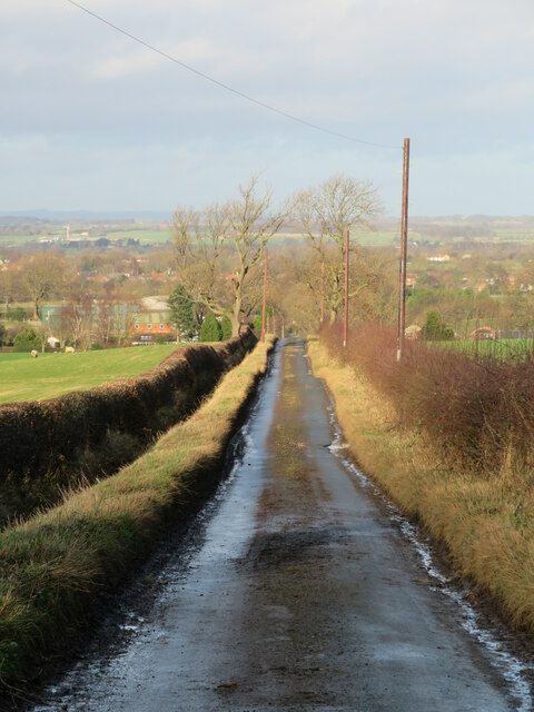
Lawns Hill Images

Images are sourced within 2km of 54.430174/-1.1168407 or Grid Reference NZ5704. Thanks to Geograph Open Source API. All images are credited.
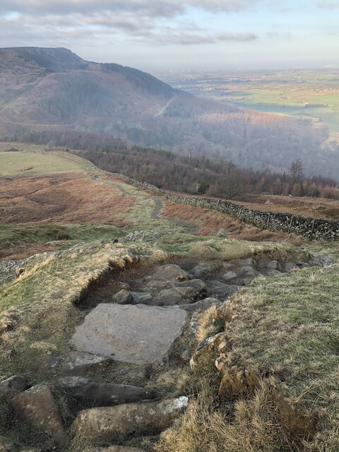
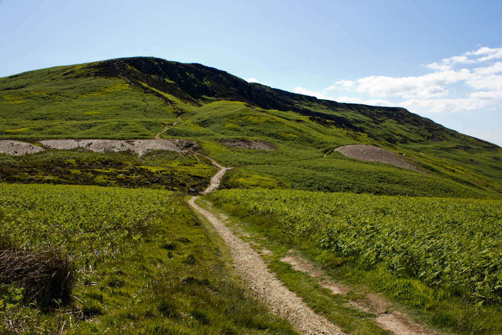
Hasty Bank Hasty Bank from a footpath near Urra.
Hasty Bank
Hasty Bank from a footpath near Urra.
Farm track and bridleway off Bank Lane This track, which is also bridleway number 10.56/2, runs along the bottom of the Cleveland Hills scarp linking a number of farms and other residences.
Farm track and bridleway off Bank Lane
This track, which is also bridleway number 10.56/2, runs along the bottom of the Cleveland Hills scarp linking a number of farms and other residences.
The start of the climb The tarmacked section of Bank Lane ends here and the route continues as a bridleway, climbing 150m up a steep hill to the gap between Cold Moor and Hasty Bank. The notice to the left, which is dates July 2021, warns of a path closure higher up the hillside due to a landslip, but one can go so far and then use forest tracks to avoid the obstacle. This is bridleway number 10.56/1.
The start of the climb
The tarmacked section of Bank Lane ends here and the route continues as a bridleway, climbing 150m up a steep hill to the gap between Cold Moor and Hasty Bank. The notice to the left, which is dates July 2021, warns of a path closure higher up the hillside due to a landslip, but one can go so far and then use forest tracks to avoid the obstacle. This is bridleway number 10.56/1.
Bank Lane Looking north down this dead end lane towards Broughton. The foreground shadow is not due to cloud, but the high hills behind the camera position which block out the mid winter sun.
Bank Lane
Looking north down this dead end lane towards Broughton. The foreground shadow is not due to cloud, but the high hills behind the camera position which block out the mid winter sun.
Narrow Lane towards Water Beck Farm A poorly surfaced road heading east from B1257 towards Water Beck Farm, which is part visible in the middle distance.
Narrow Lane towards Water Beck Farm
A poorly surfaced road heading east from B1257 towards Water Beck Farm, which is part visible in the middle distance.
Farmland to the south of Beck House This area, which is just outside the National Park boundary is farmland, surrounded on three sides by high moors.
Farmland to the south of Beck House
This area, which is just outside the National Park boundary is farmland, surrounded on three sides by high moors.
Beck House A typical Cleveland farmhouse of sandstone with a pantile roof.  On this occasion further progress along the narrow lane was halted a few hundred metres further on where a large truck, of the sort that might be carrying animal feed, was at a crazy angle, having gone off the road into soft ground. No option but to make a rather long reverse.
Beck House
A typical Cleveland farmhouse of sandstone with a pantile roof. On this occasion further progress along the narrow lane was halted a few hundred metres further on where a large truck, of the sort that might be carrying animal feed, was at a crazy angle, having gone off the road into soft ground. No option but to make a rather long reverse.
Field path towards Bonnie Hill Farm One might reasonably ask 'what footpath?', but the line of it is through this recently planted crop field, so walkers might expect plenty of mud adhering to boots.
Field path towards Bonnie Hill Farm
One might reasonably ask 'what footpath?', but the line of it is through this recently planted crop field, so walkers might expect plenty of mud adhering to boots.
Road towards Beck House Retreating by car from a road blocked by a part overturned truck which had become embedded in soft ground a little further east. The view to the west includes Beck House and the ramparts of the Cleveland Hills beyond with the 'nose' at the northern end of Cold Moor prominent.
Road towards Beck House
Retreating by car from a road blocked by a part overturned truck which had become embedded in soft ground a little further east. The view to the west includes Beck House and the ramparts of the Cleveland Hills beyond with the 'nose' at the northern end of Cold Moor prominent.
Cleveland Way Above Clay Bank
Garfit Gap and upper Bilsdale In spite of the blue sky and sunshine over upper Bilsdale, Urra Moor was decidedly gloomy and showery this afternoon.

Ahead is Garfit Gap, the col between the Wainstones and Cold Moor.

The farm below the gap to the left is Whingroves where Jack Garbutt, the Bilsdale Bombardier, grew up as a child. He was killed on the Western Front in 1918.

To the right of the gap, nestled in a combe on Hasty Bank is Garfitts, a farm which has some history.

There is no mention of Bilsdale in the Domesday Book but there are indications of pre-Norman settlement. Perhaps William the Conqueror did indeed get lost on the moors above Bilsdale and told his legati not to bother with the dale when ordering the survey of his realm.

But the thinking is that medieval Bilsdale consisted of a number of scattered hamlets, and one of these was Garthwait, the ‘clearing with an enclosure’, situated where Garfitts farm is today.

Interesting too, and probably completed unconnected, is that ‘garfits’ is an 18th-century Yorkshire ‘provincialism’ for garbage.

For links and references see my blog <span class="nowrap"><a title="http://www.fhithich.uk/?p=27439" rel="nofollow ugc noopener" href="http://www.fhithich.uk/?p=27439">Link</a><img style="margin-left:2px;" alt="External link" title="External link - shift click to open in new window" src="https://s1.geograph.org.uk/img/external.png" width="10" height="10"/></span>
Garfit Gap and upper Bilsdale
In spite of the blue sky and sunshine over upper Bilsdale, Urra Moor was decidedly gloomy and showery this afternoon. Ahead is Garfit Gap, the col between the Wainstones and Cold Moor. The farm below the gap to the left is Whingroves where Jack Garbutt, the Bilsdale Bombardier, grew up as a child. He was killed on the Western Front in 1918. To the right of the gap, nestled in a combe on Hasty Bank is Garfitts, a farm which has some history. There is no mention of Bilsdale in the Domesday Book but there are indications of pre-Norman settlement. Perhaps William the Conqueror did indeed get lost on the moors above Bilsdale and told his legati not to bother with the dale when ordering the survey of his realm. But the thinking is that medieval Bilsdale consisted of a number of scattered hamlets, and one of these was Garthwait, the ‘clearing with an enclosure’, situated where Garfitts farm is today. Interesting too, and probably completed unconnected, is that ‘garfits’ is an 18th-century Yorkshire ‘provincialism’ for garbage. For links and references see my blog LinkExternal link
Track junction ahead Looking south to the junction of forest tracks. The track in the foreground leads [behind camera position] to the road, some 50m below a car parking area at NZ578038, but is potentially muddier than the upper track.
Track junction ahead
Looking south to the junction of forest tracks. The track in the foreground leads [behind camera position] to the road, some 50m below a car parking area at NZ578038, but is potentially muddier than the upper track.
Farms in the valley bottom Looking across the valley towards Midnight Farm with New Sheepfold Farm beyond.
Farms in the valley bottom
Looking across the valley towards Midnight Farm with New Sheepfold Farm beyond.
Road to Clay Bank The minor road heading south from Ingleby Greenhow towards Clay Bank.
Road to Clay Bank
The minor road heading south from Ingleby Greenhow towards Clay Bank.
Pond at West Wood Farm Close by a gate and a junction of bridleways.
Pond at West Wood Farm
Close by a gate and a junction of bridleways.
Low Farm Ewes with lambs in this April scene at Low Farm.
Low Farm
Ewes with lambs in this April scene at Low Farm.
How Hill from the south Viewed from nearly a kilometre away, the beech trees on this low hill line up nicely with distant Roseberry Topping.
How Hill from the south
Viewed from nearly a kilometre away, the beech trees on this low hill line up nicely with distant Roseberry Topping.
Trees, young and old An area of recently planted broadleaf trees in a field below How Hill.
Trees, young and old
An area of recently planted broadleaf trees in a field below How Hill.
Show me another place!

Lawns Hill is located at Grid Ref: NZ5704 (Lat: 54.430174, Lng: -1.1168407)

Division: North Riding

Administrative County: North Yorkshire

District: Hambleton

Police Authority: North Yorkshire

What 3 Words

///outsiders.royal.carpentry. Near Ingleby Greenhow, North Yorkshire

Nearby Locations

Lawns Hill

Related Wikis

Ingleby Greenhow

Ingleby Greenhow is a village and civil parish in the Hambleton district of North Yorkshire, England. It is on the border of the North York Moors and 3...

Ingleby railway station

Ingleby railway station was a railway station built to serve the village of Ingleby Greenhow in North Yorkshire, England. The station was on the North...

Battersby

Battersby is a hamlet in North Yorkshire, England. It lies on the edge of the North York Moors National Park and within the historic boundaries of the...

Urra Moor

Urra Moor is the highest moor in the North York Moors, North Yorkshire, England. At 1,490 feet (454 m) above sea level it is the highest point in Hambleton...

Battersby railway station

Battersby is a railway station on the Esk Valley Line, which runs between Middlesbrough and Whitby via Nunthorpe. The station, situated 11 miles 4 chains...

Great Broughton, North Yorkshire

Great Broughton is a village in the Great and Little Broughton civil parish of the Hambleton district of North Yorkshire in northern England. == History... ==

Kirkby, North Yorkshire

Kirkby (historically known as Kirkby-in-Cleveland) is a village and civil parish in Hambleton district of North Yorkshire, England, near Great Busby and...

Cringle Moor

Cringle Moor (also known as Cranimoor), at 432 m (1,417 ft), is the third highest hill in the North York Moors, England, and the highest point west of...

Nearby Amenities

Located within 500m of 54.430174,-1.1168407
Lawns Hill
Natural: peak
Lat/Long: 54.4301935/-1.1168367
Barrier: stile
Step Count: 2
Stile: stepover
Lat/Long: 54.4301964/-1.1191532
Barrier: stile
Step Count: 3
Stile: stepover
Lat/Long: 54.430694/-1.1203429
Barrier: stile
Step Count: 1
Stile: stepover
Lat/Long: 54.4317922/-1.1217347
The data included in this document is from www.openstreetmap.org. The data is made available under ODbL.

Have you been to Lawns Hill?

Leave your review of Lawns Hill below (or comments, questions and feedback).