Steppington Hill
Hill, Mountain in Northamptonshire
England
Steppington Hill

Steppington Hill is a prominent geographical feature located in the county of Northamptonshire in England. It is classified as a hill rather than a mountain, as its peak does not reach the required elevation of 2,000 feet to be considered a mountain. Nonetheless, its height and distinct topography make it an important landmark in the region.
Rising to an elevation of approximately 600 feet, Steppington Hill offers breathtaking panoramic views of the surrounding countryside. It is situated in close proximity to the village of Steppington, from which it derives its name. The hill is part of an extensive range known as the Northamptonshire Uplands, which extends across the county.
Steppington Hill is characterized by its gentle slopes and is covered with lush green vegetation, primarily consisting of grasses and small shrubs. It is also home to a variety of wildlife, including rabbits, hares, and numerous bird species.
The hill has become a popular destination for outdoor enthusiasts, attracting hikers, walkers, and nature lovers. There are several well-marked trails that allow visitors to explore the area and enjoy the stunning vistas. Additionally, the hill offers a peaceful and tranquil atmosphere, making it an ideal spot for picnics and relaxation.
Steppington Hill is not only a natural gem but also has historical significance. It is believed to have been inhabited since ancient times, with archaeological evidence suggesting human activity dating back to the Iron Age. The hill's strategic location also made it a site of interest during various historical conflicts.
Overall, Steppington Hill in Northamptonshire is a captivating landmark that offers both natural beauty and historical intrigue.
If you have any feedback on the listing, please let us know in the comments section below.
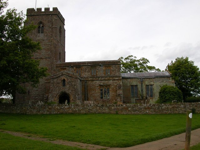
Steppington Hill Images
Images are sourced within 2km of 52.211096/-1.2348442 or Grid Reference SP5257. Thanks to Geograph Open Source API. All images are credited.


Steppington Hill is located at Grid Ref: SP5257 (Lat: 52.211096, Lng: -1.2348442)
Unitary Authority: West Northamptonshire
Police Authority: Northamptonshire
What 3 Words
///swear.downsize.texts. Near Byfield, Northamptonshire
Nearby Locations
Related Wikis

Catesby Tunnel
Catesby Tunnel is a disused railway tunnel in Northamptonshire on the route of the former Great Central Main Line. Its northern portal is about 1,100 yards...
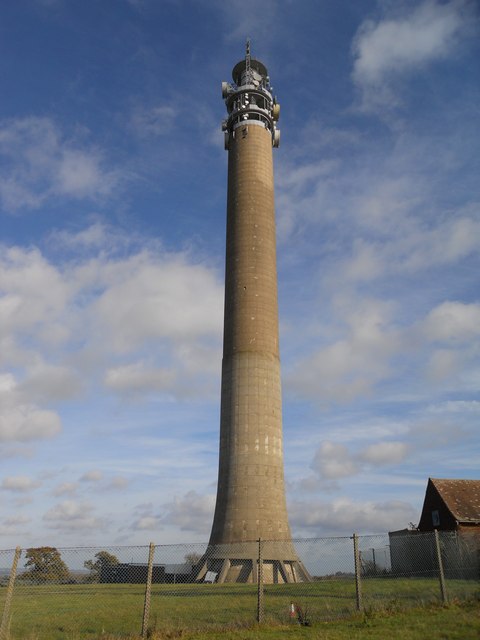
Charwelton BT Tower
Charwelton BT Tower is a telecommunication tower built of reinforced concrete at Charwelton near Byfield, Northamptonshire, England. It is 118 metres...
Hellidon
Hellidon is a village and civil parish about 5 miles (8 km) south-west of Daventry in Northamptonshire, England. The parish area is about 1,600 acres...
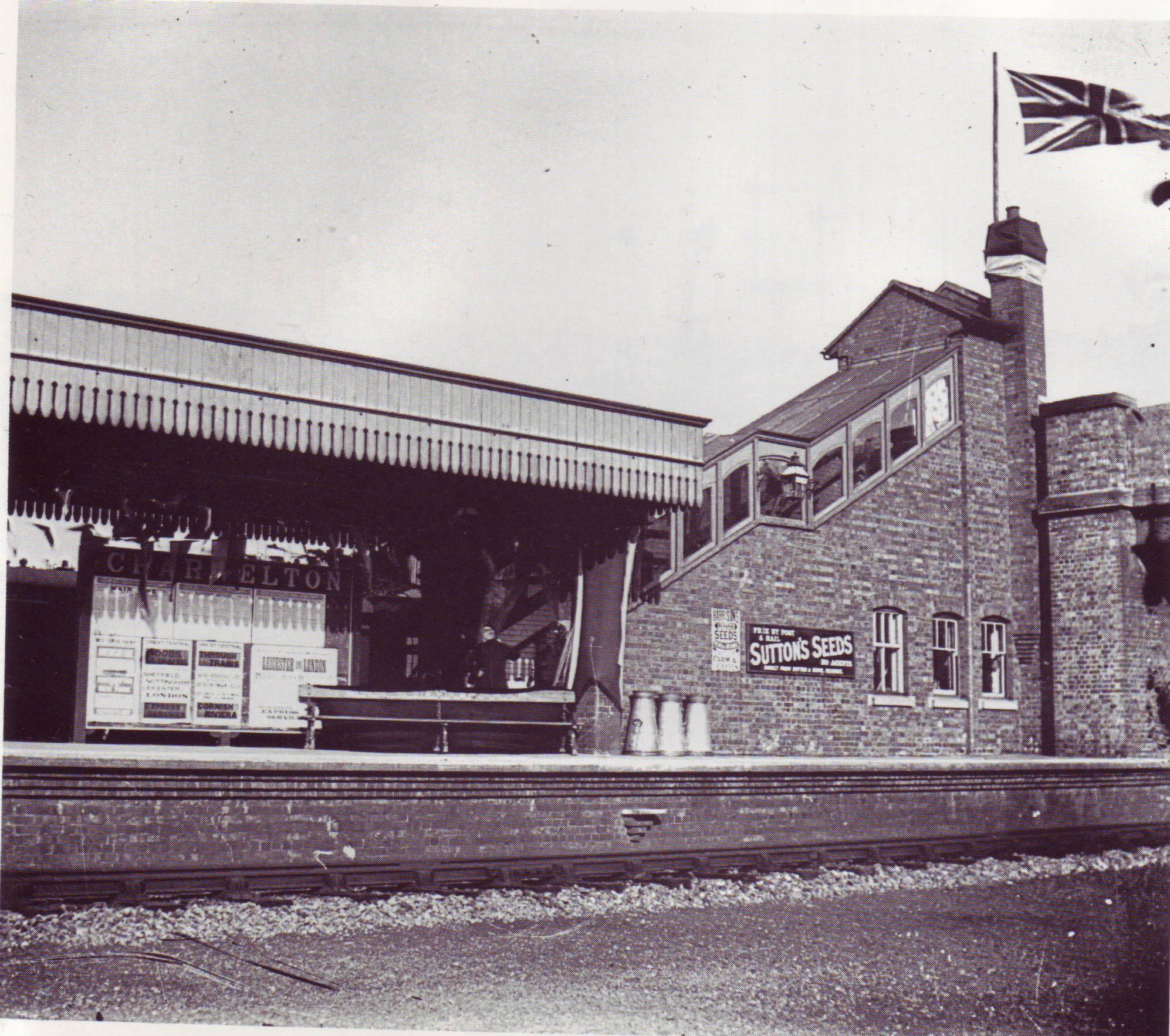
Charwelton railway station
Charwelton railway station was a station at Charwelton in Northamptonshire on the former Great Central Railway main line, the last main line to be built...
Charwelton
Charwelton is a village and civil parish about 5 miles (8 km) south of Daventry in Northamptonshire, England. The 2011 Census recorded the parish's population...

Catesby, Northamptonshire
Catesby is a civil parish in West Northamptonshire, England. There are two hamlets, Lower Catesby and Upper Catesby, each of which is a shrunken village...

Upper Catesby
Upper Catesby is a hamlet in the civil parish of Catesby, Northamptonshire, about 3.5 miles (5.6 km) southwest of Daventry. The hamlet is about 550 feet...

Arbury Hill
Arbury Hill, at 225 m (738 ft), is the joint highest point in the English county of Northamptonshire. It is 9 km (5.6 mi) southwest of the town of Daventry...
Related Videos

A Room Tour for my Weekend Spa Birthday at Hellidon lakes Golf & Spa Hotel 🌹
My part 2 Birthday treat at #hellidonlakesandspahotel #birthdaytreat #roomtour And thank you guys for supporting our YouTube ...

Exploring Catesby Viaduct on the GCR
Join me as I explore the area around Catesby Viaduct and the Viaduct itself. Starting at the Northern Portal of Catesby Tunnel I ...
Great Central Railway - Charwelton Water Troughs & Woodford Halse Water Tower
Welcome to Part 3 of our 'Ghosts of the GCR mainline' series. We're moving north up the abandoned railway line from Woodford ...

My #mayfavourites #primarkbag #nikeslippers #rimmellondon,with clips from my #birthdaytreat.❤️
My #mayfavourites #primarkbag #nikeflipflops #rimmellipsticks and more plus a clips from our fabulous week end spa bonding ...
Nearby Amenities
Located within 500m of 52.211096,-1.2348442Have you been to Steppington Hill?
Leave your review of Steppington Hill below (or comments, questions and feedback).