Hamilton Hill

Hill, Mountain in Nottinghamshire Ashfield

England

Hamilton Hill

King's Mill Viaduct Same view as <a href="https://www.geograph.org.uk/photo/856918">SK5159 : Kings Mill Viaduct</a> taken 13 years later
King's Mill Viaduct Credit: Antony Dixon

Hamilton Hill is a prominent geological feature located in Nottinghamshire, England. Known for its picturesque landscapes and breathtaking views, it is a popular destination for locals and tourists alike. Rising to an elevation of approximately 200 meters, Hamilton Hill is often referred to as a hill or a small mountain due to its height and steep slopes.

The hill is composed primarily of sandstone, which has been shaped over millions of years by erosion and weathering. This gives the hill its distinct red-brown color and rugged appearance. The exposed rock formations on the hillside provide a fascinating insight into the area's geological history.

Hamilton Hill is covered in a diverse range of vegetation, including woodlands and grassy slopes. This rich biodiversity supports a variety of wildlife, making it an important ecological site. Visitors can often spot birds such as kestrels and buzzards soaring above, while rabbits, foxes, and deer roam the surrounding countryside.

The hill offers several walking trails and paths, allowing visitors to explore its natural beauty and enjoy the breathtaking views of the surrounding landscape. On a clear day, one can see panoramic vistas stretching as far as the eye can see, taking in the rolling hills, picturesque villages, and even glimpses of the nearby city of Nottingham.

Overall, Hamilton Hill is a stunning natural landmark that offers visitors a chance to connect with nature, enjoy outdoor activities, and appreciate the unique geological and ecological wonders of Nottinghamshire.

If you have any feedback on the listing, please let us know in the comments section below.

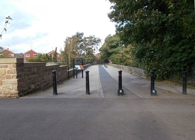
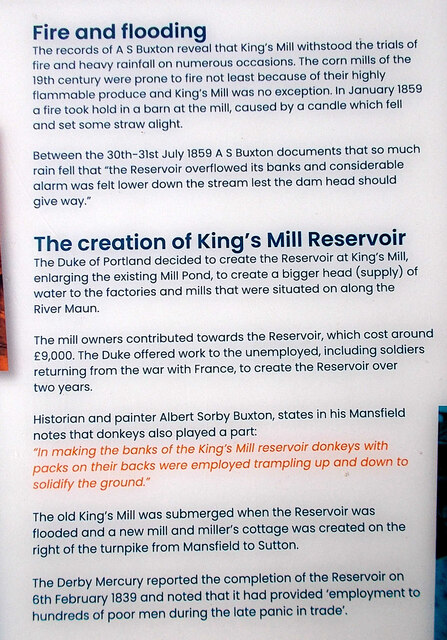
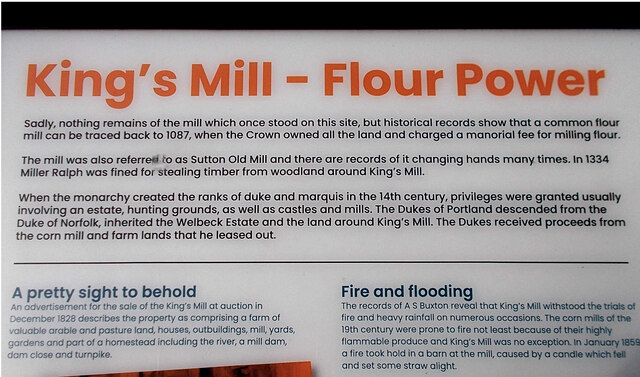
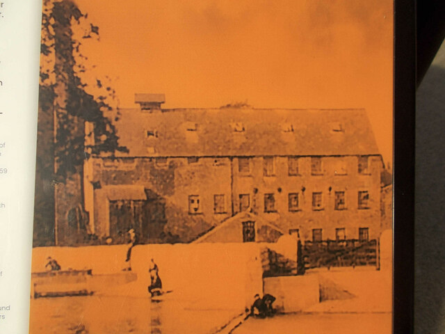
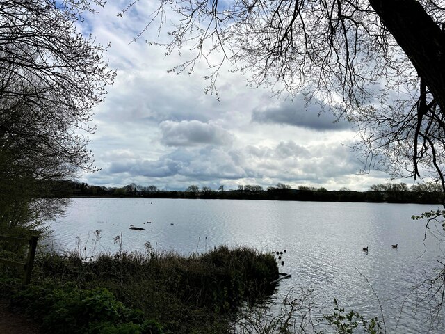
Hamilton Hill Images

Images are sourced within 2km of 53.125151/-1.223661 or Grid Reference SK5258. Thanks to Geograph Open Source API. All images are credited.

King's Mill Viaduct Same view as <a href="https://www.geograph.org.uk/photo/856918">SK5159 : Kings Mill Viaduct</a> taken 13 years later
King's Mill Viaduct
Same view as SK5159 : Kings Mill Viaduct taken 13 years later
King's Mill information board (part 2)
King's Mill information board (part 1)
Photo from King's Mill information board Shows King's Mill as it appeared in about 1900
Photo from King's Mill information board
Shows King's Mill as it appeared in about 1900
King's Mill recreated This rather clever information board gives an impression of the view from this spot about 1900
King's Mill recreated
This rather clever information board gives an impression of the view from this spot about 1900
Equestrian bridge at King's Mill This bridge was built to replace a small level crossing following a fatal accident.
The site of the crossing can be seen on the very edge of the photo, to the right of the house.
Equestrian bridge at King's Mill
This bridge was built to replace a small level crossing following a fatal accident. The site of the crossing can be seen on the very edge of the photo, to the right of the house.
Small park off Waverley Road, Mansfield
William Singleton Almshouses, Waverley Road, Mansfield Designed by F.W. Tempest 1936. One of three linked buildings.
William Singleton Almshouses, Waverley Road, Mansfield
Designed by F.W. Tempest 1936. One of three linked buildings.
Houses in Waverley Road, Mansfield
Wickes Store and Food Stand in Sutton in Ashfield DIY heaven and hell on Station Road.
Wickes Store and Food Stand in Sutton in Ashfield
DIY heaven and hell on Station Road.
Daffodils and Lake in Lawn Park
Site of Dobson's Mill at Samuel Unwin Court One of the world's earliest powered mills was built here in 1740 and some of the early buildings associated with the trade can be seen here.
Site of Dobson's Mill at Samuel Unwin Court
One of the world's earliest powered mills was built here in 1740 and some of the early buildings associated with the trade can be seen here.
Kings Mill Reservoir in Mansfield
Untended Field near Sutton Parkway Pictured from the northern edge of the grid square from a gate by the B6021 road.
Untended Field near Sutton Parkway
Pictured from the northern edge of the grid square from a gate by the B6021 road.
Crop Fields near Sutton-In-Ashfield Path and farmland to the south east of the town. The footpath skirts this wheat field's right periphery.
Crop Fields near Sutton-In-Ashfield
Path and farmland to the south east of the town. The footpath skirts this wheat field's right periphery.
Crop Field Patchwork Wheat Fields located to the south east of Sutton-in-Ashfield
Crop Field Patchwork
Wheat Fields located to the south east of Sutton-in-Ashfield
Footpath and Fields near Windmill Hill The Kirkby-in-Ashfield conurbation can be seen in the distance.
Footpath and Fields near Windmill Hill
The Kirkby-in-Ashfield conurbation can be seen in the distance.
Sherwood Observatory Operated by Mansfield and Sutton Astrological Society and home to a 61 centimetre Newtonian telescope. The observatory hosts occasional open days and run basic accredited astronomy courses in addition to group visits by arrangement. This picture was taken from a nearby derelict structure which stands at a slightly higher elevation to the observatory itself.
Sherwood Observatory
Operated by Mansfield and Sutton Astrological Society and home to a 61 centimetre Newtonian telescope. The observatory hosts occasional open days and run basic accredited astronomy courses in addition to group visits by arrangement. This picture was taken from a nearby derelict structure which stands at a slightly higher elevation to the observatory itself.
Show me another place!

Hamilton Hill is located at Grid Ref: SK5258 (Lat: 53.125151, Lng: -1.223661)

Administrative County: Nottinghamshire

District: Ashfield

Police Authority: Nottinghamshire

What 3 Words

///forgot.insect.span. Near Mansfield, Nottinghamshire

Nearby Locations

Hamilton Hill

Related Wikis

Mansfield and Pinxton Railway

The Mansfield and Pinxton Railway was an early horse-drawn railway in the United Kingdom. It was completed in 1819, to make a transport link between Mansfield...

Sutton Junction railway station

Sutton Junction railway station was a station in Sutton-in-Ashfield, Nottinghamshire, England. It was opened in 1850, and was located on the Midland Railway...

Sherwood Observatory

Sherwood Observatory is an amateur astronomical observatory in Nottinghamshire, England, owned and operated by Mansfield and Sutton Astronomical Society...

Mansfield and Sutton Astronomical Society

Mansfield and Sutton Astronomical Society (MSAS) is an amateur astronomical society in the East Midlands of England. It was formed in 1969. It is based...

King's Mill Hospital

King's Mill Hospital is an acute general district hospital serving the population of north Nottinghamshire and parts of Derbyshire and Lincolnshire. It...

Sutton-in-Ashfield Central railway station

Sutton-in-Ashfield Central railway station is a former railway station that served the town of Sutton-in-Ashfield, Nottinghamshire, England. == History... ==

Eastfield Side

Eastfield Side, also commonly known as Sutton Forest Side, is in Nottinghamshire, England. Eastfield Side is a residential and former industrial area of...

Mansfield 103.2 FM

Mansfield 103.2 FM is an Independent Local Radio station in Mansfield, Nottinghamshire, serving the areas of Mansfield and Ashfield in Nottinghamshire...

Nearby Amenities

Located within 500m of 53.125151,-1.223661
Parking
Description: patch of gravel at side of road
Note: Not sure how "official" this is, but seems to be used.
Lat/Long: 53.1254539/-1.2281864
Barrier: lift_gate
Lat/Long: 53.1263718/-1.2222181
Artwork Type: sculpture
Tourism: artwork
Lat/Long: 53.1261873/-1.2222043
Barrier: entrance
Lat/Long: 53.1226958/-1.2235134
Crossing
Lat/Long: 53.1245375/-1.2165993
Crossing
Lat/Long: 53.1261768/-1.2225509
Crossing
Lat/Long: 53.1260922/-1.2222402
Crossing
Bicycle: yes
Button Operated: yes
Crossing: traffic_signals
Crossing Island: no
Tactile Paving: yes
Lat/Long: 53.1270691/-1.225361
Crossing
Bicycle: yes
Button Operated: yes
Crossing: traffic_signals
Crossing Island: no
Tactile Paving: yes
Lat/Long: 53.1271636/-1.2255613
Crossing
Crossing: traffic_signals
Crossing Island: no
Tactile Paving: yes
Lat/Long: 53.1270602/-1.2263171
Crossing
Bicycle: yes
Button Operated: yes
Crossing: traffic_signals
Crossing Island: no
Tactile Paving: yes
Lat/Long: 53.1271556/-1.2254114
Traffic Signals
Crossing: no
Lat/Long: 53.1271815/-1.2253766
Traffic Signals
Crossing: no
Lat/Long: 53.1266947/-1.2260713
Traffic Signals
Crossing: no
Lat/Long: 53.1271019/-1.2253162
Traffic Signals
Crossing: no
Lat/Long: 53.1267349/-1.2261719
Traffic Signals
Crossing: no
Lat/Long: 53.1267929/-1.2252371
Traffic Signals
Crossing: no
Lat/Long: 53.1267317/-1.22528
Crossing
Crossing: traffic_signals
Crossing Island: no
Tactile Paving: yes
Lat/Long: 53.1269754/-1.226285
Traffic Signals
Crossing: no
Lat/Long: 53.1270669/-1.2263475
Crossing
Crossing: traffic_signals
Crossing Island: no
Tactile Paving: yes
Lat/Long: 53.127106/-1.2261934
Traffic Signals
Crossing: no
Lat/Long: 53.1271228/-1.2262563
Camera Mount: pole
Camera Type: dome
Contact Webcam: http://data.nottinghamtravelwise.org.uk/images198.jpg
Man Made: surveillance
Surveillance: public
Surveillance Type: camera
Surveillance Zone: traffic
Lat/Long: 53.1270828/-1.2258753
Camera Mount: pole
Camera Type: dome
Contact Webcam: http://data.nottinghamtravelwise.org.uk/images199.jpg
Man Made: surveillance
Surveillance: public
Surveillance Type: camera
Surveillance Zone: traffic
Lat/Long: 53.1244781/-1.2164293
Direction: 90
Man Made: surveillance
Surveillance: public
Surveillance Type: ALPR
Surveillance Zone: traffic
Lat/Long: 53.1275138/-1.2298003
Direction: 50
Man Made: surveillance
Surveillance: public
Surveillance Type: ALPR
Surveillance Zone: traffic
Lat/Long: 53.1291455/-1.222714
The data included in this document is from www.openstreetmap.org. The data is made available under ODbL.

Have you been to Hamilton Hill?

Leave your review of Hamilton Hill below (or comments, questions and feedback).