Kingsley

Settlement in Staffordshire Staffordshire Moorlands

England

Kingsley

Footbridge over River Churnet Consall Woods is an RSPB Nature Reserve in Staffordshire. 194ha in area, the site was formally an industrial valley, now occupied by mixed woodland and various water features. Link to RSPB website: <span class="nowrap"><a title="https://www.rspb.org.uk/reserves-and-events/reserves-a-z/consall-woods/" rel="nofollow ugc noopener" href="https://www.rspb.org.uk/reserves-and-events/reserves-a-z/consall-woods/">Link</a><img style="margin-left:2px;" alt="External link" title="External link - shift click to open in new window" src="https://s1.geograph.org.uk/img/external.png" width="10" height="10"/></span>
Footbridge over River Churnet Credit: Philip Cornwall

Kingsley is a charming village located in the county of Staffordshire, England. Situated approximately six miles southwest of the market town of Cheadle, Kingsley is nestled amidst picturesque rolling hills and verdant countryside. With a population of around 2,000 residents, the village exudes a strong sense of community and offers a tranquil environment for its inhabitants.

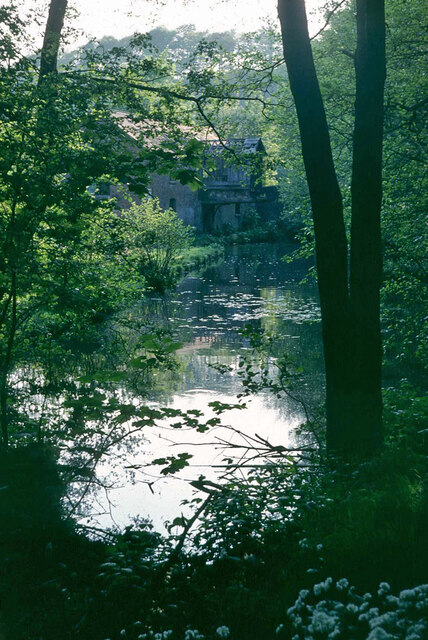
One of the key highlights of Kingsley is its rich history. The village boasts a number of well-preserved historic buildings, such as the beautiful St. Werburgh's Church, which dates back to the 12th century and features stunning stained glass windows. Additionally, Kingsley Mill, a former watermill, stands as a reminder of the village's industrial past.

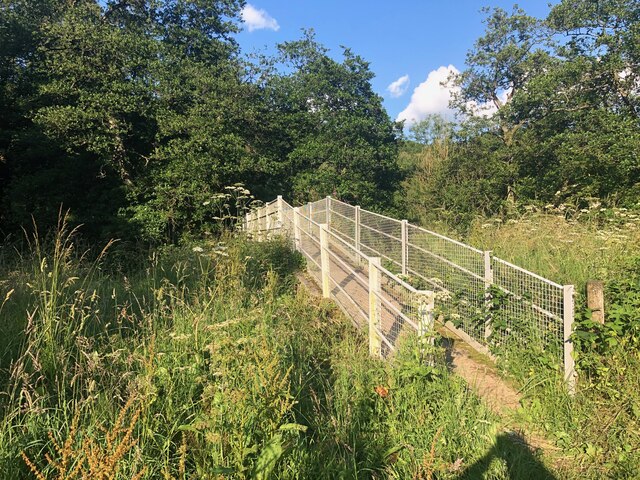
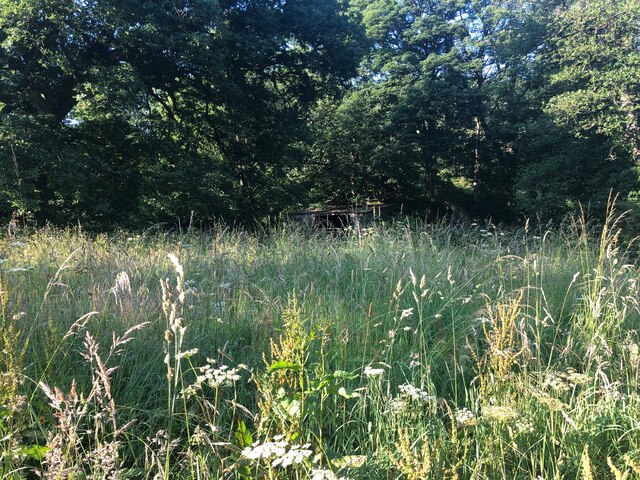
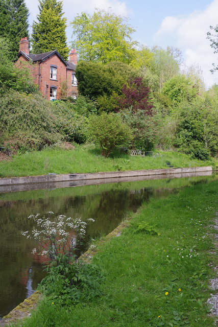
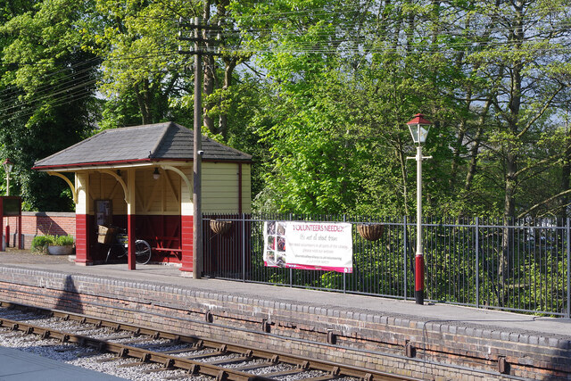
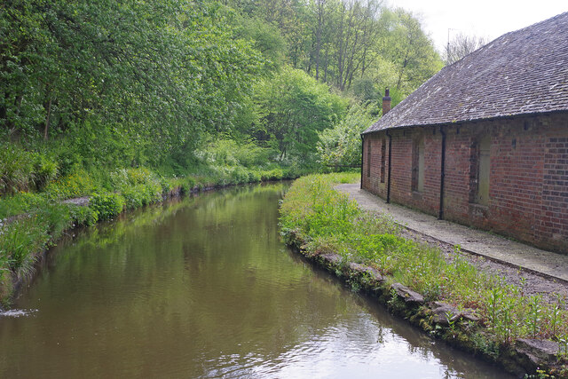
Nature enthusiasts will find themselves in paradise in Kingsley, as it is surrounded by stunning landscapes and offers numerous opportunities for outdoor activities. The nearby Consall Nature Park provides a haven for walkers and cyclists, with its scenic trails and abundance of wildlife. The Churnet Valley Railway, a heritage steam railway, is also a popular attraction, offering visitors a chance to experience a nostalgic journey through the picturesque countryside.

The village is well-served by a range of amenities, including a primary school, a village hall, and a variety of local shops and pubs. Kingsley is also conveniently located for those commuting to nearby towns and cities, with good transport links to Stoke-on-Trent and Uttoxeter.

Overall, Kingsley, Staffordshire, is a delightful village that seamlessly blends history, natural beauty, and a strong sense of community, making it an idyllic place to live or visit.

If you have any feedback on the listing, please let us know in the comments section below.

Kingsley Images

Images are sourced within 2km of 53.02017/-1.985969 or Grid Reference SK0146. Thanks to Geograph Open Source API. All images are credited.
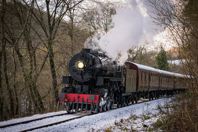
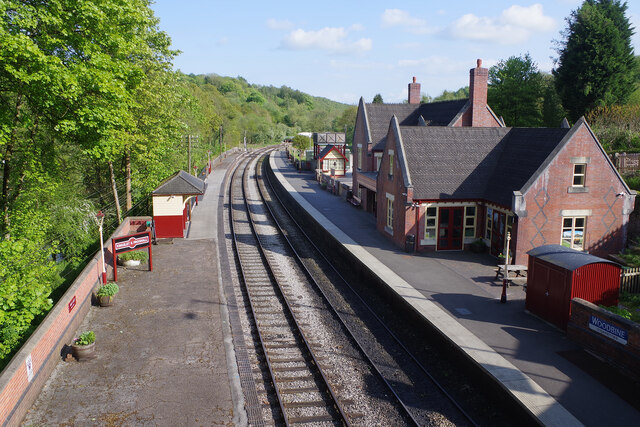
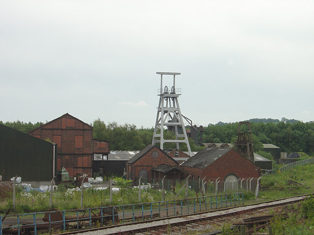
Footbridge over River Churnet Consall Woods is an RSPB Nature Reserve in Staffordshire. 194ha in area, the site was formally an industrial valley, now occupied by mixed woodland and various water features. Link to RSPB website: <span class="nowrap"><a title="https://www.rspb.org.uk/reserves-and-events/reserves-a-z/consall-woods/" rel="nofollow ugc noopener" href="https://www.rspb.org.uk/reserves-and-events/reserves-a-z/consall-woods/">Link</a><img style="margin-left:2px;" alt="External link" title="External link - shift click to open in new window" src="https://s1.geograph.org.uk/img/external.png" width="10" height="10"/></span>
Footbridge over River Churnet
Consall Woods is an RSPB Nature Reserve in Staffordshire. 194ha in area, the site was formally an industrial valley, now occupied by mixed woodland and various water features. Link to RSPB website: LinkExternal link
Meadow and Derelict Building on banks of River Churnet Consall Woods is an RSPB Nature Reserve in Staffordshire. 194ha in area, the site was formally an industrial valley, now occupied by mixed woodland and various water features. Link to RSPB website: <span class="nowrap"><a title="https://www.rspb.org.uk/reserves-and-events/reserves-a-z/consall-woods/" rel="nofollow ugc noopener" href="https://www.rspb.org.uk/reserves-and-events/reserves-a-z/consall-woods/">Link</a><img style="margin-left:2px;" alt="External link" title="External link - shift click to open in new window" src="https://s1.geograph.org.uk/img/external.png" width="10" height="10"/></span>
Meadow and Derelict Building on banks of River Churnet
Consall Woods is an RSPB Nature Reserve in Staffordshire. 194ha in area, the site was formally an industrial valley, now occupied by mixed woodland and various water features. Link to RSPB website: LinkExternal link
Froghall Wharf The end of the Caldon Canal. The lock in the foreground leads to the canal basin.
Froghall Wharf
The end of the Caldon Canal. The lock in the foreground leads to the canal basin.
Lime kilns at Froghall Wharf Lime kilns, long disused, near the canal wharf.
Lime kilns at Froghall Wharf
Lime kilns, long disused, near the canal wharf.
End of Caldon Canal, Froghall Wharf, 1978 Looking from the extreme end back towards the partly derelict warehouse. This was later restored with some alteration, it is a grade II listed building.
End of Caldon Canal, Froghall Wharf, 1978
Looking from the extreme end back towards the partly derelict warehouse. This was later restored with some alteration, it is a grade II listed building.
Churnet Valley 2021 Christmas Polar Express
Kingsley & Froghall trains A preserved railway line near Leek in Staffordshire, running from Froghall up the valley to Cheddleton with one intermediate stop at Consall, and (since 2011) on an extension to a former quarry at Cauldon Low, where as of 2012 there is no station.  The society has plans to connect to the national network at Stoke-on-Trent.

The lines were originally constructed by the North Staffordshire Railway (the "Knotty").  According to one writer, "the buildings on the Churnet Valley line are of local stone, straightforwardly neo-Tudor, and effective" [Lloyd & Insall, "Railway Station Architecture", David & Charles 1978, p.17].
Kingsley & Froghall trains
A preserved railway line near Leek in Staffordshire, running from Froghall up the valley to Cheddleton with one intermediate stop at Consall, and (since 2011) on an extension to a former quarry at Cauldon Low, where as of 2012 there is no station. The society has plans to connect to the national network at Stoke-on-Trent. The lines were originally constructed by the North Staffordshire Railway (the "Knotty"). According to one writer, "the buildings on the Churnet Valley line are of local stone, straightforwardly neo-Tudor, and effective" [Lloyd & Insall, "Railway Station Architecture", David & Charles 1978, p.17].
Bridge 52, Caldon Canal Bridge 52 carries the towpath across the canal, changing from the left to the right hand side.
Bridge 52, Caldon Canal
Bridge 52 carries the towpath across the canal, changing from the left to the right hand side.
Cherryeye Bridge, Caldon Canal Presumably the Cherryeye name comes from the unusual shape of the bridgehole. This furthest stretch of the Caldon Canal east of Flint Mill Lock is exceptionally narrow and is similar in some respects to the Llangollen Canal west of Trevor.
Cherryeye Bridge, Caldon Canal
Presumably the Cherryeye name comes from the unusual shape of the bridgehole. This furthest stretch of the Caldon Canal east of Flint Mill Lock is exceptionally narrow and is similar in some respects to the Llangollen Canal west of Trevor.
Caldon Canal, Froghall Lattice Cottage overlooks the Caldon Canal, near its end just west of Froghall Tunnel.
Caldon Canal, Froghall
Lattice Cottage overlooks the Caldon Canal, near its end just west of Froghall Tunnel.
Froghall Tunnel, Caldon Canal Froghall Tunnel is only 76 yards (69 metres) long but its very low profile means that it is an impenetrable obstacle to most modern narrowboats. To ensure boats do not enter and then get stuck there is a profile gauge hanging over the tunnel mouth. Another gauge is provided at Flint Mill Lock to give boaters forewarning so oversized boats should not get this far.
Froghall Tunnel, Caldon Canal
Froghall Tunnel is only 76 yards (69 metres) long but its very low profile means that it is an impenetrable obstacle to most modern narrowboats. To ensure boats do not enter and then get stuck there is a profile gauge hanging over the tunnel mouth. Another gauge is provided at Flint Mill Lock to give boaters forewarning so oversized boats should not get this far.
Kingsley & Froghall Station The southern terminus of the Churnet Valley Railway looks immaculate in the late afternoon sunshine although things are not quite what they seem. Firstly, although this might look like a country station, it was built to serve an area of heavy industry with limekilns and a copper works nearby (the latter did not close until 2014). After closure, the station buildings were demolished in 1968 and the new building is a replica using some original material. It was opened in 2004 by Pete Waterman, the well-known record producer and railway enthusiast.
Kingsley & Froghall Station
The southern terminus of the Churnet Valley Railway looks immaculate in the late afternoon sunshine although things are not quite what they seem. Firstly, although this might look like a country station, it was built to serve an area of heavy industry with limekilns and a copper works nearby (the latter did not close until 2014). After closure, the station buildings were demolished in 1968 and the new building is a replica using some original material. It was opened in 2004 by Pete Waterman, the well-known record producer and railway enthusiast.
Kingsley & Froghall Station - running in board Interestingly, the Churnet Valley Railway has chosen to use replica LMS signs for the running in boards (the larger signs used at the ends of the platforms, a practice largely discontinued on the modern railway) rather than the later British Railways style. The LMS usually angled these slightly outwards and that has been done at the other end of the platform.
Kingsley & Froghall Station - running in board
Interestingly, the Churnet Valley Railway has chosen to use replica LMS signs for the running in boards (the larger signs used at the ends of the platforms, a practice largely discontinued on the modern railway) rather than the later British Railways style. The LMS usually angled these slightly outwards and that has been done at the other end of the platform.
Kingsley & Froghall Station This second platform at Kingsley & Froghall was restored by the Churnet Valley Railway in 2008 to include the replica waiting shelter. The overall effect has been to create an authentic period feel. Perhaps only the 'volunteers needed' banner could not have been part of the scene 70 years ago.
Kingsley & Froghall Station
This second platform at Kingsley & Froghall was restored by the Churnet Valley Railway in 2008 to include the replica waiting shelter. The overall effect has been to create an authentic period feel. Perhaps only the 'volunteers needed' banner could not have been part of the scene 70 years ago.
Moorings at Froghall Some things defy understanding. Here at Froghall a canal basin has been restored capable of taking several full sized boats on the tiny stretch of what remains of the Uttoxeter canal. The moorings are excellent. But there is a huge snag. The only way boats can get here is to navigate the height restricted Froghall Tunnel - so it is only accessible to a small proportion of the craft currently using the canal network. Unsurprisingly on this May morning there was not a boat in site.
Moorings at Froghall
Some things defy understanding. Here at Froghall a canal basin has been restored capable of taking several full sized boats on the tiny stretch of what remains of the Uttoxeter canal. The moorings are excellent. But there is a huge snag. The only way boats can get here is to navigate the height restricted Froghall Tunnel - so it is only accessible to a small proportion of the craft currently using the canal network. Unsurprisingly on this May morning there was not a boat in site.
Lime kiln at Froghall This is one of a set of lime kilns close to Froghall Wharf believed to date from the 1880s. The kilns are set into a retaining wall 50 metres in length and 12 metres high.
Lime kiln at Froghall
This is one of a set of lime kilns close to Froghall Wharf believed to date from the 1880s. The kilns are set into a retaining wall 50 metres in length and 12 metres high.
Hetty's Tea Shop, Froghall Wharf Hetty's Tea Shop is located in this beautifully restored canalside warehouse at Froghall. Upstairs there is a holiday apartment. The building dates from the early 19th century and is grade II listed.
Hetty's Tea Shop, Froghall Wharf
Hetty's Tea Shop is located in this beautifully restored canalside warehouse at Froghall. Upstairs there is a holiday apartment. The building dates from the early 19th century and is grade II listed.
Caldon Canal below Flint Mill Lock The canal curls round towards Froghall on the final stretch from Etruria. The building on the right is part of Consall Flint Mill, built in the 1830s to supply ground flint for use in the Potteries ceramic industry. The mill ceased production around 1970.
Caldon Canal below Flint Mill Lock
The canal curls round towards Froghall on the final stretch from Etruria. The building on the right is part of Consall Flint Mill, built in the 1830s to supply ground flint for use in the Potteries ceramic industry. The mill ceased production around 1970.
Show me another place!

Kingsley is located at Grid Ref: SK0146 (Lat: 53.02017, Lng: -1.985969)

Administrative County: Staffordshire

District: Staffordshire Moorlands

Police Authority: Staffordshire

What 3 Words

///radiated.ridge.thigh. Near Cheadle, Staffordshire

Nearby Locations

Kingsley

Related Wikis

Kingsley, Staffordshire

Kingsley is a small village in the Staffordshire Moorlands near to Cheadle, and situated on the A52 from Stoke on Trent to Ashbourne. The civil parish...

Froghall

Froghall is a village situated approximately ten miles to the east of Stoke-on-Trent and two miles north of Cheadle in Staffordshire, England. Population...

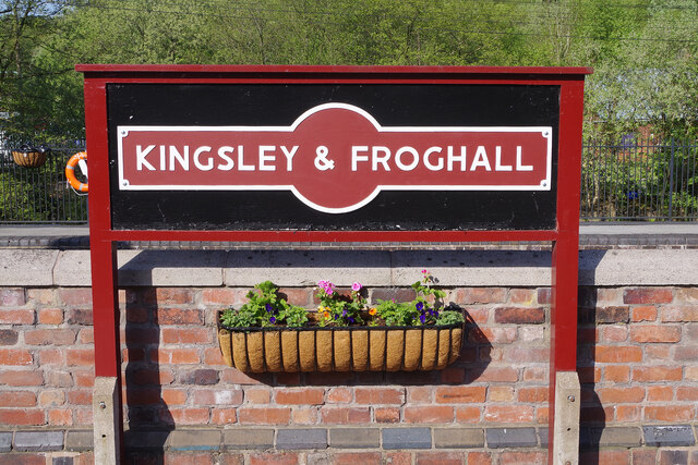
Kingsley and Froghall railway station

Kingsley and Froghall is a former railway station of the North Staffordshire Railway (NSR) that is now preserved on the Churnet Valley Railway in Staffordshire...

Uttoxeter Canal

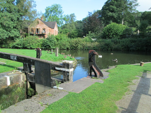
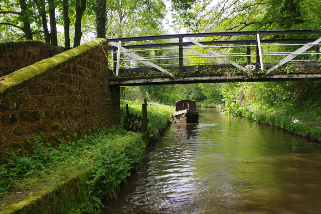
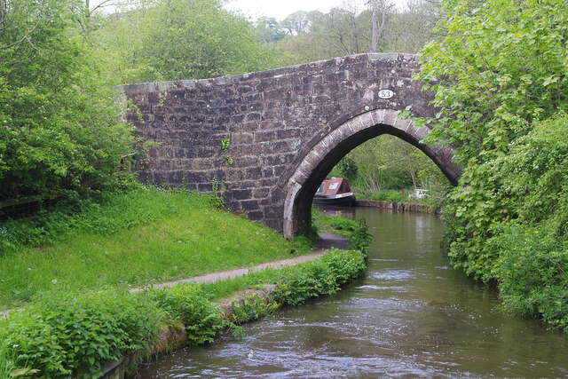
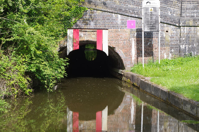
The Uttoxeter Canal was a thirteen-mile extension of the Caldon Canal running from Froghall as far as Uttoxeter in Staffordshire, England. It was authorised...

Consall railway station

Consall railway station is a former passenger railway station of the North Staffordshire Railway (NSR) and is now a preserved station on the Churnet Valley...
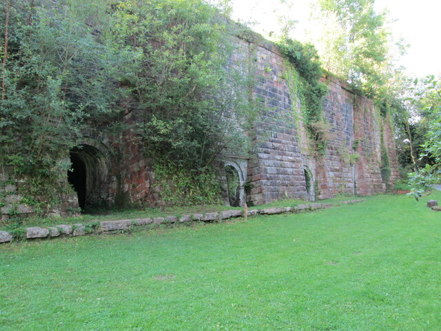
Cheadle Coalfield

The Cheadle Coalfield is a coalfield in the United Kingdom. Centred on the town of Cheadle, Staffordshire and its outlying villages it lies to the east...

Harston Wood

Harston Wood is a nature reserve of the Staffordshire Wildlife Trust. It is an ancient woodland, adjacent to the village of Froghall, near Cheadle, Staffordshire...

Woodhead Hall

Woodhead Hall is a country house at Cheadle in Staffordshire. It is a Grade II listed building. == History == Woodhead Hall was originally commissioned...

Nearby Amenities

Located within 500m of 53.02017,-1.985969
Bus Stop
Royal Oak PH
Bus: yes
Naptan AtcoCode: 3800C808600
Naptan Bearing: NW
Naptan CommonName: Royal Oak PH
Naptan Indicator: Adj
Naptan Landmark: Royal Oak PH
Naptan PlusbusZoneRef: STOKEOT
Naptan Street: High Street
Naptan Verified: no
Public Transport: platform
Source: naptan_import
Lat/Long: 53.0179215/-1.9824098
Bus Stop
Royal Oak PH
Bus: yes
Naptan AtcoCode: 3800C808601
Naptan Bearing: SE
Naptan CommonName: Royal Oak PH
Naptan Indicator: Opp
Naptan Landmark: Royal Oak PH
Naptan PlusbusZoneRef: STOKEOT
Naptan Street: High Street
Naptan Verified: no
Public Transport: platform
Source: naptan_import
Lat/Long: 53.0181642/-1.9823798
Bus Stop
Newhall Street
Bus: yes
Naptan AtcoCode: 3800C838801
Naptan Bearing: E
Naptan CommonName: Newhall Street
Naptan Indicator: Adj
Naptan Landmark: Newhall St
Naptan PlusbusZoneRef: STOKEOT
Naptan Street: The Green
Naptan Verified: no
Public Transport: platform
Source: naptan_import
Lat/Long: 53.0202054/-1.9874477
Bus Stop
Johnson Crescent
Bus: yes
Naptan AtcoCode: 3800C838802
Naptan Bearing: W
Naptan CommonName: Johnson Crescent
Naptan Indicator: Adj
Naptan Landmark: Johnson Cres
Naptan PlusbusZoneRef: STOKEOT
Naptan Street: The Green
Naptan Verified: no
Public Transport: platform
Source: naptan_import
Lat/Long: 53.0201244/-1.9867917
Pub
Bulls Head inn
Lat/Long: 53.0187333/-1.9833569
Addr Housenumber: The Gardens
Lat/Long: 53.0197946/-1.9872806
Fixme: This telephone box appears to be missing on Street Level Imagery. Please confirm if it has been removed or is in a different location.
Mapillary: 523406905653833
Removed Amenity: telephone
Survey Date: 2021-09-01
Lat/Long: 53.0189452/-1.9837004
Post Box
Brand: Royal Mail
Brand Wikidata: Q638098
Location: high street kingsley
Mapillary: 215346940589697
Operator: Royal Mail
Operator Wikidata: Q638098
Post Box Mounting: rendered_wall
Post Box Type: wall
Survey Date: 2021-09-01
Lat/Long: 53.018395/-1.982775
Turning Circle
Lat/Long: 53.019356/-1.9895582
Turning Circle
Lat/Long: 53.0178271/-1.9901162
Barrier: kissing_gate
Lat/Long: 53.0199879/-1.9816853
Bench
Lat/Long: 53.0193076/-1.9800704
Barrier: stile
Steps: 2
Stile: stepover
Lat/Long: 53.0189696/-1.9794296
Description: War memorial
Historic: memorial
Lat/Long: 53.0192901/-1.9800305
Barrier: kissing_gate
Lat/Long: 53.0192471/-1.9799916
Barrier: kissing_gate
Lat/Long: 53.0201194/-1.98174
Barrier: kissing_gate
Lat/Long: 53.0196453/-1.9810049
Barrier: stile
Material: wood
Source: survey;gps
Stile: stepover
Lat/Long: 53.0220521/-1.9856258
Fixme: Check how to get through the hedge
Lat/Long: 53.0229828/-1.9848415
Kingsley
Place: village
Wikidata: Q6413276
Lat/Long: 53.0198045/-1.9876984
Barrier: kissing_gate
Source: survey;gps
Lat/Long: 53.0227436/-1.9867801
Barrier: stile
Material: wood
Source: survey;gps
Stile: stepover
Lat/Long: 53.0230218/-1.9902611
Barrier: stile
Material: wood
Source: survey;gps
Stile: stepover
Lat/Long: 53.023287/-1.9871948
Defibrillator
Access: yes
Defibrillator Location: outside Kingsley Village Hall
Emergency: defibrillator
Indoor: no
Lat/Long: 53.0191551/-1.983856
Fixme: stile, gate or entrance?
Lat/Long: 53.018139/-1.983936
Fixme: stile, gate or entramce?
Lat/Long: 53.0164136/-1.9858569
Fixme: stile, gate or entrance?
Lat/Long: 53.0184941/-1.983265
The data included in this document is from www.openstreetmap.org. The data is made available under ODbL.

Have you been to Kingsley?

Leave your review of Kingsley below (or comments, questions and feedback).