High Acre

Hill, Mountain in Nottinghamshire Broxtowe

England

High Acre

Inham Nook Housing Estate A surprisingly large estate of social housing on the hill at Chilwell. Now rather better served by public transport than it was at the time of photo as the NET tram passes through the estate.
Inham Nook Housing Estate Credit: SK53

High Acre, Nottinghamshire, is a small hill located in the rural county of Nottinghamshire in the East Midlands region of England. Despite its name, it is not a mountain but rather a modest hill that rises to an elevation of approximately 90 meters (295 feet) above sea level. The hill is situated in the southern part of the county, close to the border with Leicestershire.

High Acre is characterized by its gentle slopes and is covered in lush green vegetation, predominantly consisting of grass and scattered trees. The hill offers panoramic views of the surrounding countryside, with rolling farmland stretching out in all directions. The top of the hill provides a vantage point from which visitors can enjoy breathtaking vistas of the picturesque Nottinghamshire landscape.

Although not a popular tourist destination, High Acre attracts some nature enthusiasts and hikers who appreciate its tranquil setting and the opportunity for leisurely walks. The hill is also home to a variety of wildlife, including numerous bird species that can be spotted in the trees and fields surrounding the area.

Access to High Acre is relatively easy, with a network of footpaths and trails leading up to the hill. The site is easily reachable by car, with ample parking available nearby. While the hill does not offer any amenities or visitor facilities, its natural beauty and peaceful atmosphere make it a pleasant spot for a quiet retreat or a peaceful picnic overlooking the Nottinghamshire countryside.

If you have any feedback on the listing, please let us know in the comments section below.

High Acre Images

Images are sourced within 2km of 52.914715/-1.2668821 or Grid Reference SK4935. Thanks to Geograph Open Source API. All images are credited.

Inham Nook Housing Estate A surprisingly large estate of social housing on the hill at Chilwell. Now rather better served by public transport than it was at the time of photo as the NET tram passes through the estate.
Inham Nook Housing Estate
A surprisingly large estate of social housing on the hill at Chilwell. Now rather better served by public transport than it was at the time of photo as the NET tram passes through the estate.
Housing in Inham Nook Estate
The New Inn A surprising survivor/  A pub I would have expected to close some years ago.
The New Inn
A surprising survivor/ A pub I would have expected to close some years ago.
Wild grassland Toton Fields Nature Reserve.
Wild grassland
Toton Fields Nature Reserve.
River cliff Has there been much erosion in seven years? <a href="https://www.geograph.org.uk/photo/4076854">SK4934 : River cliff</a>
River cliff
Has there been much erosion in seven years? SK4934 : River cliff
Autumn crocus In the grounds of Long Eaton Town Hall <a href="https://www.geograph.org.uk/photo/584899">SK4933 : Long Eaton Hall</a>.
Autumn crocus
In the grounds of Long Eaton Town Hall SK4933 : Long Eaton Hall.
Former cinema Following a reopening in 2005 which proved unsuccessful, this old cinema has been unused for many years. The last film posters (which were in place until quite recently) were for "The Woman in Black" from 2012.  A cannabis farm was discovered a year or two after that.

Redevelopment of the site has now begun.
Former cinema
Following a reopening in 2005 which proved unsuccessful, this old cinema has been unused for many years. The last film posters (which were in place until quite recently) were for "The Woman in Black" from 2012. A cannabis farm was discovered a year or two after that. Redevelopment of the site has now begun.
Mixed woodland As the debate over HS2 goes back and forth who knows what the future holds for this patch of nature.
Mixed woodland
As the debate over HS2 goes back and forth who knows what the future holds for this patch of nature.
Footbridge at night Crossing the Erewash by-pass channel to enter Nottinghamshire.
Footbridge at night
Crossing the Erewash by-pass channel to enter Nottinghamshire.
Station Road With the Circuit Drive estate on the right, so called as it occupies the former site of Long Eaton Stadium; home of the local speedway team <span class="nowrap"><a title="https://en.wikipedia.org/wiki/Long_Eaton_Speedway" rel="nofollow ugc noopener" href="https://en.wikipedia.org/wiki/Long_Eaton_Speedway">Link</a><img style="margin-left:2px;" alt="External link" title="External link - shift click to open in new window" src="https://s1.geograph.org.uk/img/external.png" width="10" height="10"/></span>.  This is an update of <a href="https://www.geograph.org.uk/photo/2144894">SK4933 : Building work on Station Road</a> taken 11 years before.
Station Road
With the Circuit Drive estate on the right, so called as it occupies the former site of Long Eaton Stadium; home of the local speedway team LinkExternal link. This is an update of SK4933 : Building work on Station Road taken 11 years before.
Toton Lane Park and Ride This is looking across the car park towards the NET Tramway terminus at Toton Lane.
Toton Lane Park and Ride
This is looking across the car park towards the NET Tramway terminus at Toton Lane.
Power station plume Of Ratciffe-on-Soar station.  Powered-up again as winter approaches.

In the foreground is the circuit drive estate flood relief storm drain pond.
Power station plume
Of Ratciffe-on-Soar station. Powered-up again as winter approaches. In the foreground is the circuit drive estate flood relief storm drain pond.
Former Sandiacre Methodist church Designed by Arthur Marshall <span class="nowrap"><a title="https://en.wikipedia.org/wiki/Arthur_George_Marshall" rel="nofollow ugc noopener" href="https://en.wikipedia.org/wiki/Arthur_George_Marshall">Link</a><img style="margin-left:2px;" alt="External link" title="External link - shift click to open in new window" src="https://s1.geograph.org.uk/img/external.png" width="10" height="10"/></span> 1886.
Former Sandiacre Methodist church
Designed by Arthur Marshall LinkExternal link 1886.
The River Erewash between Stapleford and Sandiacre Looking downstream, Sandiacre to the right. The river forms the boundary between Nottinghamshire and Derbyshire.
The River Erewash between Stapleford and Sandiacre
Looking downstream, Sandiacre to the right. The river forms the boundary between Nottinghamshire and Derbyshire.
Bessell Lane Farm, Stapleford
The River Erewash near Toton For much of its length the River Erewash forms the boundary between Nottinghamshire and Derbyshire. Here the river bends sharply to the left but the county boundary follows the relief channel straight ahead.
The River Erewash near Toton
For much of its length the River Erewash forms the boundary between Nottinghamshire and Derbyshire. Here the river bends sharply to the left but the county boundary follows the relief channel straight ahead.
Junction of paths by the Erewash Canal
66126 and Tesco train Passing the site of Stapleford and Sandiacre station.
66126 and Tesco train
Passing the site of Stapleford and Sandiacre station.
Show me another place!

High Acre is located at Grid Ref: SK4935 (Lat: 52.914715, Lng: -1.2668821)

Administrative County: Nottinghamshire

District: Broxtowe

Police Authority: Nottinghamshire

What 3 Words

///stews.such.stamp. Near Long Eaton, Derbyshire

Nearby Locations

High Acre

Related Wikis

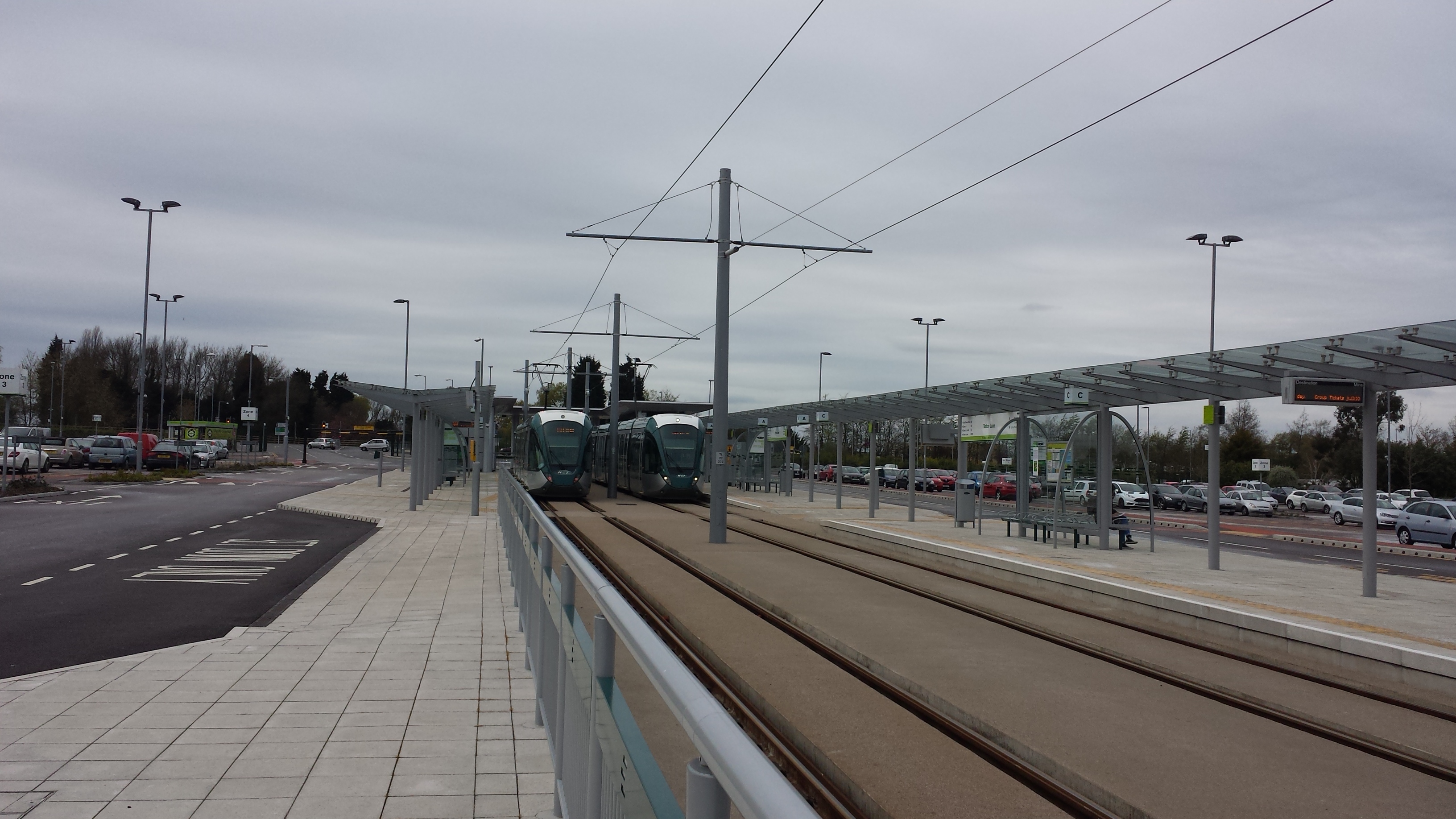
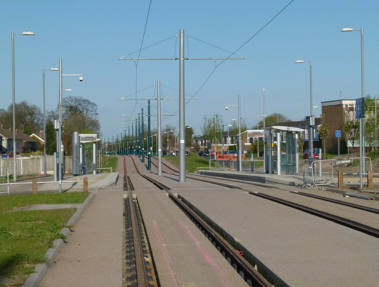
Toton Lane tram stop

Toton Lane is a tram stop and park and ride site on the Nottingham Express Transit network, serving the suburb of Chilwell and town of Stapleford, Broxtowe...

George Spencer Academy

The George Spencer Academy (informally George Spencer; formerly George Spencer Foundation School and Technology College) is an English academy in Stapleford...

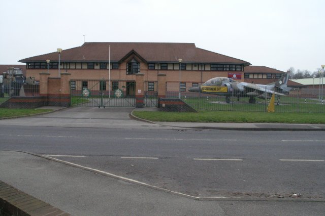
HMS Sherwood (shore establishment)

HMS Sherwood is a Royal Naval Reserve shore establishment in Nottinghamshire, England. The first naval reserve unit was established in Nottingham in 1949...

Chetwynd Barracks

Chetwynd Barracks is a British Army installation at Chilwell, Nottinghamshire, England. It is set to close in 2026. == History == The Chilwell depot and...

East Midlands Hub railway station

East Midlands Hub was a planned new railway station on the Leeds Branch of High Speed 2. It was intended to be located on the existing railway sidings...
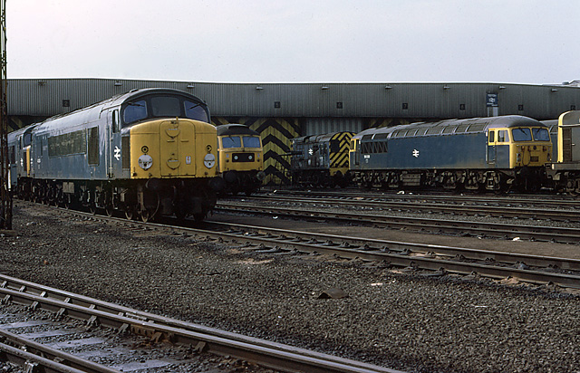
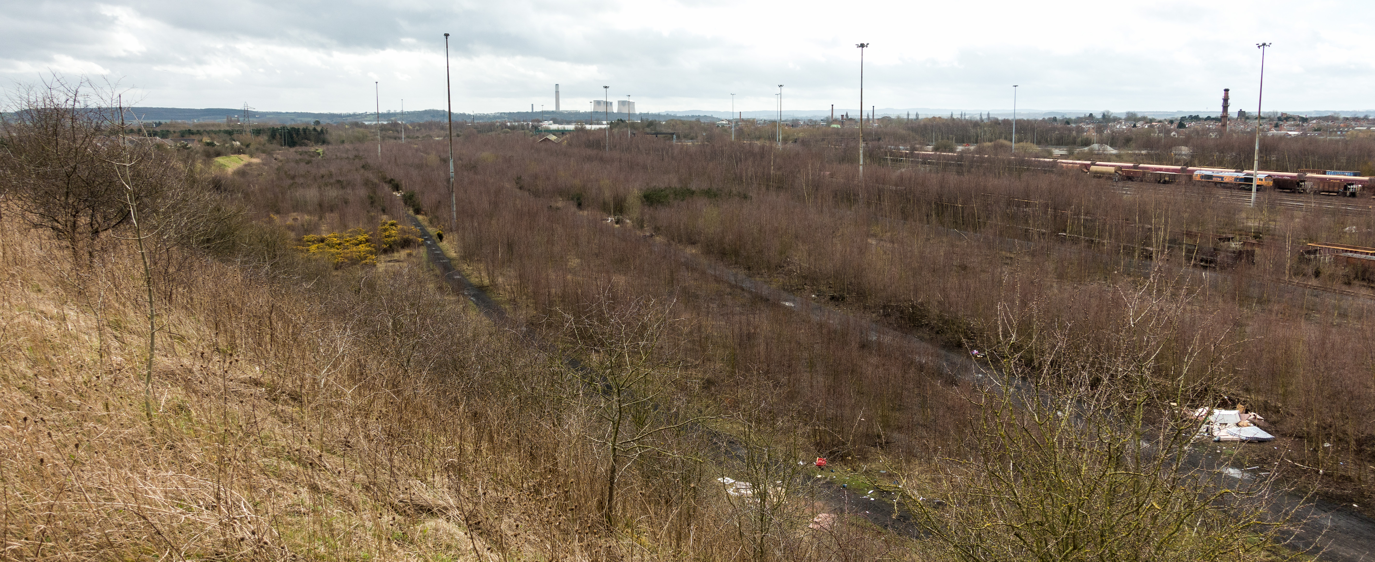
Toton TMD

Toton Traction Maintenance Depot or Toton Sidings is a large traction maintenance depot located in Toton, Nottinghamshire. The TOPS depot code for the...

Inham Road tram stop

Inham Road is a tram stop on the Nottingham Express Transit (NET) network, in the district of Broxtowe and suburb of Chilwell. It is on reserved track...

Toton

Toton is a large suburban village in the Borough of Broxtowe in Nottinghamshire, England. It forms part of the built-up area of Beeston, which in turn...

Related Videos

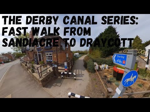
Derby Canal Series : Sandiacre to Draycott fast walking tour along the original route.

This is a very fast walking tour of the route of the Derby Canal starting in Sandiacre and ending at Draycott canal cottages.

Walking exercise in Long Eaton

A short brisk walk through part of the town Long Eaton, Derbyshire, early one summer morning.

Halloween at Trowell Garden Centre 2023

Some of the toy displays at Trowell Garden Center in Nottingham. October 2023.

Nearby Amenities

Located within 500m of 52.914715,-1.2668821
Post Box
Collection Times: Mo-Fr 09:00; Sa 07:00
Post Box Design: type_b
Post Box Type: pillar
Ref: NG9 661D
Royal Cypher: EIIR
Royal Cypher Wikidata: Q33102113
Source: survey
Lat/Long: 52.9114137/-1.2638827
Telephone
Booth: KX100
Source: survey
Lat/Long: 52.9113974/-1.2638797
Crossing
Crossing: traffic_signals
Crossing Ref: toucan
Lat/Long: 52.9182509/-1.2645627
Location Transition: yes
Power: tower
Source: Yahoo
Lat/Long: 52.917153/-1.2636108
Power: tower
Source: Yahoo
Lat/Long: 52.917576/-1.2613252
Power: tower
Source: Yahoo
Lat/Long: 52.9135156/-1.2729283
Power: tower
Lat/Long: 52.9155027/-1.2690017
Power: tower
Lat/Long: 52.9159323/-1.2650202
Crossing: uncontrolled
Lat/Long: 52.9171553/-1.2641371
Bus Stop
Katherine Drive
Bench: no
Bus: yes
Lit: no
Naptan AtcoCode: 3300BR0117
Naptan Bearing: NW
Naptan CommonName: Katherine Drive
Naptan Crossing: Katherine Drive
Naptan Indicator: opp
Naptan NaptanCode: ntsdptpg
Naptan Notes: none
Naptan Street: Stapleford Lane
Naptan Verified: yes
Public Transport: platform
Shelter: no
Source: naptan_import
Tactile Paving: no
Lat/Long: 52.9141658/-1.2618708
Bus Stop
Katherine Drive
Bench: no
Bus: yes
Lit: no
Naptan AtcoCode: 3300BR0118
Naptan Bearing: SE
Naptan CommonName: Katherine Drive
Naptan Crossing: Katherine Drive
Naptan Indicator: adj
Naptan NaptanCode: ntsdptpj
Naptan Notes: none
Naptan Street: Stapleford Lane
Naptan Verified: yes
Public Transport: platform
Shelter: no
Source: naptan_import
Tactile Paving: no
Lat/Long: 52.9140045/-1.2615895
Bus Stop
Shops
Both Ways: yes
Bus: yes
Naptan AtcoCode: 3300BR0403
Naptan Bearing: W
Naptan CommonName: Shops
Naptan Crossing: Shops
Naptan Indicator: o/s
Naptan NaptanCode: ntsatpmg
Naptan Notes: BW
Naptan Street: Woodstock Road
Naptan Verified: yes
Public Transport: platform
Ref: BR0403
Shelter: yes
Source: naptan_import
Lat/Long: 52.9114261/-1.2636721
Bus Stop
Epsom Road
Bus: yes
Naptan AtcoCode: 3300BR0413
Naptan Bearing: S
Naptan CommonName: Epsom Road
Naptan Crossing: Epsom Road
Naptan Indicator: adj
Naptan NaptanCode: ntsdagdp
Naptan Notes: none
Naptan Street: Banks Road
Naptan Verified: yes
Public Transport: platform
Shelter: no
Source: naptan_import
Lat/Long: 52.9110772/-1.2712323
Bus Stop
Woodstock Road
Both Ways: yes
Bus: yes
Naptan AtcoCode: 3300BR0415
Naptan Bearing: S
Naptan CommonName: Woodstock Road
Naptan Crossing: Woodstock Road
Naptan Indicator: adj
Naptan NaptanCode: ntsdagdw
Naptan Notes: BW
Naptan Street: Seaburn Road
Naptan Verified: yes
Public Transport: platform
Shelter: no
Source: naptan_import
Lat/Long: 52.9110344/-1.2672031
Leigh Road
Local Ref: NR
Naptan AtcoCode: 3300BR0533
Naptan Bearing: N
Naptan BusStopType: CUS
Naptan CommonName: Leigh Road
Naptan Crossing: Leigh Road
Naptan Indicator: nr
Naptan NaptanCode: ntsgmwgw
Naptan Notes: CUS
Naptan Street: Sandown Road
Naptan Verified: no
Source: naptan_import
Lat/Long: 52.9113283/-1.2623949
Woodstock Road
Naptan AtcoCode: 3300BR0567
Naptan Bearing: N
Naptan BusStopType: CUS
Naptan CommonName: Woodstock Road
Naptan Crossing: Woodstock Road
Naptan Indicator: opp
Naptan NaptanCode: ntsgpgtj
Naptan Notes: 3300BR0415
Naptan Street: Seaburn Road
Naptan Verified: no
Source: naptan_import
Lat/Long: 52.9110442/-1.2673367
Shops
Naptan AtcoCode: 3300BR0568
Naptan Bearing: E
Naptan BusStopType: CUS
Naptan CommonName: Shops
Naptan Indicator: opp
Naptan Landmark: Shops
Naptan NaptanCode: ntsgpgtm
Naptan Notes: CUS--3300BR0403
Naptan Street: Woodstock Road
Naptan Verified: no
Source: naptan_import
Lat/Long: 52.9115251/-1.2636853
Post Box
Brand: Royal Mail
Brand Wikidata: Q638098
Brand Wikipedia: en:Royal Mail
Collection Times: Mo-Fr 09:00, Sa 07:00
Operator: Royal Mail
Operator Wikidata: Q638098
Post Box Manufacturer: Carron Company, Stirlingshire
Post Box Type: lamp
Ref: NG9 658D
Royal Cypher: EIIR
Royal Cypher Wikidata: Q33102113
Source: survey
Lat/Long: 52.912984/-1.2611307
Barrier: cycle_barrier
Lat/Long: 52.9129435/-1.2724795
Addr City: Nottingham
Addr Housenumber: 11;12
Addr Parentstreet: Woodstock Road
Addr Postcode: NG9 6QP
Addr Street: Woodstock Court
Addr Suburb: Toton
Entrance: yes
Source Addr Postcode: OS Opendata Codepoint
Lat/Long: 52.9113529/-1.2642628
Addr City: Nottingham
Addr Housenumber: 13;14
Addr Parentstreet: Woodstock Road
Addr Postcode: NG9 6QP
Addr Street: Woodstock Court
Addr Suburb: Toton
Entrance: yes
Source Addr Postcode: OS Opendata Codepoint
Lat/Long: 52.9112907/-1.2645041
Addr City: Nottingham
Addr Housenumber: 5
Addr Parentstreet: Woodstock Road
Addr Postcode: NG9 6QP
Addr Street: Woodstock Court
Addr Suburb: Toton
Entrance: yes
Source Addr Postcode: OS Opendata Codepoint
Lat/Long: 52.9113465/-1.2644389
Addr City: Nottingham
Addr Housenumber: 6
Addr Parentstreet: Woodstock Road
Addr Postcode: NG9 6QP
Addr Street: Woodstock Court
Addr Suburb: Toton
Entrance: yes
Source Addr Postcode: OS Opendata Codepoint
Lat/Long: 52.9112322/-1.2644762
Addr City: Nottingham
Addr Housenumber: 8
Addr Parentstreet: Woodstock Road
Addr Postcode: NG9 6QP
Addr Street: Woodstock Court
Addr Suburb: Toton
Entrance: yes
Source Addr Postcode: OS Opendata Codepoint
Lat/Long: 52.9113504/-1.2639369
Man Made: mast
Source: Bing;local_knowledge
Lat/Long: 52.9168028/-1.2651553
Turning Circle
Lat/Long: 52.9111645/-1.2694429
Addr City: Nottingham
Addr Housenumber: 1;2
Addr Parentstreet: Woodstock Road
Addr Postcode: NG9 6QP
Addr Street: Woodstock Court
Addr Suburb: Toton
Entrance: yes
Source Addr Postcode: OS Opendata Codepoint
Lat/Long: 52.9112514/-1.2639245
Addr City: Nottingham
Addr Housenumber: 3
Addr Parentstreet: Woodstock Road
Addr Postcode: NG9 6QP
Addr Street: Woodstock Court
Addr Suburb: Toton
Entrance: yes
Source Addr Postcode: OS Opendata Codepoint
Lat/Long: 52.9112695/-1.2642134
Addr City: Nottingham
Addr Housenumber: 4
Addr Parentstreet: Woodstock Road
Addr Postcode: NG9 6QP
Addr Street: Woodstock Court
Addr Suburb: Toton
Entrance: yes
Source Addr Postcode: OS Opendata Codepoint
Lat/Long: 52.9112662/-1.2643004
Addr City: Nottingham
Addr Housenumber: 7
Addr Parentstreet: Woodstock Road
Addr Postcode: NG9 6QP
Addr Street: Woodstock Court
Addr Suburb: Toton
Entrance: yes
Source Addr Postcode: OS Opendata Codepoint
Lat/Long: 52.9111752/-1.264411
Addr City: Nottingham
Addr Housenumber: 9;10
Addr Parentstreet: Woodstock Road
Addr Postcode: NG9 6QP
Addr Street: Woodstock Court
Addr Suburb: Toton
Entrance: yes
Source Addr Postcode: OS Opendata Codepoint
Lat/Long: 52.9112754/-1.2640573
Crossing: uncontrolled
Lat/Long: 52.91718/-1.2639637
Crossing
Crossing: traffic_signals
Crossing Ref: toucan
Lat/Long: 52.9180214/-1.2640998
Crossing
Crossing: traffic_signals
Crossing Ref: toucan
Lat/Long: 52.9182023/-1.2643076
Maxheight: 2.2
Maxheight Imperial: 7'3''
Source: survey
Lat/Long: 52.9182983/-1.2628259
Toton Park and Ride
Brand: National Grid
Brand Wikidata: Q1465461
Operator: National Grid Electricity Distribution
Operator Old: Western Power Distribution
Operator Wikidata: Q7988183
Owner: National Grid Electricity Distribution (East Midlands) Plc
Owner Wikidata: Q114348127
Power: substation
Ref: 883298
Lat/Long: 52.9172608/-1.2638107
Traffic Calming: hump
Lat/Long: 52.9174329/-1.2631522
Traffic Calming: hump
Lat/Long: 52.9175512/-1.2624215
Traffic Calming: hump
Lat/Long: 52.9176339/-1.2619121
Mini Roundabout
Lat/Long: 52.9182863/-1.2629809
Maxheight: 2.2
Maxheight Imperial: 7'3''
Source: survey
Lat/Long: 52.9181556/-1.2629311
Toilets
Female: yes
Male: yes
Opening Hours: Mo-Su 06:00-19:00
Wheelchair: yes
Lat/Long: 52.9183545/-1.2626826
Vending Machine
Vending: public_transport_tickets
Lat/Long: 52.918416/-1.2627403
Direction: 255
Generator Method: photovoltaic
Generator Output Electricity: yes
Generator Solar Modules: 8
Generator Source: solar
Generator Type: solar_photovoltaic_panel
Location: roof
Power: generator
Lat/Long: 52.914402/-1.2628534
Direction: 255
Generator Method: photovoltaic
Generator Output Electricity: yes
Generator Solar Modules: 9
Generator Source: solar
Generator Type: solar_photovoltaic_panel
Location: roof
Power: generator
Lat/Long: 52.9144344/-1.2627192
Direction: 165
Generator Method: photovoltaic
Generator Output Electricity: yes
Generator Solar Modules: 2
Generator Source: solar
Generator Type: solar_photovoltaic_panel
Location: roof
Power: generator
Lat/Long: 52.9144134/-1.2626656
Direction: 165
Generator Method: photovoltaic
Generator Output Electricity: yes
Generator Solar Modules: 4
Generator Source: solar
Generator Type: solar_photovoltaic_panel
Location: roof
Power: generator
Lat/Long: 52.914457/-1.2626079
Generator Method: photovoltaic
Generator Output Electricity: yes
Generator Solar Modules: 13
Generator Source: solar
Generator Type: solar_photovoltaic_panel
Location: roof
Power: generator
Lat/Long: 52.9139476/-1.2634126
Direction: 255
Generator Method: photovoltaic
Generator Output Electricity: yes
Generator Solar Modules: 8
Generator Source: solar
Generator Type: solar_photovoltaic_panel
Location: roof
Power: generator
Lat/Long: 52.9139087/-1.2664984
Direction: 75
Generator Method: photovoltaic
Generator Output Electricity: yes
Generator Solar Modules: 6
Generator Source: solar
Generator Type: solar_photovoltaic_panel
Location: roof
Power: generator
Lat/Long: 52.9139152/-1.266422
Direction: 260
Generator Method: photovoltaic
Generator Output Electricity: yes
Generator Solar Modules: 22
Generator Source: solar
Generator Type: solar_photovoltaic_panel
Location: roof
Power: generator
Lat/Long: 52.9143543/-1.2666835
Direction: 165
Generator Method: photovoltaic
Generator Output Electricity: yes
Generator Solar Modules: 16
Generator Source: solar
Generator Type: solar_photovoltaic_panel
Location: roof
Power: generator
Lat/Long: 52.9141975/-1.2661152
Direction: 260
Generator Method: photovoltaic
Generator Output Electricity: yes
Generator Solar Modules: 10
Generator Source: solar
Generator Type: solar_photovoltaic_panel
Location: roof
Power: generator
Lat/Long: 52.9138836/-1.2676147
Direction: 170
Generator Method: photovoltaic
Generator Output Electricity: yes
Generator Solar Modules: 8
Generator Source: solar
Generator Type: solar_photovoltaic_panel
Location: roof
Power: generator
Lat/Long: 52.9138618/-1.2693644
Direction: 170
Generator Method: photovoltaic
Generator Output Electricity: yes
Generator Solar Modules: 4
Generator Source: solar
Generator Type: solar_photovoltaic_panel
Location: roof
Power: generator
Lat/Long: 52.9138513/-1.2694462
Direction: 170
Generator Method: photovoltaic
Generator Output Electricity: yes
Generator Solar Modules: 16
Generator Source: solar
Generator Type: solar_photovoltaic_panel
Location: roof
Power: generator
Lat/Long: 52.9123334/-1.2684571
Direction: 175
Generator Method: photovoltaic
Generator Output Electricity: yes
Generator Solar Modules: 18
Generator Source: solar
Generator Type: solar_photovoltaic_panel
Location: roof
Power: generator
Lat/Long: 52.9119289/-1.270298
Direction: 185
Generator Method: photovoltaic
Generator Output Electricity: yes
Generator Solar Modules: 14
Generator Source: solar
Generator Type: solar_photovoltaic_panel
Location: roof
Power: generator
Lat/Long: 52.9126815/-1.2713277
Direction: 185
Generator Method: photovoltaic
Generator Output Electricity: yes
Generator Solar Modules: 16
Generator Source: solar
Generator Type: solar_photovoltaic_panel
Location: roof
Power: generator
Lat/Long: 52.9129677/-1.2711159
Direction: 175
Generator Method: photovoltaic
Generator Output Electricity: yes
Generator Solar Modules: 16
Generator Source: solar
Generator Type: solar_photovoltaic_panel
Location: roof
Power: generator
Lat/Long: 52.9123923/-1.2715354
Direction: 175
Generator Method: photovoltaic
Generator Output Electricity: yes
Generator Solar Modules: 15
Generator Source: solar
Generator Type: solar_photovoltaic_panel
Location: roof
Power: generator
Lat/Long: 52.9115884/-1.2704572
Direction: WSW
Generator Method: photovoltaic
Generator Output Electricity: yes
Generator Solar Modules: 10
Generator Source: solar
Generator Type: solar_photovoltaic_panel
Location: roof
Power: generator
Lat/Long: 52.9108799/-1.2707308
Direction: 175
Generator Method: photovoltaic
Generator Output Electricity: yes
Generator Solar Modules: 12
Generator Source: solar
Generator Type: solar_photovoltaic_panel
Location: roof
Power: generator
Lat/Long: 52.9106439/-1.2670011
Direction: S
Generator Method: photovoltaic
Generator Output Electricity: yes
Generator Solar Modules: 15
Generator Source: solar
Generator Type: solar_photovoltaic_panel
Location: roof
Power: generator
Lat/Long: 52.9112548/-1.2654733
Direction: 170
Generator Method: photovoltaic
Generator Output Electricity: yes
Generator Solar Modules: 9
Generator Source: solar
Generator Type: solar_photovoltaic_panel
Location: roof
Power: generator
Lat/Long: 52.9123135/-1.2643106
Power: pole
Source: Bing
Lat/Long: 52.9187715/-1.2700447
Location Transition: yes
Power: pole
Source: Bing
Lat/Long: 52.9190295/-1.2686902
Power: pole
Lat/Long: 52.9136341/-1.2716869
Power: pole
Lat/Long: 52.9132681/-1.2731353
Power: pole
Lat/Long: 52.9153873/-1.2716702
Power: pole
Lat/Long: 52.9149535/-1.2725432
Power: pole
Lat/Long: 52.9144986/-1.2734458
Power: pole
Lat/Long: 52.9137538/-1.2739199
Power: pole
Lat/Long: 52.9140821/-1.269908
Power: pole
Lat/Long: 52.9158458/-1.2707528
Power: pole
Lat/Long: 52.91623/-1.2689927
Power: pole
Lat/Long: 52.9164066/-1.2679741
Location Transition: yes
Power: pole
Lat/Long: 52.9165995/-1.2667751
Power: pole
Lat/Long: 52.914629/-1.2683928
Power: pole
Lat/Long: 52.9150335/-1.2672928
Location Transition: yes
Power: pole
Lat/Long: 52.9155507/-1.2658605
Waste Basket
Lat/Long: 52.9163367/-1.263523
Waste Basket
Lat/Long: 52.9162793/-1.2636785
Crossing
Crossing: traffic_signals
Crossing Ref: toucan
Lat/Long: 52.9178626/-1.2644271
Crossing
Crossing: traffic_signals
Crossing Ref: toucan
Lat/Long: 52.9178752/-1.2643174
Crossing
Crossing: traffic_signals
Lat/Long: 52.9178386/-1.2641904
Traffic Signals
Lat/Long: 52.9180377/-1.2640227
Traffic Signals
Lat/Long: 52.9182549/-1.2643271
Traffic Signals
Lat/Long: 52.9178181/-1.2644121
Traffic Signals
Lat/Long: 52.9178327/-1.2643035
Crossing
Crossing: traffic_signals
Crossing Ref: toucan
Lat/Long: 52.9181385/-1.2640596
Waste Basket
Lat/Long: 52.9172189/-1.2642612
Waste Basket
Lat/Long: 52.9172117/-1.2638307
Waste Basket
Lat/Long: 52.9149991/-1.2624766
Traffic Calming: hump
Lat/Long: 52.918313/-1.2626331
Waste Basket
Lat/Long: 52.9183676/-1.2627283
Waste Basket
Lat/Long: 52.9184303/-1.2627424
Toilets
Opening Hours: Mo-Su 06:00-19:00
Unisex: yes
Wheelchair: yes
Lat/Long: 52.9184464/-1.2627366
Vending Machine
Vending: public_transport_tickets
Lat/Long: 52.9183846/-1.2627354
Charging Station
Authentication Membership Card: yes
Brand: BP Pulse
Brand Wikidata: Q39057719
Capacity: 11
Fee: yes
Motorcar: yes
Network: D2N2
Note: Capacity is based on number of marked parking spaces. There are 7 charging units (two types).
Operator: BP Pulse
Operator Wikidata: Q39057719
Source: survey
Lat/Long: 52.917711/-1.2639166
Entrance: main
Lat/Long: 52.918113/-1.2631055
Direction: 260
Generator Method: photovoltaic
Generator Output Electricity: yes
Generator Solar Modules: 12
Generator Source: solar
Generator Type: solar_photovoltaic_panel
Location: roof
Power: generator
Lat/Long: 52.9129951/-1.2718557
Bench
Backrest: yes
Lat/Long: 52.9130546/-1.272916
Direction: 75
Generator Method: photovoltaic
Generator Output Electricity: yes
Generator Solar Modules: 8
Generator Source: solar
Generator Type: solar_photovoltaic_panel
Location: roof
Power: generator
Lat/Long: 52.9144292/-1.2627957
Camera Mount: pole
Camera Type: dome
Man Made: surveillance
Surveillance: public
Surveillance Type: camera
Surveillance Zone: area
Lat/Long: 52.917973/-1.2639562
Power: switch
Switch: disconnector
Lat/Long: 52.9163075/-1.2652933
Power: switch
Switch: disconnector
Lat/Long: 52.9161016/-1.265161
Power: tower
Switch: disconnector
Lat/Long: 52.9161957/-1.2650297
Power: tower
Switch: disconnector
Lat/Long: 52.9161421/-1.2652589
Power: tower
Switch: disconnector
Lat/Long: 52.9162794/-1.2650835
Power: tower
Switch: disconnector
Lat/Long: 52.9162259/-1.2653127
Power: switch
Switch: circuit_breaker
Lat/Long: 52.9163951/-1.2649182
Power: switch
Switch: circuit_breaker
Lat/Long: 52.9161892/-1.2647859
Power: switch
Switch: disconnector
Lat/Long: 52.9163773/-1.2649946
Power: switch
Switch: disconnector
Lat/Long: 52.9161713/-1.2648623
Power: tower
Lat/Long: 52.9163466/-1.2653903
Power: tower
Switch: disconnector
Lat/Long: 52.9160252/-1.2651838
Power: tower
Lat/Long: 52.9164002/-1.2651611
Power: tower
Switch: disconnector
Lat/Long: 52.9160787/-1.2649546
Power: transformer
Voltage Primary: 132000
Voltage Secondary: 33000
Lat/Long: 52.9162037/-1.2647239
Power: transformer
Voltage Primary: 132000
Voltage Secondary: 33000
Lat/Long: 52.9164103/-1.2648533
Power: transformer
Voltage Primary: 33000
Voltage Secondary: 11000
Lat/Long: 52.9164851/-1.2645596
Power: transformer
Voltage Primary: 33000
Voltage Secondary: 11000
Lat/Long: 52.9163517/-1.2644731
The data included in this document is from www.openstreetmap.org. The data is made available under ODbL.

Have you been to High Acre?

Leave your review of High Acre below (or comments, questions and feedback).