Windmere Hill

Hill, Mountain in Yorkshire Hambleton

England

Windmere Hill

Low Lane Looking along Low Lane between Little Hutton and Hutton Sessay.
Low Lane Credit: DS Pugh

Windmere Hill is a prominent geographical feature located in the picturesque county of Yorkshire, England. Rising to an impressive height of 2,500 feet (762 meters), it is widely regarded as one of the highest and most scenic hills in the region. Situated amidst the stunning Yorkshire Dales National Park, Windmere Hill offers breathtaking panoramic views of the surrounding countryside and is a popular destination for nature enthusiasts, hikers, and photographers.

Characterized by its steep and rugged slopes, Windmere Hill boasts a diverse and unique ecosystem. The hill is adorned with an abundant array of flora and fauna, including heather, bracken, and various species of birds and mammals. Its distinctive geological formations, such as limestone outcrops and glacial valleys, further add to its allure.

The summit of Windmere Hill is accessible via a network of well-marked trails, making it an ideal location for walkers and climbers of varying abilities. Upon reaching the top, visitors are rewarded with breathtaking vistas of rolling hills, meandering rivers, and charming villages nestled in the valleys below.

Aside from its natural beauty, Windmere Hill also holds historical significance. The area is dotted with ancient ruins, stone circles, and burial mounds, serving as a testament to the rich heritage of this part of Yorkshire.

In conclusion, Windmere Hill stands as an impressive natural landmark in Yorkshire, offering a captivating blend of scenic beauty, biodiversity, and historical significance. Whether one seeks tranquility, adventure, or a glimpse into the past, Windmere Hill is an ideal destination for all.

If you have any feedback on the listing, please let us know in the comments section below.

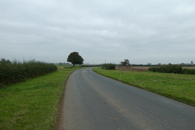
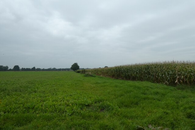
Windmere Hill Images

Images are sourced within 2km of 54.181715/-1.2655911 or Grid Reference SE4876. Thanks to Geograph Open Source API. All images are credited.

Low Lane Looking along Low Lane between Little Hutton and Hutton Sessay.
Low Lane
Looking along Low Lane between Little Hutton and Hutton Sessay.
Field boundary beside Low Lane Looking north from the road between Little Hutton and Hutton Sessay.
Field boundary beside Low Lane
Looking north from the road between Little Hutton and Hutton Sessay.
Along Low Lane Looking towards Hutton Sessay with the junction with Hutton Rae Lane ahead.
Along Low Lane
Looking towards Hutton Sessay with the junction with Hutton Rae Lane ahead.
Fields near Hutton Sessay Looking across farmland to the north of the village. Although barely visible the white horse at Kilburn is straight ahead.
Fields near Hutton Sessay
Looking across farmland to the north of the village. Although barely visible the white horse at Kilburn is straight ahead.
Ditch along Low Lane Looking along Low Lane towards Hutton Sessay.
Ditch along Low Lane
Looking along Low Lane towards Hutton Sessay.
Old and new logs beside the road An old trunk sits alongside a new trunk blocking access to the field.
Old and new logs beside the road
An old trunk sits alongside a new trunk blocking access to the field.
Low Lane in Hutton Sessay The lane leads to Dalton.
Low Lane in Hutton Sessay
The lane leads to Dalton.
Low Lane in Hutton Sessay Looking along the main street.
Low Lane in Hutton Sessay
Looking along the main street.
Hedgerow near Hutton Sessay The other side of the hedge, and 15 years on from <a href="https://www.geograph.org.uk/photo/199041">SE4775 : Outside Hutton Sessay</a>.
Hedgerow near Hutton Sessay
The other side of the hedge, and 15 years on from SE4775 : Outside Hutton Sessay.
Farmland south of Hutton Sessay Looking across a field of young cereal crops.
Farmland south of Hutton Sessay
Looking across a field of young cereal crops.
Church Lane west of Hutton Sessay Looking along the road to Little Sessay.
Church Lane west of Hutton Sessay
Looking along the road to Little Sessay.
Ditch and farmland A similar view to <a href="https://www.geograph.org.uk/photo/199050">SE4675 : Between Hutton Sessay & Little Sessay</a> 15 years on.
Ditch and farmland
A similar view to SE4675 : Between Hutton Sessay & Little Sessay 15 years on.
Church Lane Looking along Church Lane between Hutton Sessay and Little Sessay.
Church Lane
Looking along Church Lane between Hutton Sessay and Little Sessay.
Fence with a gate Looking along a field boundary beside Church Lane north of Little Sessay.
Fence with a gate
Looking along a field boundary beside Church Lane north of Little Sessay.
House beside Church Lane Looking along Church Lane on the edge of Hutton Sessay.
House beside Church Lane
Looking along Church Lane on the edge of Hutton Sessay.
Horsebreakers Arms Looking towards the public house in Hutton Sessay.
Horsebreakers Arms
Looking towards the public house in Hutton Sessay.
Manor Farm Looking along the road through Hutton Sessay as it passes Manor Farm.
Manor Farm
Looking along the road through Hutton Sessay as it passes Manor Farm.
Hutton Sessay Looking along the road through the village.
Hutton Sessay
Looking along the road through the village.
Show me another place!

Windmere Hill is located at Grid Ref: SE4876 (Lat: 54.181715, Lng: -1.2655911)

Division: North Riding

Administrative County: North Yorkshire

District: Hambleton

Police Authority: North Yorkshire

What 3 Words

///dugouts.represent.unafraid. Near Thirsk, North Yorkshire

Related Wikis

Hutton Sessay

Hutton Sessay is a village and civil parish in the Hambleton district of North Yorkshire, England. In 2013 the population of the civil parish was estimated...

Birdforth

Birdforth is a village and civil parish in the Hambleton district of North Yorkshire, England. According to the 2001 census it had a population of 13...

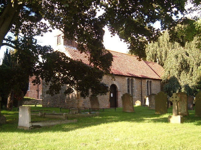
St Mary's Church, Birdforth

St Mary's Church, or Birdforth Old Chapel, is a former Anglican church in the village of Birdforth, North Yorkshire, England. It is recorded in the National...

Carlton Husthwaite

Carlton Husthwaite is a village and civil parish in the Hambleton district of North Yorkshire, England, about seven miles south-east of Thirsk. According...

Nearby Amenities

Located within 500m of 54.181715,-1.2655911
Man Made: mast
Tower Construction: freestanding
Tower Type: communication
Lat/Long: 54.1793532/-1.2594583
The data included in this document is from www.openstreetmap.org. The data is made available under ODbL.

Have you been to Windmere Hill?

Leave your review of Windmere Hill below (or comments, questions and feedback).