Cliffe Hill
Hill, Mountain in Leicestershire Hinckley and Bosworth
England
Cliffe Hill
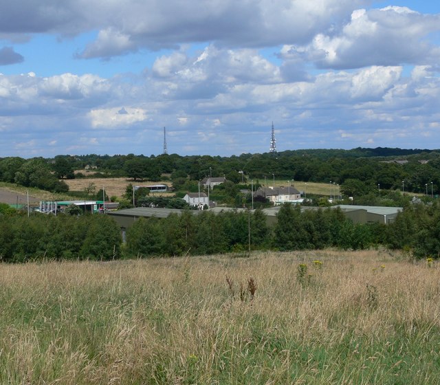
Cliffe Hill is a prominent hill located in Leicestershire, England. Standing at an elevation of 252 meters (827 feet), it is considered the highest point in the county. The hill is part of the Charnwood Forest and is situated near the village of Newtown Linford, approximately 8 miles northwest of Leicester.
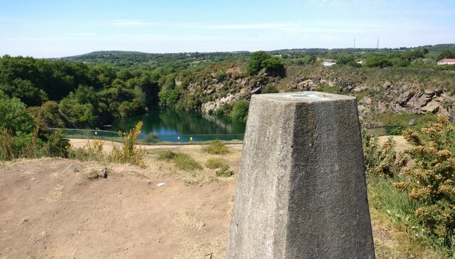
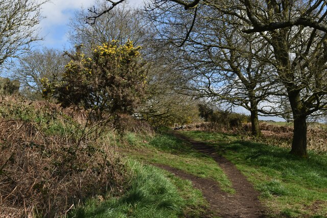
Cliffe Hill is renowned for its stunning panoramic views of the surrounding area. On a clear day, visitors can enjoy breathtaking vistas of the Leicestershire countryside, with landmarks such as Bradgate Park and Beacon Hill visible in the distance. The hill is a popular destination for hikers, nature enthusiasts, and photographers due to its picturesque landscapes.
The hill itself is composed of ancient volcanic rocks, specifically granite and quartz-dolerite. These rocks were formed during the Precambrian period, giving Cliffe Hill a unique geological significance. Moreover, the area is home to diverse flora and fauna, including heathland and woodland ecosystems, providing habitats for a variety of plant and animal species.
Cliffe Hill has a rich history, with evidence of human activity dating back to the Neolithic period. The hill's strategic location made it an ideal place for settlements and fortifications throughout history. Today, visitors can still find remnants of Iron Age hillforts and Roman roads, which serve as a reminder of the area's past.
In conclusion, Cliffe Hill is a remarkable hill in Leicestershire, offering visitors a chance to appreciate the natural beauty, geological significance, and historical heritage of the area.
If you have any feedback on the listing, please let us know in the comments section below.
Cliffe Hill Images
Images are sourced within 2km of 52.694246/-1.3031908 or Grid Reference SK4710. Thanks to Geograph Open Source API. All images are credited.


Cliffe Hill is located at Grid Ref: SK4710 (Lat: 52.694246, Lng: -1.3031908)
Administrative County: Leicestershire
District: Hinckley and Bosworth
Police Authority: Leicestershire
What 3 Words
///consults.headboard.reinvest. Near Markfield, Leicestershire
Nearby Locations
Related Wikis
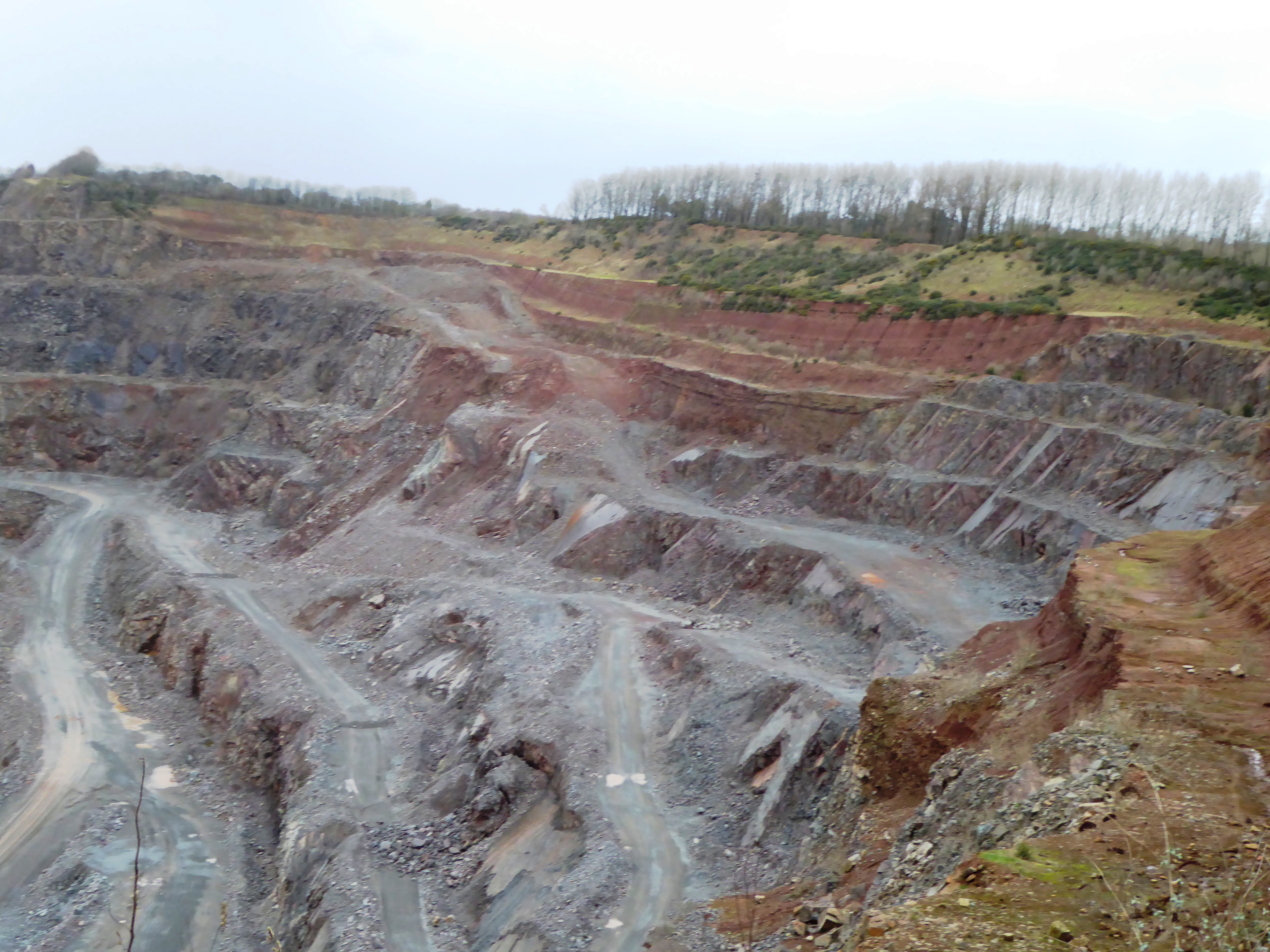
Cliffe Hill Quarry
Cliffe Hill Quarry is a 19.2 hectares (47 acres) geological Site of Special Scientific Interest on the western outskirts of Markfield in Leicestershire...
Billa Barra Hill
Billa Barra Hill is a 20.7 hectares (51 acres) Local Nature Reserve north of Stanton under Bardon in Leicestershire. It is owned and managed by Hinckley...

Stanton under Bardon
Stanton-under-Bardon is a village and civil parish about 4 miles (6.4 km) southeast of Coalville, in the Hinckley and Bosworth district, in Leicestershire...
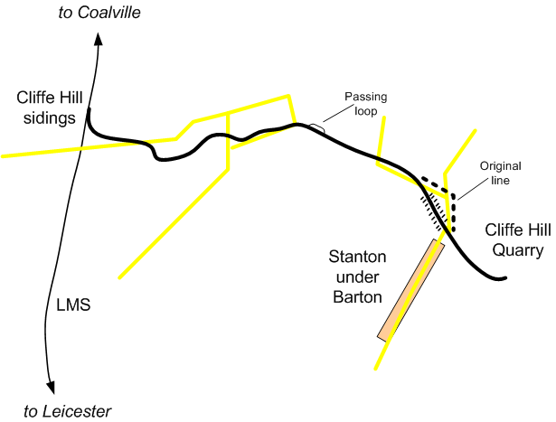
Cliffe Hill Mineral Railway
The Cliffe Hill Mineral Railway was a 2 ft (610 mm) narrow gauge industrial railway that connected the Cliffe Hill granite quarry to the nearby London...

Altar Stones Nature Reserve
Altar Stones is a 3.7-hectare (9.1-acre) nature reserve in Markfield in Leicestershire. It is owned and managed by the Leicestershire and Rutland Wildlife...

Bardon Park Chapel
Bardon Park Chapel is a 300-year-old Christian meeting house at Bardon, Leicestershire, England. It stands back from the A511 road (Shaw Lane), between...
South Charnwood High School
South Charnwood High School is a mixed secondary school located between the villages of Markfield and Thornton in the Hinckley and Bosworth district of...

Markfield
Markfield is a large village in both the National Forest and Charnwood Forest and in the Hinckley and Bosworth district of Leicestershire, England. The...
Nearby Amenities
Located within 500m of 52.694246,-1.3031908Have you been to Cliffe Hill?
Leave your review of Cliffe Hill below (or comments, questions and feedback).