Beacon Hill
Hill, Mountain in Hampshire Basingstoke and Deane
England
Beacon Hill

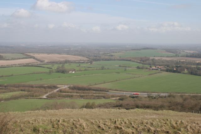
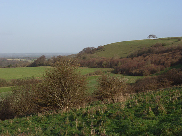
Beacon Hill is a prominent hill located in the county of Hampshire, England. Standing at an elevation of 280 meters (919 feet), it is considered one of the highest points in the county. Situated within the South Downs National Park, Beacon Hill offers breathtaking panoramic views of the surrounding countryside.
The hill is known for its distinctive shape, which resembles a beacon or a pyramid. It is covered in lush green vegetation, including grasslands, heathlands, and woodlands, providing a diverse habitat for a wide range of flora and fauna. The hill is also home to several rare and protected species, such as the Silver-studded Blue butterfly and the Dartford warbler.
Beacon Hill has a rich historical significance as well. It is believed to have been used as a beacon site during ancient times, serving as a signal point to warn of potential invasions. The hill also played a role during the Napoleonic Wars, with a beacon being lit to spread news of the Battle of Waterloo.
Today, Beacon Hill is a popular destination for outdoor enthusiasts and nature lovers. There are numerous walking and cycling trails that allow visitors to explore the hill and its surroundings. The hilltop boasts a viewpoint with benches, providing the perfect spot to enjoy the stunning vistas and take in the tranquil atmosphere.
Additionally, Beacon Hill offers various recreational activities, including picnicking, birdwatching, and kite flying. The South Downs Way, a long-distance footpath, passes through the hill, attracting both hikers and nature enthusiasts.
Overall, Beacon Hill is a cherished natural landmark in Hampshire, offering a blend of natural beauty, historical significance, and outdoor recreational opportunities.
If you have any feedback on the listing, please let us know in the comments section below.
Beacon Hill Images
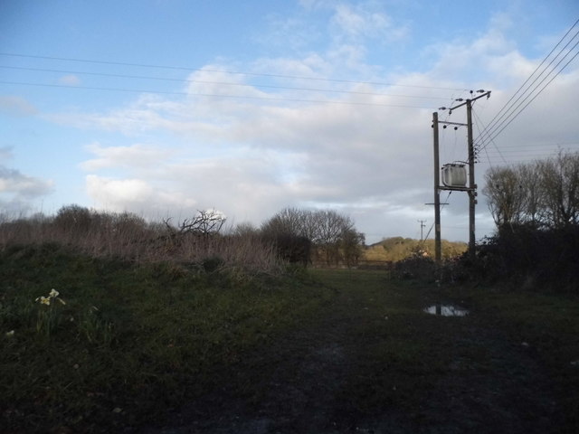
Images are sourced within 2km of 51.312803/-1.3438383 or Grid Reference SU4557. Thanks to Geograph Open Source API. All images are credited.


Beacon Hill is located at Grid Ref: SU4557 (Lat: 51.312803, Lng: -1.3438383)
Administrative County: Hampshire
District: Basingstoke and Deane
Police Authority: Hampshire
What 3 Words
///grows.campsites.alive. Near Highclere, Hampshire
Nearby Locations
Related Wikis
Beacon Hill, Burghclere, Hampshire
There are two hills in Hampshire called Beacon Hill; the other one is near Warnford.Beacon Hill is near the village of Burghclere and Watership Down, in...
Old Burghclere
Old Burghclere is part of Burghclere in Hampshire, England, located south of the large town of Newbury near the A34 road. The village of Burghclere, but...

Sidown Hill
At 255 metres (837 ft), Sidown Hill is the third highest hill in the county of Hampshire, England. At the summit is a mid-18th century Grade II listed...

Burghclere railway station
Burghclere railway station (originally named Sydmonton) was a station on the Didcot, Newbury and Southampton Railway in England. It was further from the...

Old Burghclere Lime Quarry
Old Burghclere Lime Quarry SSSI is a 4.61 ha (11.4 acres) biological Site of Special Scientific Interest at Burghclere in Hampshire, notified in 1979....
Burghclere
Burghclere is a village and civil parish in Hampshire, England. According to the 2011 census the village had a population of 1,152. The village is near...

Highclere Castle
Highclere Castle is a Grade I listed country house built in 1679 and largely renovated in the 1840s, with a park designed by Capability Brown in the 18th...
Ladle Hill
Ladle Hill is a 10.5-hectare (26-acre) biological Site of Special Scientific Interest west of Kingsclere in Hampshire. It is also a Scheduled Monument...
Nearby Amenities
Located within 500m of 51.312803,-1.3438383Have you been to Beacon Hill?
Leave your review of Beacon Hill below (or comments, questions and feedback).