Barming Heath

Settlement in Kent Maidstone

England

Barming Heath

Semi enclosed Footpath
Semi enclosed Footpath Credit: N Chadwick

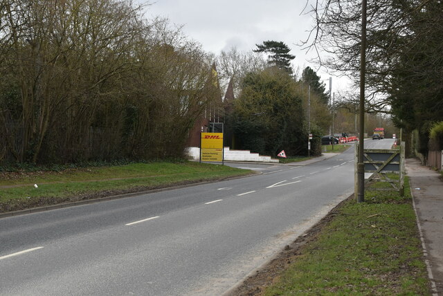
Barming Heath is a small village located in the county of Kent, in southeastern England. Situated approximately 3 miles west of Maidstone, it is nestled between the River Medway to the east and the A26 road to the west. The village falls within the borough of Maidstone and is part of the larger civil parish of Barming.

The main feature of Barming Heath is its picturesque rural setting, characterized by rolling countryside and farmland. The village itself consists of a small cluster of houses and cottages, many of which showcase traditional Kentish architecture. The community is primarily residential, with a tight-knit population that enjoys a peaceful and tranquil atmosphere.

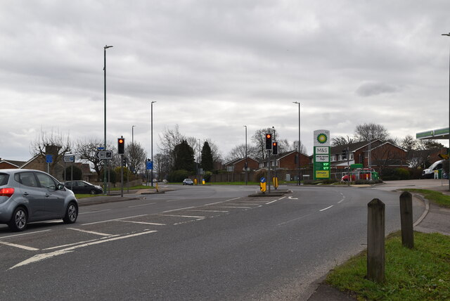
Despite its small size, Barming Heath benefits from its close proximity to larger towns and cities. Maidstone, the county town of Kent, offers a range of amenities including shopping centers, restaurants, and leisure facilities, all within a short drive. In addition, the surrounding area provides ample opportunities for outdoor activities such as hiking, cycling, and boating along the River Medway.

Barming Heath is served by a number of transportation links, including regular bus services that connect the village to nearby towns. The M20 motorway is also easily accessible, providing convenient connections to London and the rest of the United Kingdom. Overall, Barming Heath offers a quaint and idyllic rural living experience, while still providing easy access to urban conveniences.

If you have any feedback on the listing, please let us know in the comments section below.

Barming Heath Images

Images are sourced within 2km of 51.270067/0.47934 or Grid Reference TQ7355. Thanks to Geograph Open Source API. All images are credited.

Semi enclosed Footpath
Footpath junction
Footpath junction
Dog Kennel Wood
Dog Kennel Wood
Winter wheat
Winter wheat
Footpath by Dog Kennel Wood
Dog Kennel Wood
Dog Kennel Wood
Winter wheat
Winter wheat
Stubble field
Stubble field
Footpath across field
Track to Hermitage Lane
Hermitage Lane THe B2246 runs 2 miles from Royal British Legion Village <a href="https://www.geograph.org.uk/photo/7078791">TQ7257 : B2246, A20 junction</a> to Barming, through the western suburbs of Maidstone.
<span class="nowrap"><a title="https://www.sabre-roads.org.uk/wiki/index.php?title=B2246" rel="nofollow ugc noopener" href="https://www.sabre-roads.org.uk/wiki/index.php?title=B2246">Link</a><img style="margin-left:2px;" alt="External link" title="External link - shift click to open in new window" src="https://s1.geograph.org.uk/img/external.png" width="10" height="10"/></span>
Hermitage Lane
THe B2246 runs 2 miles from Royal British Legion Village TQ7257 : B2246, A20 junction to Barming, through the western suburbs of Maidstone. LinkExternal link
A20 The A20 runs from the London Borough of Lewisham to Dover, Kent. It runs through the major towns of Maidstone, Ashford and Folkestone, terminating at the port of Dover.
A20
The A20 runs from the London Borough of Lewisham to Dover, Kent. It runs through the major towns of Maidstone, Ashford and Folkestone, terminating at the port of Dover.
M&S Simply food, BP filling station, A20 Marks and Spencer (M&S) was founded in Leeds in 1894 by Michael Marks and Thomas Spencer.

Marks, a polish immigrant began 'Marks Penny Bazaar' in Hartlepool and in 1884 moved to Leeds where he set up a market stall. Thomas Spencer joined him in 1894 when they set up 'Marks and Spencer'.

M&S are primarily known for selling clothing and food, where for many years they sold both under their own labels. There are still the largest clothing retailer in the UK.

In 2009 M&S had over 600 stores in the UK and 285 internationally.
M&S Simply food, BP filling station, A20
Marks and Spencer (M&S) was founded in Leeds in 1894 by Michael Marks and Thomas Spencer. Marks, a polish immigrant began 'Marks Penny Bazaar' in Hartlepool and in 1884 moved to Leeds where he set up a market stall. Thomas Spencer joined him in 1894 when they set up 'Marks and Spencer'. M&S are primarily known for selling clothing and food, where for many years they sold both under their own labels. There are still the largest clothing retailer in the UK. In 2009 M&S had over 600 stores in the UK and 285 internationally.
Urban footpath
Urban footpath
Headingley Rd
Headingley Rd
Show me another place!

Barming Heath is located at Grid Ref: TQ7355 (Lat: 51.270067, Lng: 0.47934)

Administrative County: Kent

District: Maidstone

Police Authority: Kent

What 3 Words

///secure.kicks.wings. Near Maidstone, Kent

Related Wikis

Oakwood Hospital

Oakwood Hospital in Barming Heath near Maidstone, England was a psychiatric hospital founded in 1833 as the Kent County Lunatic Asylum. Following transfer...

Maidstone Hospital

Maidstone Hospital is a hospital in Barming, Maidstone, England. It is managed by the Maidstone and Tunbridge Wells NHS Trust. == History == The hospital...
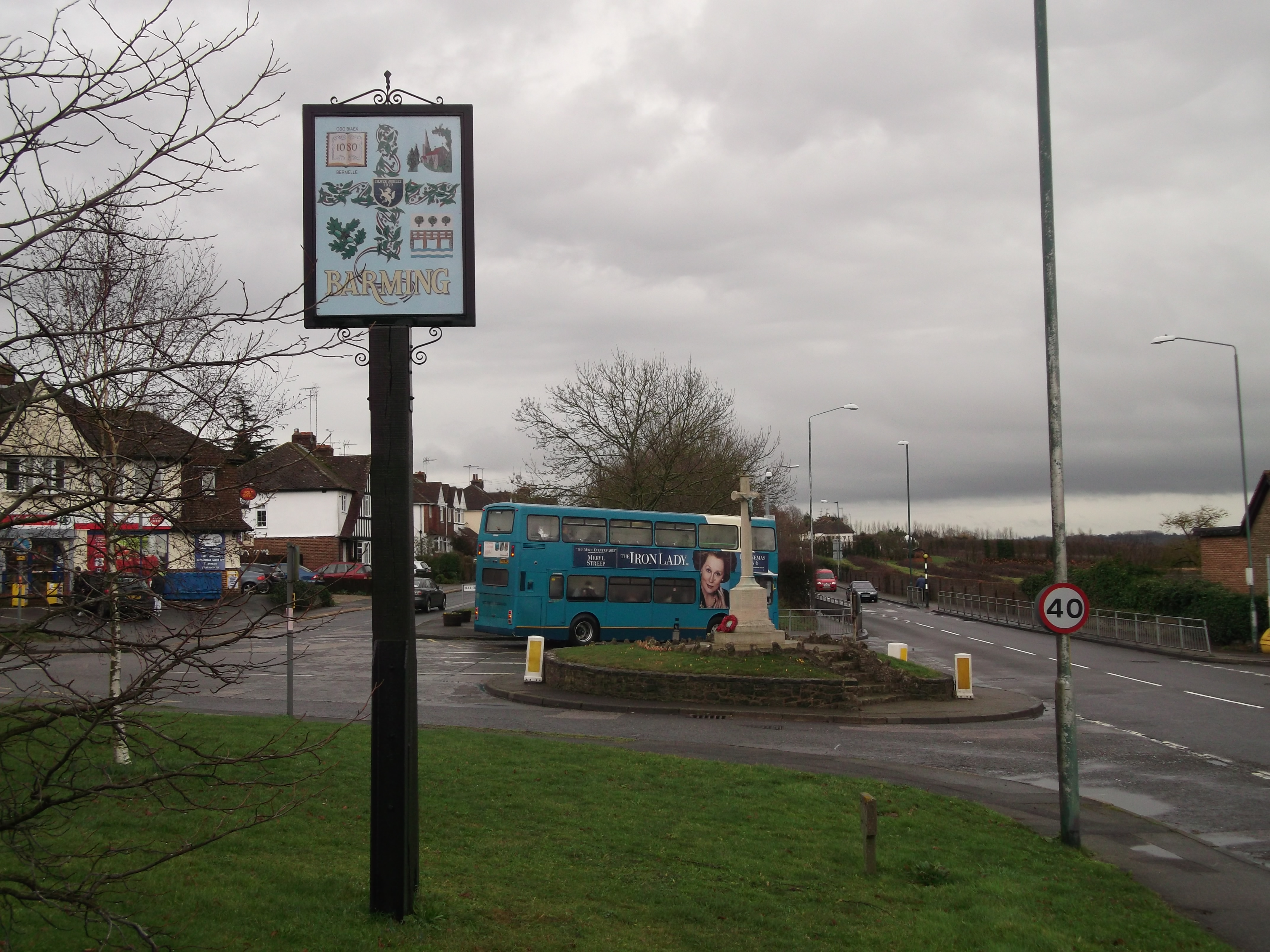
Barming

Barming is a civil parish in the Maidstone District of Kent, England. It lies to the west of Maidstone and at the 2011 census had a population of 2,690...

St Simon Stock Catholic School

St Simon Stock Catholic School is a mixed secondary school and sixth form with academy status, located in Maidstone, Kent, England. It was founded in 1967...

Kent Institute of Art & Design

The Kent Institute of Art & Design (KIAD, often ) was an art school based across three campuses in the county of Kent, in the United Kingdom. It was formed...

St Augustine Academy, Maidstone

St Augustine Academy is a coeducational secondary school with academy status, located in Maidstone, Kent. It is currently rated by Ofsted as 'Good' and...

Oakwood Park Grammar School

Oakwood Park Grammar School is a boys grammar school with academy status located in Maidstone, United Kingdom, the school is co-educational in the sixth...

Barming railway station

Barming railway station is located in Tonbridge and Malling Borough, west of Maidstone in Kent, England, and approximately 1 mile from Barming and Maidstone...

Nearby Amenities

Located within 500m of 51.270067,0.47934
Barming Heath
Created By: Potlatch 0.10f
Place: suburb
Source: npe
Wikidata: Q4861271
Lat/Long: 51.2688431/0.4764008
Turning Circle
Lat/Long: 51.2677229/0.4829889
Traffic Signals
Lat/Long: 51.2722926/0.4825983
Mini Roundabout
Direction: clockwise
Lat/Long: 51.2723263/0.4841187
Barrier: bollard
Lat/Long: 51.2722515/0.4844114
Post Box
Ref: ME16 132
Lat/Long: 51.2679551/0.4805541
Pub
Duke of Edingburgh
Addr City: Barming
Addr Housenumber: 1
Addr Street: Heath Road
Brewery: yes
Smoking: outside
Lat/Long: 51.2676289/0.4828641
Tesco Express
Addr Housename: Hermitage Walk
Addr Postcode: ME16 9NZ
Addr Street: Hermitage Lane
Addr Unit: Unit 7
Brand: Tesco Express
Brand Wikidata: Q98456772
Contact Website: https://www.tesco.com/store-locator/maidstone/1-hermitage-walk
Fhrs Id: 721173
Shop: convenience
Lat/Long: 51.2721545/0.4828182
Fast Food
Domino's
Addr Country: GB
Brand: Domino's
Brand Wikidata: Q839466
Brand Wikipedia: en:Domino's Pizza
Contact Website: https://www.dominos.co.uk/pizza-near-me/maidstone/unit-6-hermitage-walk
Cuisine: pizza
Takeaway: yes
Lat/Long: 51.2721508/0.4830111
Ladbrokes
Brand: Ladbrokes
Brand Wikidata: Q1799875
Brand Wikipedia: en:Ladbrokes Coral
Shop: bookmaker
Lat/Long: 51.2721394/0.4832499
Restaurant
Delivery Kitchen
Addr City: Maidstone
Addr Housename: Unit 4 Oakwood Park
Addr Postcode: ME16 9NZ
Addr Street: Hermitage Lane
Cuisine: mixed
Diet Mixed: yes
Source: survey
Lat/Long: 51.2721053/0.4835
Fast Food
Subway
Brand: Subway
Brand Wikidata: Q244457
Brand Wikipedia: en:Subway (restaurant)
Contact Website: https://restaurants.subway.com/united-kingdom/en/maidstone/12-robinson-avenue
Cuisine: sandwich
Takeaway: yes
Lat/Long: 51.2721091/0.4837085
Veterinary
Trinity Centre Vets
Lat/Long: 51.2721129/0.4838677
Priority House
Building: yes
Source: audio
Lat/Long: 51.2729548/0.4848422
The College Practice, Barming
Building: yes
Lat/Long: 51.26992/0.4828818
Barrier: bollard
Lat/Long: 51.270479/0.4845796
Traffic Calming: cushion
Lat/Long: 51.2697446/0.4854374
Barrier: bollard
Lat/Long: 51.2715835/0.4835499
Dempson Hermitage Mills
Building: yes
Lat/Long: 51.2715078/0.4820142
Addr Street: Sage Court
Note: FIXME Approximate Pos
Lat/Long: 51.2710154/0.4831452
Barrier: bollard
Lat/Long: 51.2711804/0.4835509
The Chapel
Building: yes
Note: Church converted to residential
Lat/Long: 51.270148/0.4862373
Blenheim Gate
Addr Street: Blenheim Gate
Note: FIXME Approximate Pos
Lat/Long: 51.2705776/0.4859914
Blenheim Gate
Power: substation
Ref: 39-4442
Lat/Long: 51.2699151/0.4863219
Parking
Access: private
Lat/Long: 51.2696658/0.4863292
Mini Roundabout
Direction: clockwise
Lat/Long: 51.2695884/0.4852529
Parking
Access: private
Lat/Long: 51.269483/0.4845053
Parking
Access: private
Lat/Long: 51.2701627/0.4853125
Barrier: bollard
Lat/Long: 51.2697513/0.4834653
Langley House
Building: yes
Lat/Long: 51.270495/0.4830349
Oakwood
Power: substation
Ref: 39-4584
Lat/Long: 51.2706747/0.484365
Post Box
Ref: ME16 453
Lat/Long: 51.2706349/0.4843639
Barrier: bollard
Lat/Long: 51.2713194/0.4845506
Bus Stop
Fountain Lane
Local Ref: B
Naptan AtcoCode: 2400A000370A
Naptan Bearing: N
Naptan CommonName: Fountain Lane
Naptan Indicator: Stop B
Naptan Landmark: Heath Grove
Naptan NaptanCode: kntadmap
Naptan PlusbusZoneRef: MSTONEB
Naptan Street: Fountain Lane
Naptan Verified: no
Public Transport: platform
Ref: kntadmap
Source: naptan_import
Source Date: 2018-02-22T10:24:00
Lat/Long: 51.2662686/0.4828153
Bus Stop
Heath Grove
Naptan AtcoCode: 2400A002320A
Naptan Bearing: E
Naptan CommonName: Heath Grove
Naptan Indicator: opp
Naptan Landmark: Heath Grove
Naptan NaptanCode: kntagadp
Naptan PlusbusZoneRef: MSTONEB
Naptan Street: Heath Road
Naptan Verified: no
Public Transport: platform
Ref: kntagadp
Source: naptan_import
Source Date: 2018-05-02T15:02:00
Lat/Long: 51.2677446/0.48149
Bus Stop
Heath Grove
Naptan AtcoCode: 2400A002330A
Naptan Bearing: W
Naptan CommonName: Heath Grove
Naptan Indicator: adj
Naptan Landmark: Heath Grove
Naptan NaptanCode: kntagadt
Naptan PlusbusZoneRef: MSTONEB
Naptan Street: Heath Road
Naptan Verified: no
Public Transport: platform
Ref: kntagadt
Source: naptan_import
Source Date: 2018-05-02T15:01:00
Lat/Long: 51.2676169/0.4819992
Bus Stop
Long Rede Lane
Naptan AtcoCode: 2400A002340A
Naptan Bearing: E
Naptan CommonName: Long Rede Lane
Naptan Indicator: adj
Naptan Landmark: Long Rede Lane
Naptan NaptanCode: kntagadw
Naptan PlusbusZoneRef: MSTONEB
Naptan Street: Heath Road
Public Transport: platform
Ref: kntagadw
Source: naptan_import
Source Date: 2018-05-02T15:04:00
Lat/Long: 51.267756/0.4784083
Bus Stop
Long Rede Lane
Naptan AtcoCode: 2400A002350A
Naptan Bearing: W
Naptan CommonName: Long Rede Lane
Naptan Indicator: opp
Naptan Landmark: Long Rede Lane
Naptan NaptanCode: kntagaga
Naptan PlusbusZoneRef: MSTONEB
Naptan Street: Heath Road
Public Transport: platform
Ref: kntagaga
Source: naptan_import
Source Date: 2018-05-02T15:05:00
Lat/Long: 51.2676336/0.478244
Bus Stop
Banky Meadow
Naptan AtcoCode: 2400A002360A
Naptan Bearing: W
Naptan CommonName: Banky Meadow
Naptan Indicator: opp
Naptan Landmark: Banky Meadow
Naptan NaptanCode: kntagagd
Naptan PlusbusZoneRef: MSTONEB
Naptan Street: Heath Road
Naptan Verified: no
Public Transport: platform
Ref: kntagagd
Source: naptan_import
Source Date: 2018-02-22T09:55:00
Lat/Long: 51.2678518/0.4760049
Bus Stop
Banky Meadow
Naptan AtcoCode: 2400A002370A
Naptan Bearing: E
Naptan CommonName: Banky Meadow
Naptan Indicator: adj
Naptan Landmark: Banky Meadow
Naptan NaptanCode: kntagagj
Naptan PlusbusZoneRef: MSTONEB
Naptan Street: Heath Road
Naptan Verified: no
Public Transport: platform
Ref: kntagagj
Source: naptan_import
Source Date: 2018-02-22T09:54:00
Lat/Long: 51.2681095/0.475302
Bus Stop
Beverley Road Shops
Naptan AtcoCode: 2400A002380A
Naptan Bearing: SE
Naptan CommonName: Beverley Road Shops
Naptan Indicator: o/s
Naptan Landmark: Beverley Road Shops
Naptan NaptanCode: kntagagm
Naptan PlusbusZoneRef: MSTONEB
Naptan Street: Beverley Road
Naptan Verified: no
Public Transport: platform
Ref: kntagagm
Source: naptan_import
Source Date: 2018-02-22T10:03:00
Lat/Long: 51.2665371/0.4765077
Bus Stop
Oakapple Lane
Naptan AtcoCode: 2400A002400A
Naptan Bearing: N
Naptan CommonName: Oakapple Lane
Naptan Indicator: adj
Naptan Landmark: Oakapple Lane
Naptan NaptanCode: kntagagt
Naptan PlusbusZoneRef: MSTONEB
Naptan Street: Hermitage Lane
Naptan Verified: no
Public Transport: platform
Ref: kntagagt
Source: naptan_import
Source Date: 2018-05-02T15:12:00
Lat/Long: 51.2707727/0.4824704
Bus Stop
Maidstone Hospital
Bus: yes
Naptan AtcoCode: 2400A002410A
Naptan Bearing: S
Naptan CommonName: Maidstone Hospital
Naptan Indicator: arrivals
Naptan Landmark: Maidstone Hospital
Naptan NaptanCode: kntagagw
Naptan PlusbusZoneRef: MSTONEB
Naptan Street: Maidstone Hospital Grounds
Naptan Verified: no
Public Transport: platform
Ref: kntagagw
Source: naptan_import
Source Date: 2018-05-02T15:07:00
Lat/Long: 51.2738332/0.4831946
Bus Stop
Maidstone Hospital
Bus: yes
Naptan AtcoCode: 2400A002420A
Naptan Bearing: S
Naptan CommonName: Maidstone Hospital
Naptan Indicator: adj
Naptan Landmark: Maidstone Hospital
Naptan NaptanCode: kntagaja
Naptan PlusbusZoneRef: MSTONEB
Naptan Street: Maidstone Hospital Grounds
Naptan Verified: no
Public Transport: platform
Ref: kntagaja
Source: naptan_import
Source Date: 2018-05-02T15:10:00
Lat/Long: 51.2736436/0.4832274
Bus Stop
Maidstone Hospital
Bus: yes
Naptan AtcoCode: 2400A002430A
Naptan Bearing: S
Naptan CommonName: Maidstone Hospital
Naptan Indicator: o/s
Naptan Landmark: Maidstone Hospital
Naptan NaptanCode: kntagajd
Naptan PlusbusZoneRef: MSTONEB
Naptan Street: Maidstone Hospital Grounds
Naptan Verified: no
Public Transport: platform
Ref: kntagajd
Source: naptan_import
Source Date: 2018-05-02T15:09:00
Lat/Long: 51.27377/0.4832055
Bus Stop
Oakapple Lane
Naptan AtcoCode: 2400A033950A
Naptan Bearing: S
Naptan CommonName: Oakapple Lane
Naptan Indicator: opp
Naptan Landmark: Oakapple Lane
Naptan NaptanCode: kntdmama
Naptan PlusbusZoneRef: MSTONEB
Naptan Street: Hermitage Lane
Naptan Verified: no
Public Transport: platform
Ref: kntdmama
Source: naptan_import
Source Date: 2018-05-02T15:13:00
Lat/Long: 51.2709571/0.482681
Old Phone: +441622728076
Removed Amenity: telephone
Lat/Long: 51.2665846/0.4767991
Post Box
Operator: Royal Mail
Post Box Type: pillar
Ref: ME16 179
Lat/Long: 51.266701/0.4763017
Heath Road
Power: substation
Ref: 392301
Lat/Long: 51.2682909/0.4739993
Turning Circle
Lat/Long: 51.2694998/0.4742971
Post Box
Ref: ME16 378
Lat/Long: 51.2696968/0.4732171
Woodleas
Power: substation
Ref: 39-2405
Lat/Long: 51.2672523/0.4778898
Sears
Shop: funeral_directors
Lat/Long: 51.2662182/0.4828409
Village Hall
Barming Village Hall
Building: yes
Lat/Long: 51.2679061/0.4773644
Turning Circle
Lat/Long: 51.2696322/0.4776997
Barrier: bollard
Lat/Long: 51.2687121/0.4804921
Traffic Calming: table
Lat/Long: 51.2697975/0.4799758
Barming Heath
Power: substation
Ref: 392139
Lat/Long: 51.2687601/0.4824485
Turning Circle
Lat/Long: 51.2703714/0.4813212
Traffic Calming: cushion
Lat/Long: 51.2698254/0.4863319
Crossing
Crossing: marked
Lat/Long: 51.2733542/0.4832121
Lynn's Floral Designs
Shop: florist
Lat/Long: 51.2666921/0.4765193
Thyme at The Lemon Tree
Shop: hairdresser
Lat/Long: 51.2667112/0.4764472
Nisa Local
Shop: convenience
Lat/Long: 51.2666533/0.476665
Traffic Calming: table
Lat/Long: 51.2729341/0.4797748
Traffic Calming: table
Lat/Long: 51.2730146/0.4809388
Traffic Signals
Lat/Long: 51.2731308/0.4824367
Barrier: yes
Lat/Long: 51.271757/0.4820935
Barrier: lift_gate
Motor Vehicle: permit
Lat/Long: 51.2738585/0.4829707
Bus Stop
Beverley Road Shops
Naptan AtcoCode: 2400102379
Naptan Bearing: W
Naptan CommonName: Beverley Road Shops
Naptan Indicator: opp
Naptan Landmark: Beverley Road Shops
Naptan NaptanCode: kntgtmjp
Naptan Street: Beverley Road
Public Transport: platform
Ref: kntgtmjp
Source: NAPTAN
Source Date: 2018-02-22T10:04:00
Lat/Long: 51.2665295/0.4760198
Leisure: pitch
Sport: basketball
Lat/Long: 51.2685037/0.4816474
Barnardo's
Brand: Barnardo's
Brand Wikidata: Q2884670
Brand Wikipedia: en:Barnardo's
Shop: charity
Lat/Long: 51.2721089/0.4839393
Barrier: bollard
Lat/Long: 51.2701851/0.4755447
Crossing
Crossing: unmarked
Crossing Markings: no
Lat/Long: 51.2723212/0.4839348
The data included in this document is from www.openstreetmap.org. The data is made available under ODbL.

Have you been to Barming Heath?

Leave your review of Barming Heath below (or comments, questions and feedback).