Cousterberry Hill

Hill, Mountain in Yorkshire Harrogate

England

Cousterberry Hill

Marton cum Grafton, B6265 road junction According to the OS benchmark database there was a benchmark cut into a concrete post at this road junction. Nothing was found and the post is likely gone.
Marton cum Grafton, B6265 road junction Credit: Mel Towler

Cousterberry Hill is a prominent hill located in the picturesque region of Yorkshire, England. Situated in the northern part of the county, it forms part of the expansive North York Moors National Park. Rising to an elevation of approximately 345 meters (1,132 feet), it offers breathtaking panoramic views of the surrounding countryside.

The hill's distinct prominence is attributed to its position within the Cleveland Hills, a range known for its rugged beauty and diverse wildlife. Cousterberry Hill's slopes boast a rich tapestry of heather moorland, grassy meadows, and scattered woodland, making it an ideal habitat for various species of flora and fauna.

Hikers and nature enthusiasts are drawn to Cousterberry Hill due to its extensive network of well-maintained footpaths and trails. The renowned Cleveland Way, a long-distance footpath, passes close to the hill's summit, offering visitors the opportunity to explore the area's stunning natural beauty.

In addition to its natural allure, Cousterberry Hill holds historical significance. The hill is home to the remains of an Iron Age hillfort, serving as a testament to its ancient past. Archaeological excavations have uncovered artifacts and evidence of human activity dating back thousands of years, providing valuable insights into the region's early inhabitants.

Whether it is the captivating views, diverse wildlife, or historical intrigue, Cousterberry Hill offers visitors an immersive experience in the heart of Yorkshire's natural and cultural heritage.

If you have any feedback on the listing, please let us know in the comments section below.

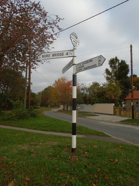
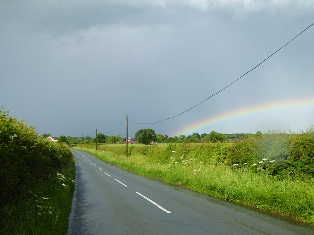
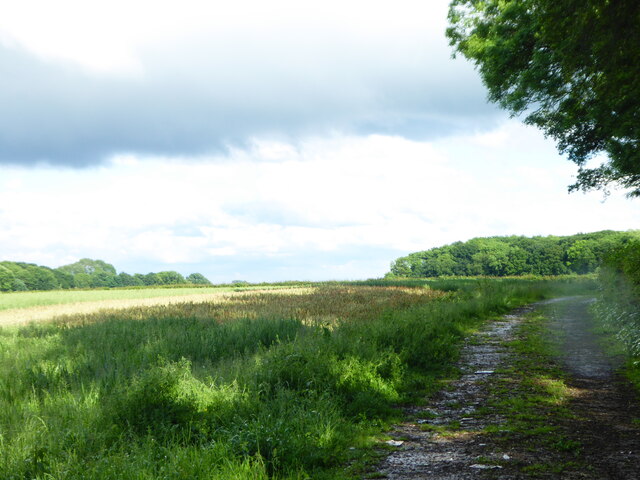
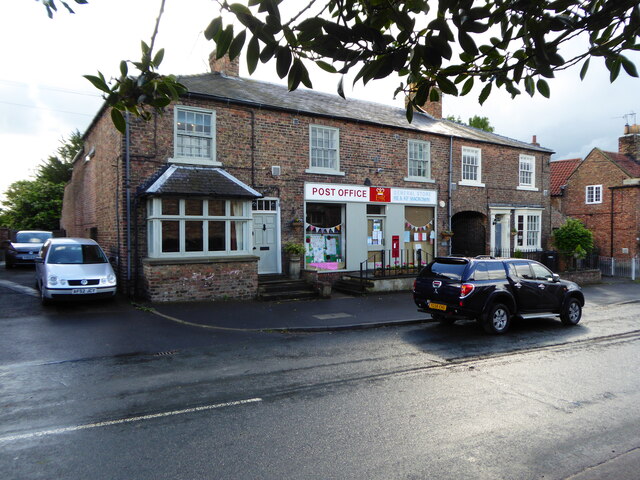
Cousterberry Hill Images

Images are sourced within 2km of 54.056537/-1.321267 or Grid Reference SE4462. Thanks to Geograph Open Source API. All images are credited.

Marton cum Grafton, B6265 road junction According to the OS benchmark database there was a benchmark cut into a concrete post at this road junction. Nothing was found and the post is likely gone.
Marton cum Grafton, B6265 road junction
According to the OS benchmark database there was a benchmark cut into a concrete post at this road junction. Nothing was found and the post is likely gone.
Direction Sign – Signpost on Main Street, Great Ouseburn Located on the north side of the junction of Main Street and Seggans Road in Great Ouseburn parish. 3 arms and annulus & bar finial. Repainted since 2019, see <a title="https://www.geograph.org.uk/photo/6545973" href="https://www.geograph.org.uk/photo/6545973">Link</a>.

Milestone Society National ID: YW_SE4462
Direction Sign – Signpost on Main Street, Great Ouseburn
Located on the north side of the junction of Main Street and Seggans Road in Great Ouseburn parish. 3 arms and annulus & bar finial. Repainted since 2019, see Link. Milestone Society National ID: YW_SE4462
Boat Lane, approaching Aldwark toll bridge
Mill Lane Leading to Sugar Hills Plantation.
Mill Lane
Leading to Sugar Hills Plantation.
Great Ouseburn Post office
Great Ouseburn village hall Serving as a polling station for the June 2017 General Election.
Great Ouseburn village hall
Serving as a polling station for the June 2017 General Election.
Great Ouseburn village green
Yeoman's Cottage Great Ouseburn Dating from 1637.
Yeoman's Cottage Great Ouseburn
Dating from 1637.
Detail of Yeoman's Cottage See <a href="https://www.geograph.org.uk/photo/7365674">SE4561 : Yeoman's Cottage Great Ouseburn</a> for context.
Detail of Yeoman's Cottage
Church Field Lane
Church Field Lane
Small field off Church Lane
Field near Kirby Villa Looking across sheep pasture beside Thorpe Green Lane.
Field near Kirby Villa
Looking across sheep pasture beside Thorpe Green Lane.
Road signs near New Lodge Situated at the road junction for Little Ouseburn on the road between Thorpe Underwood and Great Ouseburn.
Road signs near New Lodge
Situated at the road junction for Little Ouseburn on the road between Thorpe Underwood and Great Ouseburn.
Little Ouseburn Bridge Crossing Ouse Gill Beck.
Little Ouseburn Bridge
Crossing Ouse Gill Beck.
New Road Looking towards the junction of New Road with Boat Lane and Main Street.
New Road
Looking towards the junction of New Road with Boat Lane and Main Street.
Main Street, Great Ouseburn Looking towards cottages at the south end of the village.
Main Street, Great Ouseburn
Looking towards cottages at the south end of the village.
Horses on Main Street Looking along Main Street in Great Ouseburn.
Horses on Main Street
Looking along Main Street in Great Ouseburn.
Cottages on Main Street Near the cottage on the right are blue plaques (in Russian and English) commemorating an air crash. For more information see: <span class="nowrap"><a title="https://www.yorkshire-aircraft.co.uk/aircraft/yorkshire/york42/r2764.html" rel="nofollow ugc noopener" href="https://www.yorkshire-aircraft.co.uk/aircraft/yorkshire/york42/r2764.html">Link</a><img style="margin-left:2px;" alt="External link" title="External link - shift click to open in new window" src="https://s1.geograph.org.uk/img/external.png" width="10" height="10"/></span>
Cottages on Main Street
Near the cottage on the right are blue plaques (in Russian and English) commemorating an air crash. For more information see: LinkExternal link
Show me another place!

Cousterberry Hill is located at Grid Ref: SE4462 (Lat: 54.056537, Lng: -1.321267)

Division: West Riding

Administrative County: North Yorkshire

District: Harrogate

Police Authority: North Yorkshire

What 3 Words

///rash.weeps.purse. Near Linton upon Ouse, North Yorkshire

Related Wikis

Great Ouseburn

Great Ouseburn is a village and civil parish in the Harrogate district of North Yorkshire, England. It is situated 4 miles (6 km) south-east of Boroughbridge...

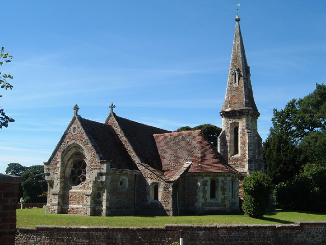
St Mary the Virgin's Church, Great Ouseburn

St Mary the Virgin's Church is in the village of Great Ouseburn, North Yorkshire, England. It is an active Anglican parish church in the deanery of Ripon...
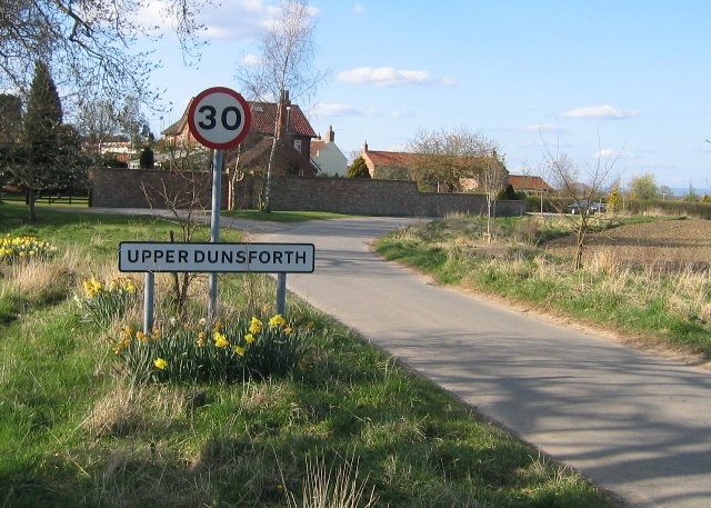
Upper Dunsforth

Upper Dunsforth is a village in located in the civil parish of Dunsforths, in the Borough of Harrogate of North Yorkshire, England. It was mentioned in...

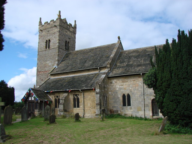
Holy Trinity Church, Little Ouseburn

Holy Trinity Church stands to the northeast of the village of Little Ouseburn, North Yorkshire, England. It is an Anglican parish church in the deanery...

Little Ouseburn

Little Ouseburn is a small village and civil parish in the Harrogate district of North Yorkshire, England. It is situated near the A1(M) motorway and 6...

Lower Dunsforth

Lower Dunsforth is a village in the civil parish of Dunsforths, in North Yorkshire, England. It was recorded in the Domesday Book (1086) as Doneforde/Dunesford/Dunesforde...

Dunsforths

Dunsforths is a civil parish in the Borough of Harrogate of North Yorkshire, England. In 2011, the civil parish had 224 inhabitants. It consists of Lower...

Aldwark, Hambleton

Aldwark is a village and civil parish in the Hambleton District of North Yorkshire, England. It is situated on the River Ouse about 14 miles from York...

Nearby Amenities

Located within 500m of 54.056537,-1.321267
Bus Stop
Bench: no
Bin: no
Lit: yes
Name Signed: no
Naptan AtcoCode: 3200YNA01367
Naptan NaptanCode: 32001367
Shelter: no
Tactile Paving: no
Lat/Long: 54.05497/-1.3284428
Generator Method: photovoltaic
Generator Output Electricity: yes
Generator Source: solar
Generator Type: solar_photovoltaic_panel
Power: generator
Lat/Long: 54.0521767/-1.3222095
Generator Method: photovoltaic
Generator Output Electricity: yes
Generator Source: solar
Generator Type: solar_photovoltaic_panel
Power: generator
Lat/Long: 54.0522308/-1.3222962
Generator Method: photovoltaic
Generator Output Electricity: yes
Generator Source: solar
Generator Type: solar_photovoltaic_panel
Power: generator
Lat/Long: 54.0522941/-1.3224042
Generator Method: photovoltaic
Generator Output Electricity: yes
Generator Source: solar
Generator Type: solar_photovoltaic_panel
Power: generator
Lat/Long: 54.0523284/-1.3224679
Defibrillator
Defibrillator Location: outside Great Ouseburn Village hall - facing car park
Emergency: defibrillator
Indoor: no
Lat/Long: 54.053162/-1.3198335
Addr City: York
Addr Housenumber: 1
Addr Postcode: YO26 9AG
Addr Street: Egglestone Close
Addr Suburb: Great Ouseburn
Lat/Long: 54.0531401/-1.3239159
Addr City: York
Addr Housenumber: 7
Addr Postcode: YO26 9AG
Addr Street: Egglestone Close
Addr Suburb: Great Ouseburn
Lat/Long: 54.0532504/-1.3243049
Addr City: York
Addr Housenumber: 19
Addr Postcode: YO26 9AG
Addr Street: Egglestone Close
Addr Suburb: Great Ouseburn
Lat/Long: 54.0525024/-1.3239455
Addr City: York
Addr Housenumber: 9
Addr Postcode: YO26 9AG
Addr Street: Egglestone Close
Addr Suburb: Great Ouseburn
Lat/Long: 54.0529512/-1.3243236
Addr City: York
Addr Housenumber: 2
Addr Postcode: YO26 9AG
Addr Street: Egglestone Close
Addr Suburb: Great Ouseburn
Lat/Long: 54.0525859/-1.324506
Addr City: York
Addr Housenumber: 1
Addr Postcode: YO26 9AH
Addr Street: Rudforth Place
Addr Suburb: Great Ouseburn
Lat/Long: 54.0528757/-1.324618
Addr City: York
Addr Housenumber: 3
Addr Postcode: YO26 9AH
Addr Street: Rudforth Place
Addr Suburb: Great Ouseburn
Lat/Long: 54.0526175/-1.3250241
Crossing
Lat/Long: 54.0522534/-1.320567
Crossing
Lat/Long: 54.0535032/-1.3242731
The data included in this document is from www.openstreetmap.org. The data is made available under ODbL.

Have you been to Cousterberry Hill?

Leave your review of Cousterberry Hill below (or comments, questions and feedback).