Hill of Girlsta

Hill, Mountain in Shetland

Scotland

Hill of Girlsta

Boat on the shore of a frozen Loch of Girlsta
Boat on the shore of a frozen Loch of Girlsta Credit: Mike Pennington

The Hill of Girlsta is a prominent landmark located in the Shetland Islands, off the northeast coast of Scotland. This hill, also known as a mountain in local terms, rises to an elevation of approximately 262 meters (860 feet) above sea level. It is situated on the mainland of Shetland, near the village of Girlsta.

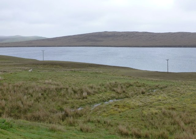
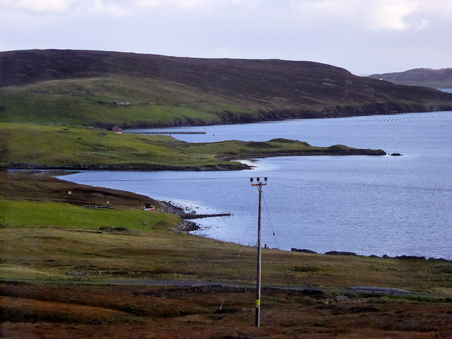
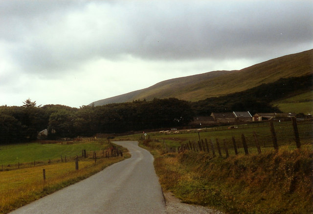
The Hill of Girlsta is characterized by its distinctive shape and rugged terrain. Its slopes are covered in heather, grasses, and scattered rocks, while its summit offers breathtaking panoramic views of the surrounding landscapes. On a clear day, visitors can enjoy vistas of the North Sea, neighboring hills, and the picturesque coastline.

The hill is a popular destination for outdoor enthusiasts, hikers, and nature lovers. Several well-marked trails and paths wind their way up the hill, providing a variety of routes for exploration. The ascent can be challenging, particularly in adverse weather conditions, but the stunning vistas and sense of accomplishment make it worthwhile.

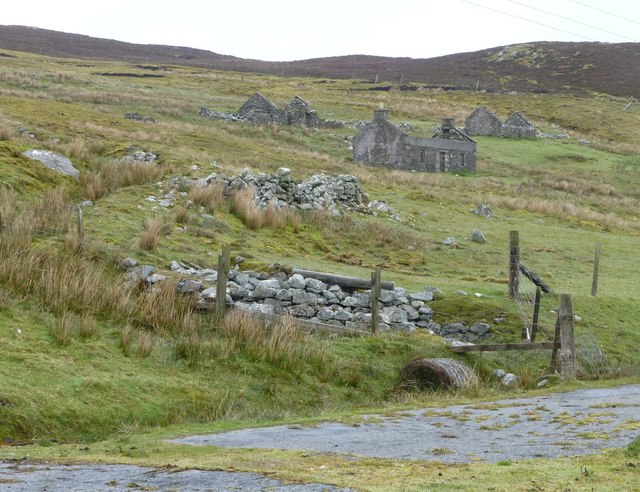
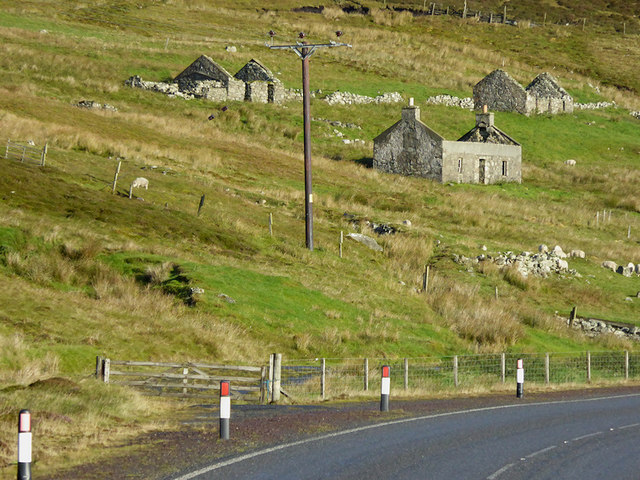
In addition to its natural beauty, the Hill of Girlsta holds historical and cultural significance. It is believed to have been an important site during ancient times, possibly for ceremonial or ritual purposes. Archaeological investigations have uncovered traces of human activity, including burial mounds and stone structures, further adding to its allure.

Overall, the Hill of Girlsta stands as an impressive natural landmark in the Shetland Islands, offering visitors a chance to connect with nature, enjoy breathtaking views, and delve into the rich history of the region.

If you have any feedback on the listing, please let us know in the comments section below.

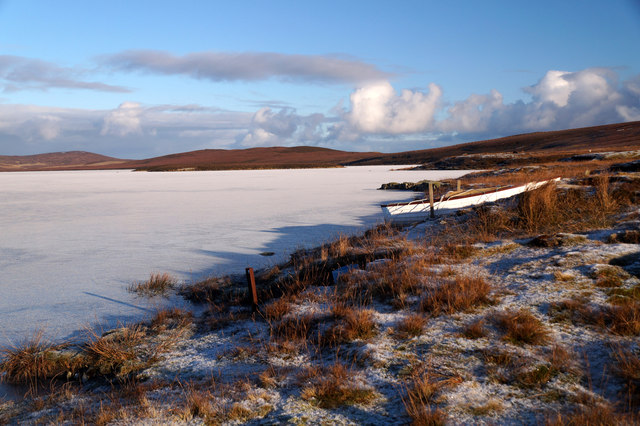
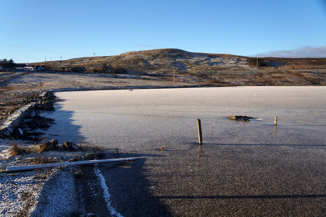
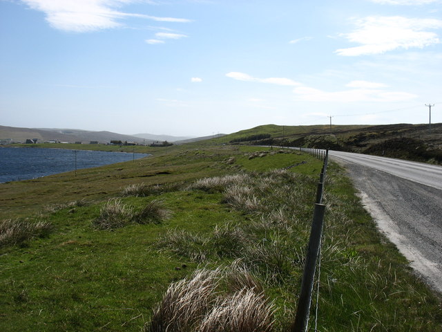
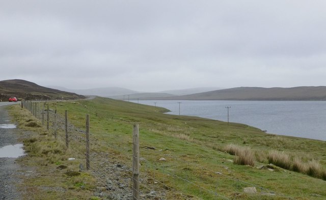
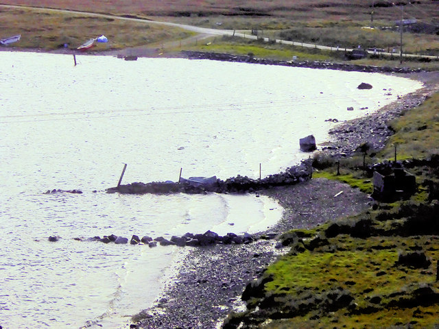
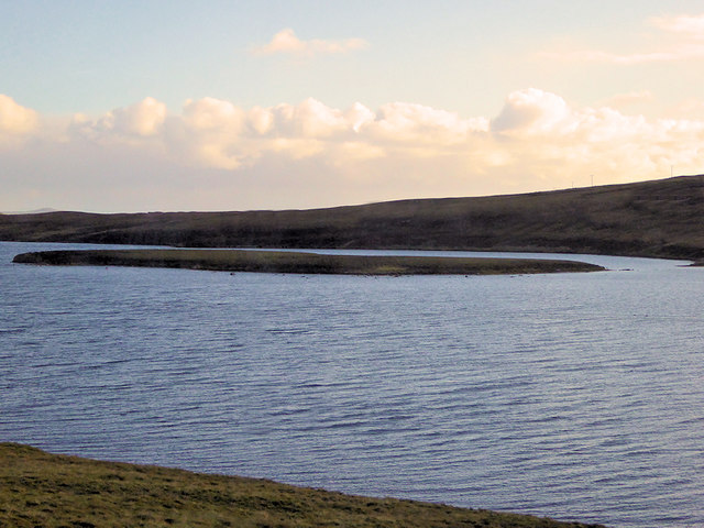
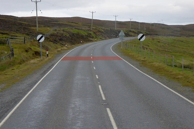
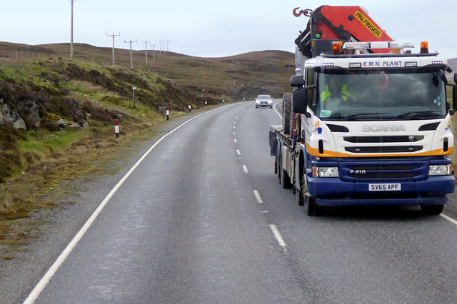
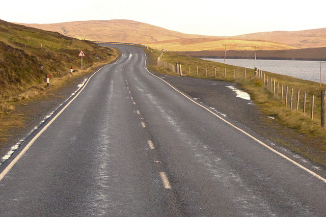
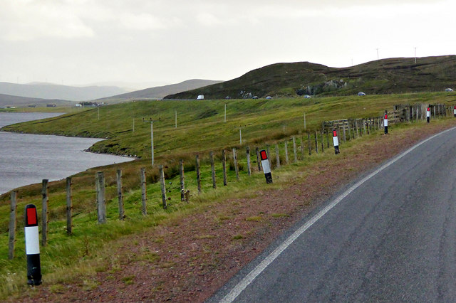
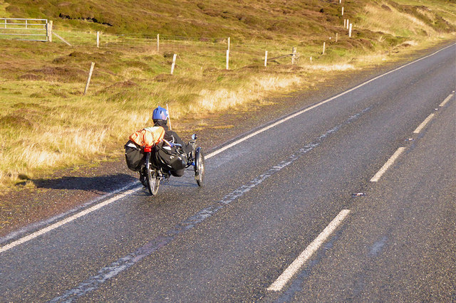
Hill of Girlsta Images

Images are sourced within 2km of 60.242067/-1.2364217 or Grid Reference HU4251. Thanks to Geograph Open Source API. All images are credited.

Boat on the shore of a frozen Loch of Girlsta
Frozen outflow from Loch of Girlsta
The A970 heading for Lerwick The Loch of Girlsta is on the left.
The A970 heading for Lerwick
The Loch of Girlsta is on the left.
Loch of Girlsta From a convenient lay-by on the A970.
When the many good new roads were built on Shetland using 'oil money' the old winding roads made good lay-bys.
Loch of Girlsta
From a convenient lay-by on the A970. When the many good new roads were built on Shetland using 'oil money' the old winding roads made good lay-bys.
Deserted settlement of Bretto A familiar scene in many parts of Shetland.
Making a living off the land and sea must have been very hard, 
the weather did not help either!
Deserted settlement of Bretto
A familiar scene in many parts of Shetland. Making a living off the land and sea must have been very hard, the weather did not help either!
Soggy moorland Leading down to Loch of Girlsta.
Soggy moorland
Leading down to Loch of Girlsta.
The Junction Bus Stop near Girlsta The A970 runs for 71 miles across most of the length of the "Mainland" in the Shetland Islands. It is a good-quality single-carriageway road for most of its route. Travelling from south to north, the road begins at Grutness near Sumburgh Airport and winds around the many hills and inlets passing close to a number of small villages without going through any large ones before Lerwick. After looping around Lerwick, a short spur runs to Scalloway whilst the main route continues northwards towards Brae where it crosses the narrow isthmus of Mavis Grind. At Sandy Lochs the road splits and a four-mile spur goes through Urafirth to Hillswick. The main route continuing to the right towards its northern terminus at Isbister. This last part of the route tends to be narrower with passing places.

<span class="nowrap"><a title="https://www.sabre-roads.org.uk/wiki/index.php?title=A970" rel="nofollow ugc noopener" href="https://www.sabre-roads.org.uk/wiki/index.php?title=A970">Link</a><img style="margin-left:2px;" alt="External link" title="External link - shift click to open in new window" src="https://s1.geograph.org.uk/img/external.png" width="10" height="10"/></span>  SABRE
The Junction Bus Stop near Girlsta
The A970 runs for 71 miles across most of the length of the "Mainland" in the Shetland Islands. It is a good-quality single-carriageway road for most of its route. Travelling from south to north, the road begins at Grutness near Sumburgh Airport and winds around the many hills and inlets passing close to a number of small villages without going through any large ones before Lerwick. After looping around Lerwick, a short spur runs to Scalloway whilst the main route continues northwards towards Brae where it crosses the narrow isthmus of Mavis Grind. At Sandy Lochs the road splits and a four-mile spur goes through Urafirth to Hillswick. The main route continuing to the right towards its northern terminus at Isbister. This last part of the route tends to be narrower with passing places. LinkExternal link SABRE
Motorcyclists on the A970 near Girlsta The A970 runs for 71 miles across most of the length of the "Mainland" in the Shetland Islands. It is a good-quality single-carriageway road for most of its route. Travelling from south to north, the road begins at Grutness near Sumburgh Airport and winds around the many hills and inlets passing close to a number of small villages without going through any large ones before Lerwick. After looping around Lerwick, a short spur runs to Scalloway whilst the main route continues northwards towards Brae where it crosses the narrow isthmus of Mavis Grind. At Sandy Lochs the road splits and a four-mile spur goes through Urafirth to Hillswick. The main route continuing to the right towards its northern terminus at Isbister. This last part of the route tends to be narrower with passing places.

<span class="nowrap"><a title="https://www.sabre-roads.org.uk/wiki/index.php?title=A970" rel="nofollow ugc noopener" href="https://www.sabre-roads.org.uk/wiki/index.php?title=A970">Link</a><img style="margin-left:2px;" alt="External link" title="External link - shift click to open in new window" src="https://s1.geograph.org.uk/img/external.png" width="10" height="10"/></span>  SABRE
Motorcyclists on the A970 near Girlsta
The A970 runs for 71 miles across most of the length of the "Mainland" in the Shetland Islands. It is a good-quality single-carriageway road for most of its route. Travelling from south to north, the road begins at Grutness near Sumburgh Airport and winds around the many hills and inlets passing close to a number of small villages without going through any large ones before Lerwick. After looping around Lerwick, a short spur runs to Scalloway whilst the main route continues northwards towards Brae where it crosses the narrow isthmus of Mavis Grind. At Sandy Lochs the road splits and a four-mile spur goes through Urafirth to Hillswick. The main route continuing to the right towards its northern terminus at Isbister. This last part of the route tends to be narrower with passing places. LinkExternal link SABRE
Loch of Girlsta The loch at Girlsta is the deepest in Shetland, at about 65ft deep in places. The name "Girlsta" comes from the Old Norse "Geirhildastadr" - meaning "the place of Geirhilda". Geirhilda was a young Viking princess, daughter of the famous 9th century Viking explorer, Flóki Vilgerðarson. According to local folklore, Geirhilda drowned in the loch after falling through the ice and she is buried on the small island within the loch. 
More information about the story at <span class="nowrap"><a title="https://www.shetlandwithlaurie.com/blog/geirhildrs-loch-a-viking-saga" rel="nofollow ugc noopener" href="https://www.shetlandwithlaurie.com/blog/geirhildrs-loch-a-viking-saga">Link</a><img style="margin-left:2px;" alt="External link" title="External link - shift click to open in new window" src="https://s1.geograph.org.uk/img/external.png" width="10" height="10"/></span> (Shetland with Laurie) and <span class="nowrap"><a title="https://madbassist.wixsite.com/hobbitpaw/folklore" rel="nofollow ugc noopener" href="https://madbassist.wixsite.com/hobbitpaw/folklore">Link</a><img style="margin-left:2px;" alt="External link" title="External link - shift click to open in new window" src="https://s1.geograph.org.uk/img/external.png" width="10" height="10"/></span> (Folklore and Shetland Stories)
Loch of Girlsta
The loch at Girlsta is the deepest in Shetland, at about 65ft deep in places. The name "Girlsta" comes from the Old Norse "Geirhildastadr" - meaning "the place of Geirhilda". Geirhilda was a young Viking princess, daughter of the famous 9th century Viking explorer, Flóki Vilgerðarson. According to local folklore, Geirhilda drowned in the loch after falling through the ice and she is buried on the small island within the loch. More information about the story at LinkExternal link (Shetland with Laurie) and LinkExternal link (Folklore and Shetland Stories)
Girlsta Island The loch at Girlsta is the deepest in Shetland, at about 65ft deep in places. The name "Girlsta" comes from the Old Norse "Geirhildastadr" - meaning "the place of Geirhilda". Geirhilda was a young Viking princess, daughter of the famous 9th century Viking explorer, Flóki Vilgerðarson. According to local folklore Geirhilda drowned in the loch after falling through the ice and she is buried on the small island within the loch. 
More information about the story at <span class="nowrap"><a title="https://www.shetlandwithlaurie.com/blog/geirhildrs-loch-a-viking-saga" rel="nofollow ugc noopener" href="https://www.shetlandwithlaurie.com/blog/geirhildrs-loch-a-viking-saga">Link</a><img style="margin-left:2px;" alt="External link" title="External link - shift click to open in new window" src="https://s1.geograph.org.uk/img/external.png" width="10" height="10"/></span> (Shetland with Laurie) and <span class="nowrap"><a title="https://madbassist.wixsite.com/hobbitpaw/folklore" rel="nofollow ugc noopener" href="https://madbassist.wixsite.com/hobbitpaw/folklore">Link</a><img style="margin-left:2px;" alt="External link" title="External link - shift click to open in new window" src="https://s1.geograph.org.uk/img/external.png" width="10" height="10"/></span> (Folklore and Shetland Stories)
Girlsta Island
The loch at Girlsta is the deepest in Shetland, at about 65ft deep in places. The name "Girlsta" comes from the Old Norse "Geirhildastadr" - meaning "the place of Geirhilda". Geirhilda was a young Viking princess, daughter of the famous 9th century Viking explorer, Flóki Vilgerðarson. According to local folklore Geirhilda drowned in the loch after falling through the ice and she is buried on the small island within the loch. More information about the story at LinkExternal link (Shetland with Laurie) and LinkExternal link (Folklore and Shetland Stories)
A970 near Girlsta The A970 runs for 71 miles across most of the length of the "Mainland" in the Shetland Islands. It is a good-quality single-carriageway road for most of its route. Travelling from south to north, the road begins at Grutness near Sumburgh Airport and winds around the many hills and inlets passing close to a number of small villages without going through any large ones before Lerwick. After looping around Lerwick, a short spur runs to Scalloway whilst the main route continues northwards towards Brae where it crosses the narrow isthmus of Mavis Grind. At Sandy Lochs the road splits and a four-mile spur goes through Urafirth to Hillswick. The main route continuing to the right towards its northern terminus at Isbister. This last part of the route tends to be narrower with passing places.

<span class="nowrap"><a title="https://www.sabre-roads.org.uk/wiki/index.php?title=A970" rel="nofollow ugc noopener" href="https://www.sabre-roads.org.uk/wiki/index.php?title=A970">Link</a><img style="margin-left:2px;" alt="External link" title="External link - shift click to open in new window" src="https://s1.geograph.org.uk/img/external.png" width="10" height="10"/></span>  SABRE
A970 near Girlsta
The A970 runs for 71 miles across most of the length of the "Mainland" in the Shetland Islands. It is a good-quality single-carriageway road for most of its route. Travelling from south to north, the road begins at Grutness near Sumburgh Airport and winds around the many hills and inlets passing close to a number of small villages without going through any large ones before Lerwick. After looping around Lerwick, a short spur runs to Scalloway whilst the main route continues northwards towards Brae where it crosses the narrow isthmus of Mavis Grind. At Sandy Lochs the road splits and a four-mile spur goes through Urafirth to Hillswick. The main route continuing to the right towards its northern terminus at Isbister. This last part of the route tends to be narrower with passing places. LinkExternal link SABRE
Northbound A970 near Girlsta The A970 runs for 71 miles across most of the length of the "Mainland" in the Shetland Islands. It is a good-quality single-carriageway road for most of its route. Travelling from south to north, the road begins at Grutness near Sumburgh Airport and winds around the many hills and inlets passing close to a number of small villages without going through any large ones before Lerwick. After looping around Lerwick, a short spur runs to Scalloway whilst the main route continues northwards towards Brae where it crosses the narrow isthmus of Mavis Grind. At Sandy Lochs the road splits and a four-mile spur goes through Urafirth to Hillswick. The main route continuing to the right towards its northern terminus at Isbister. This last part of the route tends to be narrower with passing places.

<span class="nowrap"><a title="https://www.sabre-roads.org.uk/wiki/index.php?title=A970" rel="nofollow ugc noopener" href="https://www.sabre-roads.org.uk/wiki/index.php?title=A970">Link</a><img style="margin-left:2px;" alt="External link" title="External link - shift click to open in new window" src="https://s1.geograph.org.uk/img/external.png" width="10" height="10"/></span>  SABRE
Northbound A970 near Girlsta
The A970 runs for 71 miles across most of the length of the "Mainland" in the Shetland Islands. It is a good-quality single-carriageway road for most of its route. Travelling from south to north, the road begins at Grutness near Sumburgh Airport and winds around the many hills and inlets passing close to a number of small villages without going through any large ones before Lerwick. After looping around Lerwick, a short spur runs to Scalloway whilst the main route continues northwards towards Brae where it crosses the narrow isthmus of Mavis Grind. At Sandy Lochs the road splits and a four-mile spur goes through Urafirth to Hillswick. The main route continuing to the right towards its northern terminus at Isbister. This last part of the route tends to be narrower with passing places. LinkExternal link SABRE
Small Layby on the A970 Overlooking Girlsta Loch The A970 runs for 71 miles across most of the length of the "Mainland" in the Shetland Islands. It is a good-quality single-carriageway road for most of its route. Travelling from south to north, the road begins at Grutness near Sumburgh Airport and winds around the many hills and inlets passing close to a number of small villages without going through any large ones before Lerwick. After looping around Lerwick, a short spur runs to Scalloway whilst the main route continues northwards towards Brae where it crosses the narrow isthmus of Mavis Grind. At Sandy Lochs the road splits and a four-mile spur goes through Urafirth to Hillswick. The main route continuing to the right towards its northern terminus at Isbister. This last part of the route tends to be narrower with passing places.

<span class="nowrap"><a title="https://www.sabre-roads.org.uk/wiki/index.php?title=A970" rel="nofollow ugc noopener" href="https://www.sabre-roads.org.uk/wiki/index.php?title=A970">Link</a><img style="margin-left:2px;" alt="External link" title="External link - shift click to open in new window" src="https://s1.geograph.org.uk/img/external.png" width="10" height="10"/></span>  SABRE
Small Layby on the A970 Overlooking Girlsta Loch
The A970 runs for 71 miles across most of the length of the "Mainland" in the Shetland Islands. It is a good-quality single-carriageway road for most of its route. Travelling from south to north, the road begins at Grutness near Sumburgh Airport and winds around the many hills and inlets passing close to a number of small villages without going through any large ones before Lerwick. After looping around Lerwick, a short spur runs to Scalloway whilst the main route continues northwards towards Brae where it crosses the narrow isthmus of Mavis Grind. At Sandy Lochs the road splits and a four-mile spur goes through Urafirth to Hillswick. The main route continuing to the right towards its northern terminus at Isbister. This last part of the route tends to be narrower with passing places. LinkExternal link SABRE
A970 passing Loch of Girlsta The A970 runs for 71 miles across most of the length of the "Mainland" in the Shetland Islands. It is a good-quality single-carriageway road for most of its route. Travelling from south to north, the road begins at Grutness near Sumburgh Airport and winds around the many hills and inlets passing close to a number of small villages without going through any large ones before Lerwick. After looping around Lerwick, a short spur runs to Scalloway whilst the main route continues northwards towards Brae where it crosses the narrow isthmus of Mavis Grind. At Sandy Lochs the road splits and a four-mile spur goes through Urafirth to Hillswick. The main route continuing to the right towards its northern terminus at Isbister. This last part of the route tends to be narrower with passing places.

<span class="nowrap"><a title="https://www.sabre-roads.org.uk/wiki/index.php?title=A970" rel="nofollow ugc noopener" href="https://www.sabre-roads.org.uk/wiki/index.php?title=A970">Link</a><img style="margin-left:2px;" alt="External link" title="External link - shift click to open in new window" src="https://s1.geograph.org.uk/img/external.png" width="10" height="10"/></span>  SABRE
A970 passing Loch of Girlsta
The A970 runs for 71 miles across most of the length of the "Mainland" in the Shetland Islands. It is a good-quality single-carriageway road for most of its route. Travelling from south to north, the road begins at Grutness near Sumburgh Airport and winds around the many hills and inlets passing close to a number of small villages without going through any large ones before Lerwick. After looping around Lerwick, a short spur runs to Scalloway whilst the main route continues northwards towards Brae where it crosses the narrow isthmus of Mavis Grind. At Sandy Lochs the road splits and a four-mile spur goes through Urafirth to Hillswick. The main route continuing to the right towards its northern terminus at Isbister. This last part of the route tends to be narrower with passing places. LinkExternal link SABRE
A970, Loch of Girlsta The A970 runs for 71 miles across most of the length of the "Mainland" in the Shetland Islands. It is a good-quality single-carriageway road for most of its route. Travelling from south to north, the road begins at Grutness near Sumburgh Airport and winds around the many hills and inlets passing close to a number of small villages without going through any large ones before Lerwick. After looping around Lerwick, a short spur runs to Scalloway whilst the main route continues northwards towards Brae where it crosses the narrow isthmus of Mavis Grind. At Sandy Lochs the road splits and a four-mile spur goes through Urafirth to Hillswick. The main route continuing to the right towards its northern terminus at Isbister. This last part of the route tends to be narrower with passing places.

<span class="nowrap"><a title="https://www.sabre-roads.org.uk/wiki/index.php?title=A970" rel="nofollow ugc noopener" href="https://www.sabre-roads.org.uk/wiki/index.php?title=A970">Link</a><img style="margin-left:2px;" alt="External link" title="External link - shift click to open in new window" src="https://s1.geograph.org.uk/img/external.png" width="10" height="10"/></span>  SABRE
A970, Loch of Girlsta
The A970 runs for 71 miles across most of the length of the "Mainland" in the Shetland Islands. It is a good-quality single-carriageway road for most of its route. Travelling from south to north, the road begins at Grutness near Sumburgh Airport and winds around the many hills and inlets passing close to a number of small villages without going through any large ones before Lerwick. After looping around Lerwick, a short spur runs to Scalloway whilst the main route continues northwards towards Brae where it crosses the narrow isthmus of Mavis Grind. At Sandy Lochs the road splits and a four-mile spur goes through Urafirth to Hillswick. The main route continuing to the right towards its northern terminus at Isbister. This last part of the route tends to be narrower with passing places. LinkExternal link SABRE
Wadbister Voe
Wadbister Voe
Derelict Cottages at Bretto
Tricycle on the A970 near to Girlsta The A970 runs for 71 miles across most of the length of the "Mainland" in the Shetland Islands. It is a good-quality single-carriageway road for most of its route. Travelling from south to north, the road begins at Grutness near Sumburgh Airport and winds around the many hills and inlets passing close to a number of small villages without going through any large ones before Lerwick. After looping around Lerwick, a short spur runs to Scalloway whilst the main route continues northwards towards Brae where it crosses the narrow isthmus of Mavis Grind. At Sandy Lochs the road splits and a four-mile spur goes through Urafirth to Hillswick. The main route continuing to the right towards its northern terminus at Isbister. This last part of the route tends to be narrower with passing places.

<span class="nowrap"><a title="https://www.sabre-roads.org.uk/wiki/index.php?title=A970" rel="nofollow ugc noopener" href="https://www.sabre-roads.org.uk/wiki/index.php?title=A970">Link</a><img style="margin-left:2px;" alt="External link" title="External link - shift click to open in new window" src="https://s1.geograph.org.uk/img/external.png" width="10" height="10"/></span>  SABRE
Tricycle on the A970 near to Girlsta
The A970 runs for 71 miles across most of the length of the "Mainland" in the Shetland Islands. It is a good-quality single-carriageway road for most of its route. Travelling from south to north, the road begins at Grutness near Sumburgh Airport and winds around the many hills and inlets passing close to a number of small villages without going through any large ones before Lerwick. After looping around Lerwick, a short spur runs to Scalloway whilst the main route continues northwards towards Brae where it crosses the narrow isthmus of Mavis Grind. At Sandy Lochs the road splits and a four-mile spur goes through Urafirth to Hillswick. The main route continuing to the right towards its northern terminus at Isbister. This last part of the route tends to be narrower with passing places. LinkExternal link SABRE
Show me another place!

Hill of Girlsta is located at Grid Ref: HU4251 (Lat: 60.242067, Lng: -1.2364217)

Unitary Authority: Shetland Islands

Police Authority: Highlands and Islands

What 3 Words

///mixes.drain.city. Near Aith, Shetland Islands

Related Wikis

Weisdale Mill

Weisdale Mill is a watermill in the village of Weisdale, Shetland, Scotland. It is located near the head of Weisdale Voe on the west of the island, a twenty...

RAF Catfirth

RAF Catfirth was a First World War seaplane base located on the island of Mainland in the Shetland Islands, Scotland. The base was under the control of...

Freester

Freester is a settlement on Mainland, Shetland, Scotland. It is in the parish of Nesting. == References == == External links == Canmore - Hard Knowe site...

Weisdale

Weisdale is a bay, hamlet and ancient parish on Mainland in Shetland, Scotland. The bay opens near the northern extremity of Scalloway Bay, and strikes...

Nearby Amenities

Located within 500m of 60.242067,-1.2364217
Power: pole
Lat/Long: 60.2446564/-1.2290341
Power: pole
Lat/Long: 60.2431446/-1.228352
Power: pole
Lat/Long: 60.2425912/-1.228238
Power: pole
Lat/Long: 60.2417676/-1.228079
Power: pole
Lat/Long: 60.2409016/-1.2279071
Power: pole
Lat/Long: 60.2408357/-1.2296659
Power: pole
Lat/Long: 60.243891/-1.2291641
Power: pole
Lat/Long: 60.2422455/-1.2294334
Power: pole
Lat/Long: 60.243154/-1.2292871
Power: pole
Lat/Long: 60.2414873/-1.2295509
Power: pole
Lat/Long: 60.2384529/-1.2316459
Power: pole
Lat/Long: 60.2391886/-1.2310326
Power: pole
Lat/Long: 60.239819/-1.2305139
Power: pole
Lat/Long: 60.2403454/-1.2300769
Post Box
Ref: ZE2 21
Lat/Long: 60.2409589/-1.2284992
Power: pole
Lat/Long: 60.2386436/-1.2412645
Power: pole
Lat/Long: 60.2386561/-1.2398499
Power: pole
Lat/Long: 60.2386786/-1.2385354
Power: pole
Lat/Long: 60.2385093/-1.2372641
Power: pole
Lat/Long: 60.2383693/-1.2362635
Power: pole
Lat/Long: 60.2381864/-1.2349399
Power: pole
Lat/Long: 60.2379618/-1.2333547
The data included in this document is from www.openstreetmap.org. The data is made available under ODbL.

Have you been to Hill of Girlsta?

Leave your review of Hill of Girlsta below (or comments, questions and feedback).