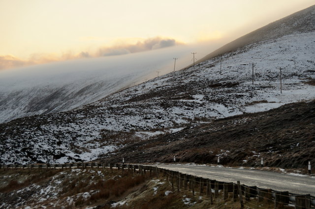
Hill of Oxnabool

Hill, Mountain in Shetland

Scotland

Hill of Oxnabool

Swinister: view towards Fora Ness Looking across the northern corner of Dales Voe, towards the 100m-high lump of Fora Ness, which is connected to the mainland by two isthmuses, North and South Ayre.
Swinister: view towards Fora Ness Credit: Chris Downer

The requested URL returned error: 429 Too Many Requests

If you have any feedback on the listing, please let us know in the comments section below.

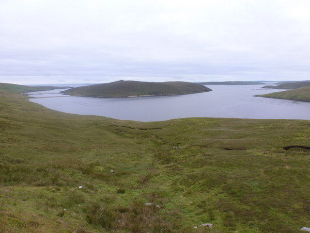
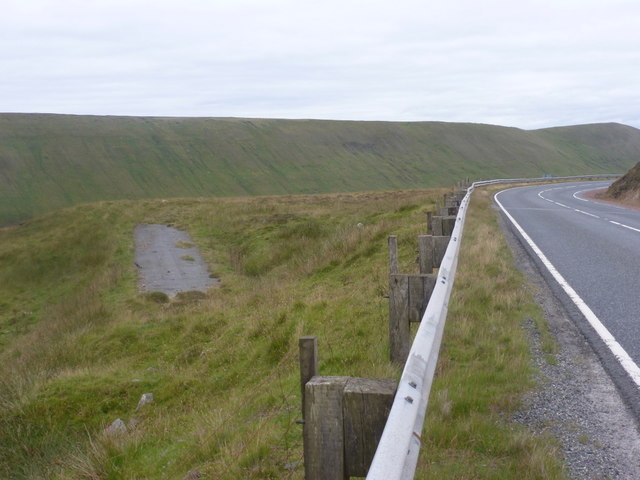
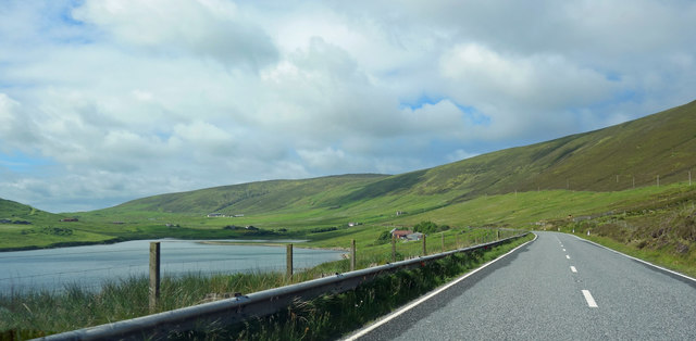
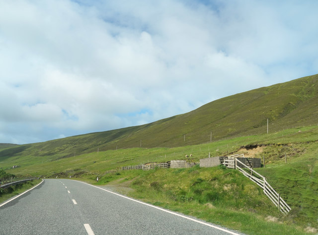
Hill of Oxnabool Images

Images are sourced within 2km of 60.417665/-1.2468372 or Grid Reference HU4170. Thanks to Geograph Open Source API. All images are credited.

Swinister: view towards Fora Ness Looking across the northern corner of Dales Voe, towards the 100m-high lump of Fora Ness, which is connected to the mainland by two isthmuses, North and South Ayre.
Swinister: view towards Fora Ness
Looking across the northern corner of Dales Voe, towards the 100m-high lump of Fora Ness, which is connected to the mainland by two isthmuses, North and South Ayre.
Swinister: orphaned segment of the A968 The course of the road has clearly been realigned over the years, leaving this tiny strip of tarmac to lay disused and inaccessible.
Swinister: orphaned segment of the A968
The course of the road has clearly been realigned over the years, leaving this tiny strip of tarmac to lay disused and inaccessible.
Scarvar Ayre, Dales Voe
Boat at mussel rafts, Dales Voe
Near Pund of Grutin A sneaky through the car window shot on the short bit of road that is in HU4069. Actually, it's not that bad a picture content-wise. 90% of this square is the same moorland hillside that you see stretching into the distance.
Near Pund of Grutin
A sneaky through the car window shot on the short bit of road that is in HU4069. Actually, it's not that bad a picture content-wise. 90% of this square is the same moorland hillside that you see stretching into the distance.
Hill of Dale This impressive hillside stretches for around 10 kms along the north west side of Dales Voe and the valley beyond.
Hill of Dale
This impressive hillside stretches for around 10 kms along the north west side of Dales Voe and the valley beyond.
The Head of Dales Voe
Bayview, Collafirth The gridline passes through the far end of the house.
Bayview, Collafirth
The gridline passes through the far end of the house.
Uphouse, Collafirth
Uphouse, Collafirth
Feely dike and fences on a hill side, Dales Voe
Mist over the flanks of the Hill of Oxnabool, Dales Voe, Delting
Clouds over a snowy Dales Voe, Delting
A968 at Dales Voe, Delting With most over the flanks of the Hill of Oxnabool.
A968 at Dales Voe, Delting
With most over the flanks of the Hill of Oxnabool.
Flanks of Gardaness Hill, Dales Voe
Dales Voe Looking towards the sun at 9 a.m.
Dales Voe
Looking towards the sun at 9 a.m.
Main Road on the Hill of Oxnabool The road contours along the hillside for several kilometres giving excellent views over Dales Voe to the west.
Main Road on the Hill of Oxnabool
The road contours along the hillside for several kilometres giving excellent views over Dales Voe to the west.
Towards Dales Voe Views like this all along here from the road up on the hillside. A fishery boat is making its way up the Voe which has various shellfish farming installations.
Towards Dales Voe
Views like this all along here from the road up on the hillside. A fishery boat is making its way up the Voe which has various shellfish farming installations.
Landing Stage at Scarvar Ayre
Show me another place!

Hill of Oxnabool is located at Grid Ref: HU4170 (Lat: 60.417665, Lng: -1.2468372)

Unitary Authority: Shetland Islands

Police Authority: Highlands and Islands

What 3 Words

///wipe.hockey.crowbar. Near Toft, Shetland Islands

Nearby Locations

Hill of Oxnabool

Related Wikis

North Mainland

The North Mainland of the Shetland Islands, Scotland is the part of the Mainland lying north of Voe (60° 21′N). == Geography == Notable places in North...

Delting

Delting is a civil parish and community council area on Mainland, Shetland, Scotland. It includes the Sullom Voe oil terminal and its main settlements...
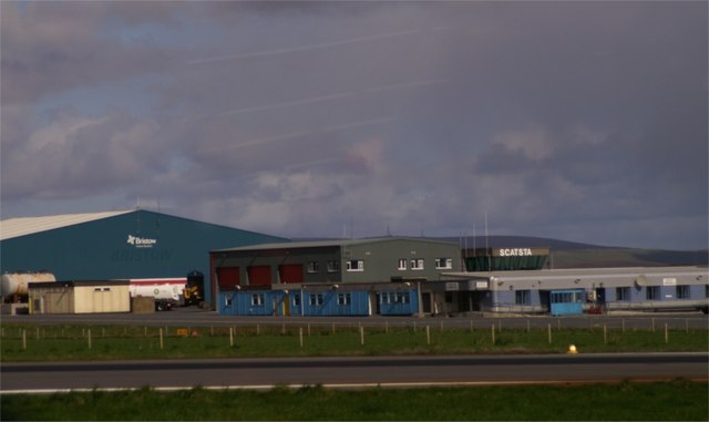
Scatsta Airport

Scatsta Airport (IATA: SCS, ICAO: EGPM), was a commercial airport on the island of Mainland, Shetland in Scotland located 17 nautical miles (31 km; 20...
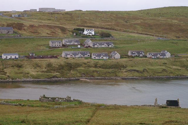
Firth, Shetland

Note: "Firth" is a common name for sounds in ShetlandFirth is a village in the north east of Mainland, Shetland, Scotland, in the parish of Delting, not...

Have you been to Hill of Oxnabool?

Leave your review of Hill of Oxnabool below (or comments, questions and feedback).