Beacon Hill
Hill, Mountain in Durham
England
Beacon Hill

Beacon Hill, located in Durham, is a prominent hill that offers stunning views of the surrounding area. Rising to an elevation of approximately 364 feet, Beacon Hill is a popular destination for hikers, nature enthusiasts, and photographers. The hill is covered in lush greenery, with a variety of plant species and wildlife calling it home.
Visitors to Beacon Hill can enjoy a network of well-maintained trails that lead to the summit, where they can take in panoramic views of the city of Durham and the surrounding countryside. The hill is also known for its historical significance, as it was once used as a signaling point for communication between nearby settlements.
Beacon Hill is easily accessible by car, with parking available at the base of the hill. The area is also popular for picnics, birdwatching, and outdoor activities. Overall, Beacon Hill is a peaceful and picturesque spot that offers a welcome escape from the hustle and bustle of city life.
If you have any feedback on the listing, please let us know in the comments section below.
Beacon Hill Images
Images are sourced within 2km of 54.968426/-1.3846485 or Grid Reference NZ3963. Thanks to Geograph Open Source API. All images are credited.


Beacon Hill is located at Grid Ref: NZ3963 (Lat: 54.968426, Lng: -1.3846485)
Unitary Authority: South Tyneside
Police Authority: Northumbria
What 3 Words
///gift.crops.orchestra. Near Whitburn, Tyne & Wear
Nearby Locations
Related Wikis
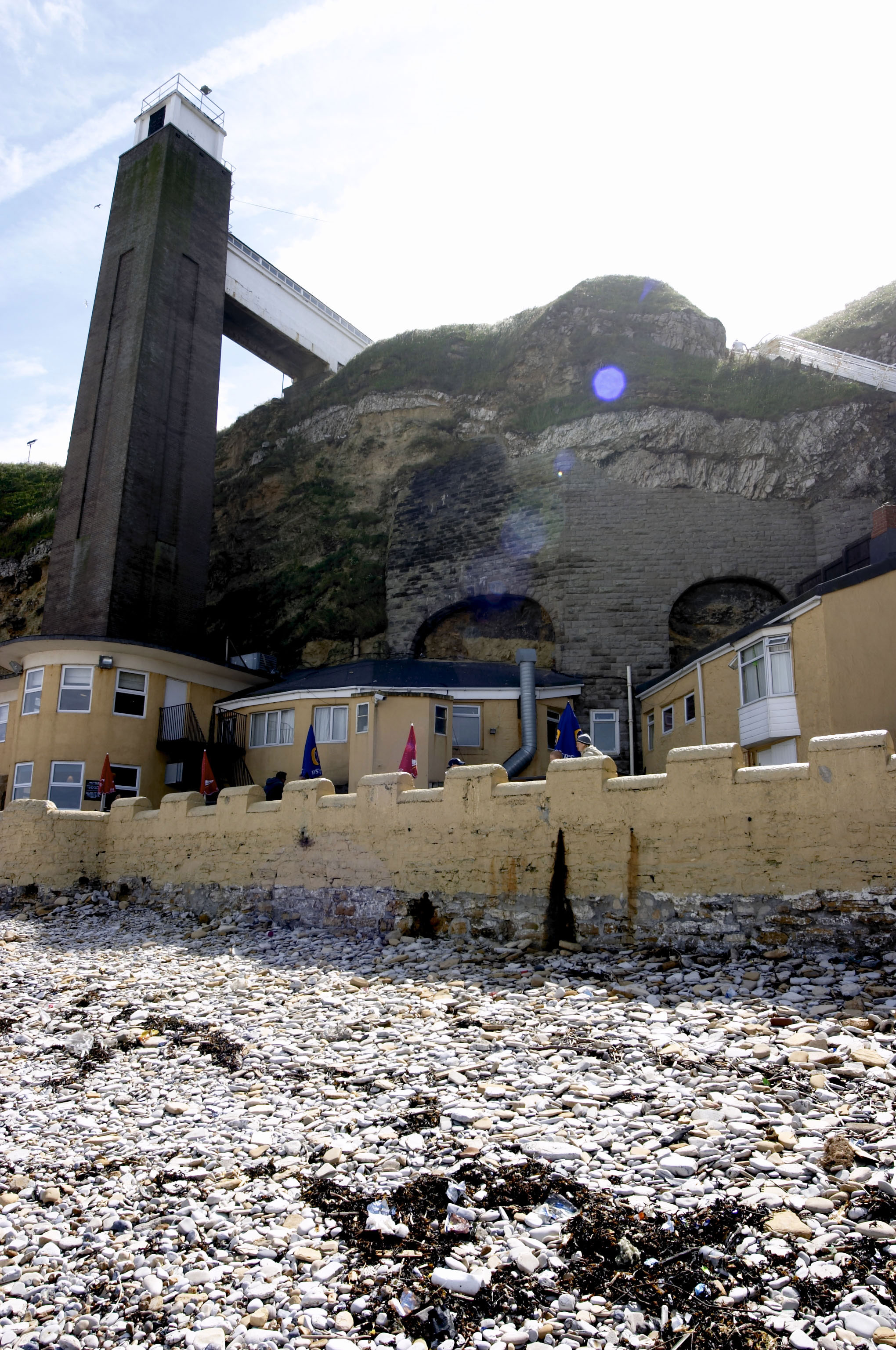
Marsden Grotto
The Marsden Grotto, locally known as The Grotto, is a gastropub located on the coast at Marsden in South Shields, Tyne & Wear, England. It is partly dug...

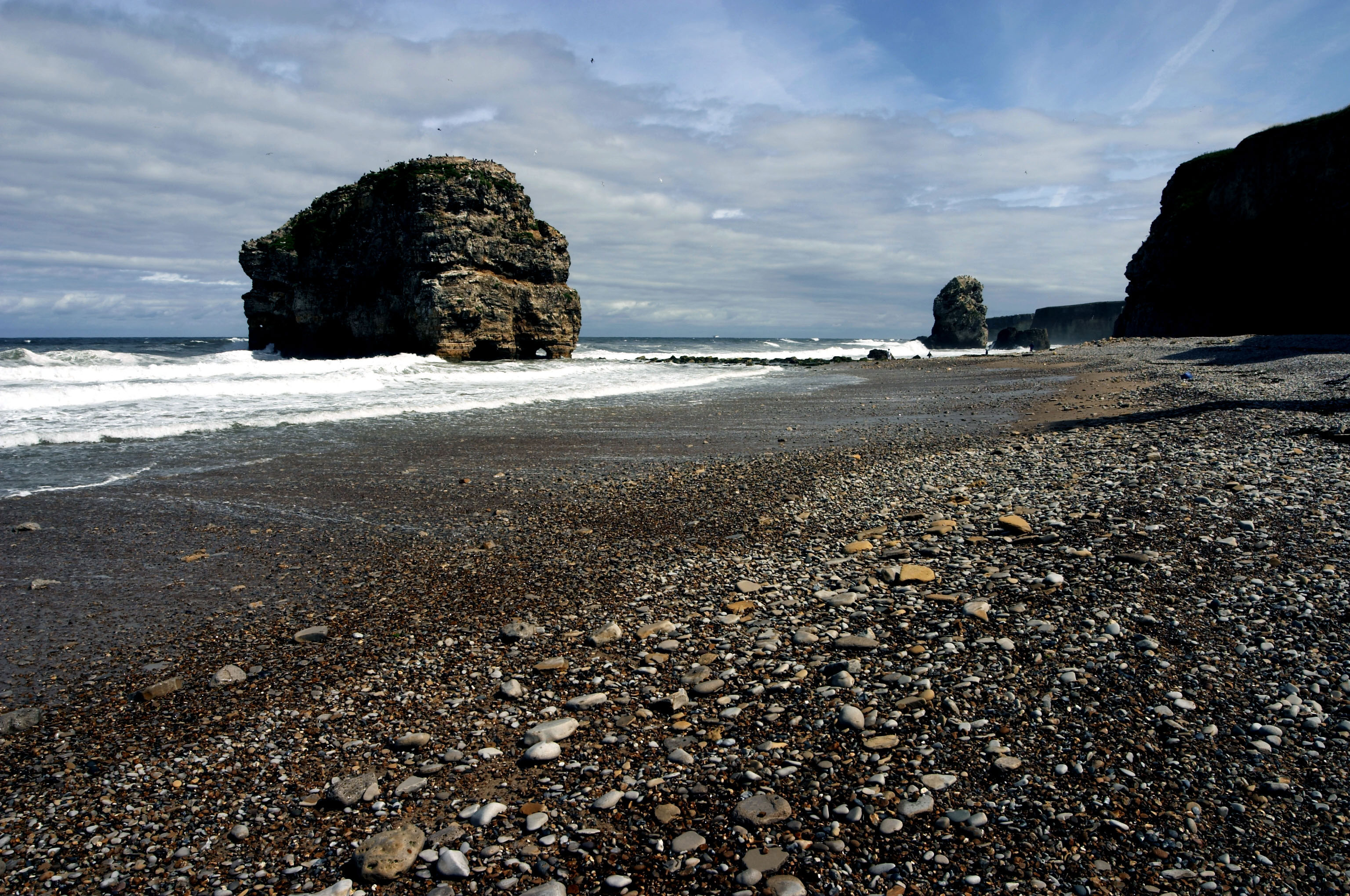
Marsden Rock
Marsden Rock is a rock in Tyne and Wear, North East England, situated in Marsden, South Shields. It is overlooked by the Marsden Grotto. The rock is a...
Marsden, Tyne and Wear
Marsden is located on the outskirts of the seaside town South Shields, North East England, located on the North Sea coast. It lies within historic County...
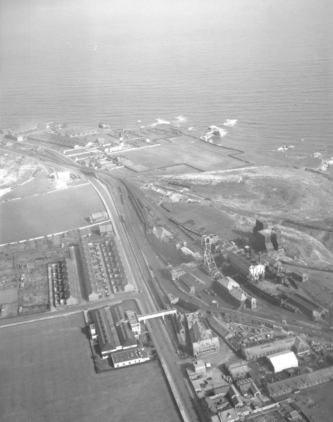
Whitburn Colliery
Whitburn Colliery was a coal mine located about three miles south of South Shields, North East England, located on the North Sea coast. == Background... ==
Nearby Amenities
Located within 500m of 54.968426,-1.3846485Have you been to Beacon Hill?
Leave your review of Beacon Hill below (or comments, questions and feedback).