Heathery Hill

Hill, Mountain in Durham

England

Heathery Hill

Children's park / play area, Haswell Plough
Children's park / play area, Haswell Plough Credit: David Robinson

Heathery Hill is a prominent hill located in Durham, a county in northeastern England. It is situated near the village of Heatherycleugh, in the North Pennines Area of Outstanding Natural Beauty. Standing at an elevation of approximately 455 meters (1,493 feet), it offers breathtaking panoramic views of the surrounding countryside.

The hill is characterized by its heather-covered slopes, which give it its name. The vibrant purple hues of the heather create a stunning contrast against the greenery of the landscape. During the summer months, the hill is transformed into a sea of purple, attracting visitors from far and wide.

Heathery Hill is a popular destination for outdoor enthusiasts, particularly hikers and walkers. There are several well-marked trails that lead to the summit, offering a range of difficulty levels to suit different abilities. The hill provides a challenge for those seeking a more strenuous hike, but also offers gentler slopes for leisurely strolls.

The summit of Heathery Hill offers breathtaking views across the Durham Dales, with the North Pennines stretching out in all directions. On clear days, it is even possible to see as far as the North Sea coastline, providing a truly awe-inspiring sight.

In addition to its natural beauty, Heathery Hill is also home to a diverse range of wildlife. The hill is a haven for birdwatchers, with various species of birds, including the elusive black grouse, being spotted in the area. The surrounding moorland is also home to other wildlife, such as hares, foxes, and the occasional deer.

Overall, Heathery Hill is a picturesque and captivating destination, offering visitors the opportunity to immerse themselves in the stunning natural landscapes of County Durham.

If you have any feedback on the listing, please let us know in the comments section below.

Heathery Hill Images

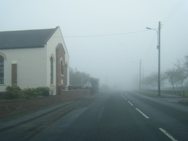
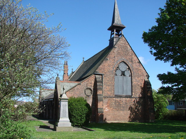
Images are sourced within 2km of 54.785879/-1.4093007 or Grid Reference NZ3843. Thanks to Geograph Open Source API. All images are credited.

Children's park / play area, Haswell Plough
Station Street, Haswell
Pesspool Lane
Pesspool Lane
Demolition of Bankhead Railway Station on 31st  May 1964 The "Haswell Bridge" station was located near to Salters Road, at the north end of Haswell Village and was the terminus for the Hartlepool Dock Railway. The boys on the left of the picture are sitting on the parapet wall to the tunnel that was constructed under the Hartlepool railway, to allow the Sunderland & Durham Branch railway to connect with the Haswell Colliery line. There was a railway siding off the Haswell Colliery line (west of this tunnel) which led back up at right angles to Bankhead Station.
A turntable was used at the Bankhead Station to turn locomotives and third-class passenger carriages around to make a connection between the Hartlepool and Sunderland Railways. 
Haswell Junction station (passenger terminus) on the Sunderland Railway was to the east of the Bankhead Station, where the 1st-class passengers had to disembark and be transported across to Bankhead for ongoing passage to Hartlepool (the tunnel under Salters Road was only large enough to allow the passage of third class and baggage carriages).
The railway station which replaced the Bankhead station can be seen in the background just beyond the level crossing and signal box at Station Street.
As a young boy I lived in Railway Cottages which can be seen on the extreme right of the image.

Further details of the arrangement and configuration of the railway lines at Bankhead are described in Parliamentary Papers which investigate a derailment on the colliery line/ sidings points.
Demolition of Bankhead Railway Station on 31st May 1964
The "Haswell Bridge" station was located near to Salters Road, at the north end of Haswell Village and was the terminus for the Hartlepool Dock Railway. The boys on the left of the picture are sitting on the parapet wall to the tunnel that was constructed under the Hartlepool railway, to allow the Sunderland & Durham Branch railway to connect with the Haswell Colliery line. There was a railway siding off the Haswell Colliery line (west of this tunnel) which led back up at right angles to Bankhead Station. A turntable was used at the Bankhead Station to turn locomotives and third-class passenger carriages around to make a connection between the Hartlepool and Sunderland Railways. Haswell Junction station (passenger terminus) on the Sunderland Railway was to the east of the Bankhead Station, where the 1st-class passengers had to disembark and be transported across to Bankhead for ongoing passage to Hartlepool (the tunnel under Salters Road was only large enough to allow the passage of third class and baggage carriages). The railway station which replaced the Bankhead station can be seen in the background just beyond the level crossing and signal box at Station Street. As a young boy I lived in Railway Cottages which can be seen on the extreme right of the image. Further details of the arrangement and configuration of the railway lines at Bankhead are described in Parliamentary Papers which investigate a derailment on the colliery line/ sidings points.
Holy Cross Farm Haswell viewed from Trig Station on Mawsons  Hill Holy Cross Farm with Duncombe MoorFarm located directly to the north of it.
Holy Cross Farm Haswell viewed from Trig Station on Mawsons Hill
Holy Cross Farm with Duncombe MoorFarm located directly to the north of it.
Haswell to Hart Cycleway This cycle route was on the former route of the Pesspool Branch Railway near to Pesspool Junction. The image shows the remains of the stone pillars which supported the bridge deck that gave road access over the railway lines and into Tuthill Quarry (former limestone quarry and Northern Sabulite I.C.I. Explosives Factory).
Haswell to Hart Cycleway
This cycle route was on the former route of the Pesspool Branch Railway near to Pesspool Junction. The image shows the remains of the stone pillars which supported the bridge deck that gave road access over the railway lines and into Tuthill Quarry (former limestone quarry and Northern Sabulite I.C.I. Explosives Factory).
Pesspool Hall, Hall Lane, Haswell Pesspool Hall, Haswell photographed on the 28th November 2008.
The building was later demolished.
Pesspool Hall, Hall Lane, Haswell
Pesspool Hall, Haswell photographed on the 28th November 2008. The building was later demolished.
Mumbai Restaurant at Haswell Plough The Mumbai Restaurant at Haswell Plough was formerly the Plough Inn public house.
The original Plough Inn was located about half a mile to the east of the Mumbai at Haswell Terrace (near to the junction of Mazine Terrace and Front Street).
<a href="https://www.geograph.org.uk/photo/7342945">NZ3642 : Mumbai Restaurant at Haswell Plough</a>
Mumbai Restaurant at Haswell Plough
The Mumbai Restaurant at Haswell Plough was formerly the Plough Inn public house. The original Plough Inn was located about half a mile to the east of the Mumbai at Haswell Terrace (near to the junction of Mazine Terrace and Front Street). NZ3642 : Mumbai Restaurant at Haswell Plough
Mumbai Restaurant at Haswell Plough The Mumbai Restaurant at Haswell Plough was formerly the Plough Inn public house.
The original Plough Inn was located about half a mile to the east of the Mumbai at Haswell Terrace (near to the junction of Mazine Terrace and Front Street).
<a href="https://www.geograph.org.uk/photo/7342939">NZ3642 : Mumbai Restaurant at Haswell Plough</a>
Mumbai Restaurant at Haswell Plough
The Mumbai Restaurant at Haswell Plough was formerly the Plough Inn public house. The original Plough Inn was located about half a mile to the east of the Mumbai at Haswell Terrace (near to the junction of Mazine Terrace and Front Street). NZ3642 : Mumbai Restaurant at Haswell Plough
Cycle path following route of former railway North of Tuthill Bridge the former trackbed of the railway appears to be a stream and the path has these railings. A view on the Hart to Haswell route.
Cycle path following route of former railway
North of Tuthill Bridge the former trackbed of the railway appears to be a stream and the path has these railings. A view on the Hart to Haswell route.
Durham Lane, Haswell Plough
Horses at Colliery Farm The fence in the picture is shared between the horses and a cheap and cheerful basic campsite (which is essentially just another field!) At the time of my short stay if you turned up on your own on foot with a tent the price was a very reasonable fiver a night, and a pound coin in the shower machine bought you six minutes of hot water. My fellow campers were a friendly bunch - they kept offering me lifts everywhere though, and looked a bit perplexed when informed that the purpose of my visit was to use the place as a base for some walking!
The 1:25,000 OS map tricks you into thinking that the farm is called Higher Haswell; this is the name given to the very small hamlet the farm forms the largest part of though.
Horses at Colliery Farm
The fence in the picture is shared between the horses and a cheap and cheerful basic campsite (which is essentially just another field!) At the time of my short stay if you turned up on your own on foot with a tent the price was a very reasonable fiver a night, and a pound coin in the shower machine bought you six minutes of hot water. My fellow campers were a friendly bunch - they kept offering me lifts everywhere though, and looked a bit perplexed when informed that the purpose of my visit was to use the place as a base for some walking! The 1:25,000 OS map tricks you into thinking that the farm is called Higher Haswell; this is the name given to the very small hamlet the farm forms the largest part of though.
Sandy Carrs, Durham Lane This crumbling ruin-in-the-making is one of two farmhouses with this name in County Durham, which pretty much rules out any idea about a Mr Sandy Carr having once farmed here. The other farmhouse is situated near Bishop Auckland, is a listed building, and in much better condition.
Due to 'carr' being such a short word there are numerous theories about its origin, including chariots, spears, and it referring to both high and low ground. The most accepted one is that it once referred to boggy or marshy ground, or groups of trees that favoured such conditions. Considering that there are lots of named moors neighbouring this property in the Ordnance Survey's first map of here - surveyed in the 1850s - this seems quite plausible in this case. Moorland is usually damp because of its relatively high elevation and soil type. However, sandy soils are well-known for being free-draining, so this either points to the two farms being positioned in fairly unusual habitats, or this theory being completely wrong.
Sandy Carrs, Durham Lane
This crumbling ruin-in-the-making is one of two farmhouses with this name in County Durham, which pretty much rules out any idea about a Mr Sandy Carr having once farmed here. The other farmhouse is situated near Bishop Auckland, is a listed building, and in much better condition. Due to 'carr' being such a short word there are numerous theories about its origin, including chariots, spears, and it referring to both high and low ground. The most accepted one is that it once referred to boggy or marshy ground, or groups of trees that favoured such conditions. Considering that there are lots of named moors neighbouring this property in the Ordnance Survey's first map of here - surveyed in the 1850s - this seems quite plausible in this case. Moorland is usually damp because of its relatively high elevation and soil type. However, sandy soils are well-known for being free-draining, so this either points to the two farms being positioned in fairly unusual habitats, or this theory being completely wrong.
B1283 at Haswell Plough village boundary
B1283 Front Street in mist heading east
B1283 Durham Lane, east of Birch Farm
Durham Lane nearing the B1280 junction
Durham Lane at Tuthill Bridge
Show me another place!

Heathery Hill is located at Grid Ref: NZ3843 (Lat: 54.785879, Lng: -1.4093007)

Unitary Authority: County Durham

Police Authority: Durham

What 3 Words

///corrupted.bumpy.gates. Near Haswell, Co. Durham

Nearby Locations

Heathery Hill

Related Wikis

Haswell, County Durham

Haswell is a village in County Durham, in England. It is situated 6 miles (9.7 km) east of the city of Durham, 9 miles (14 km) south of the city of Sunderland...

Tuthill Quarry

Tuthill Quarry is a Site of Special Scientific Interest in the County Durham district of north-east County Durham, England. It lies just over 1 km east...

High Haswell

High Haswell is a village in County Durham, in England. It is situated close to Haswell, a few miles to the east of Durham. == External links == Map sources...

South Hetton

South Hetton is a former mining village in the County Durham district of the ceremonial county of County Durham, England. It is situated 6.25 miles (10...

Nearby Amenities

Located within 500m of 54.785879,-1.4093007
Post Box
Postal Code: DH6
Ref: DH6 272
Lat/Long: 54.7848797/-1.4135114
Haswell
Historic Railway: station
Railway: site
Source: NPE
Wikidata: Q105559462
Wikipedia: en:Haswell railway station
Lat/Long: 54.7846019/-1.4149974
Barrier: stile
Lat/Long: 54.7816473/-1.4117605
Power: pole
Lat/Long: 54.7893335/-1.4043403
Power: pole
Lat/Long: 54.788636/-1.4043778
Power: pole
Lat/Long: 54.7879307/-1.404414
Power: pole
Lat/Long: 54.7872356/-1.4044435
Power: pole
Lat/Long: 54.7865264/-1.4044878
Power: pole
Lat/Long: 54.7858227/-1.4045253
Power: pole
Lat/Long: 54.7851275/-1.404583
Power: pole
Lat/Long: 54.784416/-1.4046514
Power: pole
Lat/Long: 54.7837153/-1.4046957
Power: pole
Lat/Long: 54.7832993/-1.40476
Power: pole
Lat/Long: 54.7832304/-1.4045763
Power: pole
Lat/Long: 54.7815963/-1.4077735
Power: pole
Lat/Long: 54.7817772/-1.4078955
Power: pole
Lat/Long: 54.7818708/-1.4099179
Power: pole
Lat/Long: 54.7817672/-1.4109197
Power: pole
Lat/Long: 54.7816597/-1.4119416
Waste Basket
Lat/Long: 54.7854138/-1.4046034
Barrier: swing_gate
Bicycle: yes
Description: Gate is usually closed but you can cycle on the left of it. You have to cycle in a curve.
Foot: yes
Swing Gate Type: single
Vehicle: no
Lat/Long: 54.7854665/-1.4044867
Barrier: swing_gate
Bicycle: yes
Foot: yes
Swing Gate Type: single
Vehicle: no
Lat/Long: 54.7852521/-1.4045053
The data included in this document is from www.openstreetmap.org. The data is made available under ODbL.

Have you been to Heathery Hill?

Leave your review of Heathery Hill below (or comments, questions and feedback).