Ber Field

Hill, Mountain in Shetland

Scotland

Ber Field

Saltmarsh at the head of Tresta Voe Looking across to Lung Ness.
Saltmarsh at the head of Tresta Voe Credit: Mike Pennington

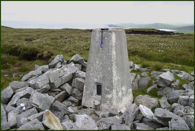
Ber Field is a prominent hill located in the Shetland Islands, an archipelago in northern Scotland. Situated in the central part of the Mainland, Shetland's largest island, Ber Field stands at an elevation of approximately 385 meters (1,263 feet) above sea level. This makes it one of the highest peaks in the region, offering stunning panoramic views of the surrounding landscape.

The hill is characterized by its distinct shape, featuring a gently sloping eastern side and a steeper western face. Its summit is marked by a rocky outcrop, which provides an ideal vantage point for sightseers and hikers. On clear days, visitors can enjoy breathtaking vistas of the rugged coastline, rolling hills, and neighboring islands.

Due to its location and elevation, Ber Field is subject to the unpredictable and often harsh weather conditions typical of the Shetland Islands. It is not uncommon for the hill to be shrouded in mist or buffeted by strong winds. As a result, appropriate clothing and caution are advised for those planning to explore the area.

Ber Field is a popular destination for outdoor enthusiasts, offering various opportunities for hiking, nature-watching, and photography. Several well-marked trails traverse the hill, allowing visitors to explore its diverse flora and fauna, which include heather, mosses, and bird species such as puffins and skuas.

In summary, Ber Field is a significant hill in the Shetland Islands, offering breathtaking views, diverse wildlife, and a challenging yet rewarding experience for outdoor enthusiasts.

If you have any feedback on the listing, please let us know in the comments section below.
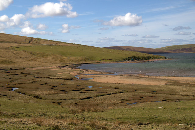
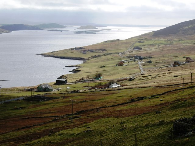
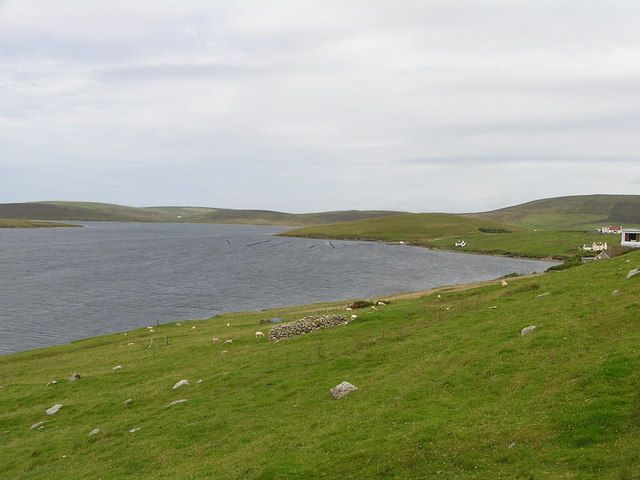
Ber Field Images

Images are sourced within 2km of 60.222323/-1.3532112 or Grid Reference HU3548. Thanks to Geograph Open Source API. All images are credited.

Saltmarsh at the head of Tresta Voe Looking across to Lung Ness.
Saltmarsh at the head of Tresta Voe
Looking across to Lung Ness.
Cott, Weisdale Voe, Shetland Looking south across the community of Cott on the east side of Russaness Hill and down Weisdale Voe with the islands of Greena, Flotta and the Hoggs of Hoy in the distance.
Cott, Weisdale Voe, Shetland
Looking south across the community of Cott on the east side of Russaness Hill and down Weisdale Voe with the islands of Greena, Flotta and the Hoggs of Hoy in the distance.
Breaking waves and Fora Ness, Sand, Shetland Sand Beach is one of the many shallow sandy bays around the Shetland coastline.  It's perfect for a late afternoon swim if there's no wind, and the sun has been shining all day to warm the sand and water, but pretty chilly the rest of the time - which is most of the time!
Breaking waves and Fora Ness, Sand, Shetland
Sand Beach is one of the many shallow sandy bays around the Shetland coastline. It's perfect for a late afternoon swim if there's no wind, and the sun has been shining all day to warm the sand and water, but pretty chilly the rest of the time - which is most of the time!
Hostaberg top Triangulation point at the top of hill
Hostaberg top
Triangulation point at the top of hill
Geomorphology in miniature Sand cliffs and sand arch along a stream after rain.
Geomorphology in miniature
Sand cliffs and sand arch along a stream after rain.
Spume and walkers on Sand beach
Innersand
Innersand
Houses and gardens at Sand
Sand beach
Sand beach
Telephone box on the road to Sandsound Sorry it's a bit dull - but the Shetland summer does this sometimes, and it was the only day I could go and get the shot.
Telephone box on the road to Sandsound
Sorry it's a bit dull - but the Shetland summer does this sometimes, and it was the only day I could go and get the shot.
Cottages on the road to Sandsound
Abandoned dwellings, Sandsound Voe Idyllic on a gorgeous day, but imagine living here during winter storms and gales!
Abandoned dwellings, Sandsound Voe
Idyllic on a gorgeous day, but imagine living here during winter storms and gales!
Dale Burn from the track bridge, Sandsound
Cottage with ruin, and Sandsound Voe, Sandsound
Inner Sand Seen from the sea.
Inner Sand
Seen from the sea.
Sandsound Voe Looking into the voe from Sandsound.
Sandsound Voe
Looking into the voe from Sandsound.
Sandsound Voe Looking towards Lung Ness.
Sandsound Voe
Looking towards Lung Ness.
Small cottage at Sandsound Voe
Show me another place!

Ber Field is located at Grid Ref: HU3548 (Lat: 60.222323, Lng: -1.3532112)

Unitary Authority: Shetland Islands

Police Authority: Highlands and Islands

What 3 Words

///valued.presume.named. Near Aith, Shetland Islands

Related Wikis

Greena

Greena is a small island off the west coast of Mainland, Shetland. It is 10m at its highest point, and is north of Flotta, Shetland. It is in Weisdale...

Westerfield, Shetland

Westerfield is a coastal community on Mainland, in Shetland, Scotland. The community is within the parish of Sandsting.It lies to the west of Tresta on...

Sandsting

Sandsting is a parish in the West Mainland of Shetland, Scotland, forming a southern arm of the Walls Peninsula. After the parish of Aithsting was annexed...

Flotta, Shetland

Flotta (grid reference HU375462) is an island off the south west of Mainland, Shetland. The name may come from the Old Norse, flatey meaning flat island...

Nearby Amenities

Located within 500m of 60.222323,-1.3532112
Telephone
Lat/Long: 60.2230502/-1.3618668
Sandsound
Place: hamlet
Lat/Long: 60.2208176/-1.3573446
Omunsgarth
Corbett: no
Ele: 144
Graham: no
Marilyn: no
Munro: no
Natural: peak
Lat/Long: 60.2221665/-1.3547447
Power: pole
Lat/Long: 60.2182392/-1.3561062
Power: pole
Lat/Long: 60.218499/-1.3563928
Power: pole
Lat/Long: 60.2187938/-1.3567362
Power: pole
Lat/Long: 60.2191112/-1.3571069
Power: pole
Lat/Long: 60.2184312/-1.3571092
Power: pole
Lat/Long: 60.2185995/-1.3580507
Power: pole
Lat/Long: 60.2203469/-1.3605842
Power: pole
Lat/Long: 60.2210179/-1.3606092
Power: pole
Lat/Long: 60.2217374/-1.360641
Power: pole
Lat/Long: 60.222362/-1.360657
Power: pole
Lat/Long: 60.2230058/-1.3606706
Power: pole
Lat/Long: 60.223444/-1.3606046
Power: pole
Lat/Long: 60.2238946/-1.3605273
Power: pole
Lat/Long: 60.2246536/-1.3603772
Bus Stop
Sandsound
Naptan AtcoCode: 6030657
Naptan NaptanCode: 45825469
Public Transport: platform
Lat/Long: 60.2229883/-1.3618997
The data included in this document is from www.openstreetmap.org. The data is made available under ODbL.

Have you been to Ber Field?

Leave your review of Ber Field below (or comments, questions and feedback).