Beorgs of Housetter

Hill, Mountain in Shetland

Scotland

Beorgs of Housetter

Waiting for the boats It might just be serendipitous but the tall, rough rock beats many pieces of sculpture. Given her position by the pier north of Collafirth and looking out to sea, "Waiting for the boats" would seem an appropriate title for this fishwife.
Waiting for the boats Credit: AlastairG

The requested URL returned error: 429 Too Many Requests

If you have any feedback on the listing, please let us know in the comments section below.

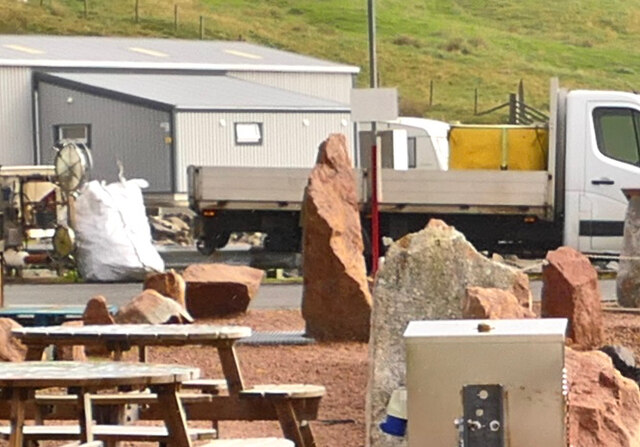
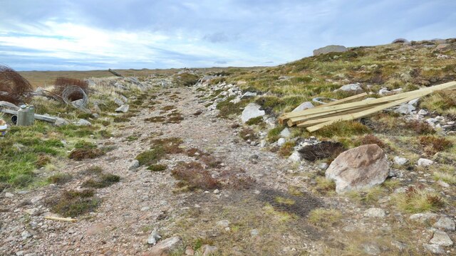
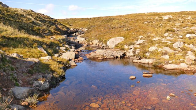
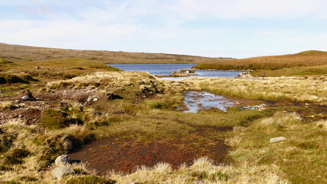
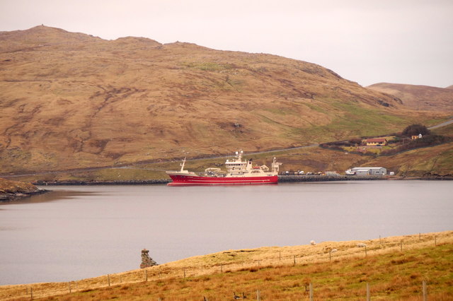
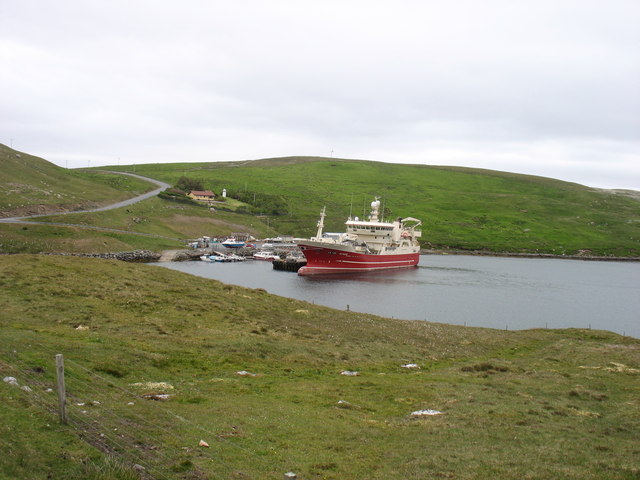
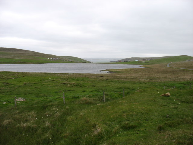
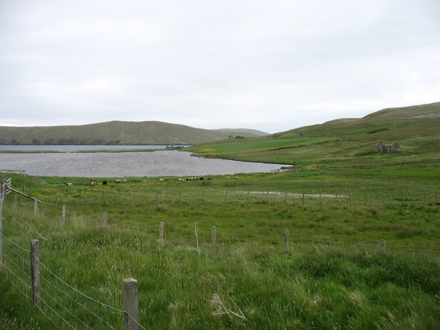
Beorgs of Housetter Images

Images are sourced within 2km of 60.551204/-1.3473704 or Grid Reference HU3585. Thanks to Geograph Open Source API. All images are credited.

Waiting for the boats It might just be serendipitous but the tall, rough rock beats many pieces of sculpture. Given her position by the pier north of Collafirth and looking out to sea, "Waiting for the boats" would seem an appropriate title for this fishwife.
Waiting for the boats
It might just be serendipitous but the tall, rough rock beats many pieces of sculpture. Given her position by the pier north of Collafirth and looking out to sea, "Waiting for the boats" would seem an appropriate title for this fishwife.
Fencing work, Collafirth, Shetland Material was stored at the end of the hill track by Roer Water. An existing fence was being replaced. It looked as if it was designed to prevent livestock contaminating the loch which is a public water supply.
Fencing work, Collafirth, Shetland
Material was stored at the end of the hill track by Roer Water. An existing fence was being replaced. It looked as if it was designed to prevent livestock contaminating the loch which is a public water supply.
Hill burn, Collafirth, Shetland The Burn of the Twa-roes falls steeply to join the Burn of Roerwater. This empties into the sea at the Voe of the Brig.
Hill burn, Collafirth, Shetland
The Burn of the Twa-roes falls steeply to join the Burn of Roerwater. This empties into the sea at the Voe of the Brig.
Junction of the Burn of Twa-roes with the Burn of Roerwater This was photographed from the same bridge as <a href="https://www.geograph.org.uk/photo/7316876">HU3484 : Hill burn, Collafirth, Shetland</a>. The gully has been fenced in and has been planted with saplings of native trees.
Junction of the Burn of Twa-roes with the Burn of Roerwater
This was photographed from the same bridge as HU3484 : Hill burn, Collafirth, Shetland. The gully has been fenced in and has been planted with saplings of native trees.
Roer Water, Shetland Roer Water acts as a water supply for the locality.
Roer Water, Shetland
Roer Water acts as a water supply for the locality.
Track on Billia Field, North Roe
Skelberry, North Roe, from the Colsta track
Track to Colsta on Billia Field, North Roe
Skelberry, North Roe
Purple saxifrage (Saxifraga oppositifolia), Skelberry, North Roe A very local plant in Shetland, only found in North Roe. It is however, widespread in northern latitudes and is Holarctic (found around the Arctic in Eurasia and America).
Purple saxifrage (Saxifraga oppositifolia), Skelberry, North Roe
A very local plant in Shetland, only found in North Roe. It is however, widespread in northern latitudes and is Holarctic (found around the Arctic in Eurasia and America).
MV Altaire at Collafirth pier, from Queyfirth
MV Altaire in Voe of the Brig She seems to be manoeuvring, perhaps to prepare for her next departure?
MV Altaire in Voe of the Brig
She seems to be manoeuvring, perhaps to prepare for her next departure?
The A970 heading south The A970 just comes to a dead stop about 4 km north of here (behind the camera), at Isbister. Looking south, for just under ten miles it is "single track with passing places", but there is so little traffic that it is hardly a problem. After that, and all the way to Sumburgh <a href="https://www.geograph.org.uk/gridref/HU4009">HU4009</a>, 80 km away, it is a splendid road, upgraded (like other main routes on the Shetland Islands) when the oil money was at its peak.
The A970 heading south
The A970 just comes to a dead stop about 4 km north of here (behind the camera), at Isbister. Looking south, for just under ten miles it is "single track with passing places", but there is so little traffic that it is hardly a problem. After that, and all the way to Sumburgh HU4009, 80 km away, it is a splendid road, upgraded (like other main routes on the Shetland Islands) when the oil money was at its peak.
Loch of Housetter The road on the right is, believe it or not, the main A970 on Shetland Mainland. To be fair, this far north it is not exactly busy.
Loch of Housetter
The road on the right is, believe it or not, the main A970 on Shetland Mainland. To be fair, this far north it is not exactly busy.
Housetter and Colla Firth
The Beorgs of Collafirth
Collafirth Pier Collafirth Pier redevelopment of a new jetty and out buildings.  The area includes parking for caravans, and provides some basic facilities like a washing machine, electric shower and toilets.
Collafirth Pier
Collafirth Pier redevelopment of a new jetty and out buildings. The area includes parking for caravans, and provides some basic facilities like a washing machine, electric shower and toilets.
Ordnance Survey OSBM bolt Ordnance Survey OSBM bolt, described as NEW OSBM BOLT LIVING ROCK 10.8M SE SIDE RD 17.7M SE C CUL (37.306m above Lerwick datum, 2nd order, new 1970).
Ordnance Survey OSBM bolt
Ordnance Survey OSBM bolt, described as NEW OSBM BOLT LIVING ROCK 10.8M SE SIDE RD 17.7M SE C CUL (37.306m above Lerwick datum, 2nd order, new 1970).
Show me another place!

Beorgs of Housetter is located at Grid Ref: HU3585 (Lat: 60.551204, Lng: -1.3473704)

Unitary Authority: Shetland Islands

Police Authority: Highlands and Islands

What 3 Words

///bronze.contoured.beakers. Near Ulsta, Shetland Islands

Nearby Locations

Beorgs of Housetter

Related Wikis

North Roe

North Roe is a village, and protected area at the northern tip in the large Northmavine peninsula of the Mainland of Shetland, Scotland. It is a small...

Little Holm, Yell Sound

Little Holm is a small island in Yell Sound, in Shetland, Scotland. It lies between Northmavine and the island of Yell. There is a lighthouse here. In...

Voe, Northmavine

Voe is a settlement on the Northmavine peninsula of Mainland, Shetland, Scotland. It is at the head of Ronas Voe and just off the A970 road. == Whaling... ==

Ollaberry

Ollaberry (Old Norse: Olafrsberg, meaning Olaf's Hill) is a village on Mainland, Shetland, Scotland on the west shore of Yell Sound, 10.9 miles (17.5 km...

Nearby Amenities

Located within 500m of 60.551204,-1.3473704
Post Box
Operator: Royal Mail
Ref: ZE2 35
Lat/Long: 60.5483277/-1.34111
Passing Place
Lat/Long: 60.5502793/-1.3406649
Passing Place
Lat/Long: 60.5528019/-1.3408259
Power: pole
Lat/Long: 60.5474366/-1.343194
Power: pole
Lat/Long: 60.5479707/-1.3430196
Power: pole
Lat/Long: 60.5488833/-1.3427085
Power: pole
Lat/Long: 60.54937/-1.3425154
Power: pole
Lat/Long: 60.5500881/-1.3424952
Power: pole
Lat/Long: 60.5508098/-1.3424648
Power: pole
Lat/Long: 60.5514769/-1.3424414
Power: pole
Lat/Long: 60.5521826/-1.3424111
Power: pole
Lat/Long: 60.5528223/-1.3423866
Power: pole
Lat/Long: 60.5536319/-1.3423571
Power: pole
Lat/Long: 60.5547896/-1.3418958
The data included in this document is from www.openstreetmap.org. The data is made available under ODbL.

Have you been to Beorgs of Housetter?

Leave your review of Beorgs of Housetter below (or comments, questions and feedback).