Radford Hill

Hill, Mountain in Warwickshire Warwick

England

Radford Hill

HS2 enabling works, Welsh Road area, June 2021 (1) This is the entry to the northern leg of the Offchurch Greenway, a footpath and cycleway following the line of the former railway between Rugby and Leamington Spa, much of it in cuttings. It will be crossed by HS2. This gate is on the west side of the junction of Welsh Road and Long Itchington Road. <span class="nowrap"><a title="https://countryparks.warwickshire.gov.uk/offchurchgreenway" rel="nofollow ugc noopener" href="https://countryparks.warwickshire.gov.uk/offchurchgreenway">Link</a><img style="margin-left:2px;" alt="External link" title="External link - shift click to open in new window" src="https://s1.geograph.org.uk/img/external.png" width="10" height="10"/></span>
HS2 enabling works, Welsh Road area, June 2021 (1) Credit: Robin Stott

Radford Hill is a prominent feature located in the county of Warwickshire, England. Despite its name, Radford Hill is more accurately classified as a hill rather than a mountain, as it stands at an elevation of approximately 150 meters (492 feet) above sea level. It is situated near the village of Radford Semele, just south of the historic town of Leamington Spa.

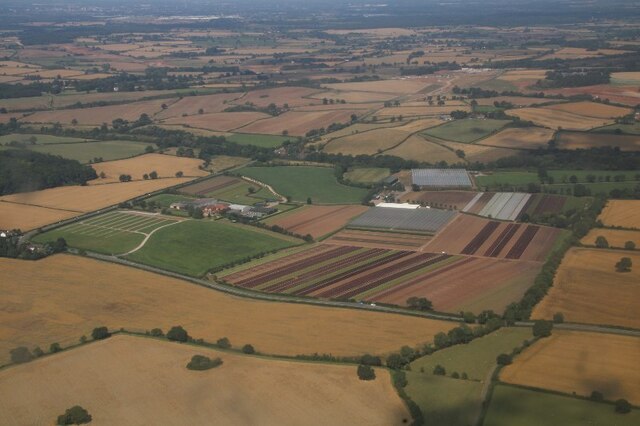
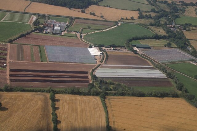
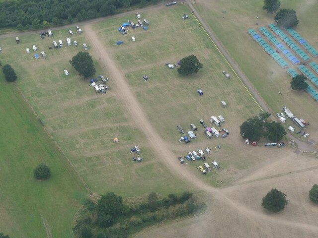
The hill is notable for its picturesque views of the surrounding countryside, with rolling green fields and charming rural landscapes stretching as far as the eye can see. It is a popular destination for hikers, nature enthusiasts, and locals looking for a peaceful retreat from the hustle and bustle of nearby towns.

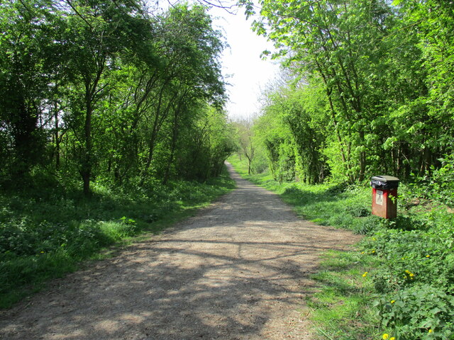
Radford Hill is characterized by its gentle slopes and lush vegetation, which supports a diverse range of flora and fauna. The hill is home to various plant species, including wildflowers, grasses, and native trees such as oak and beech. It also provides a habitat for a variety of wildlife, including birds, small mammals, and insects.

The hill offers several walking trails and footpaths, allowing visitors to explore its natural beauty and enjoy the tranquility of the area. At the summit of Radford Hill, there is a small viewing point where visitors can take in the panoramic vistas of the Warwickshire countryside.

Overall, Radford Hill is a charming and accessible natural landmark that offers visitors a chance to immerse themselves in the beauty of the English countryside.

If you have any feedback on the listing, please let us know in the comments section below.
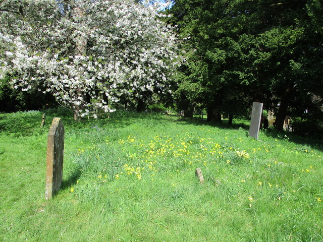
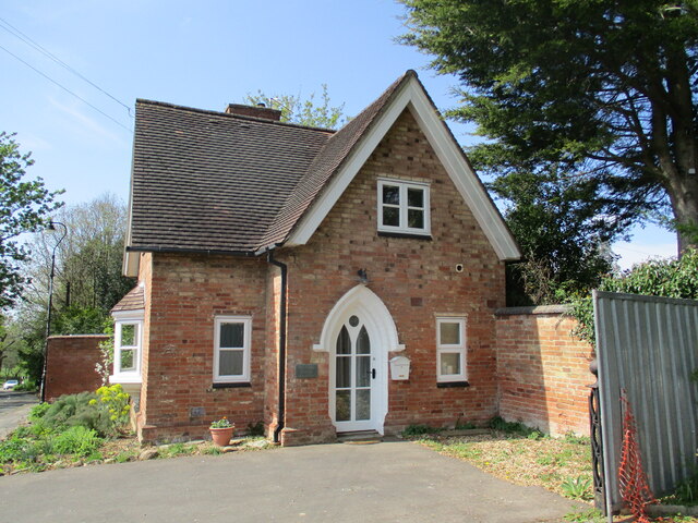
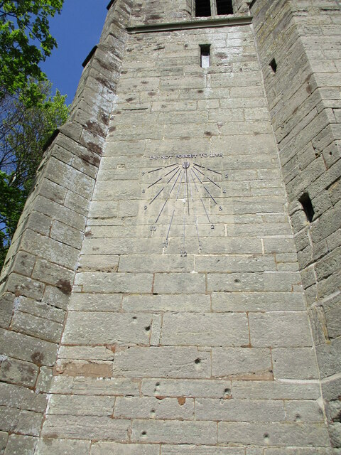
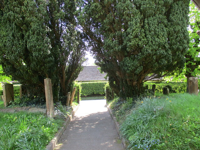
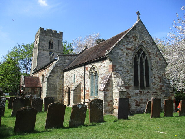
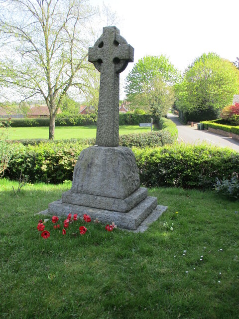
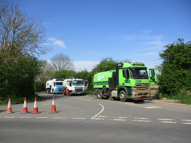
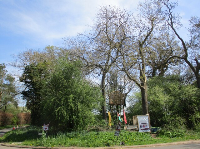
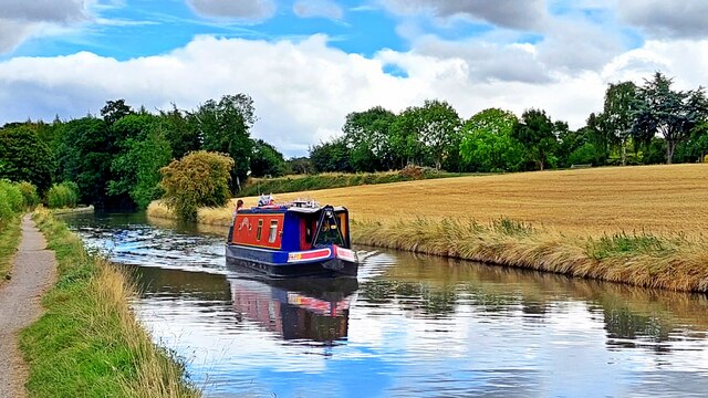
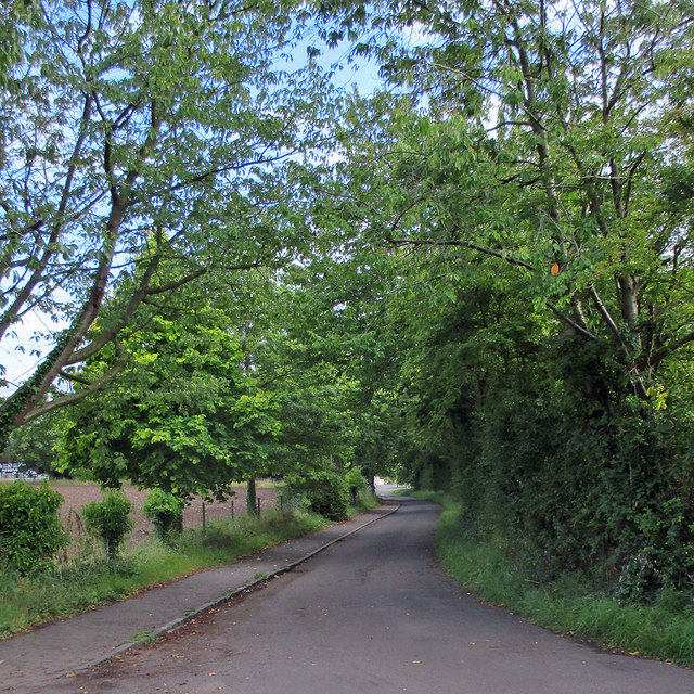
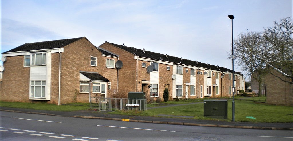
Radford Hill Images

Images are sourced within 2km of 52.271422/-1.4791917 or Grid Reference SP3563. Thanks to Geograph Open Source API. All images are credited.

HS2 enabling works, Welsh Road area, June 2021 (1) This is the entry to the northern leg of the Offchurch Greenway, a footpath and cycleway following the line of the former railway between Rugby and Leamington Spa, much of it in cuttings. It will be crossed by HS2. This gate is on the west side of the junction of Welsh Road and Long Itchington Road. <span class="nowrap"><a title="https://countryparks.warwickshire.gov.uk/offchurchgreenway" rel="nofollow ugc noopener" href="https://countryparks.warwickshire.gov.uk/offchurchgreenway">Link</a><img style="margin-left:2px;" alt="External link" title="External link - shift click to open in new window" src="https://s1.geograph.org.uk/img/external.png" width="10" height="10"/></span>
HS2 enabling works, Welsh Road area, June 2021 (1)
This is the entry to the northern leg of the Offchurch Greenway, a footpath and cycleway following the line of the former railway between Rugby and Leamington Spa, much of it in cuttings. It will be crossed by HS2. This gate is on the west side of the junction of Welsh Road and Long Itchington Road. LinkExternal link
HS2 enabling works, Welsh Road area, June 2021 (2) This is the staggered junction of Welsh Road, to right and left (out of shot), Offchurch Lane ahead continuing as Long Itchington Road behind the camera. Originally there was a railway bridge here with a two-way junction at either end. In time, the bridge was removed and the railway cutting filled in to form the present junction. It is fast, unpredictable and risky: remodelling as part of the HS2 works should make it safer.
HS2 enabling works, Welsh Road area, June 2021 (2)
This is the staggered junction of Welsh Road, to right and left (out of shot), Offchurch Lane ahead continuing as Long Itchington Road behind the camera. Originally there was a railway bridge here with a two-way junction at either end. In time, the bridge was removed and the railway cutting filled in to form the present junction. It is fast, unpredictable and risky: remodelling as part of the HS2 works should make it safer.
HS2 enabling works, Welsh Road area, June 2021 (3) This is the sign on the gate into the Offchurch Greenway <a href="https://www.geograph.org.uk/photo/6902975">SP3665 : HS2 enabling works, Welsh Road area, June 2021 (1)</a>. It says that the Greenway will be closed temporarily from mid-to-late November 2020. The plan shows a short section and a diversion.
HS2 enabling works, Welsh Road area, June 2021 (3)
This is the sign on the gate into the Offchurch Greenway SP3665 : HS2 enabling works, Welsh Road area, June 2021 (1). It says that the Greenway will be closed temporarily from mid-to-late November 2020. The plan shows a short section and a diversion.
Nursery near Leamington Spa: aerial 2021 (1) Blackdown Growers.
Nursery near Leamington Spa: aerial 2021 (1)
Blackdown Growers.
Nursery near Leamington Spa: aerial 2021 (2) Blackdown Growers.
Nursery near Leamington Spa: aerial 2021 (2)
Blackdown Growers.
Offchurch Bury Park, aerial 2021 Horsebox Park, in connection with Pony Club event.
Offchurch Bury Park, aerial 2021
Horsebox Park, in connection with Pony Club event.
Offchurch Greenway Follows the course of the former Rugby to Leamington Spa railway line.
Offchurch Greenway
Follows the course of the former Rugby to Leamington Spa railway line.
Cowslips in the churchyard, Offchurch
The Lodge Cottage, Offchurch
Sundial on St. Gregory's church, Offchurch The sundial installed in 2006 replaced one painted on the stonework in 1795.
Sundial on St. Gregory's church, Offchurch
The sundial installed in 2006 replaced one painted on the stonework in 1795.
Churchyard path, Offchurch
St. Gregory's church, Offchurch The oldest parts date to the eleventh century <span class="nowrap"><a title="https://historicengland.org.uk/listing/the-list/list-entry/1035084?section=official-list-entry" rel="nofollow ugc noopener" href="https://historicengland.org.uk/listing/the-list/list-entry/1035084?section=official-list-entry">Link</a><img style="margin-left:2px;" alt="External link" title="External link - shift click to open in new window" src="https://s1.geograph.org.uk/img/external.png" width="10" height="10"/></span>
St. Gregory's church, Offchurch
The oldest parts date to the eleventh century LinkExternal link
War memorial, Offchurch
Ready to clean up No doubt in connection with nearby work on HS2.
Ready to clean up
No doubt in connection with nearby work on HS2.
Protest camp, Offchurch Protesting against the construction of HS2 nearby.
Protest camp, Offchurch
Protesting against the construction of HS2 nearby.
Improved junction of Welsh Road and Fosse Way The view is northwest from Welsh Road; Fosse Way runs almost out of sight across the photo. HS2 will cross Fosse Way a short distance to the north (right). The opportunity has been taken to remodel two if not three dangerous junctions on these fast local roads. Ahead was formerly a frightening and frustrating staggered crossroads.
Improved junction of Welsh Road and Fosse Way
The view is northwest from Welsh Road; Fosse Way runs almost out of sight across the photo. HS2 will cross Fosse Way a short distance to the north (right). The opportunity has been taken to remodel two if not three dangerous junctions on these fast local roads. Ahead was formerly a frightening and frustrating staggered crossroads.
Grand Union Canal
Grand Union Canal
Radford Semele: Church End An August-afternoon view towards Southam Road, the A425, taken from the bend by the church. For a spring version, see Nigel Mykura's <a href="https://www.geograph.org.uk/photo/2932807">SP3464 : Church Lane Radford Semele</a>.
Radford Semele: Church End
An August-afternoon view towards Southam Road, the A425, taken from the bend by the church. For a spring version, see Nigel Mykura's SP3464 : Church Lane Radford Semele.
Show me another place!

Radford Hill is located at Grid Ref: SP3563 (Lat: 52.271422, Lng: -1.4791917)

Administrative County: Warwickshire

District: Warwick

Police Authority: Warwickshire

What 3 Words

///overpower.acid.included. Near Royal Leamington Spa, Warwickshire

Nearby Locations

Radford Hill

Related Wikis

Radford Semele

Radford Semele is a village and civil parish in Warwickshire, England, situated close to the Regency spa town of Leamington Spa. According to the 2001...

Offchurch

Offchurch is a village and civil parish on the River Leam, 3 miles (4.8 km) east of Leamington Spa in Warwickshire. The population of the civil parish...

Sydenham, Leamington Spa

Sydenham is an eastern suburb of the town of Leamington Spa, Warwickshire, England. Prior to the 1960s the area was rural, with only agricultural buildings...

Offchurch Bury

Offchurch Bury is a manor house one mile north-west of the centre of the village of Offchurch, Warwickshire, England. It is supposed to represent the...

Campion School, Leamington Spa

Campion School was formed in 1977 when it moved to the present site on Sydenham Drive in Leamington Spa, Warwickshire, England. In 2006, Campion was awarded...

Whitnash

Whitnash is a town and civil parish located southeast of, and contiguous with Leamington Spa and Warwick in Warwickshire, England. In 2001, it had a population...

Newbold Comyn

Newbold Comyn is a park on the Eastern edge of Leamington Spa, Warwickshire, England. == History == The first mention of Newbold Comyn in history was in...

St Mary's Church, Leamington Spa

St. Mary's Church, Leamington Spa is a Grade II listed parish church in Leamington Spa, England. == History == St. Mary's Church was built between 1838...

Related Videos

Winter Woodland Walk - Walking in the English Countryside 4K

A Winter Woodland Walk, today's walk was something a little different. We decided to take our collie for a walk in the woods and ...

Ukliving🇬🇧 | ROAD TRIP: travel with me from rugby to scotland 🏴󠁧󠁢󠁳󠁣󠁴󠁿

Welcome back loves Go with me on a road trip from rugby to Scotland… As long as this trip appeared, I enjoyed every bit of it ...

Charlecote Park #travel #warwickshire #cinematic #england #deer

Charlecote Park - A hidden gem in the county of Warwickshire.

English Village Walk

English village walk, sound for relaxation, sleep, meditation and studying. Calming and relaxing audio of nature from the British ...

Nearby Amenities

Located within 500m of 52.271422,-1.4791917
Direction: both
Maxspeed: 50 mph
Traffic Sign: maxspeed
Lat/Long: 52.271575/-1.4794619
Leasowe Farm
Naptan AtcoCode: 4200F128830
Naptan Bearing: SE
Naptan BusStopType: CUS
Naptan CommonName: Leasowe Farm
Naptan Indicator: Adj
Naptan NaptanCode: wardjdjm
Naptan Street: Southam Road
Naptan Verified: no
Source: naptan_import
Lat/Long: 52.2741357/-1.482136
Bus Stop
Leasowe Farm
Bench: no
Bin: no
Bus: yes
Covered: no
Lit: no
Naptan AtcoCode: 4200F128831
Naptan Bearing: NW
Naptan CommonName: Leasowe Farm
Naptan Indicator: Opp
Naptan Landmark: Leasowe Farm
Naptan NaptanCode: warawmwd
Naptan Street: Southam Road
Naptan Verified: no
Passenger Information Display: no
Public Transport: platform
Source: naptan_import
Tactile Paving: no
Lat/Long: 52.2740917/-1.4823417
Bus Stop
Fosse Way Roundabout
Bench: no
Bin: no
Bus: yes
Covered: no
Lit: yes
Naptan AtcoCode: 4200F128832
Naptan Bearing: SE
Naptan CommonName: Fosse Way Roundabout
Naptan Landmark: Fosse Way Roundabout
Naptan NaptanCode: warawmwg
Naptan Street: Southam Road
Naptan Verified: no
Passenger Information Display: no
Public Transport: platform
Source: naptan_import
Tactile Paving: no
Lat/Long: 52.2689582/-1.4742535
Fosse Way Roundabout
Naptan AtcoCode: 4200F128833
Naptan Bearing: NW
Naptan BusStopType: CUS
Naptan CommonName: Fosse Way Roundabout
Naptan Indicator: Adj
Naptan Landmark: Fosse Way Roundabout
Naptan NaptanCode: wardgwpd
Naptan Street: Southam Road
Naptan Verified: no
Source: naptan_import
Lat/Long: 52.2688419/-1.4743721
Street Lamp
Lat/Long: 52.2685955/-1.4735006
Direction: forward
Maxspeed: 50 mph
Traffic Sign: maxspeed
Lat/Long: 52.2737801/-1.4819176
Brand: National Grid
Brand Wikidata: Q1465461
Material: wood
Operator: National Grid Electricity Distribution
Operator Old: Western Power Distribution
Operator Wikidata: Q7988183
Owner: National Grid Electricity Distribution (East Midlands) Plc
Owner Wikidata: Q114348127
Power: pole
Lat/Long: 52.27464/-1.4810567
Leasowe Farm
Brand: National Grid
Brand Wikidata: Q1465461
Frequency: 50
Location Transition: yes
Material: wood
Operator: National Grid Electricity Distribution
Operator Old: Western Power Distribution
Operator Wikidata: Q7988183
Owner: National Grid Electricity Distribution (East Midlands) Plc
Owner Wikidata: Q114348127
Power: pole
Ref: 932945
Transformer: distribution
Voltage Primary: 11000
Voltage Secondary: 400
Lat/Long: 52.2752283/-1.4800456
Brand: National Grid
Brand Wikidata: Q1465461
Location Transition: yes
Material: wood
Operator: National Grid Electricity Distribution
Operator Old: Western Power Distribution
Operator Wikidata: Q7988183
Owner: National Grid Electricity Distribution (East Midlands) Plc
Owner Wikidata: Q114348127
Power: pole
Lat/Long: 52.2740755/-1.4819947
Direction: both
Maxspeed: 50 mph
Traffic Sign: maxspeed
Lat/Long: 52.2689116/-1.4743623
The data included in this document is from www.openstreetmap.org. The data is made available under ODbL.

Have you been to Radford Hill?

Leave your review of Radford Hill below (or comments, questions and feedback).