Coppy Hill

Hill, Mountain in Derbyshire South Derbyshire

England

Coppy Hill

Royal Observer Corps Monitoring Post Entrance to the ROC bunker. It was featured in BBC news back in 2012.
Royal Observer Corps Monitoring Post Credit: Martin

Coppy Hill is a notable hill located in Derbyshire, England. Situated near the village of Matlock Bath, it forms a part of the Pennines, a range of hills and mountains in Northern England. Rising to an elevation of around 393 meters (1,289 feet), Coppy Hill offers breathtaking panoramic views of the surrounding countryside.

The hill is predominantly covered in lush green grass, with scattered patches of heather and bracken. Its terrain is relatively gentle, making it accessible to hikers and walkers of all abilities. A well-defined footpath leads to the summit, allowing visitors to enjoy a pleasant and picturesque trek.

At the top of Coppy Hill, there is a trig point that serves as a reference marker for surveyors. The trig point offers an elevated vantage point for taking in the stunning vistas, including the nearby River Derwent and the charming town of Matlock Bath.

Coppy Hill is a popular destination for outdoor enthusiasts, offering various recreational activities such as hiking, birdwatching, and picnicking. The hill's location within the Derbyshire Dales also provides opportunities for exploring the nearby countryside and visiting attractions such as the Heights of Abraham, a hilltop park with stunning views and cavern tours.

Overall, Coppy Hill in Derbyshire is a delightful natural feature that offers both locals and tourists the chance to immerse themselves in the region's natural beauty, with its captivating landscapes and peaceful ambiance.

If you have any feedback on the listing, please let us know in the comments section below.
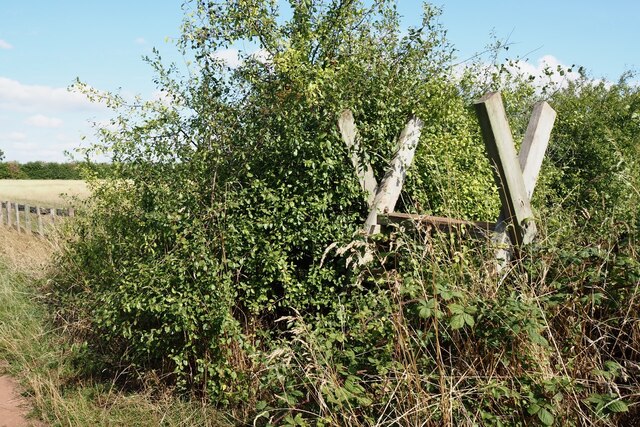
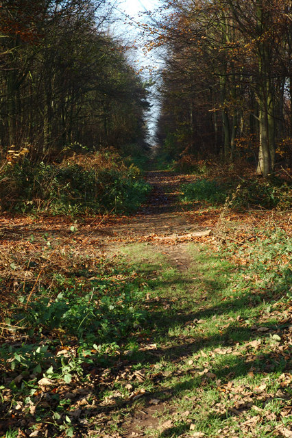
Coppy Hill Images

Images are sourced within 2km of 52.825357/-1.4753121 or Grid Reference SK3525. Thanks to Geograph Open Source API. All images are credited.

Royal Observer Corps Monitoring Post Entrance to the ROC bunker. It was featured in BBC news back in 2012.
Royal Observer Corps Monitoring Post
Entrance to the ROC bunker. It was featured in BBC news back in 2012.
Harvested field and hedge From the National Forest Way at Tinknall.
Harvested field and hedge
From the National Forest Way at Tinknall.
Ladder stile beside the National Forest Way
Overgrown stile beside the National Forest Way
Harvested wheat field Still showing the machinery track lines.
Harvested wheat field
Still showing the machinery track lines.
View toward Bendalls Clump
Gate on the edge of Heath Wood A Forestry Commission wood of mixed deciduous trees.
Gate on the edge of Heath Wood
A Forestry Commission wood of mixed deciduous trees.
Path in Heath Wood A forestry Commission wood of mixed deciduous trees.
Path in Heath Wood
A forestry Commission wood of mixed deciduous trees.
Gate on the edge of Heath Wood A Forestry Commission wood of mixed deciduous trees.
Gate on the edge of Heath Wood
A Forestry Commission wood of mixed deciduous trees.
Footpath skirting St George's church
Archway Cottage With a lovely "cottage garden".   Surprised to find that this is not a listed building. The farmhouse just visible to the left is though.
Archway Cottage
With a lovely "cottage garden". Surprised to find that this is not a listed building. The farmhouse just visible to the left is though.
The Wheel Inn Been closed and boarded up since at least September 2022 when I was last here.  But according to the banner it has "refurbishment planned".

It is a Grade II listed building.
List Entry Number:1203417 <span class="nowrap"><a title="https://historicengland.org.uk/listing/the-list/list-entry/1203417?section=official-list-entry" rel="nofollow ugc noopener" href="https://historicengland.org.uk/listing/the-list/list-entry/1203417?section=official-list-entry">Link</a><img style="margin-left:2px;" alt="External link" title="External link - shift click to open in new window" src="https://s1.geograph.org.uk/img/external.png" width="10" height="10"/></span>
The Wheel Inn
Been closed and boarded up since at least September 2022 when I was last here. But according to the banner it has "refurbishment planned". It is a Grade II listed building. List Entry Number:1203417 LinkExternal link
St. George's Church, Ticknall Grade II listed parish church built in 1842 by the architect Henry Isaac Stevens to replace the old church dedicated to St Thomas Becket. 

The church was designed by H. I. Stevens in Perpendicular style. It is in sandstone with Welsh slate roofs, and consists of a nave, north and south aisles, a south porch, a chancel with a north vestry, and a west steeple. The steeple has a tower with four stages, moulded string courses, diagonal buttresses, a west doorway, Perpendicular windows, a clock face on the south side, and two-light bell openings.

<span class="nowrap"><a title="https://en.wikipedia.org/wiki/St_George%27s_Church,_Ticknall" rel="nofollow ugc noopener" href="https://en.wikipedia.org/wiki/St_George%27s_Church,_Ticknall">Link</a><img style="margin-left:2px;" alt="External link" title="External link - shift click to open in new window" src="https://s1.geograph.org.uk/img/external.png" width="10" height="10"/></span>

<span class="nowrap"><a title="https://britishlistedbuildings.co.uk/101334583-church-of-st-george-ticknall" rel="nofollow ugc noopener" href="https://britishlistedbuildings.co.uk/101334583-church-of-st-george-ticknall">Link</a><img style="margin-left:2px;" alt="External link" title="External link - shift click to open in new window" src="https://s1.geograph.org.uk/img/external.png" width="10" height="10"/></span>
St. George's Church, Ticknall
Grade II listed parish church built in 1842 by the architect Henry Isaac Stevens to replace the old church dedicated to St Thomas Becket. The church was designed by H. I. Stevens in Perpendicular style. It is in sandstone with Welsh slate roofs, and consists of a nave, north and south aisles, a south porch, a chancel with a north vestry, and a west steeple. The steeple has a tower with four stages, moulded string courses, diagonal buttresses, a west doorway, Perpendicular windows, a clock face on the south side, and two-light bell openings. LinkExternal link LinkExternal link
James Sim Gent 1844 Grave, St George Graveyard James Sims, 1844, who was pageboy to H. R. H. Princess Charlotte (1796-1817), the only child of George, Prince of Wales (later George IV), and his wife, Caroline of Brunswick. She was expected to ascend the British throne after the deaths of her grandfather, George III, and her father, but died in childbirth at the age of 21, predeceasing them both.

<span class="nowrap"><a title="https://en.wikipedia.org/wiki/Princess_Charlotte_of_Wales_(1796%E2%80%931817)" rel="nofollow ugc noopener" href="https://en.wikipedia.org/wiki/Princess_Charlotte_of_Wales_(1796%E2%80%931817)">Link</a><img style="margin-left:2px;" alt="External link" title="External link - shift click to open in new window" src="https://s1.geograph.org.uk/img/external.png" width="10" height="10"/></span>
James Sim Gent 1844 Grave, St George Graveyard
James Sims, 1844, who was pageboy to H. R. H. Princess Charlotte (1796-1817), the only child of George, Prince of Wales (later George IV), and his wife, Caroline of Brunswick. She was expected to ascend the British throne after the deaths of her grandfather, George III, and her father, but died in childbirth at the age of 21, predeceasing them both. LinkExternal link
Medieval Cross, St George Graveyard The cross, which is Listed Grade II and principally of medieval
date, was originally a village or market cross which, it is believed, was
moved into the churchyard in the 18th century. It is of stepped form, with a
base consisting of a plinth, two steps, a socket stone, a shaft and the
remains of the cross head. The steps are circular in plan and are constructed
of sandstone blocks resting on a plinth of just over 2m diameter. The socket
stone stands on the upper step and is octagonal in plan with step moulding
around its upper edge. The shaft, which is also octagonal in plan, stands to a
height of approximately 1m and is surmounted by a large irregular square
finial which has been repaired in cement with an iron band. Although moved
from its original location, the cross probably relates to the position of the
18th century south porch and may mark the spot of an earlier cross.

<span class="nowrap"><a title="https://ancientmonuments.uk/116563-medieval-church-and-cross-45m-south-of-st-georges-church-ticknall" rel="nofollow ugc noopener" href="https://ancientmonuments.uk/116563-medieval-church-and-cross-45m-south-of-st-georges-church-ticknall">Link</a><img style="margin-left:2px;" alt="External link" title="External link - shift click to open in new window" src="https://s1.geograph.org.uk/img/external.png" width="10" height="10"/></span>
Medieval Cross, St George Graveyard
The cross, which is Listed Grade II and principally of medieval date, was originally a village or market cross which, it is believed, was moved into the churchyard in the 18th century. It is of stepped form, with a base consisting of a plinth, two steps, a socket stone, a shaft and the remains of the cross head. The steps are circular in plan and are constructed of sandstone blocks resting on a plinth of just over 2m diameter. The socket stone stands on the upper step and is octagonal in plan with step moulding around its upper edge. The shaft, which is also octagonal in plan, stands to a height of approximately 1m and is surmounted by a large irregular square finial which has been repaired in cement with an iron band. Although moved from its original location, the cross probably relates to the position of the 18th century south porch and may mark the spot of an earlier cross. LinkExternal link
Cast Iron Grave Marker,  Delilah "Dellie" Boswell 1800-1885 The Harper - Crewe family allowed the Boswell family of gipsies to camp in Calke Park and their graves are marked by iron crosses near the path to the church. 

Delilah Boswell was a particular favourite of Sir John Crewe, and she died in 1885 at the age of 85.
Cast Iron Grave Marker, Delilah "Dellie" Boswell 1800-1885
The Harper - Crewe family allowed the Boswell family of gipsies to camp in Calke Park and their graves are marked by iron crosses near the path to the church. Delilah Boswell was a particular favourite of Sir John Crewe, and she died in 1885 at the age of 85.
John Franceys Knight Effigy c1360, St. George's Church Alabaster slab boldly incised effigy of a knight in plate armour and a marginal but imperfect inscription to John Franceys, c. 1360

Moved from the old 13th century church dedicated to St. Thomas à Becket. This church was demolished in 1841.
John Franceys Knight Effigy c1360, St. George's Church
Alabaster slab boldly incised effigy of a knight in plate armour and a marginal but imperfect inscription to John Franceys, c. 1360 Moved from the old 13th century church dedicated to St. Thomas à Becket. This church was demolished in 1841.
Ruins of Thomas Becket Church, Ticknall The scanty remains of an early 13th century church dedicated to St. Thomas à Becket. This church was demolished in 1841 and the new St. George church was erected to fill the needs of an increased population. The old church was demolished with gunpowder from the Lime yards, and the patron of the new church was Sir George Crewe of Calke Abbey. Perhaps this is why
the dedication was changed from St. Thomas to St. George.
Ruins of Thomas Becket Church, Ticknall
The scanty remains of an early 13th century church dedicated to St. Thomas à Becket. This church was demolished in 1841 and the new St. George church was erected to fill the needs of an increased population. The old church was demolished with gunpowder from the Lime yards, and the patron of the new church was Sir George Crewe of Calke Abbey. Perhaps this is why the dedication was changed from St. Thomas to St. George.
Show me another place!

Coppy Hill is located at Grid Ref: SK3525 (Lat: 52.825357, Lng: -1.4753121)

Administrative County: Derbyshire

District: South Derbyshire

Police Authority: Derbyshire

What 3 Words

///relatives.surveyed.helper. Near Melbourne, Derbyshire

Related Wikis

Heath Wood barrow cemetery

Heath Wood barrow cemetery is a Viking burial site near Ingleby, Derbyshire. == Description == Heath Wood contains a series of 59 barrows which is a Viking...

St George's Church, Ticknall

St George's Church, Ticknall is a Grade II listed parish church in the Church of England in Ticknall, Derbyshire. == History == The church was built in...

Ticknall

Ticknall is a small village and civil parish in South Derbyshire, England. The population of the civil parish (including Calke) at the 2011 Census was...

Ticknall Tramway

The Ticknall Tramway was a 12.8 mi (20.6 km) long 4 ft 2 in (1,270 mm) gauge horse-drawn plateway terminating at Ticknall, Derbyshire, England. It operated...

Ingleby, Derbyshire

Ingleby is a hamlet and civil parish in South Derbyshire, England, situated to the south of the River Trent on a rise between Stanton by Bridge and Repton...

St Michael's Church, Stanton by Bridge

St Michael's Church, Stanton by Bridge is a Grade I listed parish church in the Church of England in Stanton by Bridge, Derbyshire. == History == The church...

Anchor Church

Anchor Church is the name given to a series of caves in a Keuper Sandstone (Triassic conglomerate) outcrop, close to the village of Ingleby, Derbyshire...

Foremark

Foremark is a hamlet and civil parish in the South Derbyshire district of Derbyshire, England. It contains Foremarke Hall, a medieval manor house which...

Nearby Amenities

Located within 500m of 52.825357,-1.4753121
Coppy Plantation
Natural: wood
Lat/Long: 52.8289163/-1.4754338
Fox Hole Wood
Natural: wood
Lat/Long: 52.8272139/-1.4722405
Gorsey Leys
Natural: wood
Lat/Long: 52.822926/-1.472011
Coppy Hill
Place: locality
Lat/Long: 52.8280665/-1.474075
Knowlehill
Place: locality
Lat/Long: 52.8274733/-1.4803703
Barrier: stile
Lat/Long: 52.8249815/-1.4795788
The data included in this document is from www.openstreetmap.org. The data is made available under ODbL.

Have you been to Coppy Hill?

Leave your review of Coppy Hill below (or comments, questions and feedback).