Beacon Hill

Hill, Mountain in Durham

England

Beacon Hill

Park Area, Kelloe Green space providing a park area on Woodland Crescent, Kelloe.
Park Area, Kelloe Credit: David Robinson

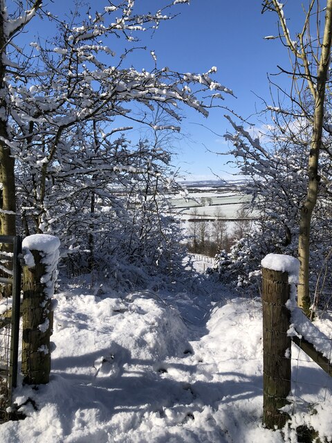
Beacon Hill is a prominent hill located in the city of Durham, in the county of Durham, England. Rising to an elevation of approximately 243 meters (797 feet), it is considered one of the highest points in the area and offers spectacular views of the surrounding countryside.

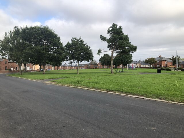
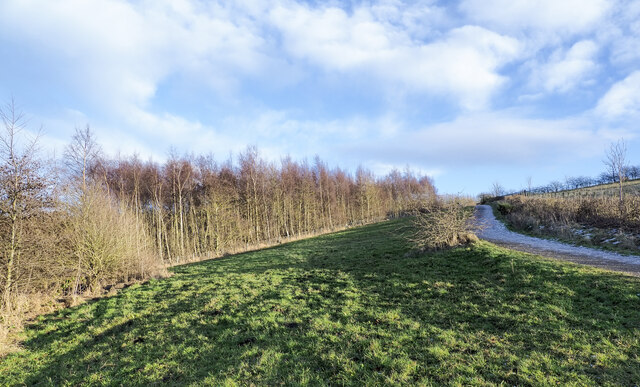
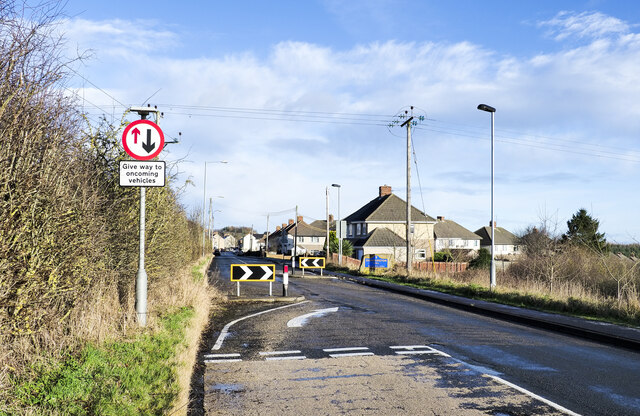
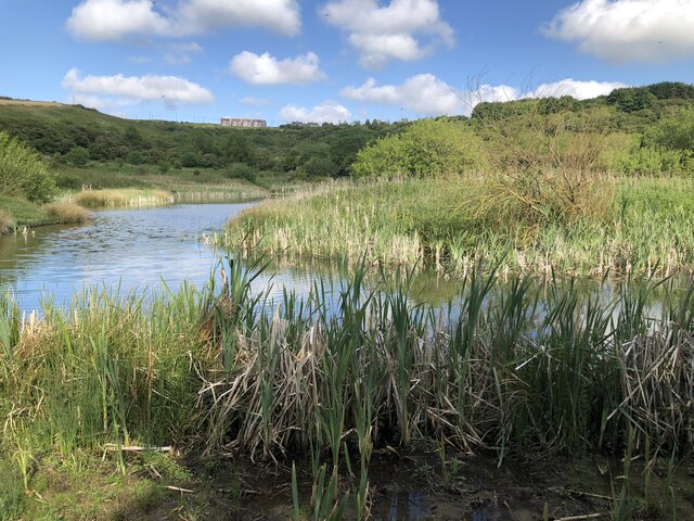
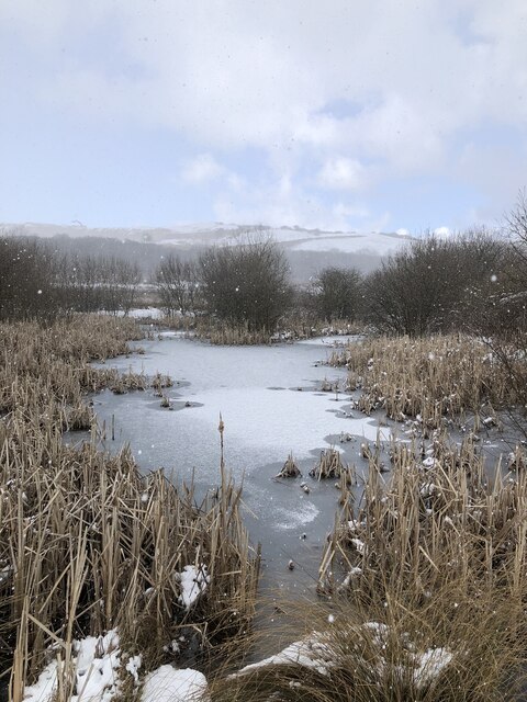
Situated to the south of Durham city center, Beacon Hill is easily accessible by road and is a popular destination for both locals and tourists alike. The hill is part of Beacon Hill Country Park, which spans over 110 hectares and encompasses a diverse range of habitats, including woodlands, grasslands, and ponds.

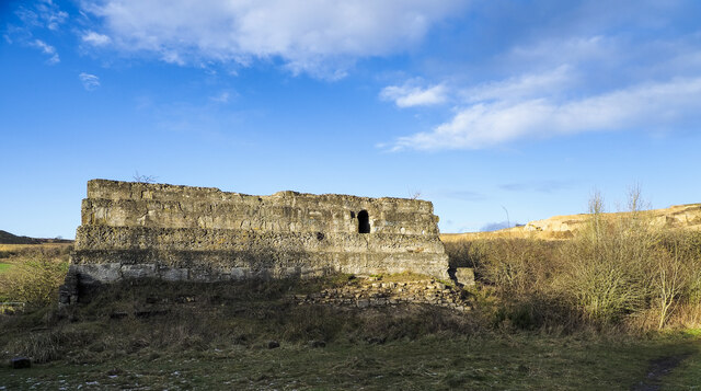
The hill takes its name from the beacon that once stood on its summit, serving as a warning signal during times of war. Although the beacon no longer remains, the hill continues to be an important historical site, with evidence of human activity dating back to the Iron Age.

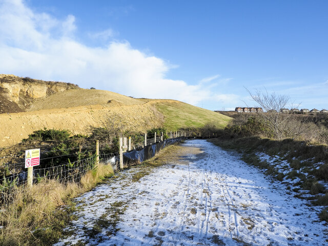
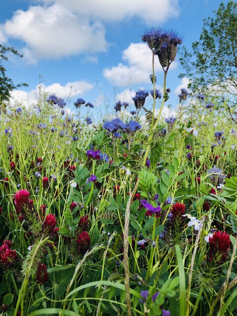
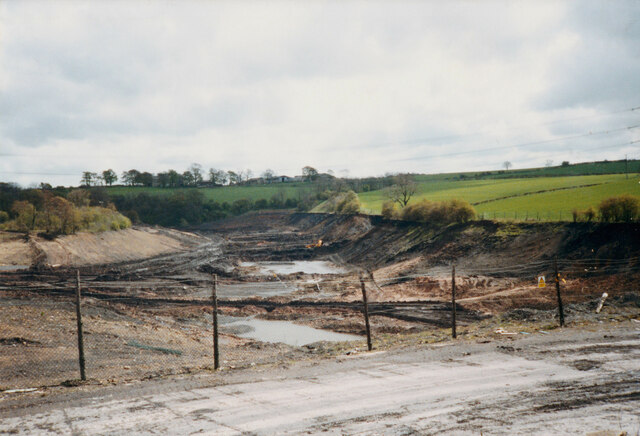
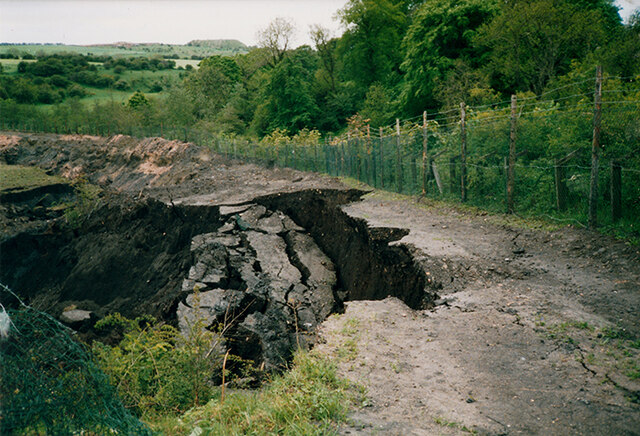
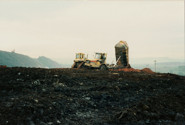
Beacon Hill is a haven for nature enthusiasts, offering numerous walking trails and picnic areas. The park is home to a variety of wildlife, including kestrels, skylarks, and rabbits. Visitors can also explore the remnants of an old quarry on the hillside, which adds to its geological significance.

Overall, Beacon Hill is a picturesque and historically significant landmark in Durham, providing visitors with breathtaking views, opportunities for outdoor activities, and a chance to connect with nature.

If you have any feedback on the listing, please let us know in the comments section below.

Beacon Hill Images

Images are sourced within 2km of 54.73475/-1.4789984 or Grid Reference NZ3337. Thanks to Geograph Open Source API. All images are credited.

Park Area, Kelloe Green space providing a park area on Woodland Crescent, Kelloe.
Park Area, Kelloe
Green space providing a park area on Woodland Crescent, Kelloe.
Pylons & Power Lines
Ice, mud and ruts at field entrance Fields north-west of the small village at Quarrington Hill accessed from a gate on minor road.
Ice, mud and ruts at field entrance
Fields north-west of the small village at Quarrington Hill accessed from a gate on minor road.
Grassy slope rising to birch woodland The grass, trees and the road all appear to be within the Crow Trees Nature Reserve, close to the village of Quarrington Hill. The reserve is important for its  magnesian limestone grassland.
The surrounding area has been extensively quarried and mined in the past and extraction continues at Tarmac's Quarrington Quarry to the north of the reserve.
Grassy slope rising to birch woodland
The grass, trees and the road all appear to be within the Crow Trees Nature Reserve, close to the village of Quarrington Hill. The reserve is important for its magnesian limestone grassland. The surrounding area has been extensively quarried and mined in the past and extraction continues at Tarmac's Quarrington Quarry to the north of the reserve.
Unmade road east of Old Quarrington The tarmacked road reaching Old Quarrington ends there as a public road but continues as an unmade one to the east of the village where it joins another road. OS mapping differs according to its age and source in how access along the routes applies. Some maps including paper ones in the possession of the photographer show the upper road as a bridleway continuing to Quarrington Hill. Others show the bridleway ending east of Quarrington Farm.
The County Durham definitive map, (January 2022), now shows the lower, southern road to be the route of the bridleway and that must be considered to be the actual current situation. The explanation is that the upper, northern road is now in use by Tarmac as a quarry access road and is a private way.
Part of Tarmac's Quarrington Quarry can be seen in the image.
Unmade road east of Old Quarrington
The tarmacked road reaching Old Quarrington ends there as a public road but continues as an unmade one to the east of the village where it joins another road. OS mapping differs according to its age and source in how access along the routes applies. Some maps including paper ones in the possession of the photographer show the upper road as a bridleway continuing to Quarrington Hill. Others show the bridleway ending east of Quarrington Farm. The County Durham definitive map, (January 2022), now shows the lower, southern road to be the route of the bridleway and that must be considered to be the actual current situation. The explanation is that the upper, northern road is now in use by Tarmac as a quarry access road and is a private way. Part of Tarmac's Quarrington Quarry can be seen in the image.
Bridleway heading towards Quarrington Hill The bridleway, presumably an old industrial / mining route, connects Old Quarrington with Quarrington Hill. The route is in use a s a bridleway which has replaced another bridleway route running above to the left. That is now a private road used for quarry access by the Tarmac company.
OS mapping has not, (January 2022), caught up with the changed route situation; an explanation is given here: <a title="https://www.geograph.org.uk/photo/7063932" href="https://www.geograph.org.uk/photo/7063932">Link</a> .
Bridleway heading towards Quarrington Hill
The bridleway, presumably an old industrial / mining route, connects Old Quarrington with Quarrington Hill. The route is in use a s a bridleway which has replaced another bridleway route running above to the left. That is now a private road used for quarry access by the Tarmac company. OS mapping has not, (January 2022), caught up with the changed route situation; an explanation is given here: Link .
Industrial ruin in Crow Trees Nature Reserve This might be the remains of an engine house mentioned in the County Durham leaflet about the Crow Trees Reserve but it's made largely from coarse concrete and the document talks of, "using stonework".
Whatever the case, it's clearly an old industrial feature, presumably from coal mining or earlier quarrying operations. Quarrying still goes on nearby; distantly, to the right of the ruin, there's an active quarry in view.
Industrial ruin in Crow Trees Nature Reserve
This might be the remains of an engine house mentioned in the County Durham leaflet about the Crow Trees Reserve but it's made largely from coarse concrete and the document talks of, "using stonework". Whatever the case, it's clearly an old industrial feature, presumably from coal mining or earlier quarrying operations. Quarrying still goes on nearby; distantly, to the right of the ruin, there's an active quarry in view.
Traffic calming measures at Quarrington Hill The B6291 approaching Quarrington Hill from the south-west where there's a chicane and a priority arrangement for traffic entering and leaving the village.
Traffic calming measures at Quarrington Hill
The B6291 approaching Quarrington Hill from the south-west where there's a chicane and a priority arrangement for traffic entering and leaving the village.
Mast On Beacon Hill
Mast On Beacon Hill
Ponds at Crowtrees Local Nature Reserve On the site of a former colliery, closed late 19th century, that supplied coal to local iron works at Cornforth.
Ponds at Crowtrees Local Nature Reserve
On the site of a former colliery, closed late 19th century, that supplied coal to local iron works at Cornforth.
Wild flowers in arable field, Kelloe
East Hetton Colliery Land Reclamation, Co. Durham Removal of the coal slurry waste from the bottom of Kelloe Valley.
During coal mining operations prior to 1983 at East Hetton Colliery, a dam had been constructed across the valley to retain and store the coal slurry waste that was produced from the coal washing plant.
The reclamation works required the removal of the slurry from the valley, transporting it, and mixing it with the red shale of the pit heap to remodel the contours of the existing landscape.
<a href="https://www.geograph.org.uk/photo/7341908">NZ3437 : East Hetton Colliery Land Reclamation, Co. Durham</a>
<a href="https://www.geograph.org.uk/photo/7340306">NZ3436 : East Hetton Colliery Land Reclamation, Co. Durham</a>
East Hetton Colliery Land Reclamation, Co. Durham
Removal of the coal slurry waste from the bottom of Kelloe Valley. During coal mining operations prior to 1983 at East Hetton Colliery, a dam had been constructed across the valley to retain and store the coal slurry waste that was produced from the coal washing plant. The reclamation works required the removal of the slurry from the valley, transporting it, and mixing it with the red shale of the pit heap to remodel the contours of the existing landscape. NZ3437 : East Hetton Colliery Land Reclamation, Co. Durham NZ3436 : East Hetton Colliery Land Reclamation, Co. Durham
East Hetton Colliery Land Reclamation, Co. Durham Progress photograph of land reclamation works in May 1991.
The image shows the removal of the coal slurry from the Kelloe Valley. The slurry coal waste fill was very unstable and contained pockets of water which if disturbed could result in the sudden collapse of the vertical face of the slurry. A crust would form on the top surface of the slurry and it would appear to be solid, yet beneath it was like a blancmange unable to support construction plant or persons walking on it. Temporary shale berms or temporary access roads had to be constructed to allow plant and equipment to access the slurry and remove it.
<a href="https://www.geograph.org.uk/photo/7341908">NZ3437 : East Hetton Colliery Land Reclamation, Co. Durham</a>
<a href="https://www.geograph.org.uk/photo/7338657">NZ3536 : East Hetton Colliery Land Reclamation, Co. Durham</a>
East Hetton Colliery Land Reclamation, Co. Durham
Progress photograph of land reclamation works in May 1991. The image shows the removal of the coal slurry from the Kelloe Valley. The slurry coal waste fill was very unstable and contained pockets of water which if disturbed could result in the sudden collapse of the vertical face of the slurry. A crust would form on the top surface of the slurry and it would appear to be solid, yet beneath it was like a blancmange unable to support construction plant or persons walking on it. Temporary shale berms or temporary access roads had to be constructed to allow plant and equipment to access the slurry and remove it. NZ3437 : East Hetton Colliery Land Reclamation, Co. Durham NZ3536 : East Hetton Colliery Land Reclamation, Co. Durham
East Hetton Colliery Land Reclamation, Co. Durham A construction progress photograph taken of the land reclamation works during November 1990.
Shale is being transported and deposited by articulated dump truck and spread by dozer during fill operations to remodel the contours of the former pit heap at East Hetton Colliery.
An excavator can be seen on the top of the pit heap excavating and loading shale into the dump trucks.
<a href="https://www.geograph.org.uk/photo/7340306">NZ3436 : East Hetton Colliery Land Reclamation, Co. Durham</a>
<a href="https://www.geograph.org.uk/photo/7338657">NZ3536 : East Hetton Colliery Land Reclamation, Co. Durham</a>
East Hetton Colliery Land Reclamation, Co. Durham
A construction progress photograph taken of the land reclamation works during November 1990. Shale is being transported and deposited by articulated dump truck and spread by dozer during fill operations to remodel the contours of the former pit heap at East Hetton Colliery. An excavator can be seen on the top of the pit heap excavating and loading shale into the dump trucks. NZ3436 : East Hetton Colliery Land Reclamation, Co. Durham NZ3536 : East Hetton Colliery Land Reclamation, Co. Durham
Snow covered footpath at Crowtrees nature Reserve
Snow shower at Crowtrees ponds
Quarrington Hill from Little Wood nature reserve Former mining/pit workings turned into woodland and nature reserves.
Quarrington Hill from Little Wood nature reserve
Former mining/pit workings turned into woodland and nature reserves.
Hawthorn hedge with berries A mass of red berries meant there was plenty of bird life including Fieldfares, Redwing, Chaffinch and Bull finches.
Hawthorn hedge with berries
A mass of red berries meant there was plenty of bird life including Fieldfares, Redwing, Chaffinch and Bull finches.
Show me another place!

Beacon Hill is located at Grid Ref: NZ3337 (Lat: 54.73475, Lng: -1.4789984)

Unitary Authority: County Durham

Police Authority: Durham

What 3 Words

///fees.matchbox.romance. Near Kelloe, Co. Durham

Related Wikis

Quarrington Hill

Quarrington Hill is a village in County Durham, in England. It is situated a short distance to the north of Kelloe. Having been part of the extensive parish...

Quarrington Hill Grasslands

Quarrington Hill Grasslands is a Site of Special Scientific Interest in County Durham, England. The site consists of three separate areas, two closely...

Cassop Vale

Cassop Vale is a Site of Special Scientific Interest in the Durham City district of County Durham, England. It lies between the villages of Bowburn and...

Cassop

Cassop (formerly New Cassop) is a village and former civil parish, now in the parish of Cassop-cum-Quarrington, in the County Durham district, in the ceremonial...

Cassop-cum-Quarrington

Cassop-cum-Quarrington is a civil parish in County Durham, England. According to the 2001 census it had a population of 4,735, increasing to 5,219 at...

Old Quarrington

Old Quarrington is a hamlet in County Durham, in England. It is situated between Bowburn and Quarrington Hill. It is also known locally as Heugh Hall,...

Kelloe

Kelloe is a village and civil parish in County Durham, England. The population of the civil parish as taken at the 2011 Census was 1,502. It is situated...

Old Cassop

Old Cassop is a hamlet in County Durham, in England. It is situated a few miles to the south-east of Durham. Old Cassop lies within the Cassop-cum-Quarrington...

Nearby Amenities

Located within 500m of 54.73475,-1.4789984
Traffic Calming: bump
Lat/Long: 54.7321835/-1.4769373
Traffic Calming: bump
Lat/Long: 54.7325072/-1.4762715
Traffic Calming: bump
Lat/Long: 54.7327897/-1.4754681
Traffic Calming: bump
Lat/Long: 54.7331417/-1.4740022
Traffic Calming: bump
Lat/Long: 54.7333357/-1.4733903
Crossing
Bicycle: yes
Crossing: uncontrolled
Lat/Long: 54.7340285/-1.4721399
Bench
Ele: 173.0
Lat/Long: 54.7359643/-1.4814381
Traffic Calming: hump
Lat/Long: 54.7327336/-1.4796024
Ele: 166.0
Lat/Long: 54.7318636/-1.4788685
Traffic Calming: hump
Lat/Long: 54.7320247/-1.4790938
Barrier: entrance
Lat/Long: 54.7346323/-1.4816783
Waste Basket
Ele: 182.53
Lat/Long: 54.7354043/-1.4817042
Bench
Ele: 182.29
Lat/Long: 54.7353944/-1.4817471
Board Type: nature
Ele: 183.26
Information: board
Tourism: information
Lat/Long: 54.7353894/-1.4817728
Bench
Ele: 182.78
Lat/Long: 54.735989/-1.4814553
Building: yes
Lat/Long: 54.738204/-1.4833779
Bus Stop
Working Mens Club
Ele: 156.82
Naptan AtcoCode: 13005150B
Naptan Bearing: NE
Naptan CommonName: Working Mens Club
Naptan Indicator: north east bound
Naptan Landmark: Landmark not known
Naptan NaptanCode: durdjapj
Naptan Notes: opposite electric substaition front street south- durham- dh6 4qn
Naptan Street: B6291 Front Street
Naptan Verified: no
Source: naptan_import
Lat/Long: 54.7307167/-1.4789585
Bus Stop
Working Mens Club
Ele: 158.98
Naptan AtcoCode: 13005150F
Naptan Bearing: SW
Naptan CommonName: Working Mens Club
Naptan Indicator: south west bound
Naptan Landmark: Landmark not known
Naptan NaptanCode: durdjapm
Naptan Notes: on front street south outside quarrington hill community centre- opposite aged miners homes- du
Naptan Street: B6291 Front Street
Naptan Verified: no
Source: naptan_import
Lat/Long: 54.7303492/-1.4791651
Bus Stop
Half Moon
Naptan AtcoCode: 13005151G
Naptan Bearing: W
Naptan CommonName: Half Moon
Naptan Indicator: west bound
Naptan Landmark: Landmark not known
Naptan NaptanCode: durdjapt
Naptan Notes: Quarrington Hill- Front Street- oposite to the Half Moon between no.15 and no.16
Naptan Street: B6291 Front Street
Naptan Verified: no
Shelter: yes
Source: naptan_import
Lat/Long: 54.7316253/-1.4775458
Bus Stop
School
Naptan AtcoCode: 13005152F
Naptan Bearing: SW
Naptan CommonName: School
Naptan Indicator: south west bound
Naptan Landmark: Landmark not known
Naptan NaptanCode: durdjapw
Naptan Notes: On B 6291 oposite from Cassop County Junior and Infant School
Naptan Street: B6291 Front Street
Naptan Verified: yes
Source: naptan_import; survey
Lat/Long: 54.733336/-1.473203
Barrier: kissing_gate
Foot: yes
Lat/Long: 54.7352238/-1.4783925
Man Made: mast
Lat/Long: 54.7350373/-1.4784302
Barrier: stile
Foot: yes
Lat/Long: 54.7360425/-1.4756185
Barrier: stile
Lat/Long: 54.7339124/-1.4718634
Barrier: stile
Ele: 119.57
Lat/Long: 54.7325147/-1.4845439
Bench
Ele: 174.6
Lat/Long: 54.732784/-1.4797278
Barrier: bollard
Ele: 175.08
Lat/Long: 54.7327503/-1.4797309
Barrier: cycle_barrier
Ele: 175.32
Lat/Long: 54.7328064/-1.4797288
Crowtrees Industrial and Natural Heritage
Board Type: history
Ele: 174.84
Information: board
Tourism: information
Lat/Long: 54.7328021/-1.4797904
Barrier: bollard
Ele: 169.08
Lat/Long: 54.7316369/-1.4814417
Bench
Ele: 162.83
Lat/Long: 54.7317819/-1.4823667
Board Type: notice
Ele: 166.67
Information: board
Tourism: information
Lat/Long: 54.7317524/-1.4821698
Barrier: cycle_barrier
Ele: 168.6
Lat/Long: 54.7312445/-1.4820977
Bench
Ele: 136.87
Lat/Long: 54.7316006/-1.4839467
Barrier: cycle_barrier
Ele: 161.15
Lat/Long: 54.7309186/-1.4828941
Bench
Ele: 168.84
Lat/Long: 54.7323131/-1.4797196
Waste Basket
Ele: 169.08
Lat/Long: 54.7322973/-1.4796428
Ele: 165.47
Playground: climbingframe
Playground Theme: rocket
Lat/Long: 54.7323926/-1.479924
Ele: 166.43
Playground: swing
Lat/Long: 54.7322142/-1.4796928
Ele: 165.47
Playground: climbingframe;slide
Lat/Long: 54.7322211/-1.4797833
Barrier: entrance
Lat/Long: 54.7321101/-1.4793541
Telephone
Ele: 161.15
Lat/Long: 54.7303158/-1.479225
Waste Basket
Ele: 158.74
Lat/Long: 54.7302621/-1.4792836
Waste Basket
Ele: 160.91
Vending: excrement_bags
Waste: dog_excrement
Lat/Long: 54.7306132/-1.4796196
Denomination: methodist
Disused Amenity: place_of_worship
Ele: 160.42
Old Name: Primitive Methodist Chapel
Religion: christian
Start Date: 1886
Lat/Long: 54.7309473/-1.4787703
Traffic Calming: hump
Lat/Long: 54.7342828/-1.4804215
Barrier: stile
Lat/Long: 54.7366181/-1.4726263
Barrier: stile
Lat/Long: 54.7383466/-1.4778334
Barrier: stile
Lat/Long: 54.7376699/-1.4831346
Turning Circle
Lat/Long: 54.7328401/-1.4787069
Post Box
Collection Times: Mo-Fr 09:00, Sa 07:00
Lat/Long: 54.731904/-1.4774957
Traffic Calming: bump
Lat/Long: 54.7340795/-1.4720731
Traffic Calming: bump
Lat/Long: 54.7336823/-1.472632
Traffic Calming: bump
Lat/Long: 54.7329661/-1.4747804
Traffic Calming: hump
Lat/Long: 54.7335265/-1.4800076
Power: pole
Lat/Long: 54.7327353/-1.4730477
Power: pole
Transformer: distribution
Lat/Long: 54.7330551/-1.473847
Barrier: stile
Dog Gate: yes
Foot: yes
Note: Also private access gate
Stile: stepover
Lat/Long: 54.7317922/-1.4734098
Barrier: stile
Foot: yes
Stile: stepover
Lat/Long: 54.7319904/-1.4768665
Power: pole
Lat/Long: 54.7341895/-1.4715242
Power: pole
Lat/Long: 54.7335693/-1.4714961
Bicycle: yes
Image: https://www.geograph.org.uk/photo/5631435
Information: guidepost
Tourism: information
Lat/Long: 54.7327772/-1.4796956
Man Made: tower
Tower Construction: lattice
Tower Type: communication
Lat/Long: 54.7350684/-1.4782821
Barrier: horse_stile
Lat/Long: 54.734492/-1.4807122
Beacon Hill
Natural: peak
Source Name: OS_OpenData_StreetView
Lat/Long: 54.7349305/-1.4786857
Bus Stop
Church Street
Naptan AtcoCode: 13005975H
Naptan Bearing: NW
Naptan BusStopType: MKD
Naptan CommonName: Church Street
Naptan Indicator: NW-bound
Naptan NaptanCode: durgatwg
Naptan RevisionNumber: 0
Naptan Street: Church Street
Naptan Verified: no
Source: naptan_import
Lat/Long: 54.7309989/-1.4771826
The data included in this document is from www.openstreetmap.org. The data is made available under ODbL.

Have you been to Beacon Hill?

Leave your review of Beacon Hill below (or comments, questions and feedback).