Sherburn Hill

Hill, Mountain in Durham

England

Sherburn Hill

Farm Buildings, Littletown Farm
Farm Buildings, Littletown Farm Credit: David Robinson

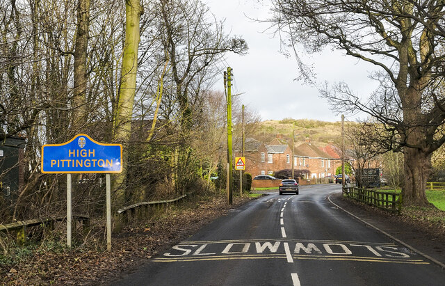
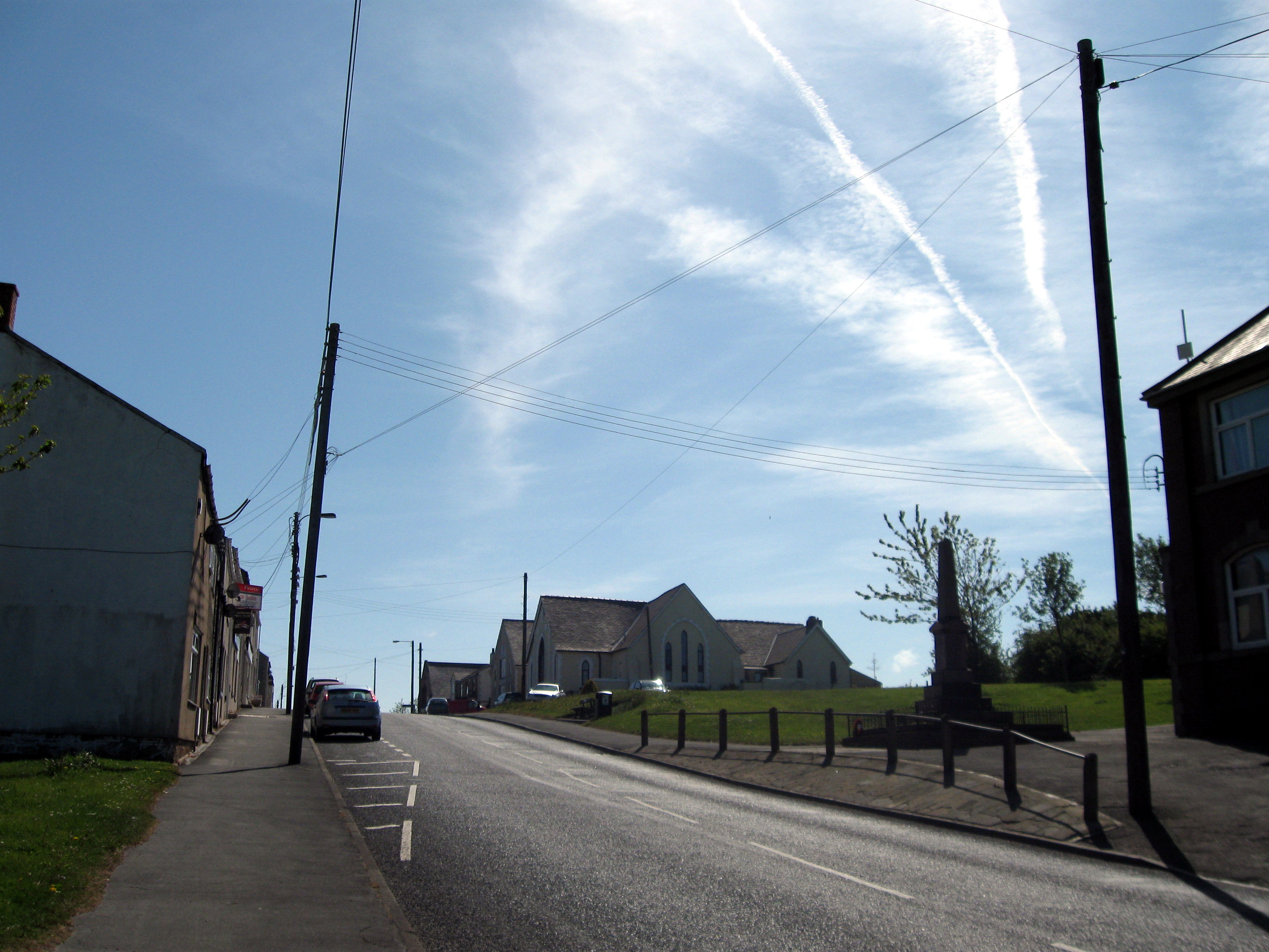
Sherburn Hill is a small village located in County Durham, England. Situated on a hilltop, it offers picturesque views of the surrounding countryside. The village falls within the administrative boundaries of Durham County Council.

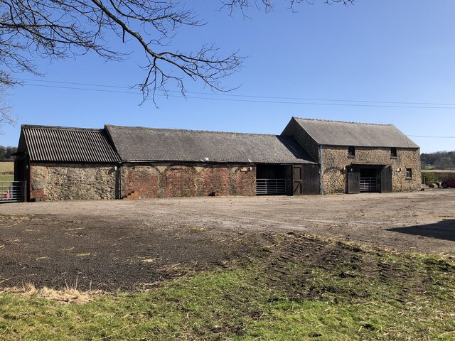
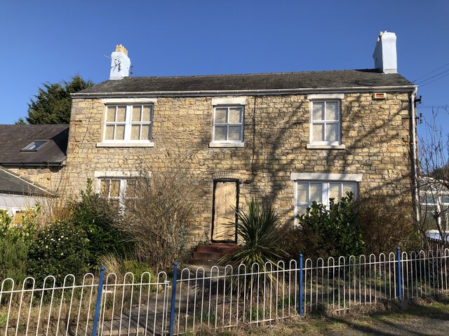
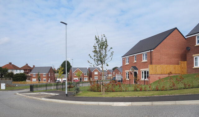
The village is primarily residential, with a population of around 1,500 people. It is known for its close-knit community and friendly atmosphere. The houses in Sherburn Hill are a mix of traditional stone-built cottages and more modern properties.

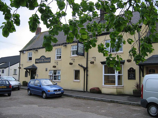
Sherburn Hill has a few amenities to cater to the needs of its residents. These include a local convenience store, a post office, and a primary school. The village also has a pub, providing a meeting place for locals and visitors alike.

The area surrounding Sherburn Hill offers plenty of opportunities for outdoor activities. The village is surrounded by beautiful countryside, making it a popular spot for hikers and nature enthusiasts. There are several walking trails and footpaths that allow visitors to explore the area and take in the stunning views.

Despite its rural location, Sherburn Hill benefits from good transport links. The village is well-connected to nearby towns and cities, with regular bus services. The A181 road runs through the village, providing easy access to Durham and other major destinations.

In conclusion, Sherburn Hill is a charming village nestled on a hilltop in County Durham. With its friendly community, stunning views, and convenient location, it offers a peaceful and idyllic place to live or visit.

If you have any feedback on the listing, please let us know in the comments section below.

Sherburn Hill Images

Images are sourced within 2km of 54.77242/-1.4806288 or Grid Reference NZ3342. Thanks to Geograph Open Source API. All images are credited.

Farm Buildings, Littletown Farm
Cook's Hold Farm Former farm house, derelict at the time of posting following the closure of the kennels that occupied the site. A victim of Covid's impact on business, the kennels only opened on the site in 2019.
Cook's Hold Farm
Former farm house, derelict at the time of posting following the closure of the kennels that occupied the site. A victim of Covid's impact on business, the kennels only opened on the site in 2019.
Spring Below Sherburn Hill
Disused Quarry At Running Waters
Latimer Way, Sherburn New housing on the edge of the village.
Latimer Way, Sherburn
New housing on the edge of the village.
New Houses, Latimer Way Still being built up the far end of the road. A new development on the edge of Sherburn.
New Houses, Latimer Way
Still being built up the far end of the road. A new development on the edge of Sherburn.
Nelson Terrace, Sherburn Terraced housing on Park House Gardens.
Nelson Terrace, Sherburn
Terraced housing on Park House Gardens.
Front Street, Sherburn The centre of the village, with the Lambton Arms pub across the road.
Front Street, Sherburn
The centre of the village, with the Lambton Arms pub across the road.
Medical Centre, Gray Avenue
War Memorial at St Lawrence's church, Pittington Grade II listed war memorial from 1920 in the churchyard of the Grade I listed Norman parish church.
War Memorial at St Lawrence's church, Pittington
Grade II listed war memorial from 1920 in the churchyard of the Grade I listed Norman parish church.
Road entering High Pittington This is Hallgarth Lane entering the village from the south. The blue and yellow road sign is in the style very common in County Durham.
Road entering High Pittington
This is Hallgarth Lane entering the village from the south. The blue and yellow road sign is in the style very common in County Durham.
Hallgarth Hotel The Hallgarth Hotel on the outskirts of High Pittington, seen from the north.
Hallgarth Hotel
The Hallgarth Hotel on the outskirts of High Pittington, seen from the north.
B1283 Front Street leaving Sherburn
B1283/Crime Rigg Bank junction in fog
B1283 at Sherburn Hill, Churchill Terrace
B1283 Durham Lane heading east
Grassed area with house beyond The grass is on the north side of the B1283 passing through the village of Sherburn Hill.
Grassed area with house beyond
The grass is on the north side of the B1283 passing through the village of Sherburn Hill.
Houses and farm in Sherburn Sherburn is a village astride the B1283 lying to the west of Durham city. The buildings in view are at the eastern end of the settlement and on the south side of the main road.
Houses and farm in Sherburn
Sherburn is a village astride the B1283 lying to the west of Durham city. The buildings in view are at the eastern end of the settlement and on the south side of the main road.
Show me another place!

Sherburn Hill is located at Grid Ref: NZ3342 (Lat: 54.77242, Lng: -1.4806288)

Unitary Authority: County Durham

Police Authority: Durham

What 3 Words

///frightens.good.palms. Near Sherburn Hill, Co. Durham

Related Wikis

Sherburn Hill

Sherburn Hill is a village in County Durham, in England. It is situated to the east of Sherburn. From 1835 to 1965, the Sherburn Hill Colliery operated...

Sherburn Hill (SSSI)

Sherburn Hill is a Site of Special Scientific Interest in County Durham, England. It lies just south of the road between the villages of Sherburn and Sherburn...

Crime Rigg and Sherburn Hill Quarries

Crime Rigg and Sherburn Hill Quarries is a Site of Special Scientific Interest in County Durham, England. It lies about 1 kilometre (0.6 mi) east of the...

Shadforth

Shadforth is a village in County Durham, England. It is situated a few miles to the east of Durham. The historic centre of the village is designated a...

Nearby Amenities

Located within 500m of 54.77242,-1.4806288
Sherburn Hill
Place: village
Source: npe
Wikidata: Q7494763
Wikipedia: en:Sherburn Hill
Lat/Long: 54.7735926/-1.4805034
Turning Circle
Lat/Long: 54.7728518/-1.477209
Post Box
Postal Code: DH6
Ref: DH6 211
Lat/Long: 54.7752299/-1.4771061
Telephone
Lat/Long: 54.7749874/-1.4753014
Man Made: water_tower
Lat/Long: 54.7731648/-1.4796254
Post Box
Operator: Royal Mail
Operator Wikidata: Q638098
Post Box Type: pillar
Ref: DH6 467
Lat/Long: 54.7728402/-1.4797569
Sherburn Hill Club
Disused Club: social
Note: No current trace (including FHRS ID)
Lat/Long: 54.7731629/-1.481959
Sherburn Hill War Memorial
Historic: memorial
Memorial: war_memorial
Monument: war_memorial
Wikidata: Q66478152
Lat/Long: 54.7729959/-1.482477
Telephone
Lat/Long: 54.7733842/-1.4852129
Bus Stop
Jubilee Crescent
Naptan AtcoCode: 13005357C
Naptan Bearing: E
Naptan CommonName: Jubilee Crescent
Naptan Indicator: east bound
Naptan Landmark: Landmark not known
Naptan NaptanCode: durdjtpw
Naptan Notes: Junction of North View and East View- Sherbern Hill
Naptan Street: Littletown Lane
Naptan Verified: no
Shelter: yes
Source: naptan_import
Lat/Long: 54.7755817/-1.4753194
Bus Stop
Jubilee Crescent
Naptan AtcoCode: 13005357E
Naptan Bearing: S
Naptan CommonName: Jubilee Crescent
Naptan Indicator: south bound
Naptan Landmark: Landmark not known
Naptan NaptanCode: durdjtwa
Naptan Notes: 7- Jubilee Crescent- Sherbern Hill
Naptan Street: Littletown Lane
Naptan Verified: no
Shelter: yes
Source: naptan_import
Lat/Long: 54.7750055/-1.4750782
Bus Stop
Railway Bridge
Naptan AtcoCode: 13005378C
Naptan Bearing: E
Naptan CommonName: Railway Bridge
Naptan Indicator: east bound
Naptan Landmark: Landmark not known
Naptan NaptanCode: durdjwjm
Naptan Notes: beside 36- Local Avenue- Sherbern Hill
Naptan Street: B1283 Local Avenue
Naptan Verified: no
Source: naptan_import
Lat/Long: 54.7737386/-1.4877642
Bus Stop
Aged Miners Homes
Naptan AtcoCode: 13005379C
Naptan Bearing: E
Naptan CommonName: Aged Miners Homes
Naptan Indicator: east bound
Naptan Landmark: Landmark not known
Naptan NaptanCode: durdjwjt
Naptan Notes: 51- Local Avenue- Sherbern Ave
Naptan Street: B1283 Local Avenue
Naptan Verified: no
Source: naptan_import
Lat/Long: 54.7735414/-1.4857613
Bus Stop
Aged Miners Homes
Naptan AtcoCode: 13005379G
Naptan Bearing: W
Naptan CommonName: Aged Miners Homes
Naptan Indicator: west bound
Naptan Landmark: Landmark not known
Naptan NaptanCode: durdjwjw
Naptan Notes: Just E of Aged Miners Homes- Local Av- Sherbern Hill
Naptan Street: B1283 Local Avenue
Naptan Verified: no
Shelter: yes
Source: naptan_import
Lat/Long: 54.7730285/-1.4841604
Bus Stop
Moor Edge
Bench: yes
Bin: yes
Bus: yes
Departures Board: timetable
Naptan AtcoCode: 13005380C
Naptan Bearing: E
Naptan CommonName: Moor Edge
Naptan Indicator: east bound
Naptan Landmark: Landmark not known
Naptan NaptanCode: durdjwma
Naptan Notes: Between 9 and 10 Front Street- Sherbern Hill
Naptan Street: Front Street
Naptan Verified: no
Public Transport: platform
Shelter: yes
Source: naptan_import
Lat/Long: 54.7730137/-1.4814976
Bus Stop
Moor Edge
Bench: yes
Bin: no
Bus: yes
Departures Board: timetable
Naptan AtcoCode: 13005380G
Naptan Bearing: W
Naptan CommonName: Moor Edge
Naptan Indicator: west bound
Naptan Landmark: Landmark not known
Naptan NaptanCode: durdjwmd
Naptan Notes: opp 14- Front Street- Sherbern Hill
Naptan Street: Front Street
Naptan Verified: no
Public Transport: platform
Shelter: yes
Source: naptan_import
Lat/Long: 54.7728008/-1.4806874
Bus Stop
Salvation Army
Naptan AtcoCode: 13005381D
Naptan Bearing: SE
Naptan CommonName: Salvation Army
Naptan Indicator: south east bound
Naptan Landmark: Landmark not known
Naptan NaptanCode: durdjwmg
Naptan Notes: Durham Rd- outside 11- Pinders Way- Sherbern Hill
Naptan Street: Front Street
Naptan Verified: no
Source: naptan_import
Lat/Long: 54.7725355/-1.4774885
Bus Stop
Salvation Army
Naptan AtcoCode: 13005381H
Naptan Bearing: NW
Naptan BusStopType: MKD
Naptan CommonName: Salvation Army
Naptan Indicator: NW-bound
Naptan Landmark: Landmark not known
Naptan NaptanCode: durdjwmj
Naptan Notes: opp Salvation Army Hall- Durham Rd- Sherbern Hill
Naptan RevisionNumber: 3
Naptan Street: Front Street
Naptan Verified: no
Source: naptan_import
Lat/Long: 54.7722352/-1.4766374
Power: pole
Lat/Long: 54.7686729/-1.4816536
Power: pole
Lat/Long: 54.7691378/-1.4827091
Power: pole
Lat/Long: 54.7696175/-1.4837967
Power: pole
Lat/Long: 54.7700902/-1.484887
Power: pole
Lat/Long: 54.7705729/-1.4858741
Power: pole
Lat/Long: 54.7710549/-1.4870596
Power: pole
Lat/Long: 54.7713001/-1.487588
Power: pole
Lat/Long: 54.774546/-1.4873305
Power: pole
Lat/Long: 54.7749204/-1.4862281
Power: pole
Lat/Long: 54.7751997/-1.4853738
Power: pole
Lat/Long: 54.77539/-1.4847878
Power: pole
Lat/Long: 54.7757458/-1.4837149
Power: pole
Lat/Long: 54.776042/-1.4825146
High House Farm
Addr City: Durham
Addr Postcode: DH6 1PQ
Place: farm
Source Name: OS_OpenData_StreetView
Source Postcode: CodePoint Open
Lat/Long: 54.7734398/-1.4738095
Power: pole
Lat/Long: 54.774136/-1.4739007
Power: pole
Lat/Long: 54.7738854/-1.475054
Power: pole
Lat/Long: 54.7760846/-1.4825816
Power: pole
Lat/Long: 54.7681924/-1.4805579
Power: pole
Lat/Long: 54.7680416/-1.4793053
Waste Basket
Lat/Long: 54.7759441/-1.4785858
The data included in this document is from www.openstreetmap.org. The data is made available under ODbL.

Have you been to Sherburn Hill?

Leave your review of Sherburn Hill below (or comments, questions and feedback).