Barley Hill

Hill, Mountain in Durham

England

Barley Hill

Skerne valley
Skerne valley Credit: N Chadwick

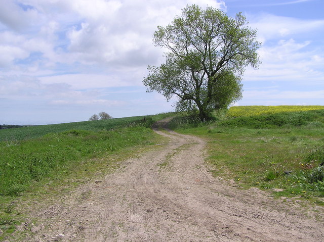
Barley Hill is a prominent hill located in the county of Durham, England. It is situated near the village of Barley, hence its name. Rising to an elevation of approximately 290 meters (951 feet), Barley Hill is considered one of the notable peaks in the region, offering stunning panoramic views of the surrounding countryside.

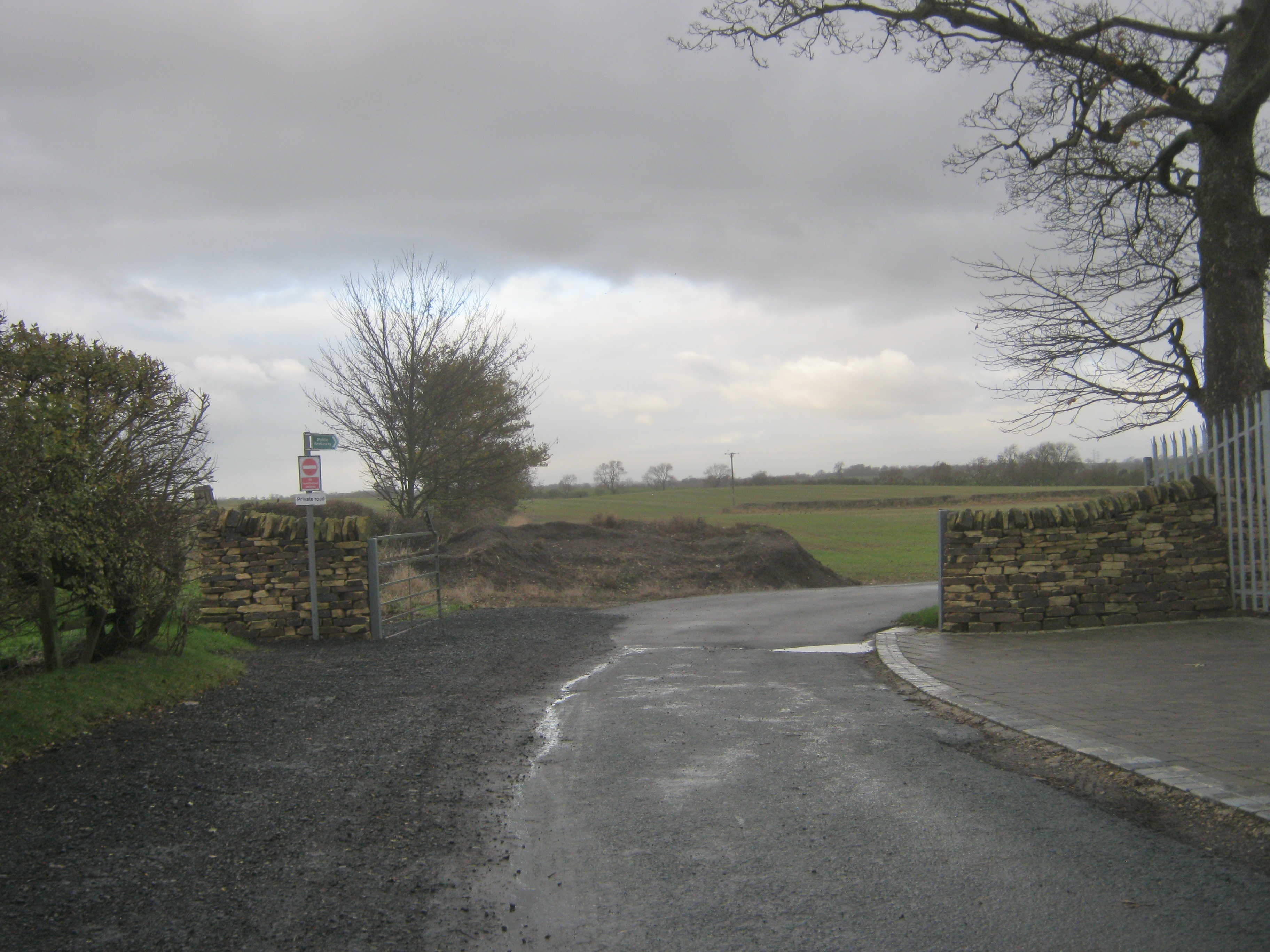
The hill is a popular destination for outdoor enthusiasts, including hikers, walkers, and nature lovers. Its well-maintained trails and footpaths make it accessible to people of varying fitness levels. The ascent to the summit is relatively moderate, with a gradual incline throughout most of the route.

At the top of Barley Hill, visitors are rewarded with breathtaking vistas, which encompass vast stretches of rolling green fields, meandering rivers, and picturesque villages nestled among the landscape. On clear days, it is even possible to catch a glimpse of the distant Pennines to the west.

Barley Hill is also renowned for its diverse wildlife and natural beauty. The hillside is adorned with a rich variety of flora, including heather, gorse, and wildflowers, creating a vibrant and colorful display during the summer months. The area is also home to numerous species of birds, small mammals, and insects, making it a haven for wildlife enthusiasts and birdwatchers.

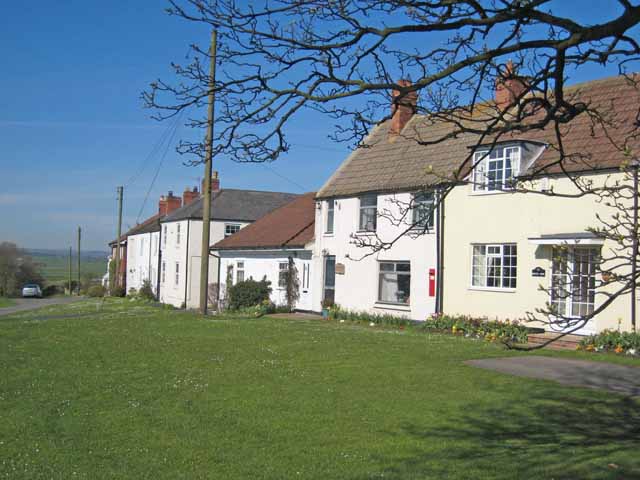
Overall, Barley Hill offers a tranquil and scenic retreat for those looking to escape the hustle and bustle of daily life. Its accessibility, natural beauty, and sweeping views make it a must-visit destination for both locals and tourists alike.

If you have any feedback on the listing, please let us know in the comments section below.

Barley Hill Images

Images are sourced within 2km of 54.614543/-1.4937425 or Grid Reference NZ3224. Thanks to Geograph Open Source API. All images are credited.

Skerne valley
Skerne valley
Nissen huts, Preston Carrs This is a prefabricated steel structure made from a half-cylindrical skin of corrugated steel, was used extensively during World War II. Between April 16 and April 18, 1916, Major Peter Norman Nissen of the 29th Company Royal Engineers began to experiment with hut designs. Nissen, a mining engineer and inventor, constructed three prototype semi-cylindrical huts. The semi-cylindrical shape was derived from the drill-shed roof at Queen's University, Kingston, Ontario. Nissen’s design was subject to intensive review by his fellow officers, Lieutenant Colonels Shelly, Sewell and McDonald, and General Clive Gerard Liddell, which helped Nissen develop the design. After the third prototype was completed, the design was formalized and the Nissen hut was put into production in August 1916. At least 100,000 were produced in World War I
Nissen huts, Preston Carrs
This is a prefabricated steel structure made from a half-cylindrical skin of corrugated steel, was used extensively during World War II. Between April 16 and April 18, 1916, Major Peter Norman Nissen of the 29th Company Royal Engineers began to experiment with hut designs. Nissen, a mining engineer and inventor, constructed three prototype semi-cylindrical huts. The semi-cylindrical shape was derived from the drill-shed roof at Queen's University, Kingston, Ontario. Nissen’s design was subject to intensive review by his fellow officers, Lieutenant Colonels Shelly, Sewell and McDonald, and General Clive Gerard Liddell, which helped Nissen develop the design. After the third prototype was completed, the design was formalized and the Nissen hut was put into production in August 1916. At least 100,000 were produced in World War I
Preston Carrs
Preston Carrs
Cattle grazing, Preston Carrs
Railway underbridge at Preston le Skerne A rail underbridge on the disused Shildon to Newport line at the point where Leehall Lane meets Wildgoose Lane at Preston le Skerne
Railway underbridge at Preston le Skerne
A rail underbridge on the disused Shildon to Newport line at the point where Leehall Lane meets Wildgoose Lane at Preston le Skerne
Platelayer's hut near Preston le Skerne What was once a platelayer's hut next to the former Shildon to Newport Railway which was in remarkably good condition given its age.
Platelayer's hut near Preston le Skerne
What was once a platelayer's hut next to the former Shildon to Newport Railway which was in remarkably good condition given its age.
Wild Goose Lane near Preston le Skerne Following the bridleway east of Preston le Skerne it runs beside the former Shildon to Newport railway line. According to the OS map this is Wildgoose Lane, only there isn't a lane, just open fields.
Wild Goose Lane near Preston le Skerne
Following the bridleway east of Preston le Skerne it runs beside the former Shildon to Newport railway line. According to the OS map this is Wildgoose Lane, only there isn't a lane, just open fields.
Site of High Grindon medieval village. The high ground leading up to the trees on the skyline is the site of High Grindon medieval village of which there is no discernable sign today.
Site of High Grindon medieval village.
The high ground leading up to the trees on the skyline is the site of High Grindon medieval village of which there is no discernable sign today.
Grindon Lane This is a section of Grindon Lane north of Stainton Hill House in County Durham, which with its drainage ditches and seemingly raised roadbed intrigued me.
Grindon Lane
This is a section of Grindon Lane north of Stainton Hill House in County Durham, which with its drainage ditches and seemingly raised roadbed intrigued me.
Grindon  Lane Green Lane to High Grindon Farm (demolished) looking south.
Grindon Lane
Green Lane to High Grindon Farm (demolished) looking south.
High Grindon : near Deserted Medieval Village There are remains of a medieval village with a number of earth banks and ditches forming small enclosures. A later farm house on the site now demolished.
High Grindon : near Deserted Medieval Village
There are remains of a medieval village with a number of earth banks and ditches forming small enclosures. A later farm house on the site now demolished.
Dismantled Railway  (Cutting) Part of the former Clarence Railway 1833. This stretch from Simpasture Junction to Stillington Junction. Electrified in 1915 by the NER.
Dismantled Railway (Cutting)
Part of the former Clarence Railway 1833. This stretch from Simpasture Junction to Stillington Junction. Electrified in 1915 by the NER.
Wildgoose Lane. Trackbed of the old Clarence Railway (1833)
Wildgoose Lane.
Trackbed of the old Clarence Railway (1833)
Bridge over Elstob  Beck
Bridge over Elstob Beck
Hope House  Farm Hogg's House 1940's
Hope House Farm
Hogg's House 1940's
Railway Bridge :  Mordon South east of Mordon crossing the Stockton to Ferryhill Station line.
Railway Bridge : Mordon
South east of Mordon crossing the Stockton to Ferryhill Station line.
Elstob  Hall
Elstob Hall
Elstob Crossing, West Looking west from Elstob Crossing, with track-bed and disused bridge of the Clarence Railway (1833). A  section of the line from this point westward has been surfaced with bark etc, and used for horse training.
Elstob Crossing, West
Looking west from Elstob Crossing, with track-bed and disused bridge of the Clarence Railway (1833). A section of the line from this point westward has been surfaced with bark etc, and used for horse training.
Show me another place!

Barley Hill is located at Grid Ref: NZ3224 (Lat: 54.614543, Lng: -1.4937425)

Unitary Authority: County Durham

Police Authority: Durham

What 3 Words

///ahead.such.played. Near Stillington, Co. Durham

Nearby Locations

Barley Hill Mordon

Related Wikis

Railway Stell West

Railway Stell West is a Site of Special Scientific Interest in the Sedgefield district of County Durham, England. The site consists of a length of ditch...

Mordon

Mordon is a village and civil parish in County Durham, England. It is situated a few miles to the north-east of Newton Aycliffe. The population recorded...

Preston-le-Skerne

Preston-le-Skerne is a hamlet in the civil parish of Mordon, County Durham, in England. It is situated a short distance to the east of Newton Aycliffe...

Foxton, County Durham

Foxton is a small village in County Durham, England. It is situated to the north-west of Stockton-on-Tees, near Stillington. The origin of the place-name...

Nearby Amenities

Located within 500m of 54.614543,-1.4937425
Power: pole
Lat/Long: 54.616739/-1.4936592
Power: pole
Lat/Long: 54.6165526/-1.4923342
Power: pole
Lat/Long: 54.6163453/-1.4909568
Power: pole
Lat/Long: 54.6161674/-1.4896198
Power: pole
Lat/Long: 54.6159578/-1.4882062
Power: pole
Lat/Long: 54.6157489/-1.4868101
Howe Hills Farm
Operator: Rebecca Menzies Racing
Place: farm
Source Name: OS_OpenData_StreetView
Website: https://rebeccamenziesracing.co.uk/home
Lat/Long: 54.614716/-1.4924401
Power: pole
Lat/Long: 54.6111109/-1.4967196
Power: pole
Lat/Long: 54.6122479/-1.4963709
Power: pole
Lat/Long: 54.6133748/-1.496041
Power: pole
Lat/Long: 54.6144007/-1.4957955
Power: pole
Lat/Long: 54.615519/-1.4954522
Power: pole
Lat/Long: 54.6162303/-1.4952537
Power: pole
Lat/Long: 54.6169463/-1.4950486
Power: pole
Lat/Long: 54.6176739/-1.4947857
Power: pole
Lat/Long: 54.6186858/-1.494897
Power: pole
Lat/Long: 54.6176638/-1.494846
Power: pole
Lat/Long: 54.6177741/-1.4958639
Power: pole
Lat/Long: 54.617896/-1.4970186
Power: pole
Lat/Long: 54.6180343/-1.4982806
The data included in this document is from www.openstreetmap.org. The data is made available under ODbL.

Have you been to Barley Hill?

Leave your review of Barley Hill below (or comments, questions and feedback).