Kimberworth

Settlement in Yorkshire

England

Kimberworth

Iccles Locks View from the Iccles road bridge across the Sheffield and South Yorkshire Navigation canal.
Iccles Locks Credit: Ryk Rak

Kimberworth is a small suburban area located in the metropolitan borough of Rotherham, South Yorkshire, England. Situated approximately 3 miles north of Rotherham town center, Kimberworth is nestled in the eastern region of the county of Yorkshire. It is bounded by other areas like Thorpe Hesley, Greasbrough, and Wingfield.

Historically, Kimberworth was a former mining village with a rich industrial heritage. It was predominantly known for its coal mining, ironworks, and steel production industries during the 19th and early 20th centuries. However, as with many industrial areas in Yorkshire, these industries have declined, and the village has transitioned into a residential area.

Today, Kimberworth offers a mix of housing, ranging from traditional stone-built terraced houses to modern developments. It has a small commercial area with a few local shops, pubs, and amenities, catering to the needs of its residents. The village is well-connected to surrounding areas by various road networks, including the A6109 road, ensuring easy access to neighboring towns and cities.

Kimberworth benefits from its proximity to the beautiful Yorkshire countryside, with several parks and green spaces nearby, including the popular Wentworth Woodhouse Gardens and Park. Additionally, the area boasts a strong sense of community, with local events and activities organized by community groups.

In summary, Kimberworth is a once thriving industrial village that has transformed into a residential area, offering a mix of housing options and easy access to surrounding towns. With its rich history and proximity to beautiful countryside, it provides a peaceful and picturesque place to reside.

If you have any feedback on the listing, please let us know in the comments section below.
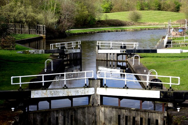
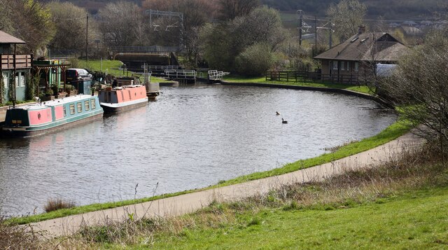
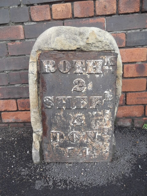
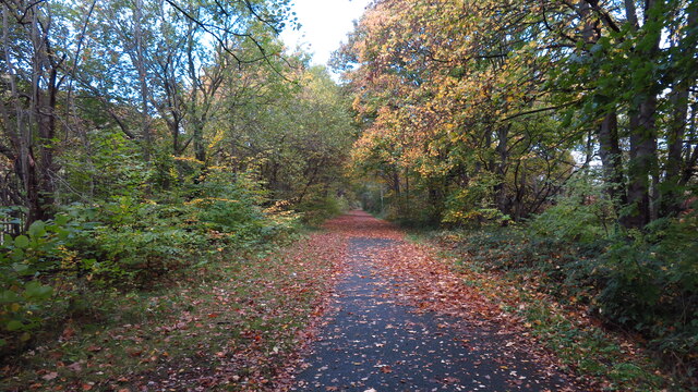
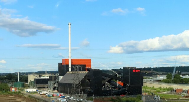
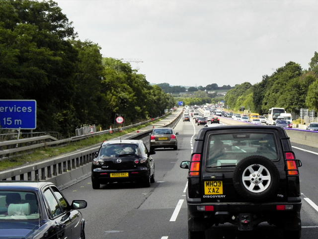
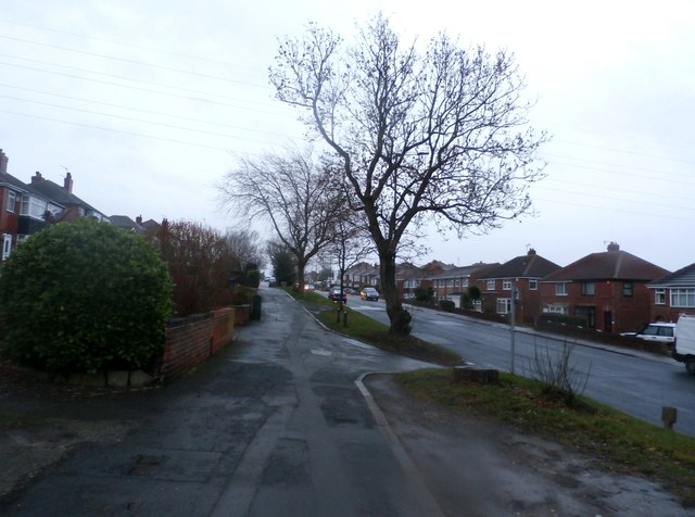
Kimberworth Images

Images are sourced within 2km of 53.432682/-1.393384 or Grid Reference SK4093. Thanks to Geograph Open Source API. All images are credited.

Iccles Locks View from the Iccles road bridge across the Sheffield and South Yorkshire Navigation canal.
Iccles Locks
View from the Iccles road bridge across the Sheffield and South Yorkshire Navigation canal.
Iccles canal basin Canal basin next to the Iccles locks (seen in the background)
Iccles canal basin
Canal basin next to the Iccles locks (seen in the background)
Old milestone In March 2018 this milestone on the Tinsley to Doncaster tollroad (1764 -1873), now A6178, was the only one of the 5 remaining posts to have retained its plate.
Old milestone
In March 2018 this milestone on the Tinsley to Doncaster tollroad (1764 -1873), now A6178, was the only one of the 5 remaining posts to have retained its plate.
Old milestone During the summer of 2018 the pavement was relayed and the plate disappeared from the stone.  The 'authorities' were questioned and the plate was to be put back.   It hasn't happened.  But the stone remains by the side of Deadman's Hole Lane.
Old milestone
During the summer of 2018 the pavement was relayed and the plate disappeared from the stone. The 'authorities' were questioned and the plate was to be put back. It hasn't happened. But the stone remains by the side of Deadman's Hole Lane.
Old milestone In the contract between the West Riding County Council and Gill & Frank Stead, stonemasons, of Mirfield, six of these milestones were to be erected from this one on the A629, Wortley Road, in Kimberworth to where the route meets the Sheffield to Penistone road, A61.   Rotherham 3 & 4 are now missing with 5, 6 and 7 still in situ.   They were set up in 1893/94.
Old milestone
In the contract between the West Riding County Council and Gill & Frank Stead, stonemasons, of Mirfield, six of these milestones were to be erected from this one on the A629, Wortley Road, in Kimberworth to where the route meets the Sheffield to Penistone road, A61. Rotherham 3 & 4 are now missing with 5, 6 and 7 still in situ. They were set up in 1893/94.
Tinsley Viaduct from Meadowhall shopping centre car park The two-tier Tinsley Viaduct section of the M1 motorway. Construction began in 1965 and both tiers opened three years later.
Tinsley Viaduct from Meadowhall shopping centre car park
The two-tier Tinsley Viaduct section of the M1 motorway. Construction began in 1965 and both tiers opened three years later.
Meadowhall and the M1, Sheffield
Millmoor Juniors Football Club, Rotherham
Autumn colours, Blackburn Valley Trail, NW of Meadowhall A surprisingly pleasant walkway in what is quite an industrial area.
Autumn colours, Blackburn Valley Trail, NW of Meadowhall
A surprisingly pleasant walkway in what is quite an industrial area.
Blackburn Meadows Power Station
M1, North of Tinsley The M1 is a north–south motorway connecting London to Leeds, where it joins the A1(M) near Aberford. It was the first motorway to be completed in the United Kingdom.
The motorway is 193 miles long and was constructed in four phases. Most of the motorway was opened between 1959 and 1968 but the southern end was extended in 1977 and the northern end was extended in 1999.
M1, North of Tinsley
The M1 is a north–south motorway connecting London to Leeds, where it joins the A1(M) near Aberford. It was the first motorway to be completed in the United Kingdom. The motorway is 193 miles long and was constructed in four phases. Most of the motorway was opened between 1959 and 1968 but the southern end was extended in 1977 and the northern end was extended in 1999.
Car park, Meadowhall Meadowhall is an indoor shopping centre in Sheffield. It lies 3 miles  north-east of Sheffield city centre and 2 miles from Rotherham town centre. It is the largest shopping centre in Yorkshire and the eighth largest in the United Kingdom.
The centre opened in 1990 and has over 280 shops.
Wikipedia: <span class="nowrap"><a title="https://en.wikipedia.org/wiki/Meadowhall_Centre" rel="nofollow ugc noopener" href="https://en.wikipedia.org/wiki/Meadowhall_Centre">Link</a><img style="margin-left:2px;" alt="External link" title="External link - shift click to open in new window" src="https://s1.geograph.org.uk/img/external.png" width="10" height="10"/></span>
Car park, Meadowhall
Meadowhall is an indoor shopping centre in Sheffield. It lies 3 miles north-east of Sheffield city centre and 2 miles from Rotherham town centre. It is the largest shopping centre in Yorkshire and the eighth largest in the United Kingdom. The centre opened in 1990 and has over 280 shops. Wikipedia: LinkExternal link
Elevated M1 The M1 is a north–south motorway connecting London to Leeds, where it joins the A1(M) near Aberford. It was the first motorway to be completed in the United Kingdom.
The motorway is 193 miles long and was constructed in four phases. Most of the motorway was opened between 1959 and 1968 but the southern end was extended in 1977 and the northern end was extended in 1999.
Elevated M1
The M1 is a north–south motorway connecting London to Leeds, where it joins the A1(M) near Aberford. It was the first motorway to be completed in the United Kingdom. The motorway is 193 miles long and was constructed in four phases. Most of the motorway was opened between 1959 and 1968 but the southern end was extended in 1977 and the northern end was extended in 1999.
Upper Wortley Road in Rotherham Pictured as Storm Barbara was moving into the area. This turned out to be a fairly benign pre-xmas weather system.
Upper Wortley Road in Rotherham
Pictured as Storm Barbara was moving into the area. This turned out to be a fairly benign pre-xmas weather system.
Tinsley Viaduct from Meadowhall Road
Blackburn Meadows Way under construction Construction of a new road to help reduce congestion at the Tinsley Viaduct (south) roundabout by providing an alternate route to Rotherham. Also see <a href="https://www.geograph.org.uk/photo/5619370">SK3991 : Blackburn Meadow Way under construction</a> in February 2016.
Blackburn Meadows Way under construction
Construction of a new road to help reduce congestion at the Tinsley Viaduct (south) roundabout by providing an alternate route to Rotherham. Also see SK3991 : Blackburn Meadow Way under construction in February 2016.
Blackburn Meadow Way under construction
Blackburn Meadows power station The biomass power plant is seen here from the M1. The architects were BDP. "The striking black and amber volumes draw their inspiration from the processes of the past: the black is a reference to the site’s industrial heritage or even the smut and smoke of the coal fired power stations, while the amber is a symbol of fire, surrounding the burners glowing at dusk like a rising phoenix of the old Tinsley Towers" <span class="nowrap"><a title="https://www.architecture.com/awards-and-competitions-landing-page/awards/riba-regional-awards/riba-yorkshire-award-winners/2017/blackburn-meadows-biomass" rel="nofollow ugc noopener" href="https://www.architecture.com/awards-and-competitions-landing-page/awards/riba-regional-awards/riba-yorkshire-award-winners/2017/blackburn-meadows-biomass">Link</a><img style="margin-left:2px;" alt="External link" title="External link - shift click to open in new window" src="https://s1.geograph.org.uk/img/external.png" width="10" height="10"/></span> .

On the left is the Blackburn Meadows Sewage Works. On the right is a curving section of the Fitzwilliam Bridge, part of the Bus Rapid Transport Tinsley Link network. Beyond it is part of Rotherham.
Blackburn Meadows power station
The biomass power plant is seen here from the M1. The architects were BDP. "The striking black and amber volumes draw their inspiration from the processes of the past: the black is a reference to the site’s industrial heritage or even the smut and smoke of the coal fired power stations, while the amber is a symbol of fire, surrounding the burners glowing at dusk like a rising phoenix of the old Tinsley Towers" LinkExternal link . On the left is the Blackburn Meadows Sewage Works. On the right is a curving section of the Fitzwilliam Bridge, part of the Bus Rapid Transport Tinsley Link network. Beyond it is part of Rotherham.
Show me another place!

Kimberworth is located at Grid Ref: SK4093 (Lat: 53.432682, Lng: -1.393384)

Division: West Riding

Unitary Authority: Rotherham

Police Authority: South Yorkshire

What 3 Words

///plates.belly.slot. Near Rotherham, South Yorkshire

Nearby Locations

Kimberworth Bradgate

Related Wikis

Winterhill School

Winterhill School is a mixed secondary school located in Kimberworth, Rotherham, South Yorkshire, England. The school was formed in 2004 by the merger...

Old Hall Comprehensive School

Old Hall Comprehensive School was a comprehensive school located in Kimberworth, Rotherham, South Yorkshire, England. It merged with Kimberworth Comprehensive...

Ferham Park

Ferham Park was a cricket ground in Rotherham, Yorkshire, England. The first recorded match on the ground was in 1880, when the North played a United...

Abbey School, Rotherham

Abbey School is a mixed special school for children with moderate and complex learning difficulties. It is located in Kimberworth, South Yorkshire, England...

Nearby Amenities

Located within 500m of 53.432682,-1.393384
Kimberworth
Is In: Rotherham, South Yorkshire, England, UK
Place: suburb
Wikidata: Q6409995
Wikipedia: en:Kimberworth
Lat/Long: 53.4333919/-1.3947488
Turning Circle
Lat/Long: 53.4316637/-1.3917082
Crossing
Crossing: zebra
Lat/Long: 53.4349086/-1.3968655
Turning Circle
Lat/Long: 53.4369968/-1.3933768
Turning Circle
Lat/Long: 53.4357124/-1.3954439
Turning Circle
Lat/Long: 53.4368277/-1.3947761
Pharmacy
Winterhill Pharmacy
Addr City: Rotherham
Addr Country: GB
Addr Housenumber: 2
Addr Postcode: S61 2DT
Addr Street: Fellowsfield Way
Addr Suburb: Kimberworth
Dispensing: yes
Healthcare: pharmacy
Opening Hours: Mo-Fr 08:30-18:30; Sa 09:00-13:00
Phone: +44 1709 555295
Lat/Long: 53.4350075/-1.3964672
Power: substation
Lat/Long: 53.4342372/-1.3890812
Power: substation
Lat/Long: 53.4360227/-1.3911944
Kindergarten
Haven-Lea Day Nursery
Lat/Long: 53.4329009/-1.3864822
Note: FIXME
Lat/Long: 53.4331696/-1.385965
Post Box
Brand: Royal Mail
Brand Wikidata: Q638098
Collection Times: Mo-Fr 09:00; Sa 07:00
Operator: Royal Mail
Operator Wikidata: Q638098
Post Box Type: lamp
Ref: S61 114
Royal Cypher: EIIR
Royal Cypher Wikidata: Q33102113
Lat/Long: 53.4320443/-1.3867546
Bus Stop
Old Wortley Road/Farm View Road
Alt Name: Old Wortley Road/Farm View Road
Bus: yes
Naptan AltCommonName: Old Wortley Road/Farm View Road
Naptan AtcoCode: 370030224
Naptan Bearing: N
Naptan CommonName: Old Wortley Road/Farm View Road
Naptan Indicator: 30224
Naptan Landmark: S Light No 3/Sir Colin Campbe
Naptan PlusbusZoneRef: ROTHCEN
Naptan Street: Old Wortley Road
Naptan Verified: no
Public Transport: platform
Source: naptan_import
Lat/Long: 53.4354954/-1.3973103
Bus Stop
Farm View Road/Little Common Lane
Alt Name: Farm View Road/Little Common Lane
Bus: yes
Naptan AltCommonName: Farm View Road/Little Common Lane
Naptan AtcoCode: 370030225
Naptan Bearing: N
Naptan CommonName: Farm View Road/Little Common Lane
Naptan Indicator: 30225
Naptan Landmark: School Buildings
Naptan PlusbusZoneRef: ROTHCEN
Naptan Street: Farm View Road
Naptan Verified: no
Public Transport: platform
Source: naptan_import
Lat/Long: 53.4352123/-1.3978293
Bus Stop
Farm View Road/Little Common Lane
Bus: yes
Naptan AtcoCode: 370030226
Naptan Bearing: N
Naptan CommonName: Farm View Road/Little Common Lane
Naptan Indicator: 30226
Naptan Landmark: SIR COLIN CAMPBELL
Naptan PlusbusZoneRef: ROTHCEN
Naptan Street: Farm View Road
Naptan Verified: no
Public Transport: platform
Source: naptan_import
Lat/Long: 53.435265/-1.3977441
Bus Stop
Fellowsfield Way/Welling Way
Alt Name: Fellowsfield Way/Welling Way
Bus: yes
Naptan AltCommonName: Fellowsfield Way/Welling Way
Naptan AtcoCode: 370030227
Naptan Bearing: N
Naptan CommonName: Fellowsfield Way/Welling Way
Naptan Indicator: 30227
Naptan Landmark: OPPOSITE NUMBER 21
Naptan PlusbusZoneRef: ROTHCEN
Naptan Street: Fellowsfield Way
Naptan Verified: no
Public Transport: platform
Source: naptan_import
Lat/Long: 53.4360971/-1.3959955
Bus Stop
High Street/Peter Street
Alt Name: High Street/Peter Street
Bus: yes
Naptan AltCommonName: High Street/Peter Street
Naptan AtcoCode: 370030228
Naptan Bearing: N
Naptan CommonName: High Street/Peter Street
Naptan Indicator: 30228
Naptan Landmark: 30228
Naptan PlusbusZoneRef: ROTHCEN
Naptan Street: High Street
Naptan Verified: no
Public Transport: platform
Source: naptan_import
Lat/Long: 53.4335833/-1.3952793
Bus Stop
Meadowhall Road/Winter Hill Lane
Alt Name: Meadowhall Road/Winter Hill Lane
Bus: yes
Naptan AltCommonName: Meadowhall Road/Winter Hill Lane
Naptan AtcoCode: 370030229
Naptan Bearing: N
Naptan CommonName: Meadowhall Road/Winter Hill Lane
Naptan Indicator: 30229
Naptan Landmark: CHURCH
Naptan PlusbusZoneRef: ROTHCEN
Naptan Street: Meadowhall Road
Naptan Verified: no
Public Transport: platform
Source: naptan_import
Lat/Long: 53.4327725/-1.3952528
Bus Stop
Meadowhall Road/Winter Hill Lane
Alt Name: Meadowhall Road/Winter Hill Lane
Bus: yes
Naptan AltCommonName: Meadowhall Road/Winter Hill Lane
Naptan AtcoCode: 370030230
Naptan Bearing: NE
Naptan CommonName: Meadowhall Road/Winter Hill Lane
Naptan Indicator: 30230
Naptan Landmark: CHURCH
Naptan PlusbusZoneRef: ROTHCEN
Naptan Street: Meadowhall Road
Naptan Verified: no
Public Transport: platform
Source: naptan_import
Lat/Long: 53.4324005/-1.3959199
Bus Stop
Kimberworth Road/Ewers Road
Bus: yes
Naptan AtcoCode: 370030231
Naptan Bearing: NW
Naptan CommonName: Kimberworth Road/Ewers Road
Naptan Indicator: 30231
Naptan Landmark: COMPREHENSIVE SCHOOL
Naptan PlusbusZoneRef: ROTHCEN
Naptan Street: Kimberworth Road
Naptan Verified: no
Public Transport: platform
Source: naptan_import
Lat/Long: 53.4332706/-1.3895989
Bus Stop
Church Street/High Street
Alt Name: Church Street/High Street
Bus: yes
Naptan AltCommonName: Church Street/High Street
Naptan AtcoCode: 370030892
Naptan Bearing: N
Naptan CommonName: Church Street/High Street
Naptan Indicator: 30892
Naptan Landmark: Church
Naptan PlusbusZoneRef: ROTHCEN
Naptan Street: Church Street
Naptan Verified: no
Public Transport: platform
Source: naptan_import
Lat/Long: 53.4336878/-1.3934925
Bus Stop
Kimberworth Road/Psalters Lane
Alt Name: Kimberworth Road/Psalter Lane
Bus: yes
Naptan AltCommonName: Kimberworth Road/Psalter Lane
Naptan AtcoCode: 370030893
Naptan Bearing: N
Naptan CommonName: Kimberworth Road/Psalter Lane
Naptan Indicator: 30893
Naptan Landmark: Comprehensive School
Naptan PlusbusZoneRef: ROTHCEN
Naptan Street: Kimberworth Road
Naptan Verified: no
Public Transport: platform
Source: naptan_import
Lat/Long: 53.4328585/-1.3869529
Bus Stop
Kimberworth Road/Bradgate Lane
Alt Name: Kimberworth Road/Bradgate Lane
Bus: yes
Naptan AltCommonName: Kimberworth Road/Bradgate Lane
Naptan AtcoCode: 370030894
Naptan Bearing: N
Naptan CommonName: Kimberworth Road/Bradgate Lane
Naptan Indicator: 30894
Naptan Landmark: RECREATION FIELD
Naptan PlusbusZoneRef: ROTHCEN
Naptan Street: Kimberworth Road
Naptan Verified: no
Public Transport: platform
Source: naptan_import
Lat/Long: 53.4330484/-1.3862253
Bus Stop
South Street/Deepdale Road
Bus: yes
Naptan AtcoCode: 370031041
Naptan Bearing: SW
Naptan CommonName: South Street/Deepdale Road
Naptan Indicator: 31041
Naptan Landmark: CORNER HOUSE
Naptan PlusbusZoneRef: ROTHCEN
Naptan Street: South Street
Naptan Verified: no
Public Transport: platform
Source: naptan_import
Lat/Long: 53.429494/-1.3934731
Bus Stop
Kimberworth/Deepdale Road
Bus: yes
Naptan AtcoCode: 370031042
Naptan Bearing: NE
Naptan CommonName: Kimberworth/Deepdale Road
Naptan Indicator: 31042
Naptan Landmark: 31042
Naptan PlusbusZoneRef: ROTHCEN
Naptan Street: South Street
Naptan Verified: no
Public Transport: platform
Source: naptan_import
Lat/Long: 53.4294505/-1.3937597
Bus Stop
South Street/Richmond Road
Bus: yes
Naptan AtcoCode: 370031043
Naptan Bearing: N
Naptan CommonName: South Street/Richmond Road
Naptan Indicator: 31043
Naptan Landmark: SHOP
Naptan PlusbusZoneRef: ROTHCEN
Naptan Street: South Street
Naptan Verified: no
Public Transport: platform
Source: naptan_import
Lat/Long: 53.4282596/-1.3946646
Bus Stop
Deepdale Road/Oakdale Road
Bus: yes
Naptan AtcoCode: 370031049
Naptan Bearing: SE
Naptan CommonName: Deepdale Road/Oakdale Road
Naptan Indicator: 31049
Naptan Landmark: BRICK WALL
Naptan PlusbusZoneRef: ROTHCEN
Naptan Street: Deepdale Road
Naptan Verified: no
Public Transport: platform
Source: naptan_import
Lat/Long: 53.4290923/-1.3904838
Bus Stop
Deepdale Road/Oakdale Road
Bus: yes
Naptan AtcoCode: 370031050
Naptan Bearing: NW
Naptan CommonName: Deepdale Road/Oakdale Road
Naptan Indicator: 31050
Naptan Landmark: 31050
Naptan PlusbusZoneRef: ROTHCEN
Naptan Street: Deepdale Road
Naptan Verified: no
Public Transport: platform
Source: naptan_import
Lat/Long: 53.4290496/-1.3909359
Bus Stop
Meadowhall Road
Alt Name: Meadowhall Road
Bus: yes
Naptan AltCommonName: Meadowhall Road
Naptan AtcoCode: 370031216
Naptan Bearing: SW
Naptan CommonName: Meadowhall Road
Naptan Indicator: 31216
Naptan Landmark: MEADOWHALL JUNIOR SCHOOL
Naptan PlusbusZoneRef: ROTHCEN
Naptan Street: Meadowhall Road
Naptan Verified: no
Public Transport: platform
Source: naptan_import
Lat/Long: 53.4318028/-1.3964383
Bus Stop
Fellowsfield Way/Welling Way
Alt Name: Fellowsfield Way/Welling Way
Bus: yes
Naptan AltCommonName: Fellowsfield Way/Welling Way
Naptan AtcoCode: 370035647
Naptan Bearing: N
Naptan BusStopType: CUS
Naptan CommonName: Fellowsfield Way/Welling Way
Naptan Indicator: 35647
Naptan Landmark: OPPOSITE NUMBER 21
Naptan PlusbusZoneRef: ROTHCEN
Naptan Street: Fellowsfield Way
Naptan Verified: no
Public Transport: platform
Source: naptan_import
Lat/Long: 53.4361286/-1.3961353
Bus Stop
Richmond Park Avenue/Meadowhall Road
Alt Name: Richmond Park Avenue/Meadowhall Road
Bus: yes
Naptan AltCommonName: Richmond Park Avenue/Meadowhall Road
Naptan AtcoCode: 370035339
Naptan Bearing: N
Naptan CommonName: Richmond Park Avenue/Meadowhall Road
Naptan Indicator: 35339
Naptan Landmark: Outside Roman Court
Naptan PlusbusZoneRef: ROTHCEN
Naptan Street: Richmond Park Avenue
Naptan Verified: no
Public Transport: platform
Source: naptan_import
Lat/Long: 53.4312959/-1.3974861
Bus Stop
High Street/Fellowfields Way
Alt Name: High Street/Fellowfields Way
Bus: yes
Naptan AltCommonName: High Street/Fellowfields Way
Naptan AtcoCode: 370035348
Naptan Bearing: SE
Naptan CommonName: High Street/Fellowfields Way
Naptan Indicator: 35348
Naptan Landmark: Comprehensive School
Naptan PlusbusZoneRef: ROTHCEN
Naptan Street: High Street
Naptan Verified: no
Public Transport: platform
Source: naptan_import
Lat/Long: 53.4346338/-1.3964361
Bus Stop
Kimberworth Road/Ewers Road
Bus: yes
Naptan AtcoCode: 370035403
Naptan Bearing: SE
Naptan CommonName: Kimberworth Road/Ewers Road
Naptan Indicator: 35403
Naptan Landmark: SERVICE STATION M.O.T.
Naptan PlusbusZoneRef: ROTHCEN
Naptan Street: Kimberworth Road
Naptan Verified: no
Public Transport: platform
Source: naptan_import
Lat/Long: 53.4337227/-1.3903496
Power: tower
Lat/Long: 53.4349144/-1.3998213
Power: tower
Lat/Long: 53.4352879/-1.3963037
Power: tower
Lat/Long: 53.4357602/-1.3924021
Barrier: bollard
Lat/Long: 53.4327627/-1.3968852
Richmond Park
Place: neighbourhood
Lat/Long: 53.4304496/-1.3992954
Kimberworth Road/Ewers Road
Bus: yes
Public Transport: stop_position
Lat/Long: 53.4333149/-1.3895763
Mini Roundabout
Lat/Long: 53.4313003/-1.394616
Turning Circle
Lat/Long: 53.4324654/-1.3969218
Turning Circle
Lat/Long: 53.4354855/-1.396498
Turning Circle
Lat/Long: 53.4362988/-1.3951221
Turning Circle
Lat/Long: 53.4357188/-1.3978338
Turning Circle
Lat/Long: 53.4346423/-1.3923591
Turning Circle
Lat/Long: 53.4362098/-1.392453
Kimberworth Castle
Historic: archaeological_site
Lat/Long: 53.4367906/-1.3911505
Library
Kimberworth Library
Wikidata: Q54807354
Lat/Long: 53.4336372/-1.3927806
Post Office
Kimberworth Post Office
Addr City: Rotherham
Addr Country: GB
Addr Housenumber: 125
Addr Postcode: S61 1HA
Addr Street: Church Street
Addr Suburb: Kimberworth
Opening Hours: Mo-Fr 08:00-17:30; Sa,Su 09:00-14:30
Operator: Costcutter
Ref Pol Id: 14306
Lat/Long: 53.4336122/-1.3928668
Costcutter
Addr City: Rotherham
Addr Country: GB
Addr Housenumber: 125
Addr Postcode: S61 1HA
Addr Street: Church Street
Addr Suburb: Kimberworth
Brand: Costcutter
Brand Wikidata: Q5175072
Shop: convenience
Lat/Long: 53.4335793/-1.3929572
Post Box
Collection Times: Mo-Fr 17:00; Sa 12:00
Post Box Type: pillar
Ref: S61 130
Royal Cypher: EIIR
Royal Cypher Wikidata: Q33102113
Lat/Long: 53.4336127/-1.3929831
Fast Food
Dave's Fish Bar
Lat/Long: 53.4301175/-1.3977167
Defibrillator
Access: yes
Check Date: 2023-03-09
Defibrillator Location: On outside wall. Available 24/7.
Emergency: defibrillator
Indoor: no
Opening Hours: 24/7
Ref GB The Circuit: C32B7808-F7D2-4727-900F-AE2800B83AC4
Lat/Long: 53.4336469/-1.3928244
Zena
Artist Name: Marcela Livingston
Artwork Type: statue
Material: iron
Note: The artist based the figures on characters from poems by Matt Black.
Tourism: artwork
Lat/Long: 53.4353554/-1.3990665
Farm View Road/Little Common Lane
Bus: yes
Public Transport: stop_position
Lat/Long: 53.4352198/-1.3977787
Farm View Road/Little Common Lane
Bus: yes
Public Transport: stop_position
Lat/Long: 53.4352331/-1.3978159
Fellowsfield Way/Welling Way
Bus: yes
Public Transport: stop_position
Lat/Long: 53.4361002/-1.3960579
Fellowsfield Way/Welling Way
Bus: yes
Public Transport: stop_position
Lat/Long: 53.4361261/-1.3960528
High Street/Fellowfields Way
Bus: yes
Public Transport: stop_position
Lat/Long: 53.4346068/-1.3965068
Old Wortley Road/Farm View Road
Bus: yes
Public Transport: stop_position
Lat/Long: 53.4355033/-1.3972428
High Street/Peter Street
Bus: yes
Public Transport: stop_position
Lat/Long: 53.4336202/-1.3951937
Church Street/High Street
Bus: yes
Public Transport: stop_position
Lat/Long: 53.4336186/-1.3934315
Kimberworth Road/Ewers Road
Bus: yes
Public Transport: stop_position
Lat/Long: 53.4336816/-1.3904203
Kimberworth Road/Psalters Lane
Bus: yes
Public Transport: stop_position
Lat/Long: 53.4329151/-1.3869673
Kimberworth Road/Bradgate Lane
Bus: yes
Public Transport: stop_position
Lat/Long: 53.4329773/-1.3862114
Meadowhall Road/Winter Hill Lane
Bus: yes
Public Transport: stop_position
Lat/Long: 53.4328006/-1.3953103
Meadowhall Road/Winter Hill Lane
Bus: yes
Public Transport: stop_position
Lat/Long: 53.4323628/-1.3958429
Meadowhall Road
Bus: yes
Public Transport: stop_position
Lat/Long: 53.4318277/-1.3964966
Richmond Park Avenue/Meadowhall Road
Bus: yes
Public Transport: stop_position
Lat/Long: 53.4312361/-1.397517
Waste Basket
Waste: dog_excrement
Lat/Long: 53.4355215/-1.3925579
Addr Country: GB
Addr Housenumber: 35
Addr Street: Richmond Park Avenue
Lat/Long: 53.4298452/-1.3992263
Defibrillator
Access: yes
Defibrillator Location: On the outside wall at the back of the pub.
Emergency: defibrillator
Indoor: no
Lat/Long: 53.4352801/-1.3975133
Defibrillator
Access: yes
Defibrillator Location: On the outside wall of the sandwich shop.
Emergency: defibrillator
Indoor: no
Lat/Long: 53.4332387/-1.3952538
Natural: stone
Lat/Long: 53.4353688/-1.399103
Note: The artist based the figures on characters from poems by Matt Black.
Lat/Long: 53.435389/-1.398977
The data included in this document is from www.openstreetmap.org. The data is made available under ODbL.

Have you been to Kimberworth?

Leave your review of Kimberworth below (or comments, questions and feedback).