Jaw Hill

Hill, Mountain in Yorkshire

England

Jaw Hill

Canning Avenue stepping down the hillside Wakefield Council built this small housing estate in the 1920s.
Canning Avenue stepping down the hillside Credit: Christine Johnstone

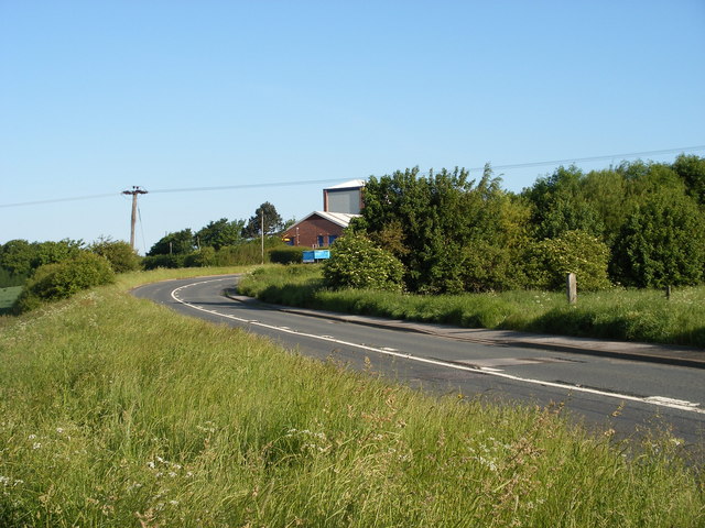
Jaw Hill is a prominent landmark located in Yorkshire, England. Situated in the northern part of the county, it is part of the beautiful Yorkshire Dales National Park. Rising to an elevation of 463 meters (1,519 feet), Jaw Hill is classified as a hill rather than a mountain.

The hill is known for its distinctive shape, featuring a steep and rugged slope on one side. Its summit provides breathtaking panoramic views of the surrounding countryside, with rolling hills, green valleys, and charming villages stretching out as far as the eye can see. On clear days, it is even possible to catch glimpses of the distant Pennine Mountains to the west.

Jaw Hill is a popular destination for hikers and outdoor enthusiasts, offering a variety of walking trails to suit different skill levels. The ascent to the summit can be challenging, but the rewarding vistas make it well worth the effort. The hill is also home to a diverse range of flora and fauna, including heather, mosses, and various species of birds.

Adjacent to Jaw Hill, there are several small villages that provide easy access to the hill, offering amenities such as parking, cafes, and accommodation for visitors. The surrounding area is steeped in history, with ancient ruins and archaeological sites scattered throughout the landscape, adding an extra layer of intrigue to any visit.

Overall, Jaw Hill is a captivating natural landmark that showcases the beauty of Yorkshire's countryside. Its impressive height, stunning views, and proximity to charming villages make it a must-visit destination for anyone exploring the region.

If you have any feedback on the listing, please let us know in the comments section below.
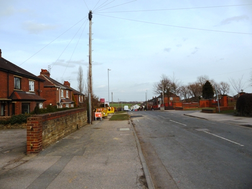
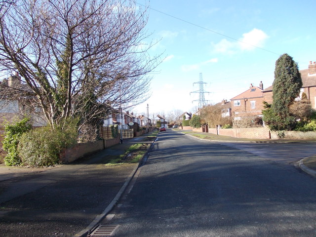
Jaw Hill Images

Images are sourced within 2km of 53.705688/-1.5571847 or Grid Reference SE2923. Thanks to Geograph Open Source API. All images are credited.

Canning Avenue stepping down the hillside Wakefield Council built this small housing estate in the 1920s.
Canning Avenue stepping down the hillside
Wakefield Council built this small housing estate in the 1920s.
Never the twain shall meet, Alverthorpe In the foreground, the end of Childs Road, part of a small estate built by Wakefield Council in the 1920s. In the background, houses on Harewood Drive, part of a private infill development built in the 1990s. There is no direct connection between the two roads.
Never the twain shall meet, Alverthorpe
In the foreground, the end of Childs Road, part of a small estate built by Wakefield Council in the 1920s. In the background, houses on Harewood Drive, part of a private infill development built in the 1990s. There is no direct connection between the two roads.
Blossom Cottage, Bradford Road, East Ardsley The building is end-on to the road and comprises at least two dwellings. The road is the main A650 between Bradford and Wakefield, which is still busy despite most through traffic taking the M62.
Blossom Cottage, Bradford Road, East Ardsley
The building is end-on to the road and comprises at least two dwellings. The road is the main A650 between Bradford and Wakefield, which is still busy despite most through traffic taking the M62.
Esso filling station, Bradford Road, East Ardsley With a Tesco Express as part of the offering.
Esso filling station, Bradford Road, East Ardsley
With a Tesco Express as part of the offering.
Derelict sheds, East Ardsley (1) These buildings have lost most of their cladding. There was fencing along the site boundary with dangerous structure warnings.
Derelict sheds, East Ardsley (1)
These buildings have lost most of their cladding. There was fencing along the site boundary with dangerous structure warnings.
Derelict sheds, East Ardsley (2) These buildings have lost most of their cladding. There was fencing along the site boundary with dangerous structure warnings.
Derelict sheds, East Ardsley (2)
These buildings have lost most of their cladding. There was fencing along the site boundary with dangerous structure warnings.
Field west of Pilden Lane With a horse box on the far side.
Field west of Pilden Lane
With a horse box on the far side.
Stile in the woods On the Leeds Country Way.
Stile in the woods
On the Leeds Country Way.
Trees on a field boundary Seen from the Leeds Country Way.
Trees on a field boundary
Seen from the Leeds Country Way.
M1 underpass This subway is longer than most, at about 60 metres, as it carries not only the main carriageway but also slip roads to Junction 41.
M1 underpass
This subway is longer than most, at about 60 metres, as it carries not only the main carriageway but also slip roads to Junction 41.
Diverted footpath This footpath has been diverted from the route shown on my printed Explorer map (2013 edition). It now runs round three sides of the West Yorkshire Police training centre (to the left, behind the security fence and trees). The date of the map, and John Slater's 2013 view of the section round the north side of the site, give this as a rough date for its construction <a href="https://www.geograph.org.uk/photo/3458244">SE3024 : Footpath approaching the M1 near Junction 41</a>.
Diverted footpath
This footpath has been diverted from the route shown on my printed Explorer map (2013 edition). It now runs round three sides of the West Yorkshire Police training centre (to the left, behind the security fence and trees). The date of the map, and John Slater's 2013 view of the section round the north side of the site, give this as a rough date for its construction SE3024 : Footpath approaching the M1 near Junction 41.
Field south of the M1 A recently ploughed and tilled field.
Field south of the M1
A recently ploughed and tilled field.
Police helicopter taking off The West Yorkshire Police training facility near Wrenthorpe is also the base for some of the aircraft of the National Police Air Service.
Police helicopter taking off
The West Yorkshire Police training facility near Wrenthorpe is also the base for some of the aircraft of the National Police Air Service.
Police helicopter warning A classic 'duck or grouse' type warning, see <a href="https://www.geograph.org.uk/photo/7627045">SE3023 : Police helicopter taking off</a>.
Police helicopter warning
A classic 'duck or grouse' type warning, see SE3023 : Police helicopter taking off.
West Yorkshire Police training centre The buildings are viewed here from the public footpath along the western side of the site.
West Yorkshire Police training centre
The buildings are viewed here from the public footpath along the western side of the site.
Distant view of Aspen Farm Glimpsed between the trees.
Distant view of Aspen Farm
Glimpsed between the trees.
Track past Aspen Farm This doesn't appear to be a working farm any longer.
Track past Aspen Farm
This doesn't appear to be a working farm any longer.
White Gate Farm The farm is situated in the Brandy Carr area, almost on the border between Wakefield and Leeds districts.
White Gate Farm
The farm is situated in the Brandy Carr area, almost on the border between Wakefield and Leeds districts.
Show me another place!

Jaw Hill is located at Grid Ref: SE2923 (Lat: 53.705688, Lng: -1.5571847)

Division: West Riding

Unitary Authority: Leeds

Police Authority: West Yorkshire

What 3 Words

///pints.arts.difficult. Near Ossett, West Yorkshire

Related Wikis

Jaw Hill

Jaw Hill is a hill in the City of Leeds district of West Yorkshire, England. It is near Kirkhamgate in the City of Wakefield district. == History == A...

Kirkhamgate

Kirkhamgate is a village in the Wakefield district, in West Yorkshire, England. It originated as a hamlet in the Alverthorpe township in the parish of...

Brandy Carr

Brandy Carr is a hamlet in the City of Wakefield in West Yorkshire, England, north of the eponymous Brandy Carr Hill and between Balne Beck in the west...

Carr Gate

Carr Gate is a village in the Wakefield district, in the county of West Yorkshire, England. The village stands to the north-west of Wakefield, and south...

Related Videos

Viagem de caminhão na Inglaterra, Reino Unido. Trabalho de motorista na Inglaterra.

Viagem de caminhão na Inglaterra, Reino Unido. Trabalho de motorista na Inglaterra. Owl Ln, Ossett WF5 9AX, Reino Unido ...

My favorite place Duke of York Street London ❤️

Love in London #night life London #Visit in London 2020 #walk in state london.

Nearby Amenities

Located within 500m of 53.705688,-1.5571847
Bus Stop
Batley Road The Springs
Bus: yes
Local Ref: 45016310
Naptan AtcoCode: 450016310
Naptan Bearing: SE
Naptan CommonName: Batley Road The Springs
Naptan Crossing: Twixt Haigh Moor Road & Woodhouse Lane
Naptan Indicator: Stop 45016310
Naptan Landmark: Haigh Hall Spring Farm
Naptan PlusbusZoneRef: LEEDS
Naptan ShortCommonName: Haigh Hall
Naptan Street: Batley Road
Naptan Verified: no
Public Transport: platform
Source: naptan_import
Lat/Long: 53.7085802/-1.5615273
Bus Stop
Batley Road Woodhouse Lane
Local Ref: 45016311
Naptan AtcoCode: 450016311
Naptan Bearing: S
Naptan CommonName: Batley Road Woodhouse Lane
Naptan Crossing: Woodhouse Lane
Naptan Indicator: Stop 45016311
Naptan PlusbusZoneRef: LEEDS
Naptan ShortCommonName: Woodhouse Lane
Naptan Street: Batley Road
Naptan Verified: no
Source: naptan_import
Lat/Long: 53.7059849/-1.5572974
Batley Road The Springs
Local Ref: 45050409
Naptan AtcoCode: 450050409
Naptan Bearing: NW
Naptan BusStopType: CUS
Naptan CommonName: Batley Road The Springs
Naptan Indicator: Stop 45050409
Naptan PlusbusZoneRef: LEEDS
Naptan ShortCommonName: Jaw Hill
Naptan Street: Batley Road
Naptan Verified: no
Source: naptan_import
Lat/Long: 53.7084906/-1.5616192
Batley Road Woodhouse Lane
Local Ref: 45050410
Naptan AtcoCode: 450050410
Naptan Bearing: N
Naptan BusStopType: CUS
Naptan CommonName: Batley Road Woodhouse Lane
Naptan Indicator: Stop 45050410
Naptan PlusbusZoneRef: LEEDS
Naptan ShortCommonName: Woodhouse Lane
Naptan Street: Batley Road
Naptan Verified: no
Source: naptan_import
Lat/Long: 53.7059675/-1.5574491
Power: pole
Lat/Long: 53.7051993/-1.5533275
Power: pole
Lat/Long: 53.7021944/-1.5581074
Power: pole
Lat/Long: 53.7046317/-1.5551276
Power: pole
Lat/Long: 53.7071664/-1.552903
Power: pole
Lat/Long: 53.7049016/-1.5542628
Power: pole
Lat/Long: 53.7043256/-1.5560911
Power: pole
Lat/Long: 53.7063596/-1.5512579
Power: pole
Lat/Long: 53.7067351/-1.5519923
Power: pole
Lat/Long: 53.7054552/-1.5509539
Power: pole
Lat/Long: 53.705586/-1.5497413
Power: pole
Lat/Long: 53.7015851/-1.5584787
Power: pole
Lat/Long: 53.7057997/-1.5501241
Power: pole
Lat/Long: 53.7053078/-1.5522324
Power: pole
Lat/Long: 53.7039973/-1.5570123
Power: pole
Lat/Long: 53.7028177/-1.5577314
Power: pole
Lat/Long: 53.7034047/-1.5573601
The data included in this document is from www.openstreetmap.org. The data is made available under ODbL.

Have you been to Jaw Hill?

Leave your review of Jaw Hill below (or comments, questions and feedback).