Centre Hill
Hill, Mountain in Yorkshire Hambleton
England
Centre Hill

Centre Hill is a picturesque hill located in the county of Yorkshire, England. Situated in the heart of the Yorkshire Dales National Park, it is part of the larger Pennine range. Rising to an elevation of approximately 600 meters (1968 feet), Centre Hill offers breathtaking panoramic views of the surrounding countryside.
This hill is renowned for its rugged beauty and is a popular destination for hikers, nature enthusiasts, and outdoor adventurers. Its rolling slopes are covered with a patchwork of lush green meadows, rocky outcrops, and heather moorland, creating a diverse and visually appealing landscape.
Centre Hill is home to a rich variety of flora and fauna, making it an ideal habitat for many species. Visitors can encounter an array of wildlife, including red squirrels, mountain hares, and various bird species such as peregrine falcons and golden eagles.
The hill is intersected by several well-marked trails and footpaths, offering visitors the opportunity to explore its natural wonders at their own pace. The ascent to the summit is moderately challenging but rewards hikers with breathtaking views that stretch for miles.
Additionally, Centre Hill holds historical significance as it was once an important trading route during the medieval period, connecting the nearby villages and market towns. The remnants of old packhorse paths and stone bridges can still be seen today, adding an element of intrigue to the hill's charm.
In summary, Centre Hill is a captivating destination that offers both natural beauty and historical significance. With its stunning landscapes and diverse wildlife, it is a haven for outdoor enthusiasts seeking a memorable experience in the heart of Yorkshire.
If you have any feedback on the listing, please let us know in the comments section below.
Centre Hill Images
Images are sourced within 2km of 54.208665/-1.5600133 or Grid Reference SE2879. Thanks to Geograph Open Source API. All images are credited.


Centre Hill is located at Grid Ref: SE2879 (Lat: 54.208665, Lng: -1.5600133)
Division: North Riding
Administrative County: North Yorkshire
District: Hambleton
Police Authority: North Yorkshire
What 3 Words
///huts.tooth.flying. Near Masham, North Yorkshire
Nearby Locations
Related Wikis
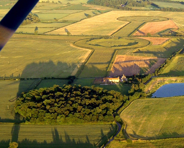
Thornborough Henges
The Thornborough Henges are an unusual ancient monument complex that includes the three aligned henges that give the site its name. They are located on...

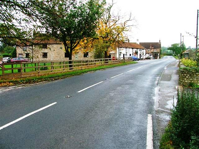
Thornborough, North Yorkshire
Thornborough is a village in Hambleton District of North Yorkshire, England. It is about 7 miles (11 km) south of Bedale and 3 miles (5 km) west of the...

East Tanfield
East Tanfield is a civil parish in North Yorkshire, England. There is no modern village in the parish, and the population was estimated at 30 in 2013...
Nosterfield
Nosterfield is a hamlet within the civil parish of West Tanfield in the Hambleton district of North Yorkshire, England formerly used for quarrying. Several...

West Tanfield
West Tanfield is a village and civil parish in the Hambleton district of North Yorkshire, England. The village is situated approximately six miles north...
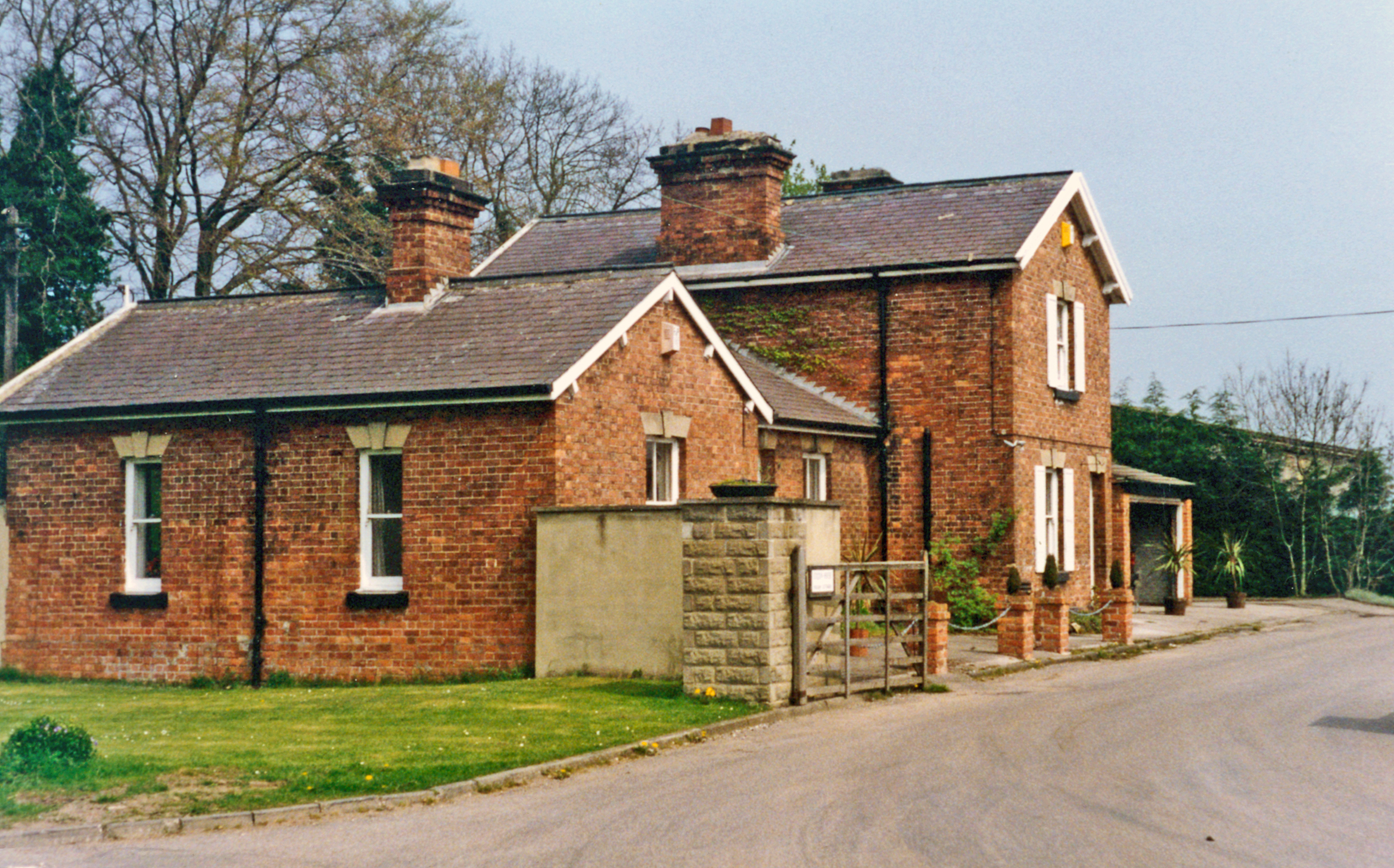
Tanfield railway station
Tanfield railway station was a railway station serving the community of West Tanfield on the Masham Line in North Yorkshire, England. The station was opened...

North Stainley with Sleningford
North Stainley with Sleningford is a civil parish in Harrogate district, North Yorkshire, England. The principal settlement and only village in the parish...
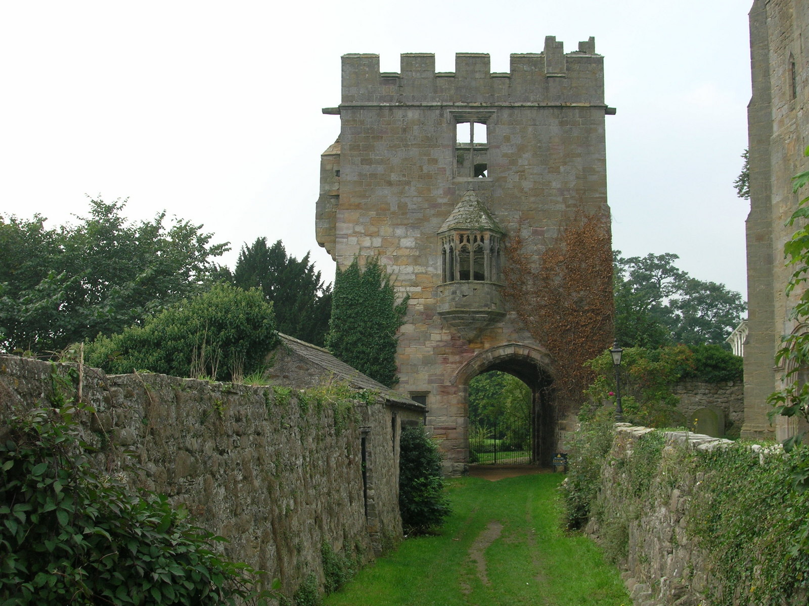
Marmion Tower
Marmion Tower, also known historically as Tanfield Castle, is a 15th-century gatehouse near the village of West Tanfield in North Yorkshire, England. It...
Nearby Amenities
Located within 500m of 54.208665,-1.5600133Have you been to Centre Hill?
Leave your review of Centre Hill below (or comments, questions and feedback).