Gallows Knoll

Hill, Mountain in Derbyshire Derbyshire Dales

England

Gallows Knoll

Old Milestone, Former B5035, Hopton The milestone is located east of Hopton village, on the verge in front of the dry stone wall, on the north side of road. Parish of Hopton (Derbyshire Dales District). Carved stone post, Wirksworth triangle design, erected by the Oakerthorpe & Ashbourne turnpike trust in the 19th century. 

Inscription reads:-
: TO / ALFRETON / 12 / MILES / WIRKSWORTH / 2 / MILES : : TO / ASHBOURN / 7 / MILES : 

Milestone Society National ID: DE_AFAB12
Old Milestone, Former B5035, Hopton Credit: John Mann

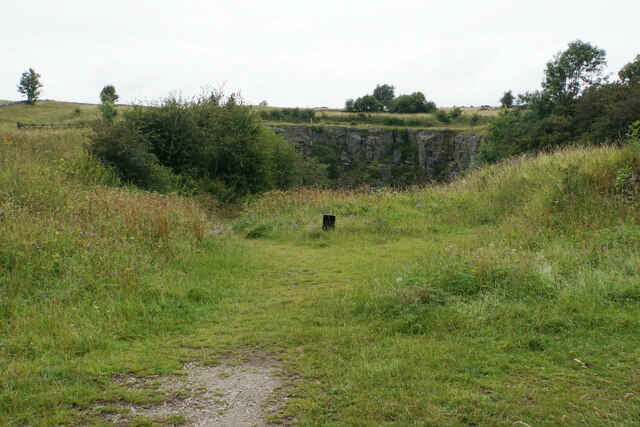
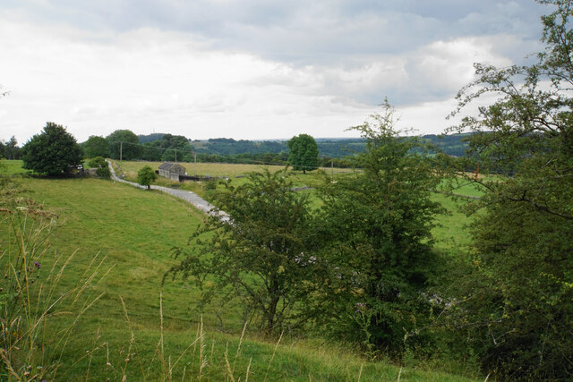
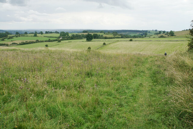
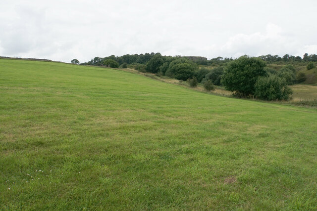
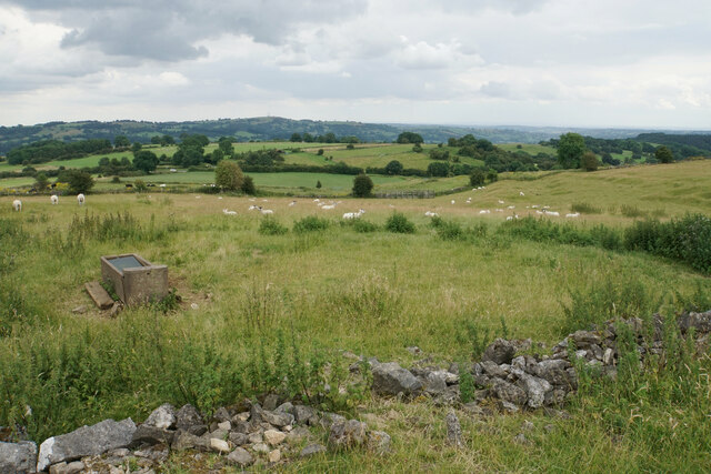
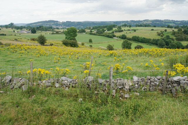
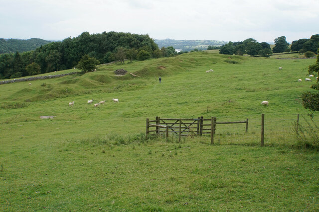
Gallows Knoll, located in Derbyshire, England, is a prominent hill standing at an elevation of approximately 300 meters above sea level. Situated in the picturesque Peak District National Park, it offers breathtaking views of the surrounding countryside and is a popular destination for nature enthusiasts and hikers alike.

The hill is characterized by its steep slopes and rugged terrain, covered in lush greenery and dotted with boulders. Its distinctive name is derived from its historical association with gallows, which were once used to execute criminals in the area. Although no longer present, this dark history adds an element of intrigue to the hill.

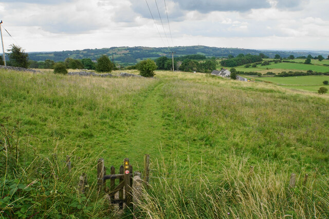
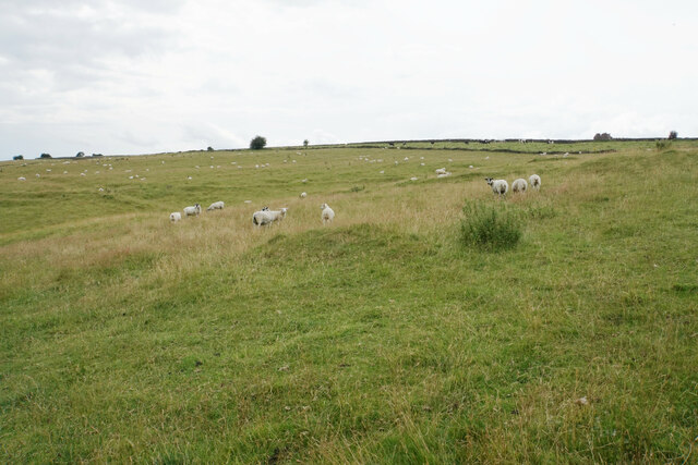
Gallows Knoll is easily accessible via well-maintained footpaths and trails that wind their way through the surrounding countryside. The hike to the summit is moderately challenging, providing a rewarding experience for adventurers. Once at the top, visitors are greeted with panoramic views of the rolling hills, valleys, and charming villages that make up the Derbyshire landscape.

The area surrounding Gallows Knoll is teeming with wildlife, making it a haven for nature lovers. It is home to a variety of bird species, including the elusive peregrine falcon, as well as small mammals such as rabbits and foxes. The hillside is also adorned with an array of vibrant wildflowers, adding to its natural beauty.

Gallows Knoll is not only a place of natural beauty but also holds historical significance and offers a peaceful retreat from the hustle and bustle of everyday life. Whether for a leisurely walk, a challenging hike, or simply to enjoy the breathtaking scenery, Gallows Knoll is a must-visit destination in Derbyshire.

If you have any feedback on the listing, please let us know in the comments section below.

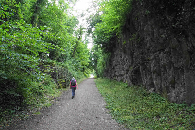
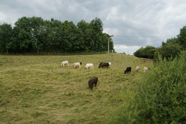
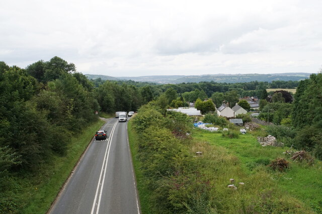
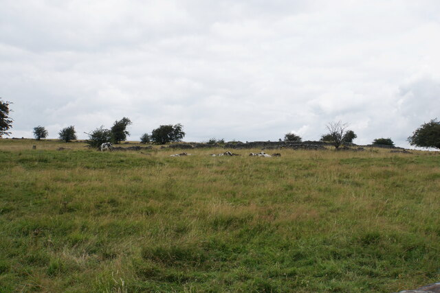
Gallows Knoll Images

Images are sourced within 2km of 53.086289/-1.6054735 or Grid Reference SK2654. Thanks to Geograph Open Source API. All images are credited.

Old Milestone, Former B5035, Hopton The milestone is located east of Hopton village, on the verge in front of the dry stone wall, on the north side of road. Parish of Hopton (Derbyshire Dales District). Carved stone post, Wirksworth triangle design, erected by the Oakerthorpe & Ashbourne turnpike trust in the 19th century. 

Inscription reads:-
: TO / ALFRETON / 12 / MILES / WIRKSWORTH / 2 / MILES : : TO / ASHBOURN / 7 / MILES : 

Milestone Society National ID: DE_AFAB12
Old Milestone, Former B5035, Hopton
The milestone is located east of Hopton village, on the verge in front of the dry stone wall, on the north side of road. Parish of Hopton (Derbyshire Dales District). Carved stone post, Wirksworth triangle design, erected by the Oakerthorpe & Ashbourne turnpike trust in the 19th century. Inscription reads:- : TO / ALFRETON / 12 / MILES / WIRKSWORTH / 2 / MILES : : TO / ASHBOURN / 7 / MILES : Milestone Society National ID: DE_AFAB12
Middleton Incline One of several former inclines on the former Cromford and High Peak Railway. This one was 708 yards long with a gradient of 1 in 8 3/4. The route is now part of the High Peak Trail.
Middleton Incline
One of several former inclines on the former Cromford and High Peak Railway. This one was 708 yards long with a gradient of 1 in 8 3/4. The route is now part of the High Peak Trail.
Cattle near Middle Peak As seen from the High Peak Trail.
Cattle near Middle Peak
As seen from the High Peak Trail.
B5035 at Middleton As seen from the High Peak Trail. Part of the village can be seen as well as the Derwent valley in the distance.
B5035 at Middleton
As seen from the High Peak Trail. Part of the village can be seen as well as the Derwent valley in the distance.
Cattle at Middleton Top Looking upwards on Middleton Moor.
Cattle at Middleton Top
Looking upwards on Middleton Moor.
Redhill Quarry A former quarry which is now a nature reserve and a picnic site.
Redhill Quarry
A former quarry which is now a nature reserve and a picnic site.
Fields and barn below Middleton Top Looking down from the High Peak Trail.
Fields and barn below Middleton Top
Looking down from the High Peak Trail.
Path towards Wirksworth Quite a long descent through former quarry land.
Path towards Wirksworth
Quite a long descent through former quarry land.
Path towards Hopton The path stays on higher ground which now aids livestock farming, but formerly was subject to a lot of mining.
Path towards Hopton
The path stays on higher ground which now aids livestock farming, but formerly was subject to a lot of mining.
Field below Intake Quarry Part of the disused quarry can be seen at the top of the hill. The High Peak Trail and Pennine Bridleway pass across just below the top.
Field below Intake Quarry
Part of the disused quarry can be seen at the top of the hill. The High Peak Trail and Pennine Bridleway pass across just below the top.
Sheep grazing below Gallows Knoll Looking down towards the Ecclesbourne valley.
Sheep grazing below Gallows Knoll
Looking down towards the Ecclesbourne valley.
Sheep below Gallows Knoll Looking up towards the top of the moor which reaches 325 metres above sea level.
Sheep below Gallows Knoll
Looking up towards the top of the moor which reaches 325 metres above sea level.
Field of ragwort Bad news for grazing, which is what most of this hillside is used for.
Field of ragwort
Bad news for grazing, which is what most of this hillside is used for.
Path to Hopton There is a clear line of former mine workings, though the land is all now given over to sheep. In the background is Carsington Water.
Path to Hopton
There is a clear line of former mine workings, though the land is all now given over to sheep. In the background is Carsington Water.
Hillside above Godfreyhole The land is used for grazing sheep but there are the remains of former mine workings.
Hillside above Godfreyhole
The land is used for grazing sheep but there are the remains of former mine workings.
Path through mine workings There are plenty of remains of spoil heaps but the land is now all grazed by sheep.
Path through mine workings
There are plenty of remains of spoil heaps but the land is now all grazed by sheep.
The northern end of Carsington Water This arm of the lake is fully grown over with rushes and other foliage. The visible water is not far away.
The northern end of Carsington Water
This arm of the lake is fully grown over with rushes and other foliage. The visible water is not far away.
Path towards Callow A steady uphill stretch. My walk instructions said head towards the holly tree. While you can't see the leaves, there is only one shape that could be a holly tree.
Path towards Callow
A steady uphill stretch. My walk instructions said head towards the holly tree. While you can't see the leaves, there is only one shape that could be a holly tree.
Show me another place!

Gallows Knoll is located at Grid Ref: SK2654 (Lat: 53.086289, Lng: -1.6054735)

Administrative County: Derbyshire

District: Derbyshire Dales

Police Authority: Derbyshire

What 3 Words

///beast.tilts.scarf. Near Wirksworth, Derbyshire

Nearby Locations

Gallows Knoll

Related Wikis

Hopton Tunnel

Hopton Tunnel is a former railway tunnel in Hopton, Derbyshire. Located on the former Cromford and High Peak Railway. The tunnel was closed along with...

Godfreyhole

Godfreyhole is a hamlet in Derbyshire, England. It is located at the junction of the B5035 and West End roads, 2 miles (3.2 km) west of Wirksworth, the...
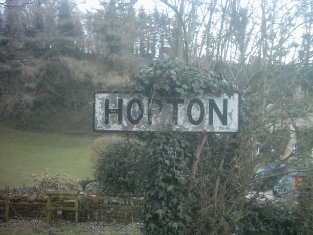
Hopton, Derbyshire

Hopton is a small village adjacent to the village of Carsington and two miles (3.2 km) from the market town of Wirksworth in the Peak District. Evidence...
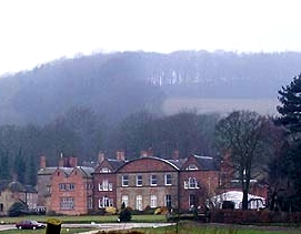
Hopton Hall

Hopton Hall is an 18th-century country house at Hopton, near Wirksworth, Derbyshire. It is a Grade II listed building. The Manor of Hopton, anciently the...

Nearby Amenities

Located within 500m of 53.086289,-1.6054735
Bench
Backrest: yes
Material: wood
Lat/Long: 53.0888819/-1.6081024
Barrier: stile
Steps: 1
Stile: stepover
Lat/Long: 53.0877756/-1.6044403
Barrier: stile
Check Date: 2023-07-16
Ele: 288.0000000
Stile: squeezer
Lat/Long: 53.0850679/-1.6016769
Crossing: informal
Lat/Long: 53.0871361/-1.6005001
Barrier: stile
Ele: 273.0000000
Material: wood
Step Count: 2
Steps: 2
Stile: stepover
Lat/Long: 53.0869792/-1.5989095
Barrier: stile
Material: wood
Source: survey
Step Count: 1
Stile: stepover
Lat/Long: 53.0871636/-1.6004329
Power: pole
Lat/Long: 53.0888543/-1.609062
Power: pole
Lat/Long: 53.0888612/-1.6089342
Power: pole
Lat/Long: 53.0888789/-1.6092564
Power: pole
Lat/Long: 53.0891346/-1.6075689
Power: pole
Lat/Long: 53.0893069/-1.6077017
Power: pole
Lat/Long: 53.0894079/-1.6063064
Power: pole
Lat/Long: 53.0896415/-1.6052004
Power: pole
Lat/Long: 53.089723/-1.6065256
Power: pole
Lat/Long: 53.0899507/-1.6092856
Power: pole
Lat/Long: 53.0899736/-1.6036443
Power: pole
Lat/Long: 53.0900632/-1.6022839
Power: pole
Lat/Long: 53.0901239/-1.6053208
Power: pole
Lat/Long: 53.0904973/-1.6042563
Leisure: picnic_table
Lat/Long: 53.0888647/-1.6081962
Hopton Winding Engine
Board Type: history
Information: board
Tourism: information
Lat/Long: 53.0886392/-1.6091028
Material: wood
Power: pole
Lat/Long: 53.0838756/-1.6116938
Material: wood
Power: pole
Lat/Long: 53.0846876/-1.6112271
Material: wood
Power: pole
Lat/Long: 53.0855398/-1.6107148
Material: wood
Power: pole
Lat/Long: 53.0868568/-1.6105539
Material: wood
Power: pole
Lat/Long: 53.0875293/-1.6104238
Material: wood
Power: pole
Lat/Long: 53.0881793/-1.610291
Give Way
Direction: backward
Lat/Long: 53.0879056/-1.6107351
Give Way
Direction: forward
Lat/Long: 53.087999/-1.6104979
The data included in this document is from www.openstreetmap.org. The data is made available under ODbL.

Have you been to Gallows Knoll?

Leave your review of Gallows Knoll below (or comments, questions and feedback).