Pickford Hill

Hill, Mountain in Hampshire Test Valley

England

Pickford Hill

Thruxton pit garage The garages at Thruxton are so small their use is only a formality really, all work on the cars is done in awnings the other side of the garages.
Thruxton pit garage Credit: TCExplorer

Pickford Hill is a prominent hill located in the county of Hampshire, England. Situated in the South Downs National Park, it forms part of the picturesque landscape of the Hampshire Downs. With an elevation of approximately 230 meters (750 feet), Pickford Hill is not classified as a mountain but rather a hill.

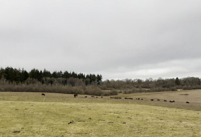
The hill is characterized by its gently sloping sides, covered in lush green grass and dotted with a variety of trees, including beech and oak. Its summit offers breathtaking panoramic views of the surrounding countryside, making it a popular destination for nature lovers, hikers, and photographers. On a clear day, visitors can see as far as the Isle of Wight, the Solent, and even the distant coastline.

Pickford Hill is also known for its historical significance. It is believed to have been used as a vantage point during ancient times, providing strategic advantages for early settlers. Archaeological evidence suggests that the hill was occupied by humans as far back as the Neolithic period, and remnants of Iron Age forts have been found in the vicinity.

The hill is easily accessible, with several footpaths leading to its summit. It is also situated near the village of Winchester, offering visitors the opportunity to explore the charming countryside and nearby attractions such as Winchester Cathedral and the South Downs Way.

Overall, Pickford Hill in Hampshire provides a beautiful natural setting, rich in history and offering stunning views of the surrounding landscape, making it a must-visit destination for both locals and tourists alike.

If you have any feedback on the listing, please let us know in the comments section below.

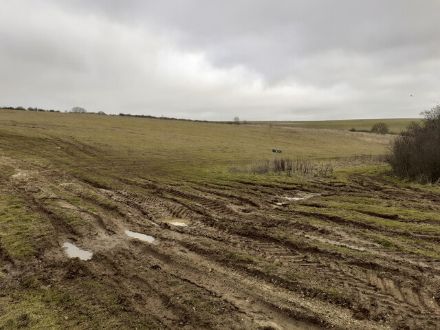
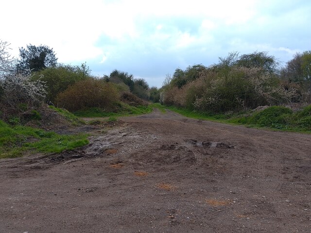
Pickford Hill Images

Images are sourced within 2km of 51.217444/-1.6233199 or Grid Reference SU2646. Thanks to Geograph Open Source API. All images are credited.

Thruxton pit garage The garages at Thruxton are so small their use is only a formality really, all work on the cars is done in awnings the other side of the garages.
Thruxton pit garage
The garages at Thruxton are so small their use is only a formality really, all work on the cars is done in awnings the other side of the garages.
Track junction at SE corner of Warren Hill plantation The Wiltshire County Council right of way sign here has been rotated 90 degrees to give false information. I rotated it back. The real public footpath runs diagonally from the bottom left corner of this photo to the middle right.
Track junction at SE corner of Warren Hill plantation
The Wiltshire County Council right of way sign here has been rotated 90 degrees to give false information. I rotated it back. The real public footpath runs diagonally from the bottom left corner of this photo to the middle right.
Public Footpath in valley south of Warren Hill
Wildlife Area in valley south of Warren Hill The woodland ahead is marked as a wildlife area and there is a request to keep dogs on leads.
Wildlife Area in valley south of Warren Hill
The woodland ahead is marked as a wildlife area and there is a request to keep dogs on leads.
Track junction at Kimpton Gorse The Wiltshire County Council public footpath sign had been rotated here through ninety degrees to give  misleading picture of the right of way. I rotated it back. The real public footpath does not follow any of the grassy tracks seen here. Rather, it runs diagonally across the hillside from here towards the second tiny clump of trees just seen on the horizon near the left of this photo.
Track junction at Kimpton Gorse
The Wiltshire County Council public footpath sign had been rotated here through ninety degrees to give misleading picture of the right of way. I rotated it back. The real public footpath does not follow any of the grassy tracks seen here. Rather, it runs diagonally across the hillside from here towards the second tiny clump of trees just seen on the horizon near the left of this photo.
Looking along public footpath towards Kimpton Gorse The hillside here seemed to have been dug up or had a crop on it recently. There was no trace of the public footpath, so I followed by GPS.
Looking along public footpath towards Kimpton Gorse
The hillside here seemed to have been dug up or had a crop on it recently. There was no trace of the public footpath, so I followed by GPS.
Public footpath from Klimpton Gorse towards Ashdown Copse The footpath passes in a straight line to the right of the disused pit seen in the distance. The line of scrub seen in the foreground is not marked on the 1:25K OS map. The footpath here is undiscernible but can be followed by GPS.
Public footpath from Klimpton Gorse towards Ashdown Copse
The footpath passes in a straight line to the right of the disused pit seen in the distance. The line of scrub seen in the foreground is not marked on the 1:25K OS map. The footpath here is undiscernible but can be followed by GPS.
Fearsome horned cattle blocking public footpath The indiscernible public footpath is climbing towards Ashdown Copse. I was following it by GPS. The cattle were enclosed by an electric fence. I deviated southwards from the footpath to avoid the cattle.
Fearsome horned cattle blocking public footpath
The indiscernible public footpath is climbing towards Ashdown Copse. I was following it by GPS. The cattle were enclosed by an electric fence. I deviated southwards from the footpath to avoid the cattle.
Signpost at Kimpton A signpost on a godcake in Kimpton. The directions are signed to NO THROUGH ROAD" (Down Road), THRUXTON 1 mile, WEYHILL 2½ miles, PERHAM DOWN 2½ miles, TIDWORTH 4¼ miles.
Signpost at Kimpton
A signpost on a godcake in Kimpton. The directions are signed to NO THROUGH ROAD" (Down Road), THRUXTON 1 mile, WEYHILL 2½ miles, PERHAM DOWN 2½ miles, TIDWORTH 4¼ miles.
Welcome Stranger, Kimpton Welcome Stranger is a pub in Kimpton in Hampshire.
Welcome Stranger, Kimpton
Welcome Stranger is a pub in Kimpton in Hampshire.
Ox Drove near Kimpton Down Farm Ox Drove is a restricted byway heading north near to Kimpton Down Farm, off Down Road.
Ox Drove near Kimpton Down Farm
Ox Drove is a restricted byway heading north near to Kimpton Down Farm, off Down Road.
Right of way sign near Kimpton Down Farm A sign giving the route of a restricted byway (Ox Drove) heading north and south near to Kimpton Down Farm, off Down Road.
Right of way sign near Kimpton Down Farm
A sign giving the route of a restricted byway (Ox Drove) heading north and south near to Kimpton Down Farm, off Down Road.
Down Road, Kimpton Down Road is a dead end road leading to Kimpton Down Farm and a few houses.
Down Road, Kimpton
Down Road is a dead end road leading to Kimpton Down Farm and a few houses.
Ox Drove near Kimpton Down Farm Ox Drove is a restricted byway heading south near to Kimpton Down Farm, off Down Road.
Ox Drove near Kimpton Down Farm
Ox Drove is a restricted byway heading south near to Kimpton Down Farm, off Down Road.
Motorcycle racing, Thruxton A race at the British Superbike meeting at Thruxton. I won't lie and pretend that I knew what was happening, or even what race this was.....
Motorcycle racing, Thruxton
A race at the British Superbike meeting at Thruxton. I won't lie and pretend that I knew what was happening, or even what race this was.....
Deacon Road, Kimpton By the last house heading north.
Deacon Road, Kimpton
By the last house heading north.
Junction of Cow Lane and Deacon Road, Kimpton Cow Lane on the left is a dead-end as a tarmac road.
Junction of Cow Lane and Deacon Road, Kimpton
Cow Lane on the left is a dead-end as a tarmac road.
Unnamed lane meets Snoddington Road Looking from the lane which skirts around the west side of Thruxton Aerodrome.
Unnamed lane meets Snoddington Road
Looking from the lane which skirts around the west side of Thruxton Aerodrome.
Show me another place!

Pickford Hill is located at Grid Ref: SU2646 (Lat: 51.217444, Lng: -1.6233199)

Administrative County: Hampshire

District: Test Valley

Police Authority: Hampshire

What 3 Words

///patching.shuttered.dumplings. Near Tidworth, Wiltshire

Related Wikis

Thruxton Circuit

The Thruxton Circuit is a 2.356 mi (3.792 km) motor-racing circuit located near the village of Thruxton in Hampshire, England, United Kingdom, about 30...
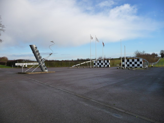
Thruxton Aerodrome

Thruxton Aerodrome (ICAO: EGHO) is located in Thruxton, 4.5 NM (8.3 km; 5.2 mi) west of Andover, in Hampshire, England. The airfield was opened in 1942...

Kimpton, Hampshire

Kimpton is a village and civil parish in the Test Valley district of Hampshire, England. The village is situated west of Andover, in the north of the county...

Perham Down

Perham Down is a village in Wiltshire, England, in Tidworth parish on the eastern edge of Salisbury Plain. It lies on a minor road about 1+1⁄2 miles (2...

Swinton Barracks

Swinton Barracks is a military installation accommodating two engineer regiments at Perham Down in Wiltshire, England. The site is on the east edge of...

Quarley

Quarley is a village and civil parish in the Test Valley district of Hampshire, England. It is about 7 mi (11 km) west of Andover and according to the...

Thruxton, Hampshire

Thruxton is just off the A303 road five miles (8.0 km) west of Andover. It is a village with a Manor House, thatched cottages and village green. Pillhill...

A338 road

The A338 is a major primary route in southern England, that runs from the junction with the A35 at Poole in Dorset to the junction with the A420 at Besselsleigh...

Nearby Amenities

Located within 500m of 51.217444,-1.6233199
Archaeological Site: tumulus
Historic: archaeological_site
Lat/Long: 51.2175192/-1.6233854
Archaeological Site: tumulus
Historic: archaeological_site
Lat/Long: 51.215577/-1.6207783
Archaeological Site: tumulus
Historic: archaeological_site
Lat/Long: 51.2168539/-1.6272585
Archaeological Site: tumulus
Historic: archaeological_site
Lat/Long: 51.2154896/-1.6239004
Kimpton Down
Place: locality
Lat/Long: 51.2180536/-1.6277361
Pickford Hill
Ele: 145
Natural: peak
Lat/Long: 51.217742/-1.6230153
The data included in this document is from www.openstreetmap.org. The data is made available under ODbL.

Have you been to Pickford Hill?

Leave your review of Pickford Hill below (or comments, questions and feedback).