Battlestead Hill

Hill, Mountain in Staffordshire East Staffordshire

England

Battlestead Hill

Houses at Tatenhill Common
Houses at Tatenhill Common Credit: Ian S

Battlestead Hill is a prominent hill located in the county of Staffordshire, England. Standing at an elevation of approximately 213 meters (699 feet), it is part of the wider Cannock Chase Area of Outstanding Natural Beauty. The hill is situated near the village of Cannock Wood, just south of Cannock town.

Covered in lush greenery and surrounded by picturesque landscapes, Battlestead Hill offers stunning panoramic views of the surrounding countryside. The hill is primarily composed of sandstone, which adds to its scenic beauty. It is believed to have been formed during the last ice age, around 10,000 years ago.

The name "Battlestead" is derived from the Old English words "beatan" and "stede," meaning "battle place" or "place of conflict." This suggests that the hill may have been a site of historical significance, possibly serving as a defensive position or battleground in ancient times. However, the exact historical events that gave rise to the name remain uncertain.

Today, Battlestead Hill is a popular destination for outdoor enthusiasts, hikers, and nature lovers. It offers various walking trails, allowing visitors to explore the diverse flora and fauna of the region. The hill is also home to a wide range of wildlife, including deer, birds, and small mammals.

With its natural beauty, historical intrigue, and recreational opportunities, Battlestead Hill continues to captivate visitors and locals alike, providing a tranquil escape into Staffordshire's stunning countryside.

If you have any feedback on the listing, please let us know in the comments section below.

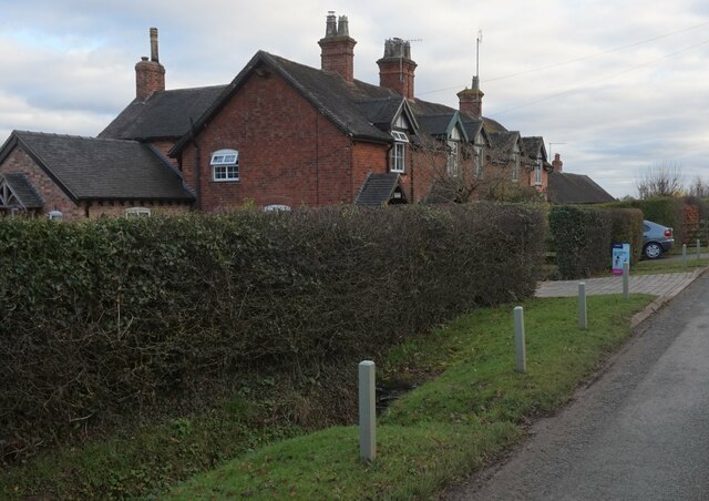
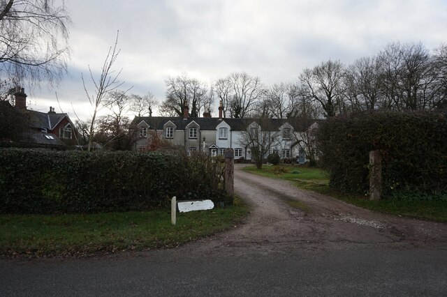
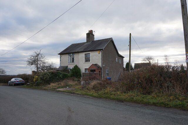
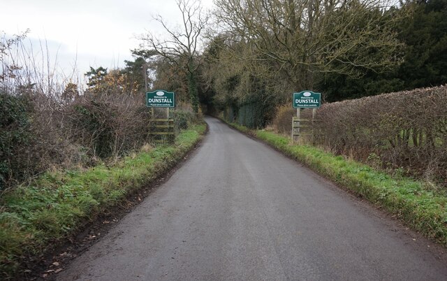
Battlestead Hill Images

Images are sourced within 2km of 52.794199/-1.6937038 or Grid Reference SK2021. Thanks to Geograph Open Source API. All images are credited.

Houses at Tatenhill Common
Bass Arms Mews, Tatenhill Common
Houses at Tatenhill Common
Entering Dunstall on unnamed road
Cuckoo Cage Plantation The National Forest Way runs past the western edge of this patch of woodland.
Cuckoo Cage Plantation
The National Forest Way runs past the western edge of this patch of woodland.
Road junction to the east of Dunstall
Oil seed rape awaiting harvesting On the Tattenhill to Barton-under-Needwood road
Oil seed rape awaiting harvesting
On the Tattenhill to Barton-under-Needwood road
Callingwood Farm Buildings A very impressive barn complex on the Rangemore Estate
Callingwood Farm Buildings
A very impressive barn complex on the Rangemore Estate
Tatenhill Common, near Burton upon Trent, Staffordshire. Tatenhill Common is a hamlet strung out along the road that runs across the ridge of high ground between Tatenhill and Rangemore. It is a collection of cottages (many of which have been renovated and extended) and a couple of small-holdings, one of which can be seen on the corner of the quaintly named Cuckoo Cage Lane. The public telephone that is marked on the map opposite this junction (just beyond the telegraph pole), was removed in late 2005 by BT following its reduction in use due to mobile phones, repeated vandalism and theft of money. It was a traditional red telephone box and had it still been there, would have further enhanced this quite nice image.
Tatenhill Common, near Burton upon Trent, Staffordshire.
Tatenhill Common is a hamlet strung out along the road that runs across the ridge of high ground between Tatenhill and Rangemore. It is a collection of cottages (many of which have been renovated and extended) and a couple of small-holdings, one of which can be seen on the corner of the quaintly named Cuckoo Cage Lane. The public telephone that is marked on the map opposite this junction (just beyond the telegraph pole), was removed in late 2005 by BT following its reduction in use due to mobile phones, repeated vandalism and theft of money. It was a traditional red telephone box and had it still been there, would have further enhanced this quite nice image.
Parkland at Dunstall Hall Bikersdale Wood forms the backdrop.
Parkland at Dunstall Hall
Bikersdale Wood forms the backdrop.
Footpath into nettles I was rather glad I had wellies to hand, and that it was only May 1st for this stinger of a path.
Footpath into nettles
I was rather glad I had wellies to hand, and that it was only May 1st for this stinger of a path.
End of the footpath Or rather it is now permanently diverted south here along the field edge to Black Meadow Wood. just beyond the sign are expansive gravel workings.
End of the footpath
Or rather it is now permanently diverted south here along the field edge to Black Meadow Wood. just beyond the sign are expansive gravel workings.
Oak by the footpath The edge of the gravel workings to the right diverts slightly around the tree.
Oak by the footpath
The edge of the gravel workings to the right diverts slightly around the tree.
Gravel pit at Dunstall 1 View north from the footpath at Greenlane Plantation.
Gravel pit at Dunstall 1
View north from the footpath at Greenlane Plantation.
Gravel pit at Dunstall 2 The gravels and sand were laid down by the Trent here on the floor of the river's floodplain.
Gravel pit at Dunstall 2
The gravels and sand were laid down by the Trent here on the floor of the river's floodplain.
Parkland cattle This looks like an 18th century painting, recording agricultural wealth.
Parkland cattle
This looks like an 18th century painting, recording agricultural wealth.
Parkland off Dunstall Road The edge of the parkland, before the ploughed fields start.
Parkland off Dunstall Road
The edge of the parkland, before the ploughed fields start.
Dunstall Park The road to Dunstall is on the left.
Dunstall Park
The road to Dunstall is on the left.
Show me another place!

Battlestead Hill is located at Grid Ref: SK2021 (Lat: 52.794199, Lng: -1.6937038)

Administrative County: Staffordshire

District: East Staffordshire

Police Authority: Staffordshire

What 3 Words

///doghouse.spared.camper. Near Burton upon Trent, Staffordshire

Related Wikis

Tatenhill

Tatenhill is an ancient village and a civil parish located in a deep valley, between two hills, which gradually descend from the eastern border of Needwood...
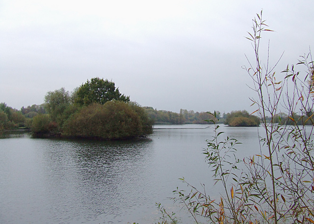
Branston Water Park

Branston Water Park is a local nature reserve near Burton upon Trent, in Staffordshire, England, adjacent to the village of Branston. == History == The...

St Saviour's Church, Branston

Saint Saviour's is the Church of England parish church for the village of Branston, south of Burton upon Trent. It is part of the Diocese of Lichfield...

Sinai Park House

Sinai Park House is a grade II* listed building in Burton upon Trent, Staffordshire, England. Consisting of a central range with two wings the building...

Branston railway station

Branston railway station was a railway station serving the village of Branston in Staffordshire. == History == In 1887 local residents began to petition...
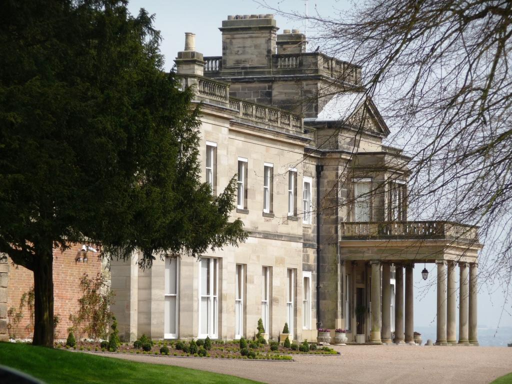
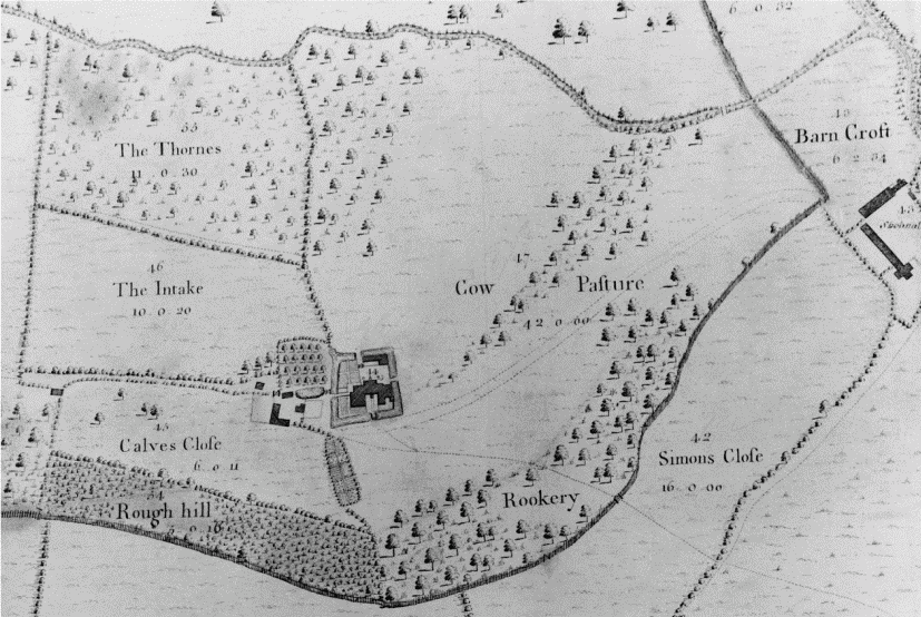
Dunstall Hall

Dunstall Hall is a privately owned 18th century mansion house near Tatenhill, Burton upon Trent, Staffordshire. It is a Grade II* listed building. �...
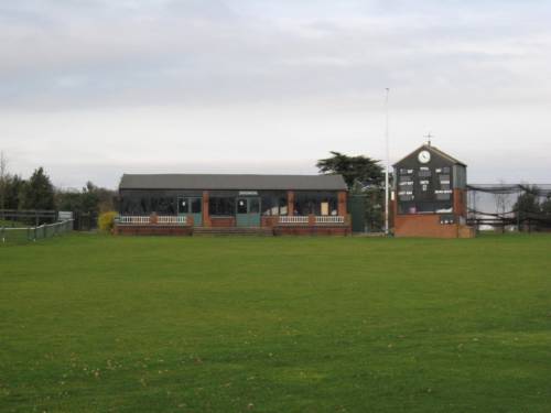
Deer Park, Dunstall

Deer Park is a cricket ground within the grounds of Dunstall Hall, Dunstall, Staffordshire. The first recorded match on the ground was in 1997, when the...

Branston, Staffordshire

Branston is a village and civil parish in Staffordshire, England. At the 2001 census, the population was 6,540, increasing to 6,749 at the 2011 Census...

Nearby Amenities

Located within 500m of 52.794199,-1.6937038
Bus Stop
Tatenhill Crossroads
Bus: yes
Naptan AtcoCode: 3800C309400
Naptan Bearing: S
Naptan CommonName: Tatenhill Crossroads
Naptan Indicator: Adj
Naptan Landmark: Crossroads
Naptan Street: Main Street
Naptan Verified: no
Public Transport: platform
Source: naptan_import
Lat/Long: 52.7917425/-1.6995233
Bus Stop
Tatenhill Crossroads
Bus: yes
Naptan AtcoCode: 3800C309401
Naptan Bearing: N
Naptan CommonName: Tatenhill Crossroads
Naptan Indicator: Adj
Naptan Landmark: Crossroads
Naptan Street: Main Street (N)
Naptan Verified: no
Public Transport: platform
Source: naptan_import
Lat/Long: 52.7918687/-1.6996707
Post Box
Brand: Royal Mail
Brand Wikidata: Q638098
Brand Wikipedia: en:Royal Mail
Operator: Royal Mail
Operator Wikidata: Q638098
Ref: DE13 1137
Lat/Long: 52.794752/-1.6983178
Tatenhill
Place: village
Source: NLS - OS 1:25k 1st Series 1937-61
Lat/Long: 52.7954306/-1.6985166
Crossing
Crossing: traffic_signals
Crossing Ref: toucan
Traffic Calming: table
Lat/Long: 52.7919828/-1.6882475
Noexit: yes
Lat/Long: 52.7929729/-1.686817
Barrier: stile
Material: wood
Source: survey;gps
Stile: stepover
Lat/Long: 52.7958941/-1.6972187
Barrier: kissing_gate
Source: survey;gps
Lat/Long: 52.798314/-1.6951427
Barrier: entrance
Source: survey;gps
Lat/Long: 52.7969369/-1.6940391
Bench
Source: survey;gps
Lat/Long: 52.7968942/-1.693815
Barrier: stile
Material: wood
Source: survey;gps
Stile: stepover
Lat/Long: 52.7954061/-1.6917592
Give Way
Direction: backward
Lat/Long: 52.7916635/-1.6996771
Give Way
Direction: forward
Lat/Long: 52.7915916/-1.6995467
Give Way
Direction: forward
Lat/Long: 52.7913393/-1.6968459
Noexit: yes
Lat/Long: 52.7946128/-1.6872933
Noexit: yes
Lat/Long: 52.7953212/-1.6884081
Noexit: yes
Lat/Long: 52.7945876/-1.6898081
Noexit: yes
Lat/Long: 52.7942978/-1.6889036
Noexit: yes
Lat/Long: 52.793297/-1.6873144
Noexit: yes
Lat/Long: 52.793587/-1.6871635
Playground: swing
Lat/Long: 52.7957682/-1.6922677
Playground: playhouse
Lat/Long: 52.7951277/-1.6917041
Bench
Lat/Long: 52.7957219/-1.6930287
Noexit: yes
Lat/Long: 52.7933278/-1.6866106
Noexit: yes
Lat/Long: 52.7931559/-1.6868734
Give Way
Direction: backward
Lat/Long: 52.7921877/-1.68811
Noexit: yes
Lat/Long: 52.7950138/-1.6878659
Noexit: yes
Lat/Long: 52.7946897/-1.6874142
Noexit: yes
Lat/Long: 52.7942871/-1.6892834
Noexit: yes
Lat/Long: 52.7952035/-1.6884425
Noexit: yes
Lat/Long: 52.7946078/-1.6895684
The data included in this document is from www.openstreetmap.org. The data is made available under ODbL.

Have you been to Battlestead Hill?

Leave your review of Battlestead Hill below (or comments, questions and feedback).